Boustie Ley
Hill, Mountain in Angus
Scotland
Boustie Ley

Boustie Ley is a prominent hill/mountain located in the Angus region of Scotland. Situated near the village of Edzell, Boustie Ley stands at an elevation of approximately 1,003 feet (306 meters) above sea level. It is a popular destination for hikers, nature enthusiasts, and outdoor adventurers due to its accessibility and stunning views.
The hill/mountain is characterized by its distinctive conical shape and is composed mainly of granite, which gives it a rugged and picturesque appearance. Its slopes are covered in heather, bracken, and other typical Scottish moorland vegetation, creating a beautiful and diverse landscape.
There are several walking routes available for visitors to explore Boustie Ley, ranging from easy strolls to more challenging hikes. The paths are well-maintained and clearly signposted, ensuring a safe and enjoyable experience for all.
From the summit of Boustie Ley, visitors can enjoy breathtaking panoramic views of the surrounding countryside, including the picturesque villages of Edzell and Fettercairn, as well as the rolling hills and glens of Angus. On clear days, it is even possible to catch a glimpse of the distant Cairngorms National Park.
The hill/mountain is also home to various species of wildlife, including red deer, mountain hares, and a variety of birds such as golden eagles and peregrine falcons. As a result, Boustie Ley provides excellent opportunities for wildlife spotting and birdwatching.
Overall, Boustie Ley in Angus offers a wonderful outdoor experience for nature lovers, hikers, and those seeking to appreciate the beauty of the Scottish countryside.
If you have any feedback on the listing, please let us know in the comments section below.
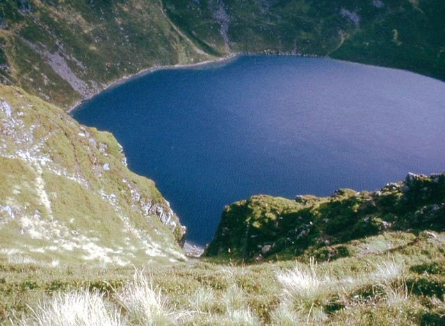
Boustie Ley Images
Images are sourced within 2km of 56.870504/-3.1133198 or Grid Reference NO3276. Thanks to Geograph Open Source API. All images are credited.


Boustie Ley is located at Grid Ref: NO3276 (Lat: 56.870504, Lng: -3.1133198)
Unitary Authority: Angus
Police Authority: Tayside
What 3 Words
///essential.fashion.baked. Near Ballater, Aberdeenshire
Nearby Locations
Related Wikis

Clova, Angus
Clova is a village in Glen Clova, Angus, Scotland. It lies on the River South Esk, some 12 miles (19 km) north of Kirriemuir. During the 1745 Jacobite...

Ben Tirran
Ben Tirran (896 m) is a mountain in the Grampian Mountains of Scotland. It lies in the vast Mounth area of the eastern Highlands in Angus, on the northern...

Driesh
Driesh (Gaelic: Dris) is a mountain located in the Grampians of Scotland. Apart from Mount Keen (939 m/3,080 ft), it is the most easterly of the Munro...

Glen Doll
Glen Doll, also sometimes spelt Glendoll, lies within the Cairngorms National Park, Scotland, at the top of Glen Clova, in an area of steep hills, corries...
Nearby Amenities
Located within 500m of 56.870504,-3.1133198Have you been to Boustie Ley?
Leave your review of Boustie Ley below (or comments, questions and feedback).