Baron's Hill

Hill, Mountain in Angus

Scotland

Baron's Hill

View from above Audallan This is interesting scenery. A steep sided valley with a small burn and flat floor. The valley runs along the base of the higher hills rather than away from them and gives one the impression that this must have been some sort of glacial meltwater channel.
View from above Audallan Credit: Gordon Hatton

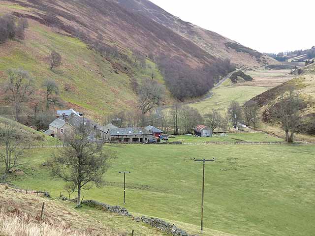
Baron's Hill, located in Angus, Scotland, is an iconic hill that offers breathtaking views and a rich historical significance. Standing at approximately 500 meters in height, it is renowned for its distinctive shape and prominent position in the landscape.

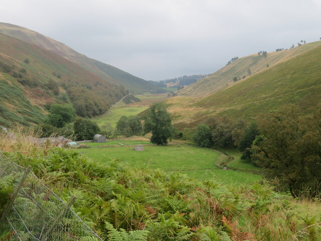
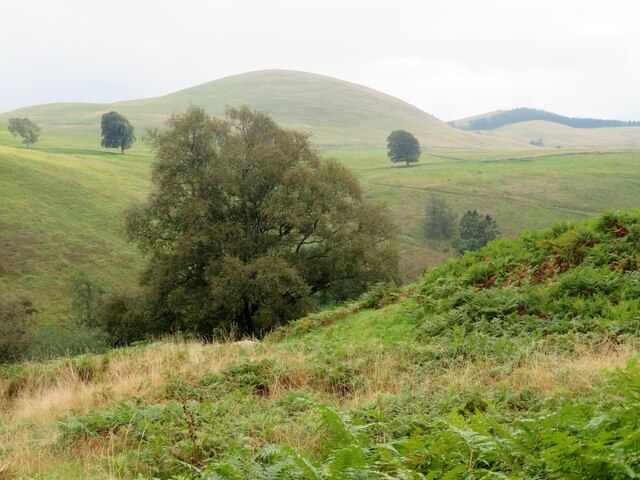
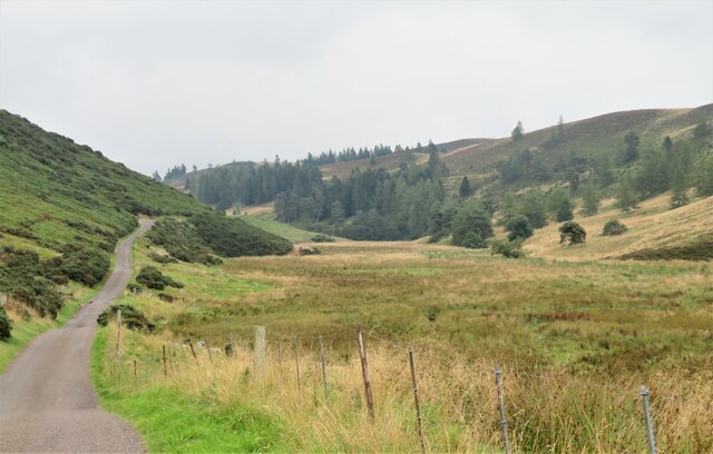
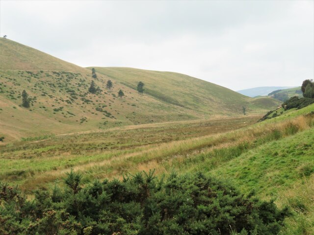
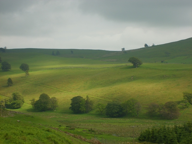
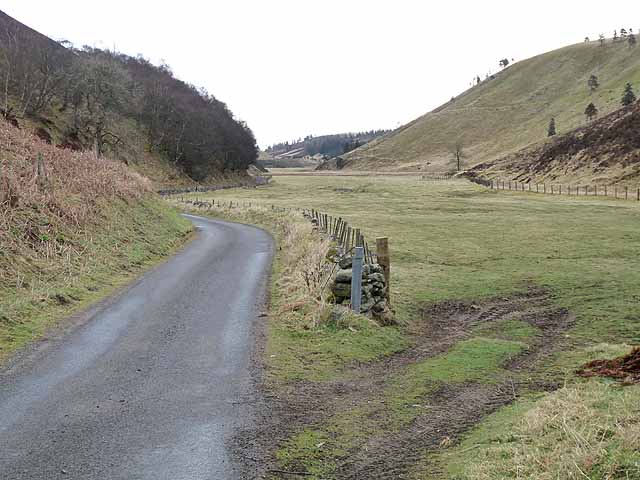
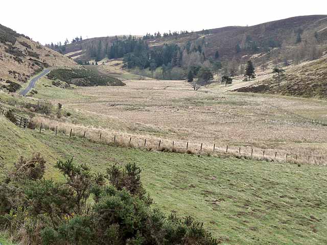
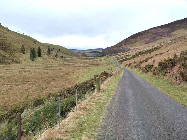
The hill is characterized by its gentle slopes, covered in lush green vegetation, creating a picturesque setting for outdoor enthusiasts and nature lovers. It forms part of the Angus Glens, a series of glens that dot the region and provide a haven for wildlife and plant species.

The name "Baron's Hill" is believed to have originated from its association with the local baronial families who once owned the land surrounding it. This historical connection adds to its allure and contributes to its reputation as a site of interest.

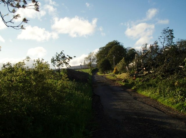
Visitors to Baron's Hill can embark on various walking trails and hiking routes that wind their way up to the summit. Along the way, they can enjoy panoramic vistas of the surrounding countryside, including the Angus Glens and the distant peaks of the Grampian Mountains. On a clear day, it is even possible to catch a glimpse of the sparkling North Sea.

With its natural beauty and cultural significance, Baron's Hill is a beloved destination for both locals and tourists seeking tranquility, exploration, and a connection with the Scottish landscape. Whether it is for a leisurely walk or a challenging hike, this hill offers an unforgettable experience for all who venture to its summit.

If you have any feedback on the listing, please let us know in the comments section below.
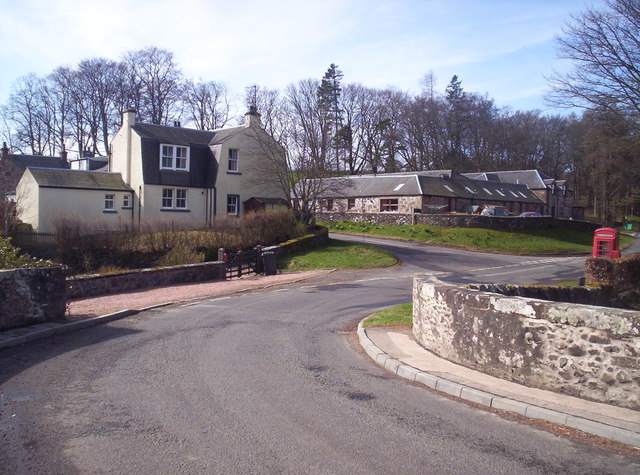
Baron's Hill Images

Images are sourced within 2km of 56.696433/-3.1115549 or Grid Reference NO3256. Thanks to Geograph Open Source API. All images are credited.

View from above Audallan This is interesting scenery. A steep sided valley with a small burn and flat floor. The valley runs along the base of the higher hills rather than away from them and gives one the impression that this must have been some sort of glacial meltwater channel.
View from above Audallan
This is interesting scenery. A steep sided valley with a small burn and flat floor. The valley runs along the base of the higher hills rather than away from them and gives one the impression that this must have been some sort of glacial meltwater channel.
A southward view near Audallan Interesting country, not quite highland and not quite lowland. There's grassland, moorland and forest around here and a curious number of mature trees scattered across the hillside. The rounded pudding shaped hill in the distance is Mile Hill at 410m.
A southward view near Audallan
Interesting country, not quite highland and not quite lowland. There's grassland, moorland and forest around here and a curious number of mature trees scattered across the hillside. The rounded pudding shaped hill in the distance is Mile Hill at 410m.
Valley of the Quharity Burn The minor road keeps to the slopes on the left of this flat bottomed valley where the little Quharity Burn meanders slowly along. This must be a misfit stream in an oversized valley, which in turn must have seen glacial action and may well have once held a lake.
Valley of the Quharity Burn
The minor road keeps to the slopes on the left of this flat bottomed valley where the little Quharity Burn meanders slowly along. This must be a misfit stream in an oversized valley, which in turn must have seen glacial action and may well have once held a lake.
Looking west along the valley towards Audallan The curious valley of the Quharity Burn, a very small stream in an impressive, steep sided valley which runs west to east along the base of the big hills instead of away from them. This bears all the hallmarks of a glacial spillway or overflow channel carved out at a time when the ice age was coming to an end.
Looking west along the valley towards Audallan
The curious valley of the Quharity Burn, a very small stream in an impressive, steep sided valley which runs west to east along the base of the big hills instead of away from them. This bears all the hallmarks of a glacial spillway or overflow channel carved out at a time when the ice age was coming to an end.
Sunny pastures at Gairlaw
After the storm A May storm had felled many trees. The remains of one lie to the right after road was cleared.
After the storm
A May storm had felled many trees. The remains of one lie to the right after road was cleared.
Farm buildings at the Welton The large house in the middle distance is Kinclune <a href="https://www.geograph.org.uk/gridref/NO3155">NO3155</a>.
Farm buildings at the Welton
The large house in the middle distance is Kinclune NO3155.
Falls of Holm A new bungalow which serves as the farmhouse for the Welton farm, and also functions as a four-star bed and breakfast establishment.
Falls of Holm
A new bungalow which serves as the farmhouse for the Welton farm, and also functions as a four-star bed and breakfast establishment.
Silage bales, sheep and the Muir of Holm The Muir of Holm is now an extensive plantation.
Silage bales, sheep and the Muir of Holm
The Muir of Holm is now an extensive plantation.
Ditch looking east from Broadford Bridge Kirkton Hill <a href="https://www.geograph.org.uk/gridref/NO3355">NO3355</a> in the distance.
Ditch looking east from Broadford Bridge
Kirkton Hill NO3355 in the distance.
Auldallan and the valley of the Quharity Burn This valley which runs along the foot of the Highlands to the north (left) gives the strong impression of having been a glacial overflow channel dating from the Ice Age.
Auldallan and the valley of the Quharity Burn
This valley which runs along the foot of the Highlands to the north (left) gives the strong impression of having been a glacial overflow channel dating from the Ice Age.
The "High Road" at Auldallan The valley of the Quharity Burn which runs along the foot of the Highlands to the north (left) gives the strong impression of having been a glacial overflow channel dating from the Ice Age.
The "High Road" at Auldallan
The valley of the Quharity Burn which runs along the foot of the Highlands to the north (left) gives the strong impression of having been a glacial overflow channel dating from the Ice Age.
Ploughed field and line of trees, Aucharroch Cottage
Ploughed field and row of trees, Aucharroch Cottage
The "High Road" and the valley of the Quharity Burn The valley of the Quharity Burn which runs along the foot of the Highlands to the north (left) gives the strong impression of having been a glacial overflow channel dating from the Ice Age.
The "High Road" and the valley of the Quharity Burn
The valley of the Quharity Burn which runs along the foot of the Highlands to the north (left) gives the strong impression of having been a glacial overflow channel dating from the Ice Age.
The "High Road" and the valley of the Quharity Burn The valley of the Quharity Burn which runs along the foot of the Highlands to the north (right) gives the strong impression of having been a glacial overflow channel dating from the Ice Age.
The "High Road" and the valley of the Quharity Burn
The valley of the Quharity Burn which runs along the foot of the Highlands to the north (right) gives the strong impression of having been a glacial overflow channel dating from the Ice Age.
Aucharroch Farm
Aucharroch Farm
Peevish notice Fed up with the sat navs getting it wrong.
Peevish notice
Fed up with the sat navs getting it wrong.
Show me another place!

Baron's Hill is located at Grid Ref: NO3256 (Lat: 56.696433, Lng: -3.1115549)

Unitary Authority: Angus

Police Authority: Tayside

What 3 Words

///hobbyists.left.insist. Near Kirriemuir, Angus

Nearby Locations

Baron's Hill

Related Wikis

Ascreavie

Ascreavie is a country house in Angus, Scotland. It is located 2 kilometres (1.2 mi) north of Kirkton of Kingoldrum, and 6 kilometres (3.7 mi) north-west...

Kirkton of Kingoldrum

Kirkton of Kingoldrum is a village in Angus, Scotland. It lies in approximately four miles (6 km) west of Kirriemuir on the B951 road. == References ==

Balfour Castle, Angus

Balfour Castle was a baronial mansion at Balfour Mains, near Kirkton of Kingoldrum, Angus, Scotland. The castle which was built in the 16th century is...

Balintore Castle

Balintore Castle is a Victorian Category A listed building in Scotland. The castle occupies an elevated site in moorland above Balintore village, a few...

Balintore, Angus

Balintore (Scottish Gaelic: Baile an Todhair) is a village in Angus, Scotland. It lies in Glen Isla, four miles north of the Loch of Lintrathen and seven...

Bridgend of Lintrathen

Bridgend of Lintrathen is a village in Angus, Scotland. It is situated on the southern shore of Loch of Lintrathen, six miles west of Kirriemuir. ��2...

Cat Law

Cat Law (671 m) is a hill in the southern Mounth of Scotland, north of Kirriemuir in Angus. A rounded peak, it lies above Strathmore in the south and offers...

Loch of Kinnordy

Loch of Kinnordy is a small loch located just west of town of Kirriemuir in Angus, Scotland, which is an important wildlife habitat. The loch itself is...

Nearby Amenities

Located within 500m of 56.696433,-3.1115549
East Kinclune
Place: isolated_dwelling
Lat/Long: 56.6976247/-3.1136949
Baron's Hill
Ele: 310
Natural: peak
Lat/Long: 56.6963275/-3.111304
Power: pole
Lat/Long: 56.6926621/-3.1087419
Power: pole
Lat/Long: 56.6930667/-3.1098349
Power: pole
Lat/Long: 56.6935235/-3.1106402
Power: pole
Lat/Long: 56.6939633/-3.1113991
Power: pole
Lat/Long: 56.6943764/-3.1121182
Power: pole
Lat/Long: 56.694917/-3.1130276
Power: pole
Lat/Long: 56.6953422/-3.1137687
Power: pole
Lat/Long: 56.6957079/-3.1144524
Power: pole
Lat/Long: 56.6961768/-3.1152821
Power: pole
Lat/Long: 56.697299/-3.1141702
Power: pole
Lat/Long: 56.6966474/-3.1144216
Power: pole
Lat/Long: 56.6956977/-3.1161207
Power: pole
Lat/Long: 56.6952267/-3.1169926
Power: pole
Lat/Long: 56.6947622/-3.1178574
Power: pole
Lat/Long: 56.6943312/-3.1186188
The data included in this document is from www.openstreetmap.org. The data is made available under ODbL.

Have you been to Baron's Hill?

Leave your review of Baron's Hill below (or comments, questions and feedback).