Cairn of Barns

Hill, Mountain in Angus

Scotland

Cairn of Barns

Graveyard and church at Clova The small village of Clova in Glen Clova has its church beside the B855 at the southern end of the settlement. The image is from October 1989 when the ground beyond the near fence may not have had any gravestones; there are some now (2021) as can be seen from later photographs and from aerial imaging.
Graveyard and church at Clova Credit: Trevor Littlewood

Cairn of Barns is a prominent hill located in Angus, Scotland. Sitting at an elevation of 607 meters (1,991 feet), it is considered a significant landmark in the region. The hill is situated within the Cairngorms National Park, which is renowned for its stunning natural beauty and diverse wildlife.

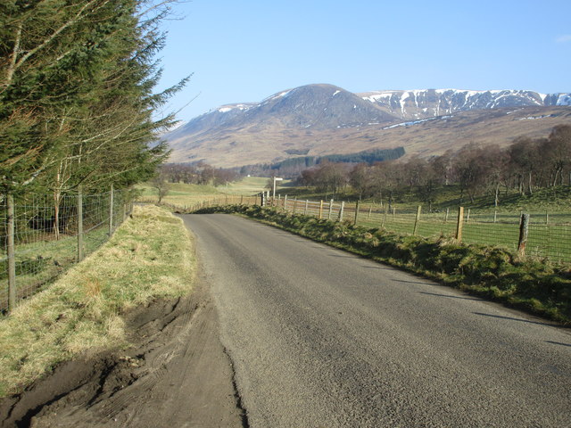
Cairn of Barns offers breathtaking panoramic views of the surrounding landscape, including the picturesque Glen Doll and the towering peaks of the Cairngorms mountain range. On a clear day, visitors can see as far as the Grampian Mountains to the south and the North Sea to the east.

The hill is characterized by its distinctive cairn, a man-made pile of stones that serves as a traditional marker in the Scottish Highlands. The cairn at the summit of Cairn of Barns is believed to have been erected centuries ago, potentially serving as a waymarker for travelers or as a memorial to a significant event or individual.

Hiking enthusiasts are drawn to Cairn of Barns due to its accessibility and well-marked trails. The most popular route starts from the Glen Doll car park, where visitors can follow a well-trodden path that gradually ascends the hill. The hike offers a moderate challenge, suitable for both experienced hikers and those seeking a scenic walk.

Nature lovers will also appreciate the abundance of flora and fauna on Cairn of Barns. The hill is home to a variety of bird species, including golden eagles, red grouse, and ptarmigans. During the summer months, vibrant wildflowers dot the landscape, adding a splash of color to the already stunning scenery.

Cairn of Barns is a must-visit destination for outdoor enthusiasts and those seeking a true Scottish Highland experience. Its majestic beauty, rich history, and diverse wildlife make it an unforgettable location within the Cairngorms National Park.

If you have any feedback on the listing, please let us know in the comments section below.

Cairn of Barns Images

Images are sourced within 2km of 56.827988/-3.1157448 or Grid Reference NO3271. Thanks to Geograph Open Source API. All images are credited.

Graveyard and church at Clova The small village of Clova in Glen Clova has its church beside the B855 at the southern end of the settlement. The image is from October 1989 when the ground beyond the near fence may not have had any gravestones; there are some now (2021) as can be seen from later photographs and from aerial imaging.
Graveyard and church at Clova
The small village of Clova in Glen Clova has its church beside the B855 at the southern end of the settlement. The image is from October 1989 when the ground beyond the near fence may not have had any gravestones; there are some now (2021) as can be seen from later photographs and from aerial imaging.
Sheep of Glen Clova
Sheep of Glen Clova
Extension to the Glen Clova Hotel Extension and renovations to increase facilities.
<span class="nowrap"><a title="http://www.clova.com/" rel="nofollow ugc noopener" href="http://www.clova.com/">Link</a><img style="margin-left:2px;" alt="External link" title="External link - shift click to open in new window" src="https://s1.geograph.org.uk/img/external.png" width="10" height="10"/></span>
Extension to the Glen Clova Hotel
Extension and renovations to increase facilities. LinkExternal link
Pasture at Caddam in Glen Clova A rainbow over Clova with Ben Reid on the horizon.
Pasture at Caddam in Glen Clova
A rainbow over Clova with Ben Reid on the horizon.
Clova Parish Kirk and graveyard
Clova Kirk Clova Kirk from the south-east.
Clova Kirk
Clova Kirk from the south-east.
Clova Kirk and graveyard The church at Clova looking from the south.
Clova Kirk and graveyard
The church at Clova looking from the south.
Little bridge at Clova Little arch bridge over the Corrie Burn next to the Clova Hotel.
Little bridge at Clova
Little arch bridge over the Corrie Burn next to the Clova Hotel.
B955 heading for Clova The B955 heading north-westwards with Ben Reid and the snow-flecked Corrie of Clova in the distance.
B955 heading for Clova
The B955 heading north-westwards with Ben Reid and the snow-flecked Corrie of Clova in the distance.
The River South Esk from bridge southwest of Clova
Clova Kirk Mid 19th century kirk built on the site of an earlier kirk. <span class="nowrap"><a title="https://canmore.org.uk/site/32431/clova-st-marys-church-and-old-parish-church" rel="nofollow ugc noopener" href="https://canmore.org.uk/site/32431/clova-st-marys-church-and-old-parish-church">Link</a><img style="margin-left:2px;" alt="External link" title="External link - shift click to open in new window" src="https://s1.geograph.org.uk/img/external.png" width="10" height="10"/></span>
Clova Kirk
Mid 19th century kirk built on the site of an earlier kirk. LinkExternal link
Clova Hotel
Clova Hotel
Car park at Clova With a convenient convenience.
Car park at Clova
With a convenient convenience.
Pasture in Glen Clova  Looking towards Cairn of Barns.
Pasture in Glen Clova
Looking towards Cairn of Barns.
Pasture in the valley floor, Glen Clova
The Clova hotel's bunkhouse The bunkhouse provides budget accommodation for climbers, walkers, cyclists and the like while tackling the hills nearby - breakfasts and evening meals available in the hotel, or on a self-catering basis. 4 or 5 rooms have been made from the former steading, with capacities for 10 people in the largest, and 4 or 5 in most of the others.
The Clova hotel's bunkhouse
The bunkhouse provides budget accommodation for climbers, walkers, cyclists and the like while tackling the hills nearby - breakfasts and evening meals available in the hotel, or on a self-catering basis. 4 or 5 rooms have been made from the former steading, with capacities for 10 people in the largest, and 4 or 5 in most of the others.
River South Esk looking upstream from Clova Bridge Compare with the mid-winter scene in <a href="https://www.geograph.org.uk/photo/2175508">NO3272 : River South Esk</a>.
River South Esk looking upstream from Clova Bridge
Compare with the mid-winter scene in NO3272 : River South Esk.
Switchback road in Glen Clova The western limb of the B955 just south of Clova Bridge.
Switchback road in Glen Clova
The western limb of the B955 just south of Clova Bridge.
Show me another place!

Cairn of Barns is located at Grid Ref: NO3271 (Lat: 56.827988, Lng: -3.1157448)

Unitary Authority: Angus

Police Authority: Tayside

What 3 Words

///landowner.beast.desktops. Near Kirriemuir, Angus

Nearby Locations

Cairn of Barns

Related Wikis

Clova, Angus

Clova is a village in Glen Clova, Angus, Scotland. It lies on the River South Esk, some 12 miles (19 km) north of Kirriemuir. During the 1745 Jacobite...

Driesh

Driesh (Gaelic: Dris) is a mountain located in the Grampians of Scotland. Apart from Mount Keen (939 m/3,080 ft), it is the most easterly of the Munro...

Ben Tirran

Ben Tirran (896 m) is a mountain in the Grampian Mountains of Scotland. It lies in the vast Mounth area of the eastern Highlands in Angus, on the northern...
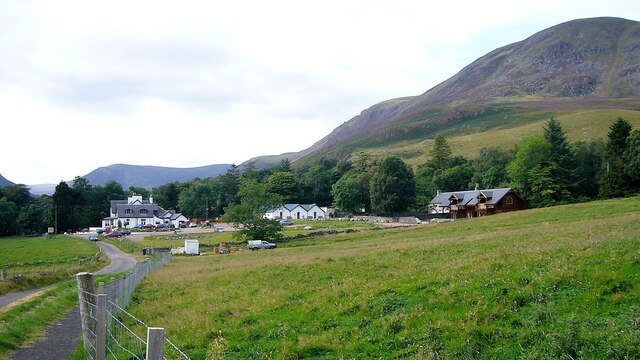
Glen Doll

Glen Doll, also sometimes spelt Glendoll, lies within the Cairngorms National Park, Scotland, at the top of Glen Clova, in an area of steep hills, corries...

Corrie Fee

Corrie Fee is a glacier-carved corrie situated at the head of Glen Clova in the Angus Glens of Scotland. It forms part of Corrie Fee National Nature Reserve...

Mayar (mountain)

Mayar is a mountain in the Grampians, in Angus, Scotland. It is usually climbed together with its near neighbour, Driesh. At an elevation of 928 m, it...

Nearby Amenities

Located within 500m of 56.827988,-3.1157448
Cairn of Barns
Ele: 648
Natural: peak
Lat/Long: 56.8281562/-3.1161309
The data included in this document is from www.openstreetmap.org. The data is made available under ODbL.

Have you been to Cairn of Barns?

Leave your review of Cairn of Barns below (or comments, questions and feedback).