Cape Hill

Hill, Mountain in Peeblesshire

Scotland

Cape Hill

Bowbeat Wind Farm from Kings Road Nick, Moorfoot Hills
Bowbeat Wind Farm from Kings Road Nick, Moorfoot Hills Credit: Colin Park

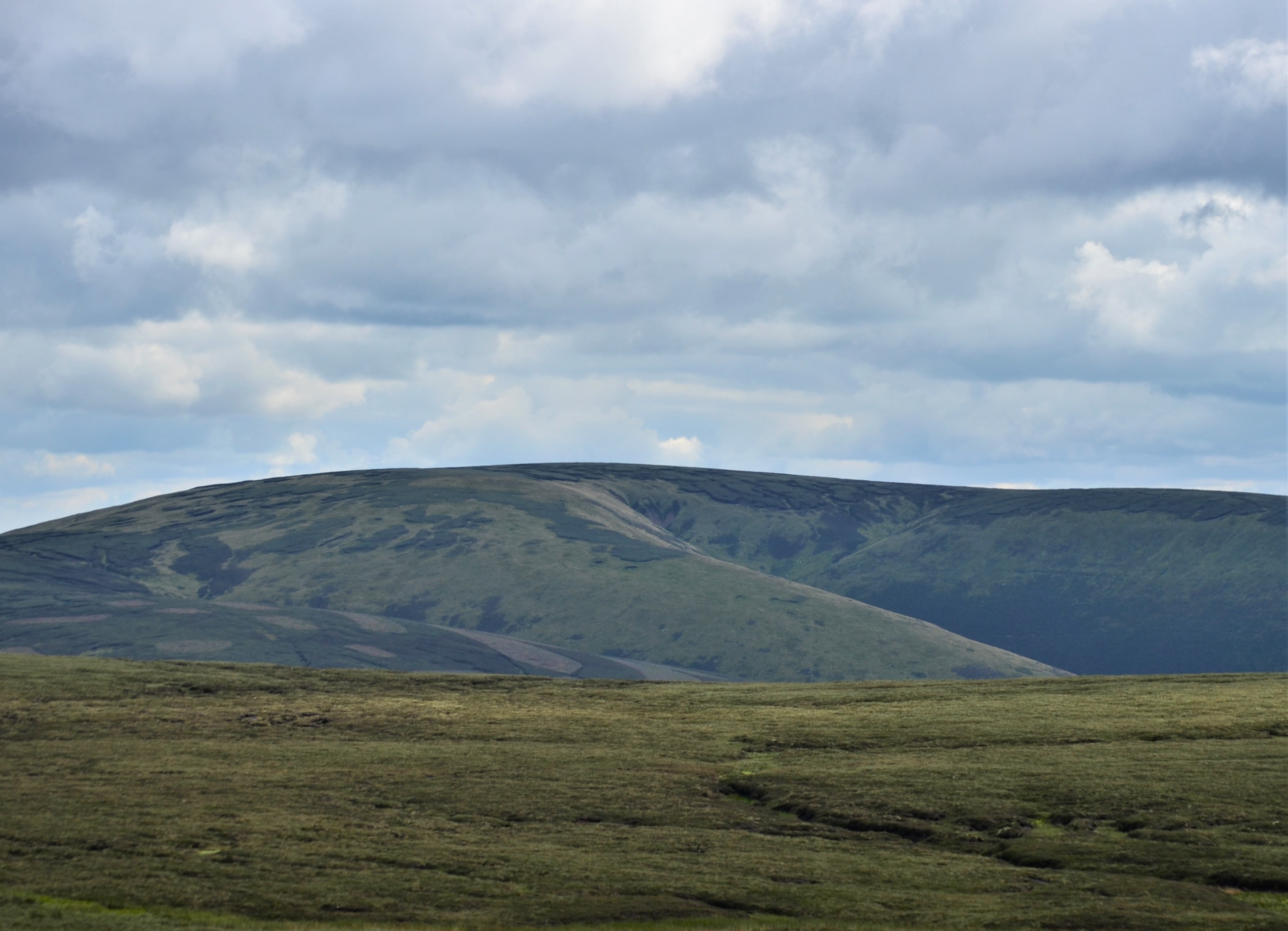
Cape Hill is a prominent hill located in the Peeblesshire region of Scotland. It forms part of the larger Southern Uplands range, which stretches across several counties in the southern part of the country. Standing at an elevation of approximately 710 meters (2,329 feet), Cape Hill offers breathtaking panoramic views of the surrounding countryside.

The hill is known for its distinctive conical shape, which is a result of its volcanic origins. It is composed mainly of basalt, a volcanic rock that gives the hill its dark appearance. Cape Hill is covered in heather and other vegetation typical of upland areas, creating a picturesque landscape.

Cape Hill is a popular destination for outdoor enthusiasts and hikers due to its accessibility and stunning vistas. Several well-marked trails lead to the summit, offering a range of difficulty levels for visitors to choose from. The hill is also home to a variety of wildlife, including birds of prey such as golden eagles and peregrine falcons, as well as red deer and various smaller mammals.

The surrounding area of Peeblesshire is known for its scenic beauty and rich history. Cape Hill is situated within close proximity to other notable landmarks, such as the historic town of Peebles and the renowned Glentress Forest, which is a popular destination for mountain bikers and nature lovers.

In summary, Cape Hill is a striking hill in Peeblesshire, Scotland, offering stunning views and a range of outdoor activities for visitors to enjoy. Its volcanic origins, diverse wildlife, and proximity to other attractions make it a must-visit destination for nature enthusiasts.

If you have any feedback on the listing, please let us know in the comments section below.

Cape Hill Images

Images are sourced within 2km of 55.704603/-3.1045337 or Grid Reference NT3046. Thanks to Geograph Open Source API. All images are credited.

Bowbeat Wind Farm from Kings Road Nick, Moorfoot Hills
Track at eastern end of Bowbeat Wind Farm - view to Blackhope Scar
Felled area above Williamslee Burn A view down the hillside along the edge of a felled area - most of this valley has been planted and logging is taking place further up the glen.
Felled area above Williamslee Burn
A view down the hillside along the edge of a felled area - most of this valley has been planted and logging is taking place further up the glen.
Upgraded forest road, Williamslee Hope The road surface has been spread with crushed stone and compacted in preparation for logging work.
Upgraded forest road, Williamslee Hope
The road surface has been spread with crushed stone and compacted in preparation for logging work.
Fauld Cleuch Rig A section of clear felled forest on Fauld Cleuch Rig in Williamslee Hope.
Fauld Cleuch Rig
A section of clear felled forest on Fauld Cleuch Rig in Williamslee Hope.
Fauld Cleuch Contrasting sides of the forestry by the small burn in Fauld Cleuch.
Fauld Cleuch
Contrasting sides of the forestry by the small burn in Fauld Cleuch.
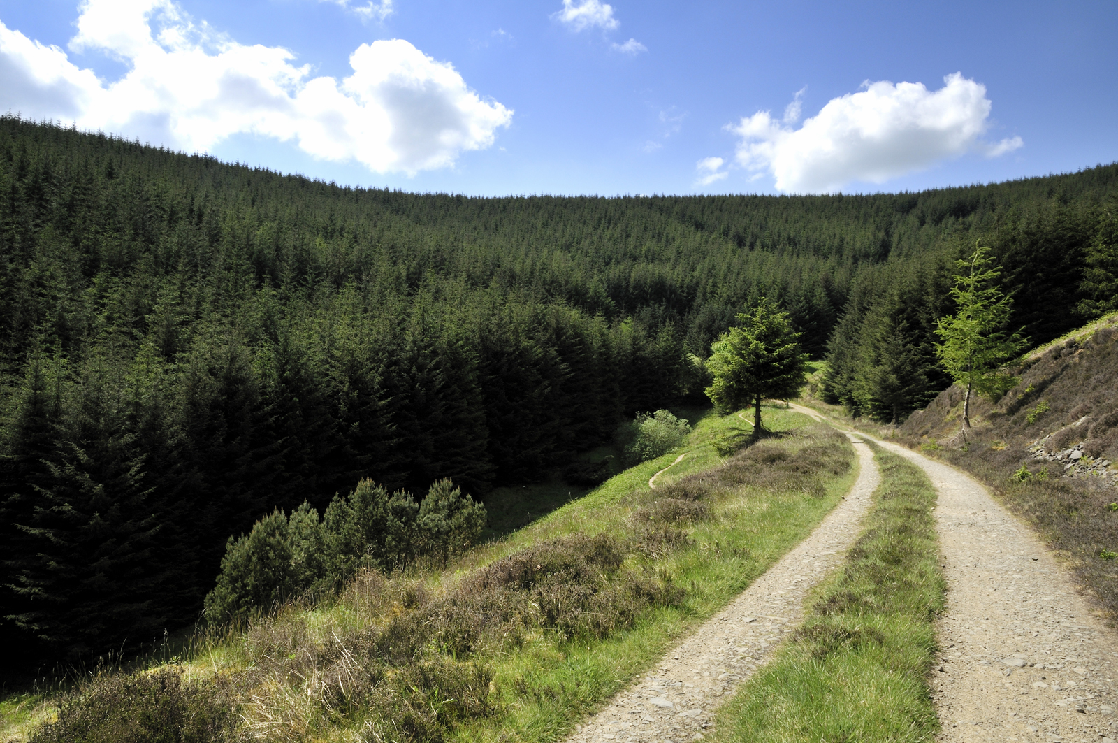
Forest road in Williamslee Hope The road climbs at a gentle gradient around the 450m contour on the W side of Williamslee Hope. The distinctive steep col (centre) is Leithen Door, Glentress Forest.
Forest road in Williamslee Hope
The road climbs at a gentle gradient around the 450m contour on the W side of Williamslee Hope. The distinctive steep col (centre) is Leithen Door, Glentress Forest.
Craigie Cleuch Several dry shaly gullies at the head of Craigie Cleuch, at the upper edge of the forestry plantation.
Craigie Cleuch
Several dry shaly gullies at the head of Craigie Cleuch, at the upper edge of the forestry plantation.
Gullies at Craigie Cleuch Several small gullies have formed where the edge of the peaty plateau S of Garvald Punks drops down to Williamslee Hope, a side valley of the Leithen Water. Seen from the track contouring just above the fringe of the forestry plantation.
Gullies at Craigie Cleuch
Several small gullies have formed where the edge of the peaty plateau S of Garvald Punks drops down to Williamslee Hope, a side valley of the Leithen Water. Seen from the track contouring just above the fringe of the forestry plantation.
Moorland and erosion gullies The expanse of almost flat peat moorland S of Blackhope Scar here meets the valley of Williamslee Hope, with several small gullies at the head of Craigie Cleuch.
Moorland and erosion gullies
The expanse of almost flat peat moorland S of Blackhope Scar here meets the valley of Williamslee Hope, with several small gullies at the head of Craigie Cleuch.
Thorter Cleuch The track skirting the forestry plantation in Wlliamslee Hope curves around the re-entrant of Thorter Cleuch.
Thorter Cleuch
The track skirting the forestry plantation in Wlliamslee Hope curves around the re-entrant of Thorter Cleuch.
Fauld Cleuch Rig forestry Forest road and clear felled area seen from the ridge between North Grain and South Grain.
Fauld Cleuch Rig forestry
Forest road and clear felled area seen from the ridge between North Grain and South Grain.
Sheepfold within the forest, Williamslee Hope A sheepfold near the foot of the ridge between North Grain and South Grain at the head of Williamslee Burn.
Sheepfold within the forest, Williamslee Hope
A sheepfold near the foot of the ridge between North Grain and South Grain at the head of Williamslee Burn.
Track by Williamslee Burn The Williamslee Burn is formed by the union of North Grain and South Grain, streams that drain the peat moorland south of Blackhope Scar.
Track by Williamslee Burn
The Williamslee Burn is formed by the union of North Grain and South Grain, streams that drain the peat moorland south of Blackhope Scar.
Track junction with forest road, Williamslee Hope The road follows the burn down to the valley of the Leithen Water.
Track junction with forest road, Williamslee Hope
The road follows the burn down to the valley of the Leithen Water.
Forest road and timber stacks Logging has been in progress by the Williamslee Burn.
Forest road and timber stacks
Logging has been in progress by the Williamslee Burn.
Bridge, Williamslee Burn The forest road leads out to the Leithen Water. <a href="https://www.geograph.org.uk/photo/260918">NT3245 : Forest roads and bridge, Williamslee burn</a> shows the bridge from the N side.
Bridge, Williamslee Burn
The forest road leads out to the Leithen Water. NT3245 : Forest roads and bridge, Williamslee burn shows the bridge from the N side.
Trap set on plank bridge Several rodent traps have been set on planks or logs across small burns and side streams in Williamslee Hope, with wooden or wire guards over them to keep out unintended visitors.
Trap set on plank bridge
Several rodent traps have been set on planks or logs across small burns and side streams in Williamslee Hope, with wooden or wire guards over them to keep out unintended visitors.
Show me another place!

Cape Hill is located at Grid Ref: NT3046 (Lat: 55.704603, Lng: -3.1045337)

Unitary Authority: The Scottish Borders

Police Authority: The Lothians and Scottish Borders

What 3 Words

///firelight.pumpkin.cosmetic. Near Peebles, Scottish Borders

Related Wikis

Bowbeat Hill

Bowbeat Hill is a hill in the Moorfoot Hills range, part of the Southern Uplands of Scotland. It lends its name to Bowbeat Onshore Wind Farm built on the...

Blackhope Scar

Blackhope Scar is a hill in the Moorfoot Hills range, part of the Southern Uplands of Scotland. It lies to the northeast of the town of Peebles and is...

Glentress Forest

Glentress Forest is located near Peebles in the Scottish Borders, about 30 miles south of Edinburgh. Part of the Tweed Valley Forest Park along with Traquair...

Moorfoot Hills

The Moorfoot Hills are a range of hills south of Edinburgh in east central Scotland, one of the ranges which collectively form the Southern Uplands....

Dewar, Scottish Borders

Dewar is a village by the Dewar Burn and Peatrig Hill, in the Scottish Borders area of Scotland. Places nearby include Allanshaugh, Borthwick Hall, Fountainhall...

Northshield Rings

Northshield Rings is a prehistoric site, a hillfort near the village of Eddleston and about 6 miles (10 km) north of Peebles, in the Scottish Borders,...

Peatrig Hill

Peatrig Hill is a minor hill in Scotland, located about 15 km south-southeast of Edinburgh. One of the Moorfoot Hills, it is located in the parish of Heriot...

Milkieston Rings

Milkieston Rings is a prehistoric site, a hillfort near the village of Eddleston and about 3 miles (5 km) north of Peebles, in the Scottish Borders, Scotland...

Related Videos

051.Blackhope Scar and the Moorfoots.Hiking in Scotland,England and Wales.

Video series about climbing the major mountains of the Scottish Highlands, England and Wales. Videó sorozat a Skót Felföld, ...

Nearby Amenities

Located within 500m of 55.704603,-3.1045337
Cape Hill
Natural: peak
Lat/Long: 55.7051104/-3.1053228
Ford: yes
Lat/Long: 55.7043118/-3.1110633
The data included in this document is from www.openstreetmap.org. The data is made available under ODbL.

Have you been to Cape Hill?

Leave your review of Cape Hill below (or comments, questions and feedback).