Hunston

Settlement in Suffolk Mid Suffolk

England

Hunston

The Walled Garden, Langham Hall
The Walled Garden, Langham Hall Credit: John Myers

Hunston is a small village located in the county of Suffolk, England. Situated approximately 5 miles southwest of the town of Chichester, Hunston is nestled in the picturesque South Downs National Park. The village is surrounded by stunning natural beauty, with rolling hills, lush green fields, and meandering streams.

Hunston is known for its rich history, dating back to the Roman era. The village's name is derived from "Hun," a Saxon warrior, and "tun," meaning farmstead or settlement. This suggests that the area has been inhabited for centuries.

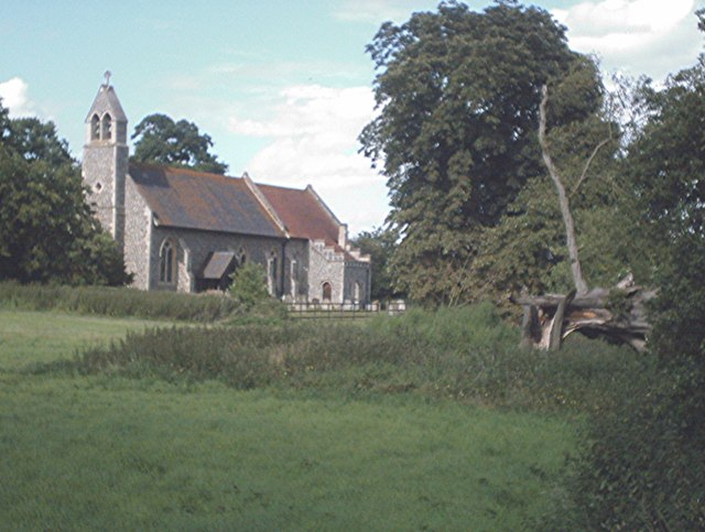
The village itself is quaint and charming, with a close-knit community. It boasts traditional thatched cottages, a picturesque village green, and a historic Norman church, St. Leodegar's. There is also a local pub, The Millstream, which serves as a popular gathering spot for residents and visitors alike.

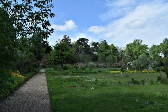
Hunston offers a peaceful and idyllic lifestyle, away from the hustle and bustle of larger towns and cities. It is a haven for nature lovers, with numerous walking and cycling trails that provide breathtaking views of the surrounding countryside. The nearby Chichester Harbour is a haven for wildlife and offers opportunities for boating and sailing.

Despite its rural setting, Hunston enjoys convenient access to amenities and facilities. The neighboring town of Chichester provides a range of shopping, dining, and entertainment options. The village is also well-connected, with good transport links to nearby cities such as Portsmouth and Brighton.

In summary, Hunston is a charming village in Suffolk, offering a tranquil and picturesque setting, a rich history, and a strong sense of community. It is a place where residents and visitors can enjoy the beauty of the English countryside while still having access to modern conveniences.

If you have any feedback on the listing, please let us know in the comments section below.

Hunston Images

Images are sourced within 2km of 52.279022/0.895604 or Grid Reference TL9768. Thanks to Geograph Open Source API. All images are credited.

The Walled Garden, Langham Hall
Power Lines North of Badwell Ash
Power Lines
North of Badwell Ash
The road to Langham The road briefly splits here going over a  signed "Weak Bridge" to the left and a lower culvert/ford to the right. If "ford" it is, I have never seen water flowing over it.
The road to Langham
The road briefly splits here going over a signed "Weak Bridge" to the left and a lower culvert/ford to the right. If "ford" it is, I have never seen water flowing over it.
Church of St Mary, Badwell Ash <span class="nowrap"><a title="https://historicengland.org.uk/listing/the-list/list-entry/1032210?section=official-list-entry" rel="nofollow ugc noopener" href="https://historicengland.org.uk/listing/the-list/list-entry/1032210?section=official-list-entry">Link</a><img style="margin-left:2px;" alt="External link" title="External link - shift click to open in new window" src="https://s1.geograph.org.uk/img/external.png" width="10" height="10"/></span>
Church of St Mary, Badwell Ash
Farmland at Langham Looking north across a stubble field towards Hillwatering Farm.
Farmland at Langham
Looking north across a stubble field towards Hillwatering Farm.
18th century almshouses by Stowlangtoft church
A farm track by Street Farm
The Street, Hunston View looking west towards Rose Cottage
The Street, Hunston
View looking west towards Rose Cottage
The Street, Hunston Unfortunately the bright red K6 Giles Gilbert Scott telephone box was vandalised and replaced by this modern affair.
The Street, Hunston
Unfortunately the bright red K6 Giles Gilbert Scott telephone box was vandalised and replaced by this modern affair.
View towards Hunston from Langham Hills The ground gently slopes down to the valley of the quiet hamlet of Hunston
View towards Hunston from Langham Hills
The ground gently slopes down to the valley of the quiet hamlet of Hunston
Maize near Hunston This hardy maize is not for the jolly green giant but provides cover and feed for game birds. The footpath through the maize provides a welcome relief from the heavy Suffolk clay.
Maize near Hunston
This hardy maize is not for the jolly green giant but provides cover and feed for game birds. The footpath through the maize provides a welcome relief from the heavy Suffolk clay.
Part of Kiln Lane
Part of Kiln Lane
The Street Road east from Stowlangtoft to Hunston
The Street
Road east from Stowlangtoft to Hunston
St George, Stowlangtoft
St George, Stowlangtoft - Gravestone
St George, Stowlangtoft
Show me another place!

Hunston is located at Grid Ref: TL9768 (Lat: 52.279022, Lng: 0.895604)

Administrative County: Suffolk

District: Mid Suffolk

Police Authority: Suffolk

What 3 Words

///machinery.talkative.jolly. Near Ixworth, Suffolk

Related Wikis

Hunston, Suffolk

Hunston is a small Suffolk village and civil parish set in a conservation area of Mid-Suffolk and lies between Stowlangtoft and Badwell Ash off the A1088...

Langham, Suffolk

Langham is a village and civil parish in the Mid Suffolk district of Suffolk in eastern England. Located around seven miles north east of Bury St Edmunds...

Stowlangtoft

Stowlangtoft is a village and civil parish in the Mid Suffolk district of Suffolk in eastern England two miles south-east from Ixworth. Located around...

Badwell Ash

Badwell Ash is a village and civil parish in the Mid Suffolk district of Suffolk, England, near Bury St Edmunds and Stowmarket. According to Eilert Ekwall...

Great Ashfield Castle

Great Ashfield Castle, also known locally as Castle Hill, is a medieval motte and bailey castle near the village of Great Ashfield, Suffolk, England....

The Gardens, Great Ashfield

The Gardens, Great Ashfield is a 3.8-hectare (9.4-acre) biological Site of Special Scientific Interest north of Great Ashfield in Suffolk.These ancient...

Great Ashfield

Great Ashfield is a village and civil parish in Suffolk, England, about 9 miles (14 km) east of Bury St Edmunds. The Domesday Book of 1086 records the...

Badwell Green

Badwell Green is a village in Suffolk, England. == External links == Media related to Badwell Green at Wikimedia Commons

Nearby Amenities

Located within 500m of 52.279022,0.895604
Hunston
Created By: POI Editor
Place: hamlet
Source: npe
Wikidata: Q2132447
Lat/Long: 52.278119/0.8948167
Dairy Farm
Naptan AtcoCode: 390040408
Naptan Bearing: W
Naptan BusStopType: CUS
Naptan CommonName: Dairy Farm
Naptan Indicator: opp
Naptan Landmark: Langham Turning
Naptan NaptanCode: sufawtmg
Naptan Street: The Street
Naptan Verified: no
Source: naptan_import
Lat/Long: 52.2791258/0.8954981
Dairy Farm
Naptan AtcoCode: 390040409
Naptan Bearing: E
Naptan BusStopType: CUS
Naptan CommonName: Dairy Farm
Naptan Indicator: adj
Naptan Landmark: Langham Turning
Naptan NaptanCode: sufawtmj
Naptan Street: The Street
Naptan Verified: no
Source: naptan_import
Lat/Long: 52.2791394/0.895675
Street Farm
Naptan AtcoCode: 390041030
Naptan Bearing: E
Naptan BusStopType: CUS
Naptan CommonName: Street Farm
Naptan Indicator: adj
Naptan Landmark: Street Farm
Naptan NaptanCode: sufjpdpd
Naptan Street: The Street
Naptan Verified: no
Source: naptan_import
Lat/Long: 52.2791976/0.8951362
Power: pole
Lat/Long: 52.2772531/0.8982554
Power: pole
Lat/Long: 52.2812359/0.8934973
Power: pole
Lat/Long: 52.2774861/0.8966086
Power: pole
Lat/Long: 52.2770332/0.8999023
Power: pole
Lat/Long: 52.27681/0.9016028
Power: pole
Lat/Long: 52.2746914/0.8941894
Power: pole
Lat/Long: 52.2788483/0.8931674
Power: pole
Lat/Long: 52.2774238/0.8935079
Power: pole
Lat/Long: 52.2819497/0.893661
Power: pole
Lat/Long: 52.2782099/0.893315
Power: pole
Lat/Long: 52.2773877/0.8956108
Power: pole
Lat/Long: 52.2765213/0.8937522
Power: pole
Lat/Long: 52.2822451/0.8948733
Power: pole
Lat/Long: 52.2794604/0.8930199
Power: pole
Lat/Long: 52.2805008/0.8933552
Power: pole
Lat/Long: 52.2756006/0.8940125
Ford: yes
Lat/Long: 52.2811919/0.8960049
Post Box
Collection Times: Mo-Fr 16:00; Sa 11:15
Post Box Mounting: brick_pillar
Post Box Type: wall
Ref: IP31 2034
Royal Cypher: EIIR
Royal Cypher Wikidata: Q33102113
Lat/Long: 52.2792452/0.8946683
The data included in this document is from www.openstreetmap.org. The data is made available under ODbL.

Have you been to Hunston?

Leave your review of Hunston below (or comments, questions and feedback).