Binn Hill

Hill, Mountain in Morayshire

Scotland

Binn Hill

Gulls on grassland A grassy field with sandy hills beyond. A change from the vast acreage of barley grown here.
Gulls on grassland Credit: Richard Webb

Binn Hill, also known as Hill of Binn or Bin Hill, is a prominent hill located in Morayshire, Scotland. It rises to an elevation of 327 meters (1,073 feet) above sea level and is situated near the village of Deskford, about 5 miles east of Cullen.

Binn Hill is known for its distinctive conical shape, making it easily recognizable from the surrounding area. It is primarily composed of quartzite, a hard metamorphic rock, which gives the hill its characteristic appearance. The hill is also covered with heather and grass, adding to its natural beauty.

The hill offers breathtaking panoramic views of the surrounding countryside, including the Moray Firth and the coastal towns of Cullen and Portknockie. On clear days, it is even possible to see as far as the Cairngorms National Park to the south.

Binn Hill is a popular destination for hikers and walkers, with a well-marked path leading to the summit. The ascent can be moderately challenging, but the reward is well worth it. Once at the top, visitors can enjoy the stunning vistas and take in the peaceful and serene atmosphere.

In addition to its natural beauty, Binn Hill also holds historical significance. There are remnants of an Iron Age hillfort located on the eastern slopes, providing insights into the area's ancient past.

Overall, Binn Hill is a captivating and picturesque destination that offers a memorable experience for outdoor enthusiasts and nature lovers alike.

If you have any feedback on the listing, please let us know in the comments section below.

Binn Hill Images

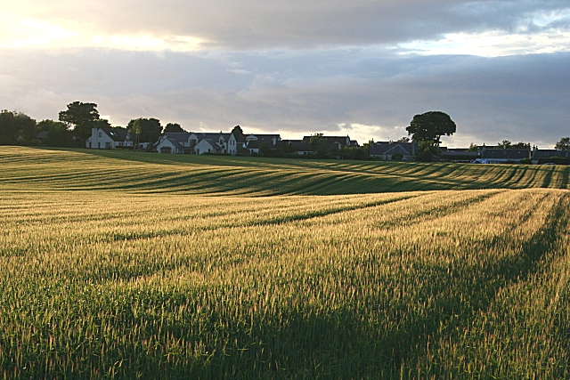
Images are sourced within 2km of 57.671473/-3.1665156 or Grid Reference NJ3065. Thanks to Geograph Open Source API. All images are credited.

Gulls on grassland A grassy field with sandy hills beyond. A change from the vast acreage of barley grown here.
Gulls on grassland
A grassy field with sandy hills beyond. A change from the vast acreage of barley grown here.
Minor road near Garmouth A quiet road (it was before 7am) between a grassy field and a barley field. The soils are sandy here, near the Lossie dune complex.
A quail was calling from the barley.
Minor road near Garmouth
A quiet road (it was before 7am) between a grassy field and a barley field. The soils are sandy here, near the Lossie dune complex. A quail was calling from the barley.
Binn Hill woodland Conifer plantation on sandy hills near Garmouth.
Binn Hill woodland
Conifer plantation on sandy hills near Garmouth.
Woodland extension Wallfield Wood is being extended with new broadleafed plantations.
Woodland extension
Wallfield Wood is being extended with new broadleafed plantations.
Ringlet (Aphantophus hyperantus) The Ringlet is unusual in that it flies even in quite dull weather. It was the only one in evidence this afternoon. It did open its wings at one point, showing that the upper surface was almost black, so this is a male. The female's upper wings are much paler. See also <a href="https://www.geograph.org.uk/photo/3039728">NJ1863 : Ringlet (Aphantophus hyperantus)</a>.
Ringlet (Aphantophus hyperantus)
The Ringlet is unusual in that it flies even in quite dull weather. It was the only one in evidence this afternoon. It did open its wings at one point, showing that the upper surface was almost black, so this is a male. The female's upper wings are much paler. See also NJ1863 : Ringlet (Aphantophus hyperantus).
"Flattie" bashing west of Kingston What an idyllic day for "flattie" bashing or angling for flat fish over the gravel and sands of the Moray Firth. There's the occasional Bass, Seatrout, Plaice or Dab to be had from these shores but the usual quarray is the Flounder (Platichthys flesus) or Muddick as it is known as locally. That's Spey Bay which you see in the background.<a href="https://www.geograph.org.uk/photo/3158145">NJ3266 : A Flounder study</a>
"Flattie" bashing west of Kingston
What an idyllic day for "flattie" bashing or angling for flat fish over the gravel and sands of the Moray Firth. There's the occasional Bass, Seatrout, Plaice or Dab to be had from these shores but the usual quarray is the Flounder (Platichthys flesus) or Muddick as it is known as locally. That's Spey Bay which you see in the background.NJ3266 : A Flounder study
A Flounder study Two minutes ago this pair of flounders (Platichthys flesus) was happily at home in the Moray Firth until they succumbed to hunger pangs and were temporarily extracted from the brine. Note the whiter than white underside and eyes that are located on the right hand side of the head. Flounders thrive on small crustaceans, lugworm and molluscs but it was a little mackerel strip which captured this duo. Both fish were returned unscathed to the Moray Firth.
A Flounder study
Two minutes ago this pair of flounders (Platichthys flesus) was happily at home in the Moray Firth until they succumbed to hunger pangs and were temporarily extracted from the brine. Note the whiter than white underside and eyes that are located on the right hand side of the head. Flounders thrive on small crustaceans, lugworm and molluscs but it was a little mackerel strip which captured this duo. Both fish were returned unscathed to the Moray Firth.
Where's the fish then? I feel that the magic of angling is found in the making contact with a wild creature that has access to countless thousand square miles of ocean.<a href="https://www.geograph.org.uk/photo/3158145">NJ3266 : A Flounder study</a>
Where's the fish then?
I feel that the magic of angling is found in the making contact with a wild creature that has access to countless thousand square miles of ocean.NJ3266 : A Flounder study
The Earth, the Sea, and the Sky Miles and miles of glorious shingle beach and not a soul in sight where dolphins visit for privacy! <a href="https://www.geograph.org.uk/photo/175836">NJ2967 : Jewels of the Boar's Head Shoreline, Morayshire</a>
The Earth, the Sea, and the Sky
Miles and miles of glorious shingle beach and not a soul in sight where dolphins visit for privacy! NJ2967 : Jewels of the Boar's Head Shoreline, Morayshire
Pillbox and Defences When it was built this pillbox had an uninterrupted view to seaward. Now, the view is blocked by banks of cobbles built up by the sea in the interim. Compare with <a href="https://www.geograph.org.uk/photo/868161">NJ3266 : Pill Box and Tank Traps</a> and <a href="https://www.geograph.org.uk/photo/73209">NJ3266 : Pill box and sea defences</a>.
Pillbox and Defences
When it was built this pillbox had an uninterrupted view to seaward. Now, the view is blocked by banks of cobbles built up by the sea in the interim. Compare with NJ3266 : Pill Box and Tank Traps and NJ3266 : Pill box and sea defences.
Orange Gorse Fungus There is quite a lot of this bright orange fungus on dead whin branches in the shade beside the path. It is possibly Tremella mesenterica, which has several names including yellow brain, the golden jelly fungus, the yellow trembler, and witches' butter. Thanks to Kenneth Allen for help with identification.
Orange Gorse Fungus
There is quite a lot of this bright orange fungus on dead whin branches in the shade beside the path. It is possibly Tremella mesenterica, which has several names including yellow brain, the golden jelly fungus, the yellow trembler, and witches' butter. Thanks to Kenneth Allen for help with identification.
Pillbox and Tank Traps This is part of the coastal defences built during the Second World War to prevent invasion via the low-lying parts of the east coast.
Pillbox and Tank Traps
This is part of the coastal defences built during the Second World War to prevent invasion via the low-lying parts of the east coast.
Whin Sculpture Even after the recent exceptionally long spell of frost, the whins are in flower, the bushes neatly trimmed by the winter gales.
Whin Sculpture
Even after the recent exceptionally long spell of frost, the whins are in flower, the bushes neatly trimmed by the winter gales.
Tank Traps and Pillbox This is part of the coastal defences built during the Second World War to prevent invasion via the low-lying parts of the east coast.
Tank Traps and Pillbox
This is part of the coastal defences built during the Second World War to prevent invasion via the low-lying parts of the east coast.
Tank Traps and Pillbox This is part of the coastal defences built during the Second World War to prevent invasion via the low-lying parts of the east coast. Notice the stunted pine in the foreground - the wind tends to keep down all the vegetation close to the sea here.
Tank Traps and Pillbox
This is part of the coastal defences built during the Second World War to prevent invasion via the low-lying parts of the east coast. Notice the stunted pine in the foreground - the wind tends to keep down all the vegetation close to the sea here.
Doing the Twist Usually Scots Pines grow pretty straight when they are close together in a forest plantation, but these ones have a definite twist in their trunks for some reason.
Doing the Twist
Usually Scots Pines grow pretty straight when they are close together in a forest plantation, but these ones have a definite twist in their trunks for some reason.
Creeping Soft-grass (Holcus mollis) At least I think that's what it is, but I am open to correction. It is one of the commonest grasses here. The reddish fronds are young ones, and the pale feathery ones are the mature seed heads.
Creeping Soft-grass (Holcus mollis)
At least I think that's what it is, but I am open to correction. It is one of the commonest grasses here. The reddish fronds are young ones, and the pale feathery ones are the mature seed heads.
Ephemeral Lagoon A small temporary lagoon forms most winters along the tank traps on the beach west of Kingston. The shadow is that of the elevated sentry post <a href="https://www.geograph.org.uk/photo/868151">NJ3266 : No Danger Today</a> at the entrance to the rifle range, from which this shot was taken.
Ephemeral Lagoon
A small temporary lagoon forms most winters along the tank traps on the beach west of Kingston. The shadow is that of the elevated sentry post NJ3266 : No Danger Today at the entrance to the rifle range, from which this shot was taken.
Show me another place!

Binn Hill is located at Grid Ref: NJ3065 (Lat: 57.671473, Lng: -3.1665156)

Unitary Authority: Moray

Police Authority: North East

What 3 Words

///furniture.usages.renting. Near Lhanbryde, Moray

Nearby Locations

Binn Hill

Related Wikis

Burniestrype

Burniestrype is a hamlet in Moray, Scotland.

Urquhart railway station

Urquhart railway station was a railway station serving the village of Urquhart, parish of Urquhart, Moray. The railway station was opened by the Great...

Urquhart Priory

Urquhart Priory was a Benedictine monastic community in Moray; the priory was dedicated to the Holy Trinity. It was founded by King David I of Scotland...

Urquhart, Moray

Urquhart ( UR-kərt; Scottish Gaelic: Urchard) is a small village in Moray, Scotland. It is approximately 5 miles (8 km) east of Elgin, between the villages...

Have you been to Binn Hill?

Leave your review of Binn Hill below (or comments, questions and feedback).