Craig Marloch
Hill, Mountain in Angus
Scotland
Craig Marloch

Craig Marloch is a hill located in the Angus region of Scotland. It is part of the Grampian Mountains, which stretch across the eastern part of the country. The hill is situated approximately 12 miles northeast of the town of Forfar and stands at a height of around 585 meters (1,919 feet) above sea level.
Craig Marloch is known for its rugged and wild terrain, offering a challenging yet rewarding experience for hikers and mountaineers. The hill is characterized by steep slopes, rocky outcrops, and numerous scree fields, making it a popular destination for those seeking adventure and stunning panoramic views of the surrounding landscape.
The hill is covered in heather and grasses, providing habitat for various wildlife species such as mountain hares, red deer, and numerous bird species. It is also home to several rare plant species that have adapted to the harsh mountain environment.
Due to its location within the Cairngorms National Park, Craig Marloch is subject to conservation efforts aimed at preserving its natural beauty and protecting its diverse ecosystem. The hill attracts outdoor enthusiasts throughout the year, with activities including hiking, climbing, and wildlife watching.
Visitors to Craig Marloch are advised to come well-prepared with appropriate clothing and equipment, as the weather conditions on the hill can be unpredictable and change rapidly. It is also recommended to consult local guides or maps to ensure a safe and enjoyable experience on this magnificent Angus mountain.
If you have any feedback on the listing, please let us know in the comments section below.
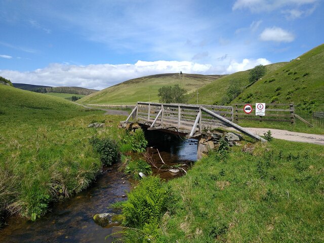
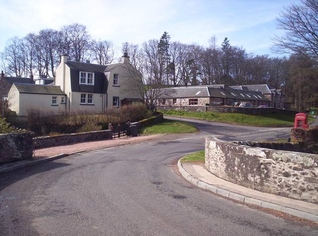
Craig Marloch Images
Images are sourced within 2km of 56.732627/-3.1388246 or Grid Reference NO3060. Thanks to Geograph Open Source API. All images are credited.


Craig Marloch is located at Grid Ref: NO3060 (Lat: 56.732627, Lng: -3.1388246)
Unitary Authority: Angus
Police Authority: Tayside
What 3 Words
///baking.fuse.perfumes. Near Kirriemuir, Angus
Nearby Locations
Related Wikis

Cat Law
Cat Law (671 m) is a hill in the southern Mounth of Scotland, north of Kirriemuir in Angus. A rounded peak, it lies above Strathmore in the south and offers...

Balintore Castle
Balintore Castle is a Victorian Category A listed building in Scotland. The castle occupies an elevated site in moorland above Balintore village, a few...
Balintore, Angus
Balintore (Scottish Gaelic: Baile an Todhair) is a village in Angus, Scotland. It lies in Glen Isla, four miles north of the Loch of Lintrathen and seven...

Ascreavie
Ascreavie is a country house in Angus, Scotland. It is located 2 kilometres (1.2 mi) north of Kirkton of Kingoldrum, and 6 kilometres (3.7 mi) north-west...

Backwater Reservoir
Backwater Reservoir is a reservoir in north west Angus, Scotland. The reservoir's sole purpose is to provide drinking water, and as such, it supplies Angus...

Loch of Lintrathen
Loch of Lintrathen is a man-made loch occupying a glacial basin at the southern end of Glen Isla, approximately 13 kilometres (8.1 mi) west of town of...

Kirkton of Kingoldrum
Kirkton of Kingoldrum is a village in Angus, Scotland. It lies in approximately four miles (6 km) west of Kirriemuir on the B951 road. == References ==
Bridgend of Lintrathen
Bridgend of Lintrathen is a village in Angus, Scotland. It is situated on the southern shore of Loch of Lintrathen, six miles west of Kirriemuir. ��2...
Nearby Amenities
Located within 500m of 56.732627,-3.1388246Have you been to Craig Marloch?
Leave your review of Craig Marloch below (or comments, questions and feedback).