Cherry Lair

Hill, Mountain in Roxburghshire

Scotland

Cherry Lair

Craik Cross Hill on Romans & Reivers Route Not much of a track or surface on this section of the Romans & Reivers Route. Unchallenging for hikers but means pushing for cyclists. Track resumes at top.
Craik Cross Hill on Romans & Reivers Route Credit: Kim McGillivray

Cherry Lair is a prominent hill located in the county of Roxburghshire, Scotland. Standing at an elevation of approximately 389 meters (1,276 feet), it is considered one of the notable peaks in the area. The hill is situated near the village of Morebattle, about 20 kilometers (12 miles) southeast of Kelso.

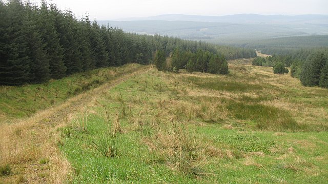
Cherry Lair offers breathtaking panoramic views of the surrounding countryside, making it a popular destination for hikers and nature enthusiasts. Its distinct conical shape and lush greenery add to its visual appeal, especially during the spring and summer months when the landscape is blanketed with colorful wildflowers.

The hill is characterized by its gentle slopes, which make it relatively easy to climb for individuals of varying fitness levels. A well-marked footpath guides visitors to the summit, where they can soak in the stunning vistas of the rolling hills, meandering rivers, and picturesque valleys that extend as far as the eye can see.

Cherry Lair also holds historical significance, as it is believed to have been an ancient hillfort. Archaeological remains, including remnants of defensive structures, have been discovered at the site, providing insights into its past use as a defensive stronghold.

Overall, Cherry Lair presents an opportunity for outdoor enthusiasts to engage in a rewarding hike while enjoying the natural beauty and historical heritage of Roxburghshire.

If you have any feedback on the listing, please let us know in the comments section below.

Cherry Lair Images

Images are sourced within 2km of 55.339214/-3.0997026 or Grid Reference NT3005. Thanks to Geograph Open Source API. All images are credited.

Craik Cross Hill on Romans & Reivers Route Not much of a track or surface on this section of the Romans & Reivers Route. Unchallenging for hikers but means pushing for cyclists. Track resumes at top.
Craik Cross Hill on Romans & Reivers Route
Not much of a track or surface on this section of the Romans & Reivers Route. Unchallenging for hikers but means pushing for cyclists. Track resumes at top.
The southern end of Moodlaw Loch The area in the foreground consists of damp, tussocky vegetation and one has to be wary where the feet are placed.  Harvesting is taking place nearby and it may well be that come the same time next year, Moodlaw Loch is free of forestry on all sides.

This photograph was taken during the Coronavirus (COVID-19) pandemic of 2020.
The southern end of Moodlaw Loch
The area in the foreground consists of damp, tussocky vegetation and one has to be wary where the feet are placed. Harvesting is taking place nearby and it may well be that come the same time next year, Moodlaw Loch is free of forestry on all sides. This photograph was taken during the Coronavirus (COVID-19) pandemic of 2020.
Gate, Ladder Law On the col between Ladder Law and Ladshaw Fell, this is a key link in the circuit of the Howpasley Burn, joining two segments of forest tracks, and easily missed when coming from the S as it is hidden by the small trees.
Gate, Ladder Law
On the col between Ladder Law and Ladshaw Fell, this is a key link in the circuit of the Howpasley Burn, joining two segments of forest tracks, and easily missed when coming from the S as it is hidden by the small trees.
Ladshaw Sike One of the tributaries to the Howpasley Burn
Ladshaw Sike
One of the tributaries to the Howpasley Burn
Comb Sike The pipe forms a culvert bridge under the forestry road
Comb Sike
The pipe forms a culvert bridge under the forestry road
Crossing the Wolfcleuch Burn The road has been reopened after being blocked by windthrown trees. Some paths are still blocked elsewhere in the forest.
Crossing the Wolfcleuch Burn
The road has been reopened after being blocked by windthrown trees. Some paths are still blocked elsewhere in the forest.
Ride, Craik Forest An area of spruce ready for harvesting. View down the ride towards Craik Moor.
Ride, Craik Forest
An area of spruce ready for harvesting. View down the ride towards Craik Moor.
Ride, Long Tae (Craik Forest) This ride was once enclosed like its continuation over on far side of the Rankle Burn. One side was felled, and the wind did for the remaining trees on the eastern side. Cotton grass is a reminder that this was once boggy moorland.
Ride, Long Tae (Craik Forest)
This ride was once enclosed like its continuation over on far side of the Rankle Burn. One side was felled, and the wind did for the remaining trees on the eastern side. Cotton grass is a reminder that this was once boggy moorland.
Ride junction, Long Tae A large replanted area on the northeast side of a boggy ride (complete with cotton grass).
Ride junction, Long Tae
A large replanted area on the northeast side of a boggy ride (complete with cotton grass).
Roman road, Craik Cross Hill Looking up the wide ride left along the site of the Roman road towards the summit of Craik Cross Hill. The going would be hard here, if it were not for the new path on the left hand side of the ride, this is part of a long distance route from Ae to Hawick, and is designed for horse traffic. Sadly it is little used, and acting as a seedbed for self seeding Sitka spruce. Without traffic, or herbicides it will soon be unridable. At the moment it gives an enjoyable , sometimes wheel lifting climb from the road end at<a href="https://www.geograph.org.uk/photo/967099">NT2904 : Road end, Mid Moss</a>.
Roman road, Craik Cross Hill
Looking up the wide ride left along the site of the Roman road towards the summit of Craik Cross Hill. The going would be hard here, if it were not for the new path on the left hand side of the ride, this is part of a long distance route from Ae to Hawick, and is designed for horse traffic. Sadly it is little used, and acting as a seedbed for self seeding Sitka spruce. Without traffic, or herbicides it will soon be unridable. At the moment it gives an enjoyable , sometimes wheel lifting climb from the road end atNT2904 : Road end, Mid Moss.
Roman road, Craik Cross Hill New path along or sometimes parallel with the Roman road over Craik Cross Hill. The hard surfaced path makes travel over the watershed much easier for feet, hooves and wheels than the soft deep grass of the ride that runs the course of the Roman Road. It gets little use, and is being colonised by spruce seedlings.
Roman road, Craik Cross Hill
New path along or sometimes parallel with the Roman road over Craik Cross Hill. The hard surfaced path makes travel over the watershed much easier for feet, hooves and wheels than the soft deep grass of the ride that runs the course of the Roman Road. It gets little use, and is being colonised by spruce seedlings.
Roman road, Craik Moor A cutting on the old road off Craik Cross Hill. I expect it was used long after the brief Roman involvement here, judging by the cuttings. It is now lost to deep grass and bog. Fortunately there is now a firm new path crossing from the Forestry Commission's woods around Craik to Kronospan's Eskdalemuir forests, so the route is quite easy again and forms part of a long distance path from Ae to Hawick.
Roman road, Craik Moor
A cutting on the old road off Craik Cross Hill. I expect it was used long after the brief Roman involvement here, judging by the cuttings. It is now lost to deep grass and bog. Fortunately there is now a firm new path crossing from the Forestry Commission's woods around Craik to Kronospan's Eskdalemuir forests, so the route is quite easy again and forms part of a long distance path from Ae to Hawick.
Ride, Craik Cross Hill Very rough ground along an old fence from the sheepwalk days. I was looking for a break in the trees heading south, but failed. My map showed the rides in the last generation of forest planted here, none were left in the young trees growing now.
Ride, Craik Cross Hill
Very rough ground along an old fence from the sheepwalk days. I was looking for a break in the trees heading south, but failed. My map showed the rides in the last generation of forest planted here, none were left in the young trees growing now.
Cherry Lair A friendly greeting from a small enclave of woodland that is neither owned by Kronospan nor the Forestry Commission. Despite the unsuccessful attempt to squeeze a goml sign past the Land Reform Act (2003) the ride beyond did provide an escape route from the deep vegetation of the ride along the Roxburghshire-Dumfriesshire march.
The photograph was taken from the main east-west watershed of Scotland.
Cherry Lair
A friendly greeting from a small enclave of woodland that is neither owned by Kronospan nor the Forestry Commission. Despite the unsuccessful attempt to squeeze a goml sign past the Land Reform Act (2003) the ride beyond did provide an escape route from the deep vegetation of the ride along the Roxburghshire-Dumfriesshire march. The photograph was taken from the main east-west watershed of Scotland.
Road, Post Office Knowe Near the road end on the Dumfriesshire side of Post Office Knowe.
Road, Post Office Knowe
Near the road end on the Dumfriesshire side of Post Office Knowe.
Ae - Hawick path, Langshawburn On the climb up to the Roman road, a real wheel-lifter. The new path allows an easy crossing of the watershed between Eskdale and Croik, which was all but blocked by forestry.
Ae - Hawick path, Langshawburn
On the climb up to the Roman road, a real wheel-lifter. The new path allows an easy crossing of the watershed between Eskdale and Croik, which was all but blocked by forestry.
Roman road, Craik Cross Hill The ride along the route of a Roman Road to Trimontium (Melrose).  Its tough going through long grass, but an easy alternative now exists thanks to a new path connecting the forest in Roxburghshire with the Dumfriesshire side over Craik Cross Hill. The path heads down a gap in the trees to the right and joins up with a logging road to Aberlosk.
Roman road, Craik Cross Hill
The ride along the route of a Roman Road to Trimontium (Melrose). Its tough going through long grass, but an easy alternative now exists thanks to a new path connecting the forest in Roxburghshire with the Dumfriesshire side over Craik Cross Hill. The path heads down a gap in the trees to the right and joins up with a logging road to Aberlosk.
Interpretation board,  Craik Cross Hill Near the summit, on the watershed. Artists impression of the signal tower that once stood here.
Interpretation board, Craik Cross Hill
Near the summit, on the watershed. Artists impression of the signal tower that once stood here.
Show me another place!

Cherry Lair is located at Grid Ref: NT3005 (Lat: 55.339214, Lng: -3.0997026)

Unitary Authority: Dumfries and Galloway

Police Authority: Dumfries and Galloway

What 3 Words

///highs.breeze.forever. Near Ettrick, Scottish Borders

Nearby Locations

Cherry Lair

Related Wikis

Craik, Scottish Borders

Craik is a hamlet in Craik Forest, by the Airhouse Burn in the Scottish Borders area of Scotland, close to Roberton, Scottish Borders (grid reference NT348084...

Craik Forest

Craik Forest is a forest near Hawick in the Scottish Borders area of Scotland, and managed by the Forestry Commission. It is adjoined to the south-west...

Eskdalemuir Observatory

The Eskdalemuir Observatory is a UK national environmental observatory located near Eskdalemuir, Dumfries and Galloway, Scotland. Along with Lerwick and...

Falnash

Falnash (Scots: Fawenesh) is a village in the Scottish Borders of Scotland. It is near Teviothead, in the former Roxburghshire, and in the parish of Teviothead...

Have you been to Cherry Lair?

Leave your review of Cherry Lair below (or comments, questions and feedback).