Cook's Cairn
Hill, Mountain in Banffshire
Scotland
Cook's Cairn
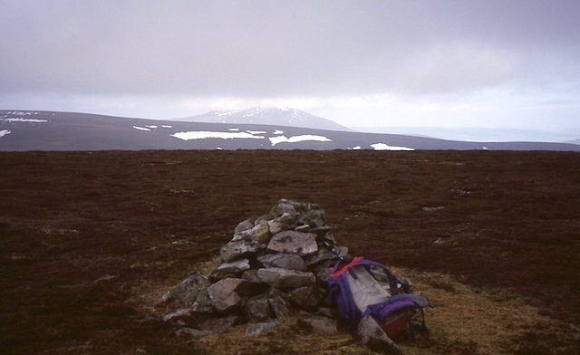
Cook's Cairn is a prominent hill located in the county of Banffshire, in northeastern Scotland. Situated near the village of Portsoy, this cairn is a well-known landmark in the region. Standing at an elevation of approximately 305 meters (1,000 feet), it offers breathtaking panoramic views of the surrounding countryside, making it a popular destination for hikers and nature enthusiasts.
The cairn is named in honor of Captain James Cook, the renowned British explorer, and navigator. Cook is said to have climbed the hill during his childhood while living in nearby Cullen. It is believed that he used this vantage point to survey the coastline, sparking his early interest in maritime exploration.
The hill is adorned with a large cairn, a man-made pile of stones, which is believed to have been constructed in the 19th century to commemorate Cook's connection to the area. The cairn stands as a tribute to his achievements and serves as a reminder of the historical significance of the region.
The area surrounding Cook's Cairn is characterized by rolling hills, lush green meadows, and picturesque farmland, creating a stunning backdrop for outdoor activities such as walking, picnicking, and wildlife spotting. The hill is easily accessible, with a well-marked trail leading to the summit. Along the way, visitors can enjoy the diverse flora and fauna that populate the area, including heather, wildflowers, and numerous bird species.
Overall, Cook's Cairn is a captivating destination that offers both historical significance and natural beauty, making it a must-visit spot for those exploring the Banffshire region.
If you have any feedback on the listing, please let us know in the comments section below.
Cook's Cairn Images
Images are sourced within 2km of 57.335857/-3.1606885 or Grid Reference NJ3027. Thanks to Geograph Open Source API. All images are credited.


Cook's Cairn is located at Grid Ref: NJ3027 (Lat: 57.335857, Lng: -3.1606885)
Unitary Authority: Moray
Police Authority: North East
What 3 Words
///unscrew.cassettes.organ. Near Dufftown, Moray
Nearby Locations
Related Wikis

Battle of Glenlivet
The Battle of Glenlivet was a Scottish clan battle fought on 3 October 1594 near Glenlivet, Moray, Scotland. It was fought between Protestant forces loyal...

Achnastank
Achnastank (Scottish Gaelic: Achadh nan Staing, field of the pool/ditch) is a scattered settlement, south east of Ben Rinnes, in the Scottish council area...
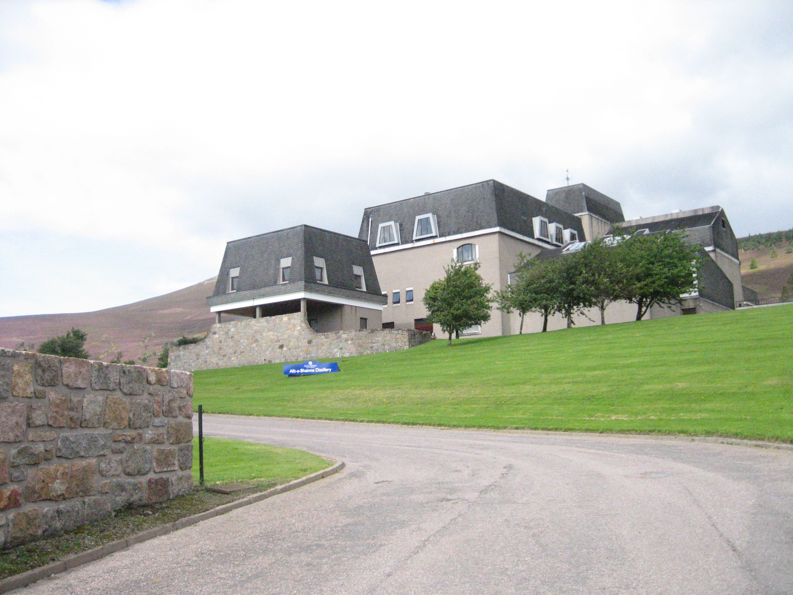
Allt-A-Bhainne distillery
Allt-A-Bhainne distillery (Scottish Gaelic: Allt a' Bhainne [al̪ˠt̪əˈvaɲə], meaning 'milk burn') is a Scotch whisky distillery in the Speyside Region of...

Cabrach
The Cabrach (Scottish Gaelic: A' Chabrach, A' Chabraich) is an estate and largely depopulated rural community in Moray, Scotland. The meaning of the name...

Church of The Incarnation, Tombae
The Church of The Incarnation was built between 1827 and 1829 as a Roman Catholic church, under the patronage of the Gordon family, in Banffshire, Scotland...

Ben Rinnes
Ben Rinnes (Scottish Gaelic: Beinn Ruaidhneis) is a mountain in Banffshire, in northern Scotland. The mountain is popular with hikers. The mountain is...

Tamnavulin distillery
Tamnavulin distillery is a producer of single malt Scotch whisky that was founded in 1966. The distillery is operated by Whyte & Mackay, which Philippines...
Auchbreck
Auchbreck (Scottish Gaelic: An t-Achadh Breac, meaning the speckled field) is a village in Moray, Scotland.
Nearby Amenities
Located within 500m of 57.335857,-3.1606885Have you been to Cook's Cairn?
Leave your review of Cook's Cairn below (or comments, questions and feedback).