South Grain Pike

Hill, Mountain in Dumfriesshire

Scotland

South Grain Pike

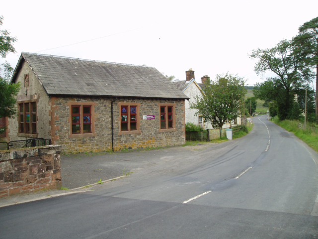
Greensykes Refurbished 2011
Greensykes Credit: Brian Barclay

South Grain Pike is a prominent hill located in Dumfriesshire, Scotland. It stands at an elevation of 536 meters (1,759 feet) above sea level and is part of the Lowther Hills range in the Southern Uplands of Scotland. The hill is characterized by its rugged terrain, with steep slopes and rocky outcrops scattered across its surface.

South Grain Pike offers stunning panoramic views of the surrounding countryside, including the rolling hills and valleys of Dumfriesshire. On a clear day, visitors can see as far as the Solway Firth and the Lake District in England. The hill is a popular destination for hikers and outdoor enthusiasts, with several walking trails leading to its summit.

The vegetation on South Grain Pike is typical of the Scottish uplands, with heather, grasses, and scattered patches of woodland covering the slopes. The hill is also home to a variety of wildlife, including red deer, mountain hares, and birds of prey such as buzzards and kestrels.

Overall, South Grain Pike is a picturesque and challenging destination for those looking to explore the natural beauty of Dumfriesshire and the Scottish Uplands.

If you have any feedback on the listing, please let us know in the comments section below.

South Grain Pike Images

Images are sourced within 2km of 55.300144/-3.10541 or Grid Reference NT2901. Thanks to Geograph Open Source API. All images are credited.

Greensykes Refurbished 2011
Greensykes
Refurbished 2011
Greensykes
Greensykes
Bushy Knowe Young Sitka plantation with a recent clearfelled block in the foreground.
Bushy Knowe
Young Sitka plantation with a recent clearfelled block in the foreground.
Forest road near Greensykes Joins up with farm tracks to Jamestown, beyond a locked gate. A newly felled block on the left above the Meggat Water.
Forest road near Greensykes
Joins up with farm tracks to Jamestown, beyond a locked gate. A newly felled block on the left above the Meggat Water.
Looking down Kirk Cleuch The edge of the vast forest, Eskdalemuir and Craik, with surviving farmland beyond a gate locked with a cheap bike lock.
Looking down Kirk Cleuch
The edge of the vast forest, Eskdalemuir and Craik, with surviving farmland beyond a gate locked with a cheap bike lock.
The track from Jamestown to Greensykes
Just round the corner to Greensykes
Greensykes
Greensykes
Extraction lane, Byre Rig A ride recently cut into the dense woodland. This is on the edge of a vast commercial forest either side of the Esk-Teviot watershed.
Extraction lane, Byre Rig
A ride recently cut into the dense woodland. This is on the edge of a vast commercial forest either side of the Esk-Teviot watershed.
Logging road, Byre Rig The road is locked off at the junction with a busy logging road just uphill from here and at the forest edge near Greensykes.  The top gate can be walked around, but the lower gate on the Greensykes road needs lifting bikes over and is a horse stopper (2019).
Logging road, Byre Rig
The road is locked off at the junction with a busy logging road just uphill from here and at the forest edge near Greensykes. The top gate can be walked around, but the lower gate on the Greensykes road needs lifting bikes over and is a horse stopper (2019).
Quarry, Byre Rig Source of stone for the logging roads.
Quarry, Byre Rig
Source of stone for the logging roads.
Road junction Under Loath Knowe with a recently cleared block between two roads.
Road junction
Under Loath Knowe with a recently cleared block between two roads.
Road above South Grain One of a pair of logging roads either side of the South Grain burn.
Road above South Grain
One of a pair of logging roads either side of the South Grain burn.
March sign, Eskdalemuir The vast forest has several owners/managers. Sometimes there is a sign when you cross a boundary.  The road here appears to be one of the more important logging roads in this part of the forest and comes out onto the public network a wee bit north of Samye Ling.
March sign, Eskdalemuir
The vast forest has several owners/managers. Sometimes there is a sign when you cross a boundary. The road here appears to be one of the more important logging roads in this part of the forest and comes out onto the public network a wee bit north of Samye Ling.
Grassed over road, Stock Hill This road, little used at the moment, runs just below the ridge line on the Dumfriesshire side of Stock Hill.
Grassed over road, Stock Hill
This road, little used at the moment, runs just below the ridge line on the Dumfriesshire side of Stock Hill.
Towards Stock Syke A newly cleared block is visible besides Stock Syke.
Towards Stock Syke
A newly cleared block is visible besides Stock Syke.
Road on Toddle Knowe A bit to the west of this 2009 image <a href="https://www.geograph.org.uk/photo/1413900">NT3002 : Toddle Knowe</a> but the same forestry blocks. Not much in the way of views here, but the road is preferable to the horror show that is the exact watershed.
Road on Toddle Knowe
A bit to the west of this 2009 image NT3002 : Toddle Knowe but the same forestry blocks. Not much in the way of views here, but the road is preferable to the horror show that is the exact watershed.
Forest road near Toddle Knowe Descending to the Rae Burn glen through dense Sitka.
Forest road near Toddle Knowe
Descending to the Rae Burn glen through dense Sitka.
Show me another place!

South Grain Pike is located at Grid Ref: NT2901 (Lat: 55.300144, Lng: -3.10541)

Unitary Authority: Dumfries and Galloway

Police Authority: Dumfries and Galloway

What 3 Words

///valve.cuts.kiosk. Near Bentpath, Dumfries & Galloway

Related Wikis

Kagyu Samye Ling Monastery and Tibetan Centre

Kagyu Samye Ling Monastery and Tibetan Centre is a Tibetan Buddhist complex associated with the Karma Kagyu school located at Eskdalemuir, Scotland....

Eskdalemuir

Eskdalemuir is a civil parish and small village in Dumfries and Galloway, Scotland, with a population of 265. It is around 10 miles (16 km) north-west...

Holm, Inverness

Holm is a small residential area in the south of the city of Inverness, Scotland. The area lies east of the River Ness. The most prominent structure in...

Loupin Stanes

The Loupin Stanes (grid reference NY25709663) is a stone circle near Eskdalemuir, Dumfries and Galloway. Oval in shape, it consists of twelve stones set...

Have you been to South Grain Pike?

Leave your review of South Grain Pike below (or comments, questions and feedback).