Barrington Hill

Hill, Mountain in Somerset South Somerset

England

Barrington Hill

Junction at Newhouse Farm Junction on the straight drove roads on the north-east side of the Blackdown Hills.
Junction at Newhouse Farm Credit: Derek Harper

Barrington Hill, located in Somerset, England, is a prominent hill that offers breathtaking views and a tranquil escape for nature enthusiasts. With an elevation of approximately 350 meters (1,150 feet), it is considered one of the highest points in the region. Situated within the beautiful Barrington Court estate, the hill is surrounded by lush greenery, rolling fields, and picturesque landscapes.

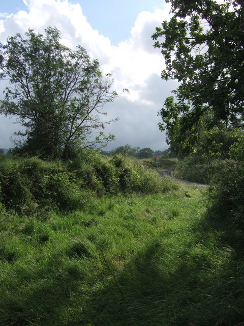
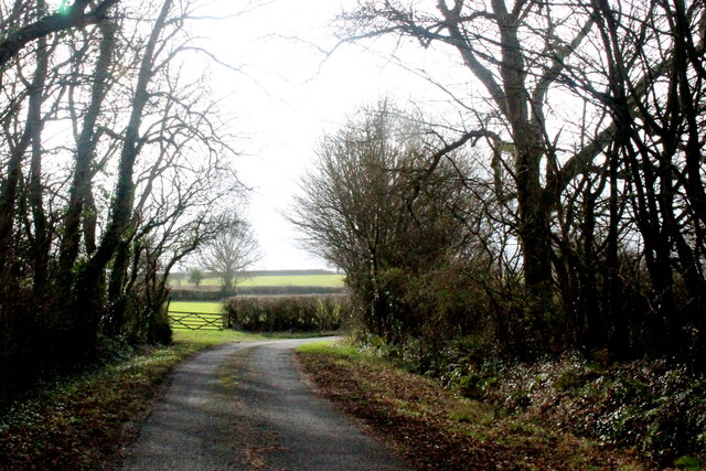
The hill itself is characterized by its gentle slopes and well-maintained footpaths, making it accessible for hikers of all levels. These paths wind through a mixture of open grassland, dense woodlands, and patches of wildflowers, creating a diverse and enchanting environment. As visitors ascend the hill, they are rewarded with stunning vistas of the surrounding Somerset countryside, extending as far as the eye can see.

Barrington Hill is not only a haven for nature lovers but also holds historical significance. It is believed that the hill has been inhabited since prehistoric times, with evidence of Iron Age settlements discovered in the area. Additionally, the hill is home to an ancient burial mound, adding an air of mystery and intrigue to its allure.

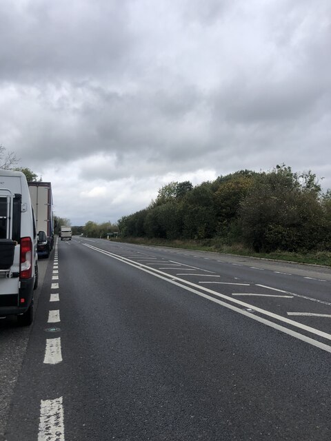
The hill is easily accessible by foot or by car, with nearby parking available. Visitors can explore the hill at their own pace, taking in its natural beauty, spotting local wildlife, or simply enjoying a peaceful picnic amidst the idyllic surroundings. For those seeking a respite from the hustle and bustle of everyday life, Barrington Hill is a must-visit destination that offers a serene retreat in the heart of Somerset.

If you have any feedback on the listing, please let us know in the comments section below.

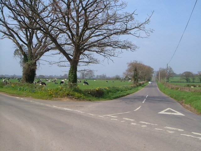
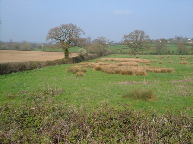
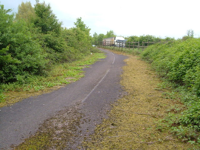
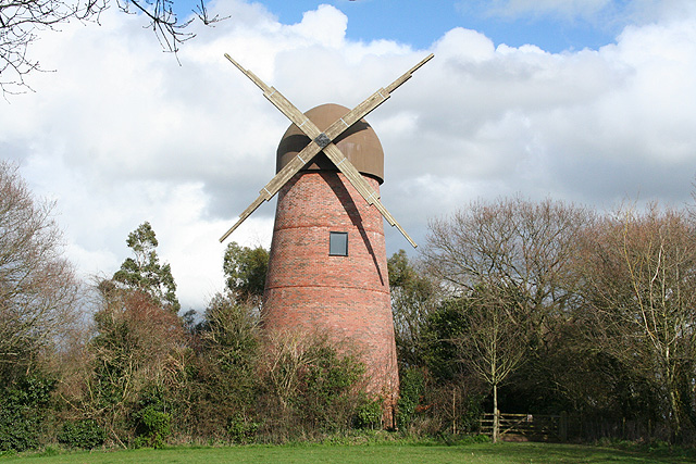
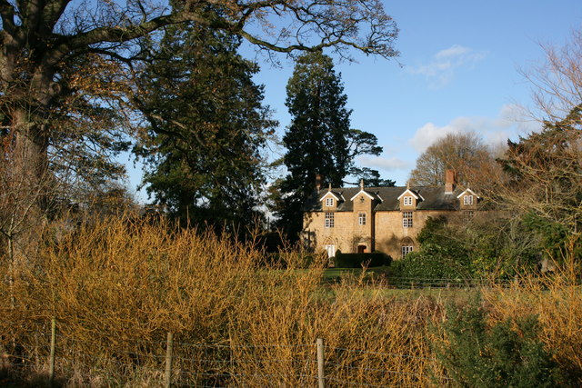
Barrington Hill Images

Images are sourced within 2km of 50.948748/-3.0045299 or Grid Reference ST2917. Thanks to Geograph Open Source API. All images are credited.

Junction at Newhouse Farm Junction on the straight drove roads on the north-east side of the Blackdown Hills.
Junction at Newhouse Farm
Junction on the straight drove roads on the north-east side of the Blackdown Hills.
View near Windmill Hill Looking towards Windmill Hill across a meadow with patches of sedge - pleasant, open countryside.
View near Windmill Hill
Looking towards Windmill Hill across a meadow with patches of sedge - pleasant, open countryside.
Old A358 at Capland Traffic beginning the Hatch Beauchamp bypass on the A358 passes tarmac still bearing white lines where the former main road rounded a bend at Capland.
Old A358 at Capland
Traffic beginning the Hatch Beauchamp bypass on the A358 passes tarmac still bearing white lines where the former main road rounded a bend at Capland.
Ashill: replica windmill A communications mast for mobile phones disguised as a windmill. It stands on Windmill Hill, probably on or near the site of a genuine working mill
Ashill: replica windmill
A communications mast for mobile phones disguised as a windmill. It stands on Windmill Hill, probably on or near the site of a genuine working mill
Folly Farm A brief burst of sunlight illuminates the farm and adjacent bungalow, seen from a bend on Barrington Hill Road aka Folly Drove.
Folly Farm
A brief burst of sunlight illuminates the farm and adjacent bungalow, seen from a bend on Barrington Hill Road aka Folly Drove.
In between the rain Taken a yard or two from the point at which <a href="https://www.geograph.org.uk/photo/474151">ST3017 : Folly Farm</a> was taken, and in the same brief burst of sunshine. Footpath CH1/16 arrives at the bend in Folly Drove.
In between the rain
Taken a yard or two from the point at which ST3017 : Folly Farm was taken, and in the same brief burst of sunshine. Footpath CH1/16 arrives at the bend in Folly Drove.
Windmill Hill Gate leading to the windmill
Windmill Hill
Gate leading to the windmill
A358 heading towards Taunton
Road Junction Near Hastings  This is the "T" junction on the minor road between Windmill Hill and Newhouse Farm. The road on the left goes off towards Hastings.
Road Junction Near Hastings
This is the "T" junction on the minor road between Windmill Hill and Newhouse Farm. The road on the left goes off towards Hastings.
Newhouse Farm Newhouse Farm sits on the minor road from Horton to Bickenhall at the junction of the road north to Windmill Hill
Newhouse Farm
Newhouse Farm sits on the minor road from Horton to Bickenhall at the junction of the road north to Windmill Hill
Wood Cottage Wood Cottage is named after the hamlet of Wood and lies on the minor road between Kenny and Windmill Hill
Wood Cottage
Wood Cottage is named after the hamlet of Wood and lies on the minor road between Kenny and Windmill Hill
Folly Drove Folly Drove is a minor road near Kenny that runs southwest off the A358 towards Barrington Hill.
Folly Drove
Folly Drove is a minor road near Kenny that runs southwest off the A358 towards Barrington Hill.
Country Lane near Folly Farm This bend in the lane next to a small copse is where Folly Drove becomes Barrington Hill Lane
Country Lane near Folly Farm
This bend in the lane next to a small copse is where Folly Drove becomes Barrington Hill Lane
Windmill Hill From the footpath Ashill to Broadway.500mm lens view.
Windmill Hill
From the footpath Ashill to Broadway.500mm lens view.
Wood near Ashill
Wood near Ashill
Wood near Ashill
Wood near Ashill
Field by Hastings Cross A view from a gate on Hastings Cross, the lane between Wood Road and Southtown, and also the name of a nearby junction. The land slopes away to a tributary of the Cad Brook.
Field by Hastings Cross
A view from a gate on Hastings Cross, the lane between Wood Road and Southtown, and also the name of a nearby junction. The land slopes away to a tributary of the Cad Brook.
Laneside, Hastings Cross The laneside verge, ditch and hedge, from the point where <a href="https://www.geograph.org.uk/photo/2951906">ST3116 : Field by Hastings Cross</a> was taken.
Laneside, Hastings Cross
The laneside verge, ditch and hedge, from the point where ST3116 : Field by Hastings Cross was taken.
Show me another place!

Barrington Hill is located at Grid Ref: ST2917 (Lat: 50.948748, Lng: -3.0045299)

Administrative County: Somerset

District: South Somerset

Police Authority: Avon and Somerset

What 3 Words

///majoring.property.graver. Near Ilminster, Somerset

Nearby Locations

Barrington Hill

Related Wikis

Barrington Hill Meadows

Barrington Hill Meadows (grid reference ST300170) is a 16.1 hectare (39.5 acre) biological Site of Special Scientific Interest in Somerset, England, notified...

Bickenhall

Bickenhall is a hamlet and parish in Somerset, England, situated 5 miles (8.0 km) south east of Taunton. The parish, which includes the hamlet of Batten...

Curland

Curland is a village and civil parish in Somerset, England, situated 6 miles (9.7 km) south of Taunton. The village has a population of 225. The parish...

All Saints Church, Curland

All Saints Church is a former Church of England parish church in Curland, Somerset, England. Designed by Benjamin Ferrey, it was built in 1855–56 to replace...

Church of the Blessed Virgin Mary, Ashill

The Anglican Church of the Blessed Virgin Mary in Ashill, Somerset, England was built in the 12th century. It is a Grade II* listed building. == History... ==

Castle Neroche

Castle Neroche is a Norman motte-and-bailey castle on the site of an earlier hill fort in the parish of Curland, near Staple Fitzpaine, Somerset, England...

Broadway, Somerset

Broadway is a village and civil parish in Somerset, England, situated 3 miles (4.8 km) west of Ilminster and 5 miles (8.0 km) north of Chard. The parish...

Ashill, Somerset

Ashill is a small village and civil parish in Somerset, England, situated 7 miles (11.3 km) south of Taunton, and three miles north-west of Ilminster....

Nearby Amenities

Located within 500m of 50.948748,-3.0045299
The data included in this document is from www.openstreetmap.org. The data is made available under ODbL.

Have you been to Barrington Hill?

Leave your review of Barrington Hill below (or comments, questions and feedback).