Black Hillock
Hill, Mountain in Banffshire
Scotland
Black Hillock

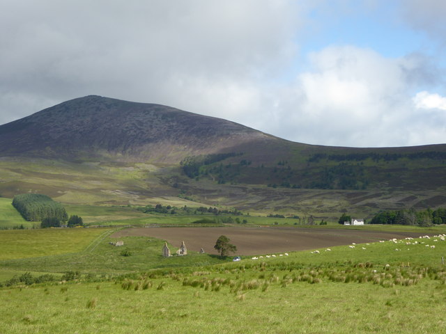
Black Hillock is a prominent hill located in the county of Banffshire, Scotland. Situated near the village of Kennethmont, it stands at an impressive height of approximately 295 meters above sea level. The hill is well-known for its distinctive black rock formations, which give it its name.
The area surrounding Black Hillock offers breathtaking views of the surrounding countryside, with rolling hills and lush greenery as far as the eye can see. It is a popular destination for hikers and nature enthusiasts, who are drawn to its natural beauty and serene atmosphere.
The hill is home to a diverse range of flora and fauna, including various species of birds, small mammals, and wildflowers. The landscape is dominated by heather, which adds a vibrant burst of color to the hillside during the summer months.
Black Hillock is also steeped in history, with evidence of ancient settlements and burial sites being discovered in the vicinity. This rich historical heritage adds an intriguing element to the hill, attracting archaeologists and history buffs alike.
Access to Black Hillock is relatively easy, with several well-marked trails leading to the summit. While the ascent can be challenging for some, the rewarding panoramic views make it well worth the effort.
Overall, Black Hillock in Banffshire is a captivating hill that offers a blend of natural beauty, wildlife, and historical significance. Whether it's for a leisurely stroll or a more adventurous hike, this enchanting destination is sure to leave a lasting impression on all who visit.
If you have any feedback on the listing, please let us know in the comments section below.
Black Hillock Images
Images are sourced within 2km of 57.388462/-3.1744953 or Grid Reference NJ2933. Thanks to Geograph Open Source API. All images are credited.


Black Hillock is located at Grid Ref: NJ2933 (Lat: 57.388462, Lng: -3.1744953)
Unitary Authority: Moray
Police Authority: North East
What 3 Words
///operating.drummers.director. Near Dufftown, Moray
Nearby Locations
Related Wikis

Achnastank
Achnastank (Scottish Gaelic: Achadh nan Staing, field of the pool/ditch) is a scattered settlement, south east of Ben Rinnes, in the Scottish council area...
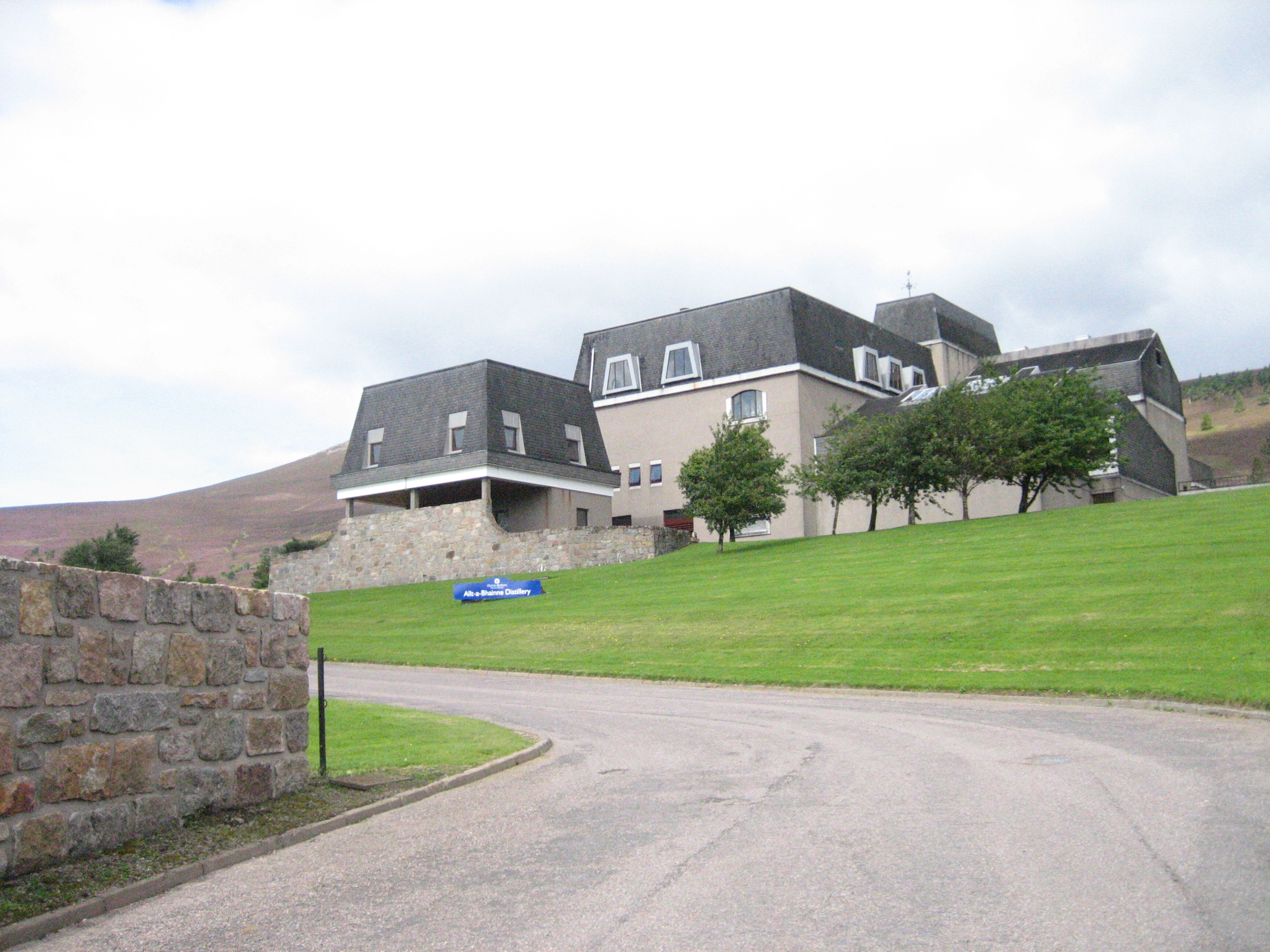
Allt-A-Bhainne distillery
Allt-A-Bhainne distillery (Scottish Gaelic: Allt a' Bhainne [al̪ˠt̪əˈvaɲə], meaning 'milk burn') is a Scotch whisky distillery in the Speyside Region of...

Ben Rinnes
Ben Rinnes (Scottish Gaelic: Beinn Ruaidhneis) is a mountain in Banffshire, in northern Scotland. The mountain is popular with hikers. The mountain is...

Moray
Moray ( ) Scottish Gaelic: Moireibh or Moireabh) is one of the 32 local government council areas of Scotland. It lies in the north-east of the country...
Pittyvaich distillery
Pittyvaich distillery was a producer of single malt Scotch whisky that operated between 1974 and 1993. == History == The Pittyvaich distillery, built in...
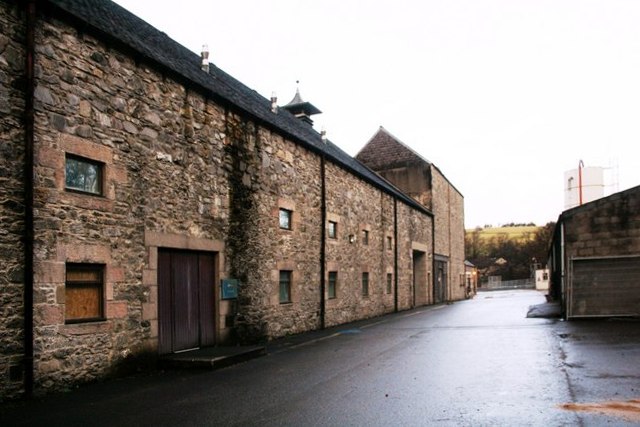
Dufftown distillery
Dufftown distillery is a Scotch whisky distillery in Dufftown, Moray, Scotland. Founded in 1895 as "Dufftown-Glenlivet Distillery", the distillery is currently...
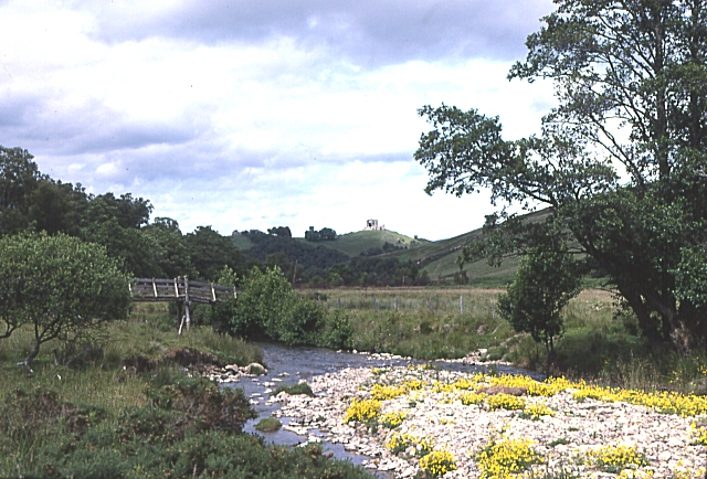
River Fiddich
The River Fiddich (Scottish Gaelic: Fiodhach / Abhainn Fhiodhaich) is a right bank tributary of the River Spey in northeast Scotland. It rises on the eastern...

Mortlach Parish Church
Mortlach Parish Church is a church within the Church of Scotland serving the parish of Mortlach, in Moray, close to the village of Dufftown. The site of...
Nearby Amenities
Located within 500m of 57.388462,-3.1744953Have you been to Black Hillock?
Leave your review of Black Hillock below (or comments, questions and feedback).