Blacklaw Hill

Hill, Mountain in Perthshire

Scotland

Blacklaw Hill

Farmland near the village of Lundie
Farmland near the village of Lundie Credit: Douglas Nelson

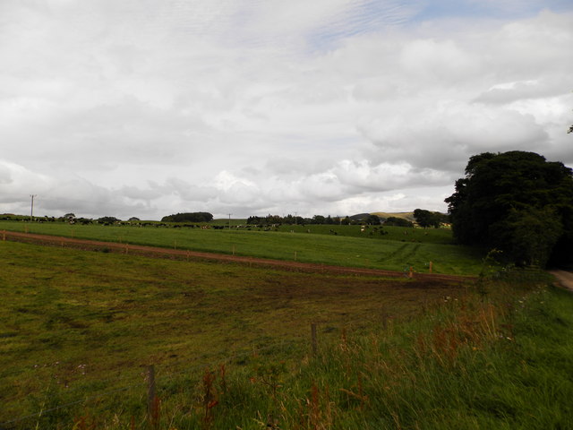
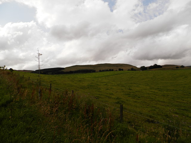
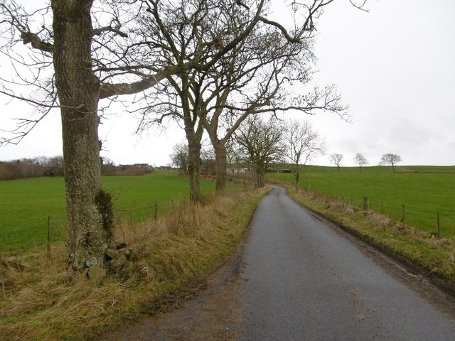
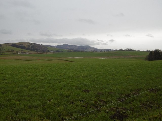
Blacklaw Hill is a prominent hill located in the county of Perthshire, Scotland. Situated near the town of Perth, it forms part of the Ochil Hills range, which stretches across central Scotland. Rising to an elevation of approximately 372 meters (1,220 feet), Blacklaw Hill offers stunning panoramic views of the surrounding landscape.

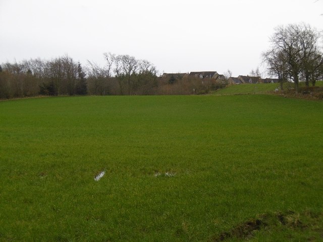
The hill is characterized by its distinct conical shape, with a relatively steep gradient towards its summit. It is covered in a mix of heather, grasses, and scattered trees, creating a picturesque and diverse environment. The terrain is rugged and uneven, presenting a moderate challenge to hikers and outdoor enthusiasts.

Blacklaw Hill is a popular destination for locals and visitors alike, offering a range of recreational activities. The well-maintained trails that crisscross the hill provide opportunities for hiking, walking, and jogging. The summit rewards climbers with breathtaking vistas, encompassing rolling hills, verdant farmland, and distant mountain ranges.

In addition to its natural beauty, Blacklaw Hill also holds historical significance. The remains of an Iron Age hillfort can be found on its slopes, indicating human occupation in the area dating back over 2,000 years. The hillfort offers a glimpse into the lives and culture of ancient inhabitants, and its preservation contributes to the cultural heritage of the region.

Overall, Blacklaw Hill is a cherished and accessible natural landmark in Perthshire, offering both recreational opportunities and a connection to the area's rich history.

If you have any feedback on the listing, please let us know in the comments section below.

Blacklaw Hill Images

Images are sourced within 2km of 56.497232/-3.1564494 or Grid Reference NO2834. Thanks to Geograph Open Source API. All images are credited.

Farmland near the village of Lundie
Upland farming near Lundie
Children's pond at Ledyatt
Woodland, Redmyre Mature conifers in a landscape dominated by younger woodlands.
Woodland, Redmyre
Mature conifers in a landscape dominated by younger woodlands.
Come on England  - you could do this The red band on the sign is the deletion of a keep out sign.  More advanced nations have laws against them, but we must never ever be complacent. 

A scattering of ancient beeches suggest there was once a tree lined strip here, old maps show a 2 acre elongated enclosure between the gate and Redmyre.
Come on England - you could do this
The red band on the sign is the deletion of a keep out sign. More advanced nations have laws against them, but we must never ever be complacent. A scattering of ancient beeches suggest there was once a tree lined strip here, old maps show a 2 acre elongated enclosure between the gate and Redmyre.
Old beech, Redmyre Once there was a line of beeches either side of a road here, possibly a pair of hedges.  Old maps show a long 2 acre (0.8 Ha) strip here. Redmyre Wood beyond has a chequered history. 1950s 1:25,000 maps show no woodland here, but there was a substantial wood here on the 25" map of 1900.
Old beech, Redmyre
Once there was a line of beeches either side of a road here, possibly a pair of hedges. Old maps show a long 2 acre (0.8 Ha) strip here. Redmyre Wood beyond has a chequered history. 1950s 1:25,000 maps show no woodland here, but there was a substantial wood here on the 25" map of 1900.
Road, Redmyre A local described a route with dense gorse in the area calling it the Priest's Road.  Later the route which is waymarked on Redmyre land, does become an attractive single track path through gorse and broom, before passing through a Forestry Commission plantation.  Well worth walking/riding.
Road, Redmyre
A local described a route with dense gorse in the area calling it the Priest's Road. Later the route which is waymarked on Redmyre land, does become an attractive single track path through gorse and broom, before passing through a Forestry Commission plantation. Well worth walking/riding.
Please respect nature Non compliant signage - more obvious keep out signs have been painted over.  You may like to put Redmyre Perthshire into a search engine and learn a little more about respecting nature.

This twee goml sign with its pretty picture is generic. I have seen them littering the place in Northumberland too. (Sadly they are still legal there).
Please respect nature
Non compliant signage - more obvious keep out signs have been painted over. You may like to put Redmyre Perthshire into a search engine and learn a little more about respecting nature. This twee goml sign with its pretty picture is generic. I have seen them littering the place in Northumberland too. (Sadly they are still legal there).
Woodland, Redmyre An older bit of woodland at Redmyre. Most of the trees elsewhere are much younger.
Woodland, Redmyre
An older bit of woodland at Redmyre. Most of the trees elsewhere are much younger.
Arable land, Binn Land west of here was also farmland until recently, it is now forested.  Dundee is in the background.
Arable land, Binn
Land west of here was also farmland until recently, it is now forested. Dundee is in the background.
Binn Arable land east of the new Redmyre woodlands.
Binn
Arable land east of the new Redmyre woodlands.
Field, Redmyre A normal field, not rough grazing as mapped at 1:25,000.
Field, Redmyre
A normal field, not rough grazing as mapped at 1:25,000.
Priest's Road There is still a way through the gorse and broom on a very attractive path through mixed woodland, mostly young but with some older trees.
Priest's Road
There is still a way through the gorse and broom on a very attractive path through mixed woodland, mostly young but with some older trees.
Priest's Road The path was obviously wider here once, but is now largely covered in gorse and broom.  It is however unobstructed and has gates which can be opened.
Priest's Road
The path was obviously wider here once, but is now largely covered in gorse and broom. It is however unobstructed and has gates which can be opened.
Wetland near Redmyre Marshy rough grazing next to the woodlands.
Wetland near Redmyre
Marshy rough grazing next to the woodlands.
Yellow road, Ledyatt Road out of Lundie towards the main road to Dundee.
Yellow road, Ledyatt
Road out of Lundie towards the main road to Dundee.
Field by Ledyatt Piperdam houses on the skyline.
Field by Ledyatt
Piperdam houses on the skyline.
Field near Ledyatt View towards Craigowl.
Field near Ledyatt
View towards Craigowl.
Show me another place!

Blacklaw Hill is located at Grid Ref: NO2834 (Lat: 56.497232, Lng: -3.1564494)

Unitary Authority: Angus

Police Authority: Tayside

What 3 Words

///improves.novelist.scribble. Near Longforgan, Perth & Kinross

Nearby Locations

Blacklaw Hill

Related Wikis

Sidlaws

The Sidlaws are a range of hills in the counties of Perthshire and Angus in Scotland that extend for 30 miles (45 km) from Kinnoull Hill, near Perth, northeast...

Lundie

Lundie is a parish and small settlement in Angus, Scotland, 10 miles (16 km) northwest of Dundee, situated at the head of the Dighty valley in the Sidlaws...

Lundie Kirk

Lundie Kirk was the parish church of Lundie, Angus, in Scotland from the 12th century until 2017. The church was constructed in Romanesque style in the...

Knapp, Perthshire

Knapp is a hamlet in Perth and Kinross, Scotland. It is located to the northeast of Inchture, about 9.7 miles (15.6 km) by road west of the city centre...

Balruddery

Balruddery House by Longforgan in Perthshire, Scotland, was designed by David Neave for James Webster circa 1820. In about 1879 it was bought by James...

Lundie Craigs

Lundie Craigs/Westerkeith Hill is one of the hills of the Sidlaw range in South East Perthshire.Lundie Craigs/Westerkeith Hill is located near Coupar Angus...

Fowlis Castle

Fowlis Castle is situated five miles north-west of Dundee, Scotland, in the hamlet of Fowlis. It is a tower house dating from the seventeenth century....

Northballo Hill

Northballo Hill is one of the hills of the Sidlaw range in South East Perthshire, and is located near Coupar Angus. It is popular with dog walkers and...

Related Videos

I Went Hill Walking Up The Sidlaws - Lock Down Boredom

Myself and Billy go for a walk up the Sidlaws, just a short video hope you enjoy.

Walking up the Sidlaw hills in winter #showusyourbrew

A walk up Auchterhouse and Craigowl hill in the snow. I take a wee break at the top of Auchterhouse hill and make a coffee.

Kinpurnie tower from Balkello car park / Sidlaw Hills

00:00 Intro 04:30 Kinpurney Hill views 05:20 Kinpurney Tower.

A walk up Ark hill, Sidlaws, Dundee

I take walk between Craigowl and Auchterhouse hills to reach Ark hill behind them. Instagram: ...

Nearby Amenities

Located within 500m of 56.497232,-3.1564494
Blacklaw Hill
Ele: 284
Natural: peak
Lat/Long: 56.4968889/-3.1561106
The data included in this document is from www.openstreetmap.org. The data is made available under ODbL.

Have you been to Blacklaw Hill?

Leave your review of Blacklaw Hill below (or comments, questions and feedback).