Lamb Law

Hill, Mountain in Peeblesshire

Scotland

Lamb Law

Logging equipment, Leithen Water A log carrier is parked up for the weekend. A block is being harvested high in Craig Hope.
Logging equipment, Leithen Water Credit: Richard Webb

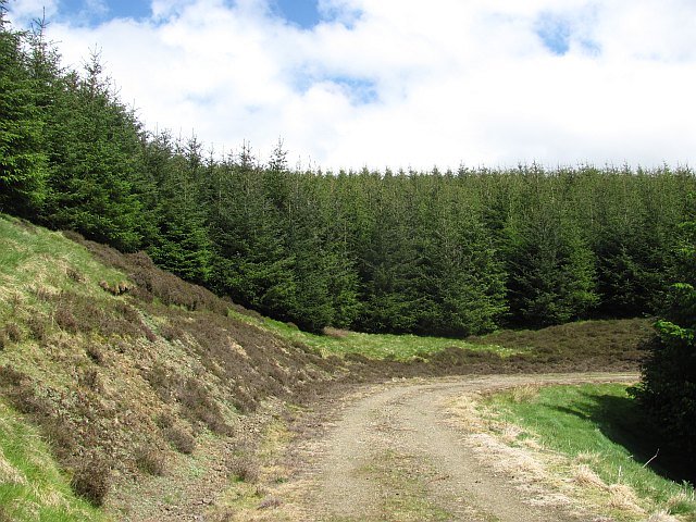
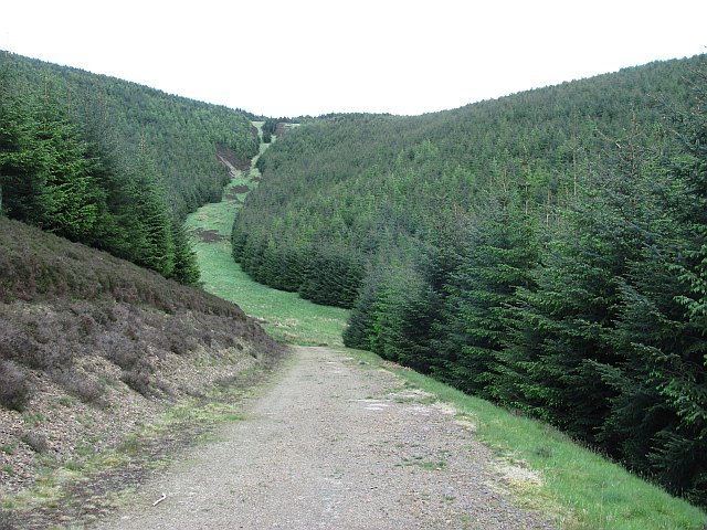
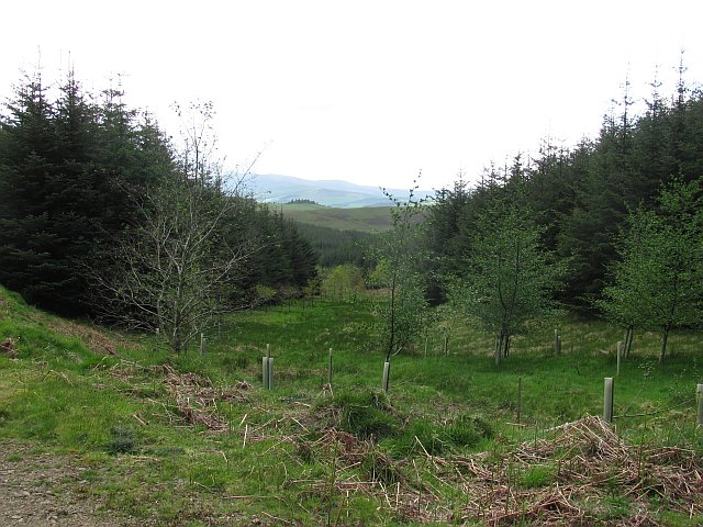
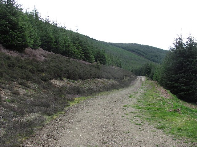
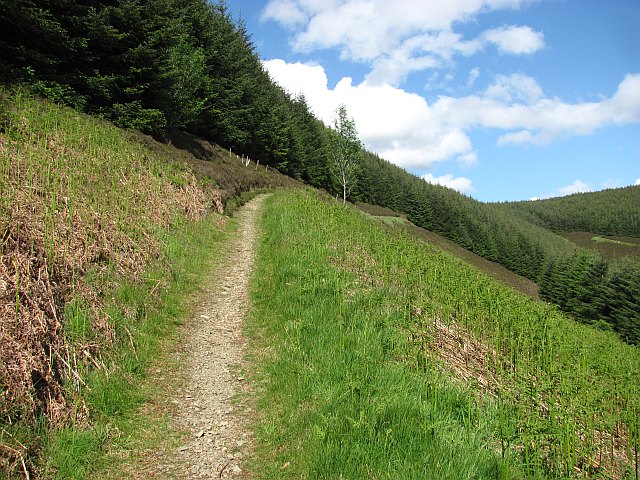
Lamb Law is a prominent hill located in Peeblesshire, Scotland. It is part of the Moorfoot Hills range and stands at an elevation of 490 meters (1,608 feet) above sea level. The hill is a popular destination for hikers and outdoor enthusiasts due to its stunning views of the surrounding countryside and its relatively easy accessibility.

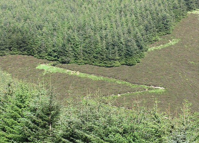
Lamb Law is known for its distinctive shape, with a gentle slope on one side and a steeper, more rugged terrain on the other. The hill is covered in heather and grasses, providing a habitat for a variety of wildlife including birds, insects, and small mammals.

Visitors to Lamb Law can enjoy a leisurely hike to the summit, where they will be rewarded with panoramic views of the rolling hills and valleys of Peeblesshire. On a clear day, it is possible to see as far as the Pentland Hills and the Southern Uplands.

Overall, Lamb Law is a picturesque and peaceful hill that offers a great opportunity to experience the natural beauty of the Scottish countryside.

If you have any feedback on the listing, please let us know in the comments section below.

Lamb Law Images

Images are sourced within 2km of 55.696239/-3.1349086 or Grid Reference NT2845. Thanks to Geograph Open Source API. All images are credited.

Logging equipment, Leithen Water A log carrier is parked up for the weekend. A block is being harvested high in Craig Hope.
Logging equipment, Leithen Water
A log carrier is parked up for the weekend. A block is being harvested high in Craig Hope.
Forest road, Leithen Water This road has been recently upgraded. Much of the forest is ready for felling and a lot of timber will be carried out.
Forest road, Leithen Water
This road has been recently upgraded. Much of the forest is ready for felling and a lot of timber will be carried out.
Forest track, Totto Hill The track gradually gains height on the west-facing slopes above the Leithen Water.
Forest track, Totto Hill
The track gradually gains height on the west-facing slopes above the Leithen Water.
Foxgloves by the track A touch of colour by the forest track around Totto Hill, Leithenwater Forest. Some of the Bowbeat windfarm turbines are on the skyline.
Foxgloves by the track
A touch of colour by the forest track around Totto Hill, Leithenwater Forest. Some of the Bowbeat windfarm turbines are on the skyline.
Forestry patterns, Leithenwater Forest Looking across the Leithen Water valley from Totto Hill to Lamb Law.
Forestry patterns, Leithenwater Forest
Looking across the Leithen Water valley from Totto Hill to Lamb Law.
Bowbeat windfarm from Leithenwater Forest Some of the 24 turbines comprising the 31MW Bowbeat windfarm, which began generating in 2002.
Bowbeat windfarm from Leithenwater Forest
Some of the 24 turbines comprising the 31MW Bowbeat windfarm, which began generating in 2002.
Forest track, Cape Hill In Leithenwater Forest above Craig Hope with some of the Bowbeat turbines on the skyline. The slope below the track has been replanted.
Forest track, Cape Hill
In Leithenwater Forest above Craig Hope with some of the Bowbeat turbines on the skyline. The slope below the track has been replanted.
Standing tree, Craig Hope A few trees are left standing in clear felling as part of the 'deadwood' that is beneficial to nutrient cycling and biodiversity in the growing forest. More information can be found in the publication 'Managing Deadwood in Forests and Woodlands', Forestry Commission at <span class="nowrap"><a title="https://www.forestry.gov.uk/england-managingdeadwood" rel="nofollow ugc noopener" href="https://www.forestry.gov.uk/england-managingdeadwood">Link</a><img style="margin-left:2px;" alt="External link" title="External link - shift click to open in new window" src="https://s1.geograph.org.uk/img/external.png" width="10" height="10"/></span>.
Standing tree, Craig Hope
A few trees are left standing in clear felling as part of the 'deadwood' that is beneficial to nutrient cycling and biodiversity in the growing forest. More information can be found in the publication 'Managing Deadwood in Forests and Woodlands', Forestry Commission at LinkExternal link.
Leithenwater Forest track
Craig Hope Looking down the track in Leithenwater Forest.
Craig Hope
Looking down the track in Leithenwater Forest.
Forest, Crookshope Sitka spruce plantations at the head of Crookshope beneath Whiteside Edge.
Forest, Crookshope
Sitka spruce plantations at the head of Crookshope beneath Whiteside Edge.
Forest road, Soonhope The upper reaches of the Soonhope Burn, clothed in a first generation Sitka spruce plantation.
Forest road, Soonhope
The upper reaches of the Soonhope Burn, clothed in a first generation Sitka spruce plantation.
Soonhope Burn A gap in the Sitka spruce for the burn, with some limited broadleaf planting.
Soonhope Burn
A gap in the Sitka spruce for the burn, with some limited broadleaf planting.
Forest road, Soonhope A road contours around the upper glen through seemingly endless Sitka plantations.
Forest road, Soonhope
A road contours around the upper glen through seemingly endless Sitka plantations.
Path, Tower Rig A well used path (the black mountain bike route uses it as an ascent route), on Tower Rig in Glentress Forest.
Path, Tower Rig
A well used path (the black mountain bike route uses it as an ascent route), on Tower Rig in Glentress Forest.
Path, Tower Rig An open section of a path which pre-dates the conifers of Glentress Forest.
Path, Tower Rig
An open section of a path which pre-dates the conifers of Glentress Forest.
Dunslair Heights The west side of the now almost completely forested hill.
Dunslair Heights
The west side of the now almost completely forested hill.
A zig-zag path A path climbing Dunslair Heights. It does not feature on the current mountain bike trail map, although it looks like a climbing track for bikes.
A zig-zag path
A path climbing Dunslair Heights. It does not feature on the current mountain bike trail map, although it looks like a climbing track for bikes.
Show me another place!

Lamb Law is located at Grid Ref: NT2845 (Lat: 55.696239, Lng: -3.1349086)

Unitary Authority: The Scottish Borders

Police Authority: The Lothians and Scottish Borders

What 3 Words

///eyebrows.elevates.panels. Near Peebles, Scottish Borders

Nearby Locations

Red Scar Lamb Law

Related Wikis

Glentress Forest

Glentress Forest is located near Peebles in the Scottish Borders, about 30 miles south of Edinburgh. Part of the Tweed Valley Forest Park along with Traquair...

Bowbeat Hill

Bowbeat Hill is a hill in the Moorfoot Hills range, part of the Southern Uplands of Scotland. It lends its name to Bowbeat Onshore Wind Farm built on the...

Milkieston Rings

Milkieston Rings is a prehistoric site, a hillfort near the village of Eddleston and about 3 miles (5 km) north of Peebles, in the Scottish Borders, Scotland...

Blackhope Scar

Blackhope Scar is a hill in the Moorfoot Hills range, part of the Southern Uplands of Scotland. It lies to the northeast of the town of Peebles and is...

Nearby Amenities

Located within 500m of 55.696239,-3.1349086
Lamb Law
Natural: peak
Lat/Long: 55.6966805/-3.1340003
The data included in this document is from www.openstreetmap.org. The data is made available under ODbL.

Have you been to Lamb Law?

Leave your review of Lamb Law below (or comments, questions and feedback).