Bowbeat Rig Head
Hill, Mountain in Peeblesshire
Scotland
Bowbeat Rig Head

Bowbeat Rig Head is a prominent hill located in Peeblesshire, Scotland. Sitting at an elevation of approximately 481 meters (1,578 feet), it is a popular destination for outdoor enthusiasts and nature lovers.
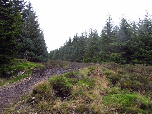
The hill is situated in the beautiful Tweed Valley, offering stunning panoramic views of the surrounding countryside. Its location in the Southern Uplands provides visitors with an opportunity to enjoy a diverse range of flora and fauna, making it a haven for wildlife enthusiasts.
Bowbeat Rig Head is easily accessible, with various walking trails leading to its summit. These trails cater to different levels of difficulty, making it suitable for both experienced hikers and casual walkers. The hill's well-maintained paths ensure a safe and enjoyable experience for visitors.
At the summit, visitors are rewarded with breathtaking views of the rolling hills, lush forests, and picturesque villages that dot the landscape. On clear days, it is even possible to catch a glimpse of the distant peaks of the Scottish Borders and the Pentland Hills.
The area surrounding Bowbeat Rig Head is steeped in history, with several archaeological sites and ancient ruins nearby. This adds an extra layer of interest for those interested in delving into the region's past.
Overall, Bowbeat Rig Head in Peeblesshire offers a fantastic opportunity to immerse oneself in the natural beauty of the Scottish countryside, providing an unforgettable experience for all who visit.
If you have any feedback on the listing, please let us know in the comments section below.
Bowbeat Rig Head Images
Images are sourced within 2km of 55.715429/-3.1391739 or Grid Reference NT2847. Thanks to Geograph Open Source API. All images are credited.


Bowbeat Rig Head is located at Grid Ref: NT2847 (Lat: 55.715429, Lng: -3.1391739)
Unitary Authority: The Scottish Borders
Police Authority: The Lothians and Scottish Borders
What 3 Words
///feasts.finally.cosmic. Near Peebles, Scottish Borders
Nearby Locations
Related Wikis

Bowbeat Hill
Bowbeat Hill is a hill in the Moorfoot Hills range, part of the Southern Uplands of Scotland. It lends its name to Bowbeat Onshore Wind Farm built on the...

Blackhope Scar
Blackhope Scar is a hill in the Moorfoot Hills range, part of the Southern Uplands of Scotland. It lies to the northeast of the town of Peebles and is...

Northshield Rings
Northshield Rings is a prehistoric site, a hillfort near the village of Eddleston and about 6 miles (10 km) north of Peebles, in the Scottish Borders,...

Glentress Forest
Glentress Forest is located near Peebles in the Scottish Borders, about 30 miles south of Edinburgh. Part of the Tweed Valley Forest Park along with Traquair...

Milkieston Rings
Milkieston Rings is a prehistoric site, a hillfort near the village of Eddleston and about 3 miles (5 km) north of Peebles, in the Scottish Borders, Scotland...

Moorfoot Hills
The Moorfoot Hills are a range of hills south of Edinburgh in east central Scotland, one of the ranges which collectively form the Southern Uplands....

Eddleston
Eddleston (Scottish Gaelic: Baile Ghille Mhoire) is a small village and civil parish in the Scottish Borders area of Scotland. It lies 4 miles (6.4 km...

Eddleston railway station
Eddleston railway station served the village of Eddleston, Scottish Borders, Scotland from 1855 to 1962 on the Peebles Railway. == History == The station...
Nearby Amenities
Located within 500m of 55.715429,-3.1391739Have you been to Bowbeat Rig Head?
Leave your review of Bowbeat Rig Head below (or comments, questions and feedback).