Balshando Hill

Hill, Mountain in Angus

Scotland

Balshando Hill

Smith Loch and Smithton Hill Most of this square is a newly planted conifer plantation, broken up by heathery moorland. The swampy area of Smith Loch is the most prominent 'feature' in the landscape. Hard going.
Smith Loch and Smithton Hill Credit: Aleks Scholz

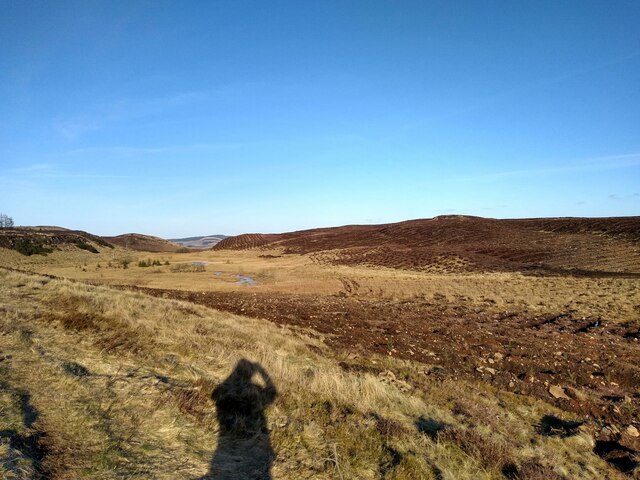
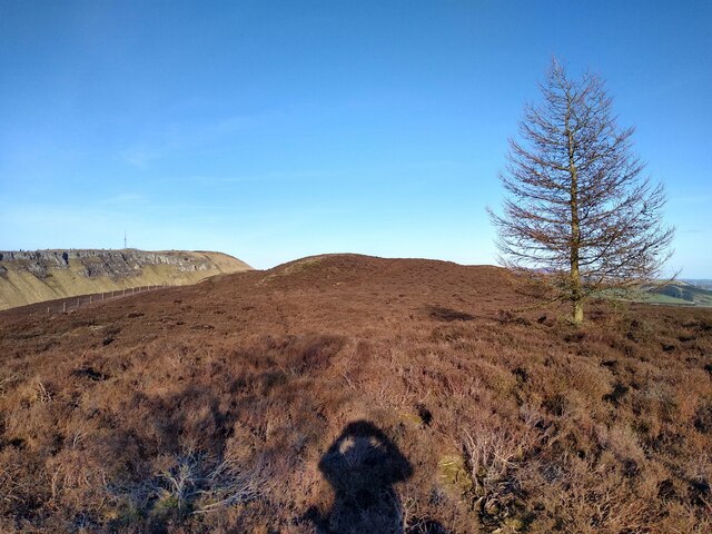
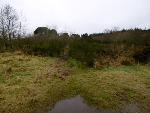
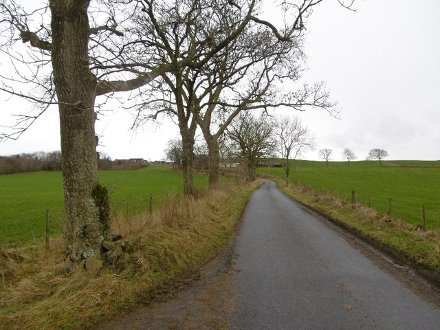
Balshando Hill, located in the county of Angus, Scotland, is a prominent hill that stands at an elevation of 370 meters (1,214 feet). It is situated near the village of Balshando, approximately 5 kilometers (3 miles) southwest of the town of Forfar. Balshando Hill is a part of the Sidlaw Hills range, which extends from the River Tay in the south to the Montrose Basin in the north.

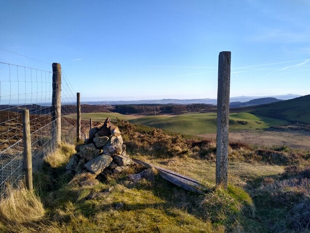
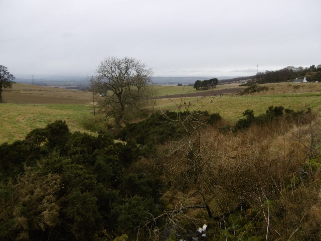
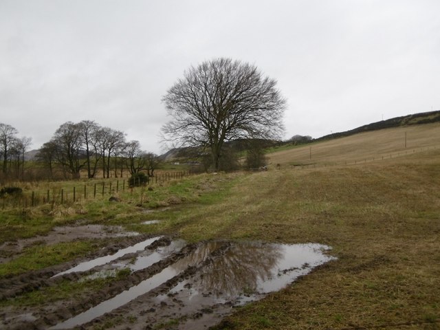
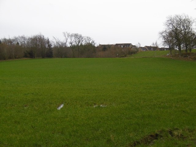
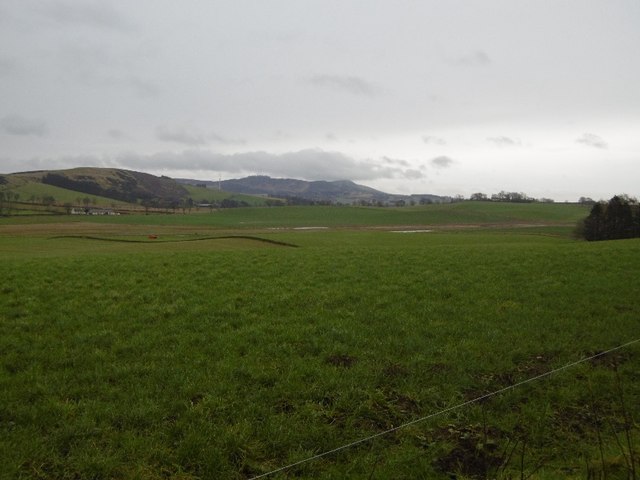
The hill offers a picturesque landscape with its rolling slopes and lush green vegetation. It is predominantly covered in grass and heather, creating a beautiful contrast against the clear blue skies. At the summit, there is a trig point, which serves as a marker for measuring distances and angles. From this vantage point, visitors are rewarded with breathtaking panoramic views of the surrounding countryside, including the Sidlaw Hills, the Strathmore Valley, and the Grampian Mountains in the distance.

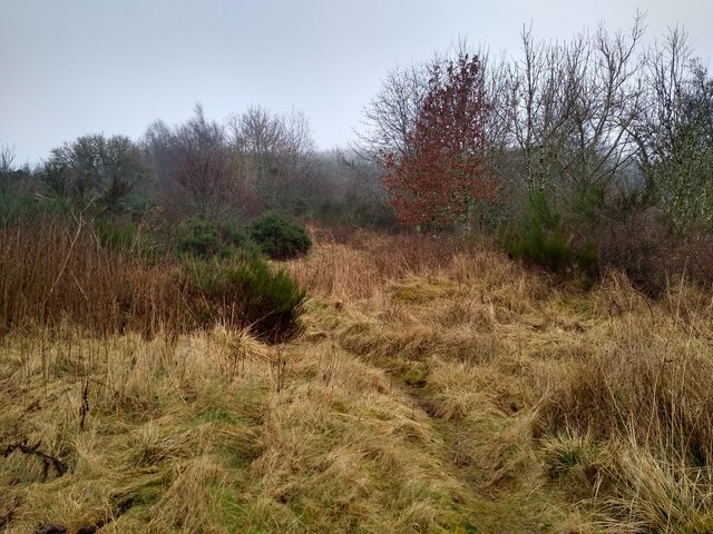
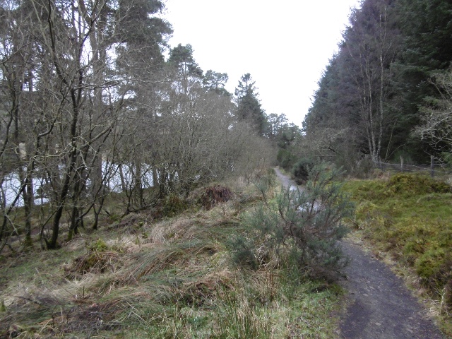
Balshando Hill is a popular destination for outdoor enthusiasts, hikers, and nature lovers. There are several walking trails that lead to the summit, varying in difficulty to accommodate different fitness levels. The hill is known for its rich biodiversity, hosting a variety of wildlife species such as red deer, rabbits, and various bird species. It is also home to a diverse range of flora, including wildflowers, ferns, and mosses.

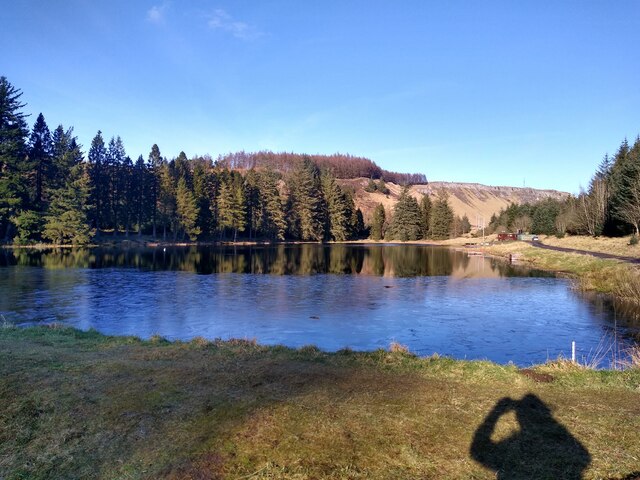
Overall, Balshando Hill offers a tranquil and scenic retreat for those seeking to escape the hustle and bustle of everyday life, providing a perfect opportunity to connect with nature and enjoy the stunning Scottish countryside.

If you have any feedback on the listing, please let us know in the comments section below.

Balshando Hill Images

Images are sourced within 2km of 56.506021/-3.1744432 or Grid Reference NO2735. Thanks to Geograph Open Source API. All images are credited.

Smith Loch and Smithton Hill Most of this square is a newly planted conifer plantation, broken up by heathery moorland. The swampy area of Smith Loch is the most prominent 'feature' in the landscape. Hard going.
Smith Loch and Smithton Hill
Most of this square is a newly planted conifer plantation, broken up by heathery moorland. The swampy area of Smith Loch is the most prominent 'feature' in the landscape. Hard going.
Tullybaccart viewpoint This small cairn marks the highest point of the land around the Tullybaccart quarry. The point is surrounded mostly by tree plantations. This is the view towards the south into Fife - the Lomond hills on the horizon on the right.
Tullybaccart viewpoint
This small cairn marks the highest point of the land around the Tullybaccart quarry. The point is surrounded mostly by tree plantations. This is the view towards the south into Fife - the Lomond hills on the horizon on the right.
This is a path It's hard to tell, but this is a path that branches off the main track to Laird's Loch, and leads towards Ballo Hill. It eventually reaches a fence, but a network of similarly faint and muddy tracks covers the slopes south of the loch.
This is a path
It's hard to tell, but this is a path that branches off the main track to Laird's Loch, and leads towards Ballo Hill. It eventually reaches a fence, but a network of similarly faint and muddy tracks covers the slopes south of the loch.
Ledcrieff Loch The loch seen from the dam at its western edge.
Ledcrieff Loch
The loch seen from the dam at its western edge.
Ardgarth Hill The ridge next to Lundie Craigs is less rock, more heather, and only some isolated trees.
Ardgarth Hill
The ridge next to Lundie Craigs is less rock, more heather, and only some isolated trees.
Farmland near the village of Lundie
Upland farming near Lundie
Children's pond at Ledyatt
Path to Laird's Loch A muddy narrow path through undergrowth - well used though, I wheeled a bike across and somebody carried an inflatable canoe through a few minutes earlier.
Path to Laird's Loch
A muddy narrow path through undergrowth - well used though, I wheeled a bike across and somebody carried an inflatable canoe through a few minutes earlier.
Tullybachart A view down the Kettins Burn, or what will become the Kettins Burn from the farm driveway.
Tullybachart
A view down the Kettins Burn, or what will become the Kettins Burn from the farm driveway.
Path beside Laird's Loch After the muddy bit in the Hallyburton Community Wood, a solid surface passing the loch.
Path beside Laird's Loch
After the muddy bit in the Hallyburton Community Wood, a solid surface passing the loch.
Stubble, Little Ballo Stubble covered slopes of Little Ballo Hill beside a wetland area.
Stubble, Little Ballo
Stubble covered slopes of Little Ballo Hill beside a wetland area.
Yellow road, Little Ballo
Priest's Road The path was obviously wider here once, but is now largely covered in gorse and broom.  It is however unobstructed and has gates which can be opened.
Priest's Road
The path was obviously wider here once, but is now largely covered in gorse and broom. It is however unobstructed and has gates which can be opened.
Wetland near Redmyre Marshy rough grazing next to the woodlands.
Wetland near Redmyre
Marshy rough grazing next to the woodlands.
Yellow road, Ledyatt Road out of Lundie towards the main road to Dundee.
Yellow road, Ledyatt
Road out of Lundie towards the main road to Dundee.
Field by Ledyatt Piperdam houses on the skyline.
Field by Ledyatt
Piperdam houses on the skyline.
Field near Ledyatt View towards Craigowl.
Field near Ledyatt
View towards Craigowl.
Show me another place!

Balshando Hill is located at Grid Ref: NO2735 (Lat: 56.506021, Lng: -3.1744432)

Unitary Authority: Angus

Police Authority: Tayside

What 3 Words

///reconnect.rhino.consults. Near Muirhead, Angus

Related Wikis

Sidlaws

The Sidlaws are a range of hills in the counties of Perthshire and Angus in Scotland that extend for 30 miles (45 km) from Kinnoull Hill, near Perth, northeast...

Lundie

Lundie is a parish and small settlement in Angus, Scotland, 10 miles (16 km) northwest of Dundee, situated at the head of the Dighty valley in the Sidlaws...

Lundie Kirk

Lundie Kirk was the parish church of Lundie, Angus, in Scotland from the 12th century until 2017. The church was constructed in Romanesque style in the...

Lundie Craigs

Lundie Craigs/Westerkeith Hill is one of the hills of the Sidlaw range in South East Perthshire.Lundie Craigs/Westerkeith Hill is located near Coupar Angus...

Northballo Hill

Northballo Hill is one of the hills of the Sidlaw range in South East Perthshire, and is located near Coupar Angus. It is popular with dog walkers and...

Pitcur

Pitcur is a hamlet at the eastern edge of Perth and Kinross, Scotland, about 2.5 miles (4.0 km) southeast of Coupar Angus.It is home to the ruined 16th...

Pitlyal Loch

Pitlyal Loch also known as Round Loch is a small lochan in Sidlaw Hills in Angus. It is located southeast of Long Loch and is almost directly south of...

Long Loch (Angus)

Long Loch is a small lowland freshwater loch within the Sidlaw Hills in Angus. It is 1.8 miles south of the village of Newtyle, three miles east-south...

Nearby Amenities

Located within 500m of 56.506021,-3.1744432
Power: tower
Lat/Long: 56.5039402/-3.1735386
Power: tower
Lat/Long: 56.5042984/-3.1774171
Power: tower
Lat/Long: 56.503505/-3.1686087
Power: tower
Lat/Long: 56.5046625/-3.1813385
Lochindores
Place: isolated_dwelling
Lat/Long: 56.5084045/-3.1803769
Material: wood
Power: pole
Lat/Long: 56.5084539/-3.1794157
Material: wood
Power: pole
Lat/Long: 56.5087804/-3.178135
Power: pole
Lat/Long: 56.5090602/-3.1771182
Power: pole
Lat/Long: 56.5093358/-3.1761194
Power: pole
Lat/Long: 56.5096156/-3.1750437
Power: pole
Lat/Long: 56.5099124/-3.1739603
Power: pole
Lat/Long: 56.5101866/-3.1728999
The data included in this document is from www.openstreetmap.org. The data is made available under ODbL.

Have you been to Balshando Hill?

Leave your review of Balshando Hill below (or comments, questions and feedback).