Walla Crag

Hill, Mountain in Cumberland Allerdale

England

Walla Crag

Summit, Bleaberry Fell
Summit, Bleaberry Fell Credit: Richard Webb

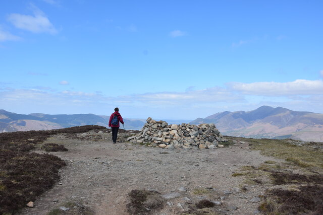
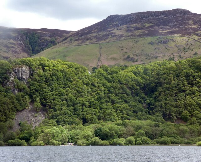
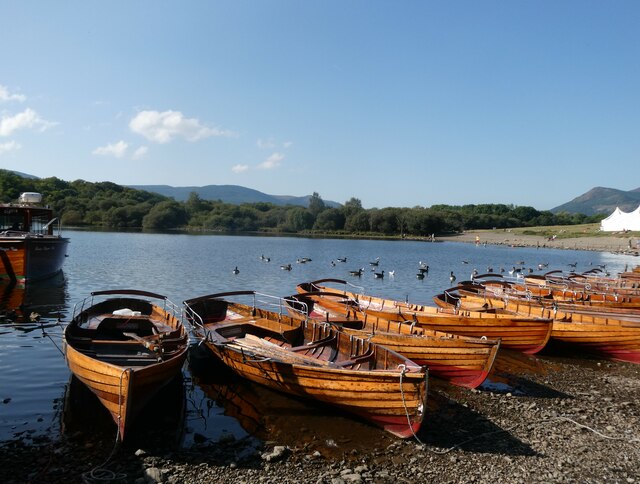
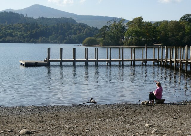
Walla Crag is a prominent hill located in the Lake District National Park in Cumberland, England. Standing at an elevation of 379 meters (1,243 feet), it offers stunning panoramic views of the surrounding landscape, including Derwentwater, Borrowdale Valley, and the Keswick town below.

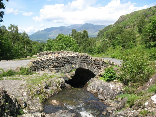
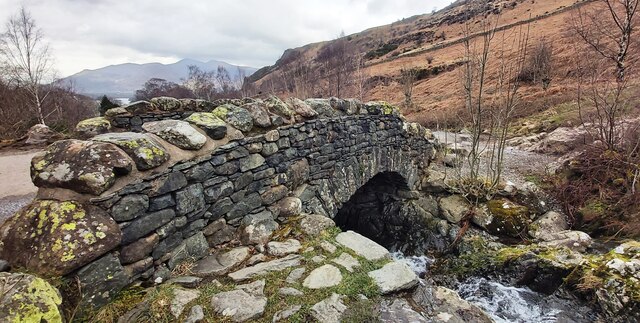
Covered in a mix of grassy slopes and rocky outcrops, Walla Crag is a popular destination for hikers and nature enthusiasts alike. Its accessible location, just a short distance from the town of Keswick, makes it a popular choice for both locals and tourists seeking a moderate outdoor adventure.

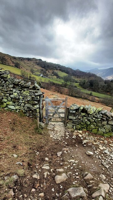
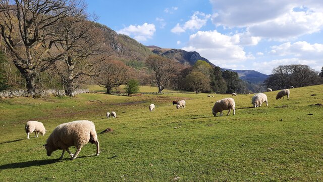
The ascent to Walla Crag can be approached from various directions, with a common starting point being Keswick. From here, a well-marked footpath leads through the picturesque woodland of Great Wood, gradually climbing towards the hill's summit. The route is relatively easy, suitable for all ages and abilities.

Once at the top, visitors are rewarded with breathtaking views across the Derwentwater and the surrounding fells. On a clear day, it is possible to see as far as Skiddaw, Blencathra, and the Helvellyn range. The picturesque beauty of the scenery makes Walla Crag a popular spot for photographers and artists.

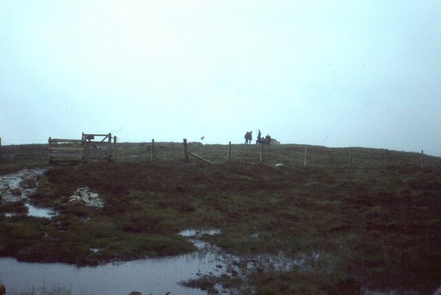
In addition to its natural beauty, Walla Crag holds historical significance. The remains of a prehistoric hillfort can be found on its summit, dating back to the late Iron Age. These ancient earthworks add an additional layer of interest to this already captivating location.

Overall, Walla Crag offers a delightful outdoor experience, combining stunning views, tranquil surroundings, and a touch of history.

If you have any feedback on the listing, please let us know in the comments section below.

Walla Crag Images

Images are sourced within 2km of 54.581609/-3.1203856 or Grid Reference NY2721. Thanks to Geograph Open Source API. All images are credited.

Summit, Bleaberry Fell
Ashness Bridge On the minor road from Barrow Bay to Watendlath, the Grade II listed Ashness Bridge over Barrow Beck is a popular tourist attraction.
Barrow Beck flows into Derwentwater and thence into the River Derwent.
Ashness Bridge
On the minor road from Barrow Bay to Watendlath, the Grade II listed Ashness Bridge over Barrow Beck is a popular tourist attraction. Barrow Beck flows into Derwentwater and thence into the River Derwent.
Ashness Bridge
Ashness Bridge
Gate on Brown Knotts
Bleaberry Fell The wind shelter on the summit of the fell. Looking north west with Skiddaw in the distance on the right of the shot.
Bleaberry Fell
The wind shelter on the summit of the fell. Looking north west with Skiddaw in the distance on the right of the shot.
Wooded cliffs overlooking Derwentwater 
Between the Bleaberry Fell and the lakeside are cliffs covered in trees. On the left, above a landslide, there seems to be some kind of face.
Wooded cliffs overlooking Derwentwater
Between the Bleaberry Fell and the lakeside are cliffs covered in trees. On the left, above a landslide, there seems to be some kind of face.
Ashness Bridge The one and only!
Ashness Bridge
The one and only!
Artist at work - Ashness Bridge A popular place to linger with a good impression of the view on the canvas.
Artist at work - Ashness Bridge
A popular place to linger with a good impression of the view on the canvas.
Ashness Bridge near Derwentwater Ashness Bridge over Barrow Beck is a highly popular tourist attraction. This is an old packhorse bridge on the single track road to Watendlath. Barrow Beck flows into Derwentwater. This is one of the most photographed bridges in Britain. Viewed on a day in early autumn.
Ashness Bridge near Derwentwater
Ashness Bridge over Barrow Beck is a highly popular tourist attraction. This is an old packhorse bridge on the single track road to Watendlath. Barrow Beck flows into Derwentwater. This is one of the most photographed bridges in Britain. Viewed on a day in early autumn.
Land below Low Strutta Wood The view is along the eastern side of Derwent Water from the Lodore landing stage.
The deciduous trees of Low Strutta Wood rise at the right side of the image, above the reeds.
Buttresses of Falcon Crag are partially sunlit high on the mountain slope.
The distant hills are Lonscale Fell and Latrigg.
Land below Low Strutta Wood
The view is along the eastern side of Derwent Water from the Lodore landing stage. The deciduous trees of Low Strutta Wood rise at the right side of the image, above the reeds. Buttresses of Falcon Crag are partially sunlit high on the mountain slope. The distant hills are Lonscale Fell and Latrigg.
Pasture on the south side of Stable Hills Farm The path takes walkers past Stable Hills into this pasture and along the edge of this field near Derwent Water.
Pasture on the south side of Stable Hills Farm
The path takes walkers past Stable Hills into this pasture and along the edge of this field near Derwent Water.
Rowing boats, Derwentwater, Keswick On the north east side of the lake, south of Crow Park.
Rowing boats, Derwentwater, Keswick
On the north east side of the lake, south of Crow Park.
Derwentwater, Keswick The woman sitting by the water is watching the low flying jet planes roaring past.
Derwentwater, Keswick
The woman sitting by the water is watching the low flying jet planes roaring past.
Derwentwater, Keswick On the north east side of the lake.
Derwentwater, Keswick
On the north east side of the lake.
Derwentwater, Keswick Rescue boat by a landing stage on the north east side of the lake.
Derwentwater, Keswick
Rescue boat by a landing stage on the north east side of the lake.
A591 at Nest Brow
A591 at Nest Brow
A591 near Dale Bottom
Derwent Water from Friar's Crag Looking down Derwent Water from Friar's Crag.
Derwent Water from Friar's Crag
Looking down Derwent Water from Friar's Crag.
Show me another place!

Walla Crag is located at Grid Ref: NY2721 (Lat: 54.581609, Lng: -3.1203856)

Administrative County: Cumbria

District: Allerdale

Police Authority: Cumbria

What 3 Words

///powers.history.genius. Near Keswick, Cumbria

Related Wikis

Walla Crag

Walla Crag is a fell in the English Lake District, near Keswick. The fell is a short walk from Keswick and overlooks Derwentwater. == Topography == The...

Black Sands (album)

Black Sands is the fourth studio album by English producer Bonobo. It was released on 29 March 2010. == Artwork == The cover features a photograph taken...

Herbert of Derwentwater

Saint Herbert of Derwentwater (died 20 March 687) was an Anglo-Saxon priest and hermit who lived on the small St Herbert's Island in Derwentwater, Cumbria...

Lord's Island

Lord's Island, which is one of the seven islands on Derwent Water in Keswick, Cumbria, England, got its name from the Earls of Derwentwater who used to...

Nearby Amenities

Located within 500m of 54.581609,-3.1203856
Barrier: stile
Lat/Long: 54.5816283/-3.1197608
Barrier: kissing_gate
Foot: yes
Lat/Long: 54.5838961/-3.117587
Barrier: stile
Lat/Long: 54.5803407/-3.1210683
Great Wood
Natural: wood
Lat/Long: 54.5841254/-3.1245586
Castlerigg Fell
Place: locality
Lat/Long: 54.5815156/-3.1139282
Man Made: cairn
Lat/Long: 54.5783323/-3.1205944
Waterway: waterfall
Lat/Long: 54.5775709/-3.1215882
Walla Crag
Ele: 379
Name Ru: Уолла-Крэг
Natural: peak
Source: GPS Survey
Wikidata: Q4476111
Wikipedia: en:Walla Crag
Lat/Long: 54.5815613/-3.1203278
Tourism: viewpoint
Lat/Long: 54.5815802/-3.1209703
Tourism: viewpoint
Lat/Long: 54.5825173/-3.1202781
Waterway: waterfall
Lat/Long: 54.5771887/-3.1203113
Ford: yes
Lat/Long: 54.5771604/-3.1202479
The data included in this document is from www.openstreetmap.org. The data is made available under ODbL.

Have you been to Walla Crag?

Leave your review of Walla Crag below (or comments, questions and feedback).