Dundreich

Hill, Mountain in Peeblesshire

Scotland

Dundreich

Looking over the Reservoir Portmore Estate, Eddleston
Looking over the Reservoir Credit: Anthony O'Neil

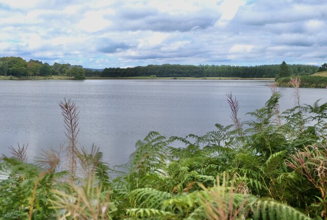
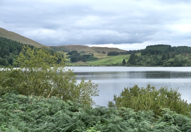
Dundreich is a prominent hill located in Peeblesshire, Scotland. Rising to an elevation of 519 meters (1,703 feet), it is considered a significant landmark in the area. Situated approximately 4 kilometers (2.5 miles) southeast of the town of Innerleithen, Dundreich offers breathtaking views of the surrounding countryside, making it a popular destination for hikers and outdoor enthusiasts.

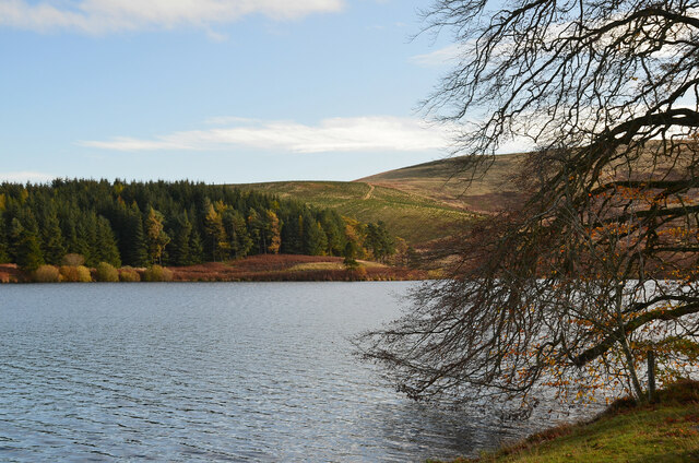
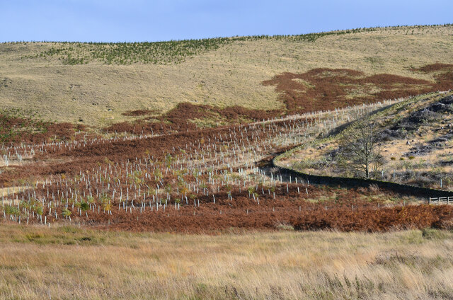
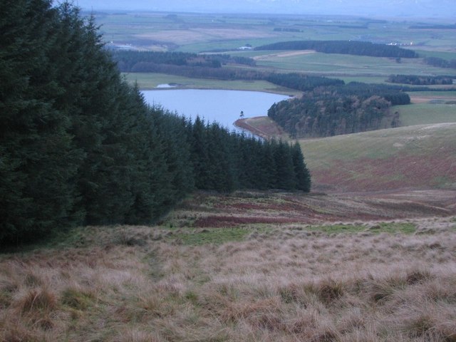
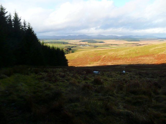
The hill is known for its distinctive conical shape, with a relatively steep ascent that offers a moderate challenge to climbers. The terrain predominantly consists of heather and grass, with scattered patches of woodland dotting the lower slopes. The summit of Dundreich provides panoramic vistas of the surrounding Tweed Valley, with the rolling hills of the Scottish Borders visible to the south and the majestic peaks of the Southern Uplands to the north.

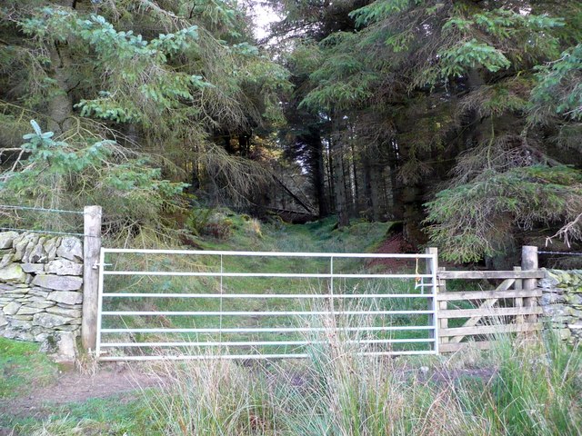
Dundreich is easily accessible via several well-marked footpaths that wind their way up its slopes. The most popular route begins near the village of Traquair, taking hikers through picturesque farmland before ascending the hill. Along the way, visitors may encounter an array of wildlife, including birds of prey, red deer, and various species of smaller mammals.

Due to its proximity to Innerleithen, Dundreich is often included in longer hiking routes that traverse the wider Peeblesshire region. It offers a wonderful opportunity for outdoor enthusiasts to experience the natural beauty and tranquility of the Scottish countryside while enjoying a moderate physical challenge.

If you have any feedback on the listing, please let us know in the comments section below.

Dundreich Images

Images are sourced within 2km of 55.729806/-3.1564877 or Grid Reference NT2749. Thanks to Geograph Open Source API. All images are credited.

Looking over the Reservoir Portmore Estate, Eddleston
Looking over the Reservoir
Portmore Estate, Eddleston
Portmore Reservoir Viewed from the north. An expanse of 136 acres, it was created in 1878 with an earth embankment. It lies within the Portmore Estate, and is a popular fishing loch, but is operated by Scottish Water to supply the local area.
Portmore Reservoir
Viewed from the north. An expanse of 136 acres, it was created in 1878 with an earth embankment. It lies within the Portmore Estate, and is a popular fishing loch, but is operated by Scottish Water to supply the local area.
Portmore Loch and plantations Mature and new plantations on the east side of the loch or reservoir. Much of the land around Westloch has been planted for forestry quite recently.
Portmore Loch and plantations
Mature and new plantations on the east side of the loch or reservoir. Much of the land around Westloch has been planted for forestry quite recently.
New plantation, Loch Hill Presumably broadleaved trees in the protective tubes with conifers higher up the slope.
New plantation, Loch Hill
Presumably broadleaved trees in the protective tubes with conifers higher up the slope.
Descent to Portmore Following the northern edge of the forestry plantation on the slopes above Portmore Loch.
Descent to Portmore
Following the northern edge of the forestry plantation on the slopes above Portmore Loch.
Descending by forestry at Fala Steel Westloch farm in the distance.
Descending by forestry at Fala Steel
Westloch farm in the distance.
Entrance to the forest at Fala Steel
Portmore Loch View down to the reservoir from Loch Hill.  Rough grazing in the foreground. Pentland Hills beyond.
Portmore Loch
View down to the reservoir from Loch Hill. Rough grazing in the foreground. Pentland Hills beyond.
Headwaters of the Tweeddale Burn The Moorfoot scarp. Sheepwalk, mostly blackfaces. The burn forms the Peeblesshire- Midlothian boundary, POV in Midlothian.
Headwaters of the Tweeddale Burn
The Moorfoot scarp. Sheepwalk, mostly blackfaces. The burn forms the Peeblesshire- Midlothian boundary, POV in Midlothian.
Cotly Hill Moorfoots Scarp.  The marks on the hillside are shelters excavated by generations of sheep. The gullies at the head of the Tweeddale Burn are also within the square. Beyond the peaty wastes of Jeffries Course.
Cotly Hill
Moorfoots Scarp. The marks on the hillside are shelters excavated by generations of sheep. The gullies at the head of the Tweeddale Burn are also within the square. Beyond the peaty wastes of Jeffries Course.
Portmore Loch View along the eastern shore. Far too bright and clear for the fishermen, who had all gone home by this time. 

There was a natural loch here, it was enlarged in 1925.
Portmore Loch
View along the eastern shore. Far too bright and clear for the fishermen, who had all gone home by this time. There was a natural loch here, it was enlarged in 1925.
Portmore Loch Some of the recently upgraded fishing infrastructure.
Portmore Loch
Some of the recently upgraded fishing infrastructure.
Portmore Loch from Loch Hill It's 'Portmore Loch' on the 1:50,000 and 'Portmore Reservoir' on the 1:25,000 map. 'Loch' seems to be the generally accepted name, though neighbouring Gladhouse is always referred to as a reservoir.
Portmore Loch from Loch Hill
It's 'Portmore Loch' on the 1:50,000 and 'Portmore Reservoir' on the 1:25,000 map. 'Loch' seems to be the generally accepted name, though neighbouring Gladhouse is always referred to as a reservoir.
Dundreich from minor top on N ridge Looking over the 475m ring contour to the upper slopes of Dundreich.
Dundreich from minor top on N ridge
Looking over the 475m ring contour to the upper slopes of Dundreich.
Portmore Loch View of the loch from Dundreich. Portmore is an old and well established reservoir which now has a natural appearance.
Portmore Loch
View of the loch from Dundreich. Portmore is an old and well established reservoir which now has a natural appearance.
Heading along the Portmore Loch Track
Portmore Loch looking West
Sheep Stell on Loch Hill Gladhouse Reservoir can be seen in the background
Sheep Stell on Loch Hill
Gladhouse Reservoir can be seen in the background
Show me another place!

Dundreich is located at Grid Ref: NT2749 (Lat: 55.729806, Lng: -3.1564877)

Unitary Authority: The Scottish Borders

Police Authority: The Lothians and Scottish Borders

What 3 Words

///reverses.suppers.twisty. Near Peebles, Scottish Borders

Nearby Locations

Dundreich

Related Wikis

Northshield Rings

Northshield Rings is a prehistoric site, a hillfort near the village of Eddleston and about 6 miles (10 km) north of Peebles, in the Scottish Borders,...

Bowbeat Hill

Bowbeat Hill is a hill in the Moorfoot Hills range, part of the Southern Uplands of Scotland. It lends its name to Bowbeat Onshore Wind Farm built on the...

Darnhall Mains

Darnhall Mains is a farm and settlement off the A703, near Eddleston and the Eddleston Water in the Scottish Borders area of Scotland, in the former Peeblesshire...

Earlyvale Gate railway station

Earlyvale Gate railway station served the Dundas family residence in Earlyvale, Scottish Borders, Scotland for 8 months (June 1856 - February 1857) on...

Nearby Amenities

Located within 500m of 55.729806,-3.1564877
Dundreich
Ele: 622
Natural: peak
Lat/Long: 55.7297662/-3.1565719
Man Made: survey_point
Lat/Long: 55.729799/-3.1565101
The data included in this document is from www.openstreetmap.org. The data is made available under ODbL.

Have you been to Dundreich?

Leave your review of Dundreich below (or comments, questions and feedback).