Doe's Hill

Hill, Mountain in Dumfriesshire

Scotland

Doe's Hill

Winterhope Reservoir The Kirtle Water is a river in Dumfries and Galloway in southern Scotland. It rises on the southern slopes of Haggy Hill where its headwaters are impounded to form Winterhope Reservoir. Below the dam it flows in a generally southerly direction passing Waterbeck and Eaglesfield to the village of Kirtlebridge.
Winterhope Reservoir Credit: James Johnstone

Doe's Hill is a prominent hill located in Dumfriesshire, Scotland. Rising to an elevation of approximately 600 meters (1,970 feet), it forms an impressive landmark in the region. Situated within the Southern Uplands, Doe's Hill is part of a range characterized by rolling hills, rugged terrain, and stunning natural beauty.

The hill is named after John Doe, a local landowner who once owned the area. It is renowned for its breathtaking views, offering sweeping panoramas of the surrounding countryside. On a clear day, visitors can enjoy vistas stretching as far as the Solway Firth and the northern Lake District.

Doe's Hill is a popular destination for outdoor enthusiasts, attracting hikers, hillwalkers, and nature lovers. Numerous walking trails crisscross the hill, providing opportunities for leisurely strolls or more challenging hikes. The diverse flora and fauna found on the hill make it an ideal spot for wildlife enthusiasts and birdwatchers.

The hill is composed mainly of sandstone and offers a variety of geological features, including crags and outcrops. Its steep slopes and rocky terrain add to its allure, providing a sense of adventure for climbers and boulderers.

Doe's Hill is easily accessible, with several access points and parking areas available for visitors. Local amenities, such as cafes and visitor centers, can be found in nearby villages, providing opportunities for refreshments and information about the area.

Overall, Doe's Hill is a captivating natural landmark in Dumfriesshire, offering stunning views, outdoor recreational activities, and a chance to immerse oneself in the beauty of the Scottish countryside.

If you have any feedback on the listing, please let us know in the comments section below.
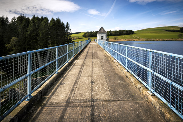
Doe's Hill Images

Images are sourced within 2km of 55.143049/-3.1446937 or Grid Reference NY2783. Thanks to Geograph Open Source API. All images are credited.

Winterhope Reservoir The Kirtle Water is a river in Dumfries and Galloway in southern Scotland. It rises on the southern slopes of Haggy Hill where its headwaters are impounded to form Winterhope Reservoir. Below the dam it flows in a generally southerly direction passing Waterbeck and Eaglesfield to the village of Kirtlebridge.
Winterhope Reservoir
The Kirtle Water is a river in Dumfries and Galloway in southern Scotland. It rises on the southern slopes of Haggy Hill where its headwaters are impounded to form Winterhope Reservoir. Below the dam it flows in a generally southerly direction passing Waterbeck and Eaglesfield to the village of Kirtlebridge.
The control tower at Winterhope Reservoir
Winterhope Reservoir Annan and District Anglers Club fish here with a catch limit of three rainbow trout per session. Brown trout have to be returned to the water.
Winterhope Reservoir
Annan and District Anglers Club fish here with a catch limit of three rainbow trout per session. Brown trout have to be returned to the water.
Burntcleuch Shoulder Looking down to ridge which flattens to Kitty's Cairn. Kitty Cleuch and Glentenmont Burn are to the left.
Burntcleuch Shoulder
Looking down to ridge which flattens to Kitty's Cairn. Kitty Cleuch and Glentenmont Burn are to the left.
Mid Hill Looking down to Papert Hill and Newland Hill.
Mid Hill
Looking down to Papert Hill and Newland Hill.
Kirtle Nick Passage between The Dod and Castlestaff at the source of Kirtle Water. There was little, if any, flowing water on this occasion. What there is starts its journey to the Solway at Gretna.
Kirtle Nick
Passage between The Dod and Castlestaff at the source of Kirtle Water. There was little, if any, flowing water on this occasion. What there is starts its journey to the Solway at Gretna.
Burnt Hill Looking down to Blackstan Hill.
Burnt Hill
Looking down to Blackstan Hill.
Kirtlehead Hill Rough pasture on the ridge from Burnt Hill.
Kirtlehead Hill
Rough pasture on the ridge from Burnt Hill.
Long Cleuch Descent to the valley of Dalbate Burn.
Long Cleuch
Descent to the valley of Dalbate Burn.
On Doe's Hill Looking across Winter Hope to Burntcleuch Shoulder and Mid Hill.
On Doe's Hill
Looking across Winter Hope to Burntcleuch Shoulder and Mid Hill.
Birny Hill Rough pasture on the gently rising slopes above Winterhope Reservoir.
Birny Hill
Rough pasture on the gently rising slopes above Winterhope Reservoir.
Birny Hill The flat ridge between Kitty's Cairn and Standingstone Edge with Burntcleuch Shoulder and Mid Hill rising beyond.
Birny Hill
The flat ridge between Kitty's Cairn and Standingstone Edge with Burntcleuch Shoulder and Mid Hill rising beyond.
Farmland at Kirtlehead A small grassy gully at the edge of a pasture field.
Farmland at Kirtlehead
A small grassy gully at the edge of a pasture field.
Hill farming countryside Rough grazing with some areas of improved grazing viewed from a track on Papert Hill. Newland Hill is on the right.
Hill farming countryside
Rough grazing with some areas of improved grazing viewed from a track on Papert Hill. Newland Hill is on the right.
A settlement on Mid Hill At the southern edge of this prehistoric settlement on the southwest ridge of Mid Hill, with Papert Hill and Newland Hill beyond.
A settlement on Mid Hill
At the southern edge of this prehistoric settlement on the southwest ridge of Mid Hill, with Papert Hill and Newland Hill beyond.
A sheepfold by the Coom Burn At the southwest edge of Capelfoot Forest and with a corrugated iron shelter within the circular wall.
A sheepfold by the Coom Burn
At the southwest edge of Capelfoot Forest and with a corrugated iron shelter within the circular wall.
Capelfoot Forest The southwest edge of a Sitka forest with some broad-leaved planting on the right.
Capelfoot Forest
The southwest edge of a Sitka forest with some broad-leaved planting on the right.
Hill farming countryside This access track runs through a rough grazing area from The Dod to Capelfoot Farm.
Hill farming countryside
This access track runs through a rough grazing area from The Dod to Capelfoot Farm.
Show me another place!

Doe's Hill is located at Grid Ref: NY2783 (Lat: 55.143049, Lng: -3.1446937)

Unitary Authority: Dumfries and Galloway

Police Authority: Dumfries and Galloway

What 3 Words

///stolen.twirls.pink. Near Bentpath, Dumfries & Galloway

Nearby Locations

Winter Hope Doe's Hill

Related Wikis

Annandale and Eskdale

Annandale and Eskdale is a committee area in Dumfries and Galloway, Scotland. It covers the areas of Annandale and Eskdale, the straths of the River Annan...

Whitcastles stone circle

Whitcastles or Little Hartfell (grid reference NY 2240 8806) is a stone circle 6½ miles NE of Lockerbie, Dumfries and Galloway. Nine fallen stones lie...

Eskdale (Scotland)

Eskdale (Scottish Gaelic: Eisgeadal, IPA:[ˈeʃkʲət̪əɫ̪]) is a glen and former lordship in the county of Dumfriesshire, Scotland. The River Esk flows through...

Bentpath

Bentpath is a small village between Eskdalemuir and Langholm in Dumfries and Galloway, Scotland. It is located on the River Esk and has a church and a...

Wauchope Castle

Wauchope Castle was a castle located at Wauchope, in Dumfries and Galloway, Scotland. The castle was a stronghold of the Lindsay family. It was the caput...

Duchess Bridge

The Duchess Bridge is a cast iron footbridge over the River Esk in Dumfries and Galloway, Scotland. It was built for Charles Montagu-Scott, 4th Duke of...

Scotsbrig

Scotsbrig is a farm near Ecclefechan, Dumfries and Galloway, Scotland, and a Category B listed building. Thomas Carlyle lived there with his family in...

Barntalloch Castle

Barntalloch Castle was a castle located at Staplegorton, in Dumfries and Galloway, Scotland. The castle was built in the 12th century by Galfrid de Coninsburgh...

Nearby Amenities

Located within 500m of 55.143049,-3.1446937
Doe's Hill
Ele: 334
Natural: peak
Lat/Long: 55.1428269/-3.1445812
The data included in this document is from www.openstreetmap.org. The data is made available under ODbL.

Have you been to Doe's Hill?

Leave your review of Doe's Hill below (or comments, questions and feedback).