Brim Fell

Hill, Mountain in Lancashire South Lakeland

England

Brim Fell

The Pudding Stone in Pudding Cove
The Pudding Stone in Pudding Cove Credit: shikari

Brim Fell is a prominent hill located in the county of Lancashire, England. It is part of the Coniston Fells, a range of mountains within the Lake District National Park. With an elevation of 796 meters (2,612 feet), Brim Fell is a notable peak in the area.

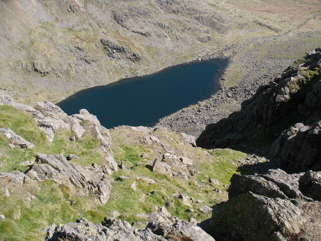
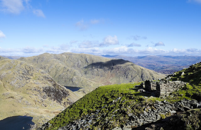
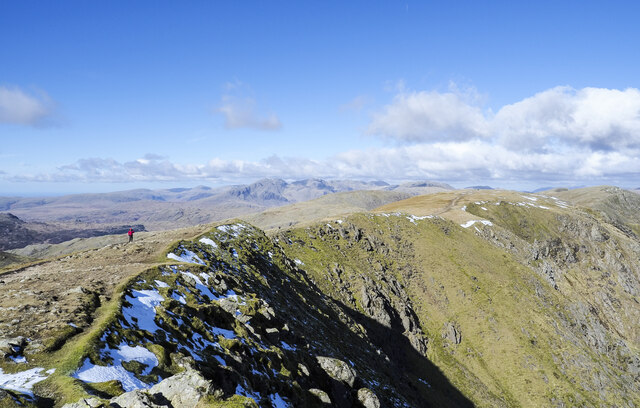
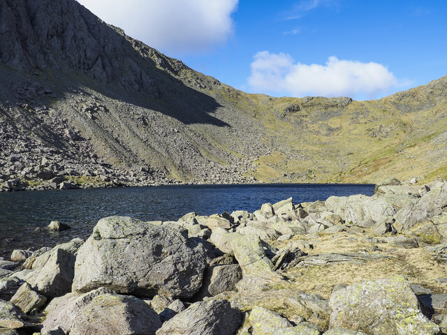
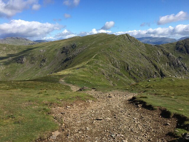
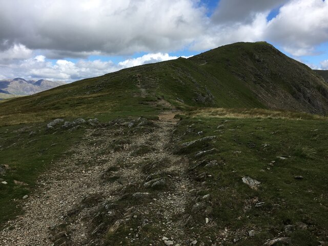
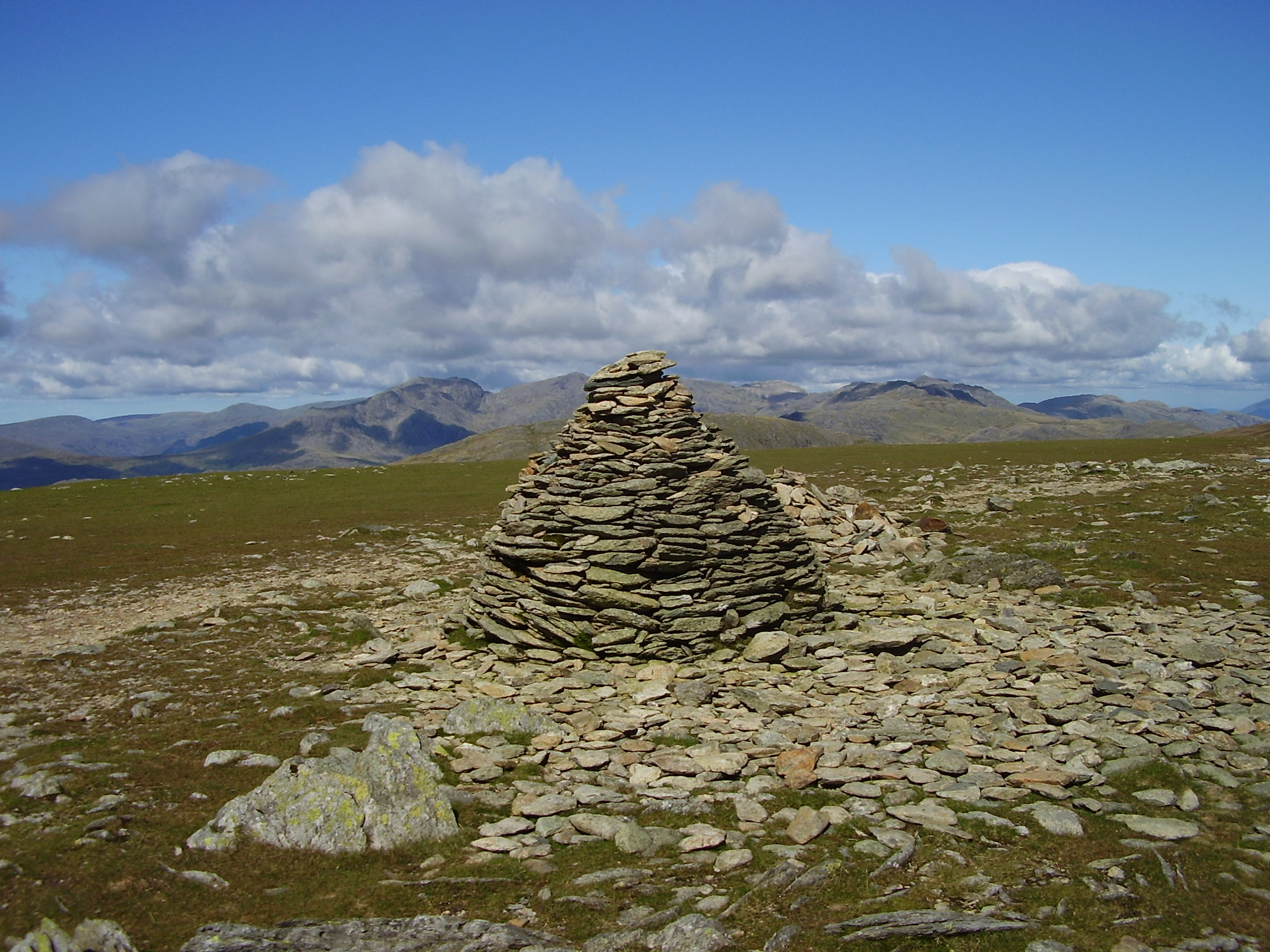
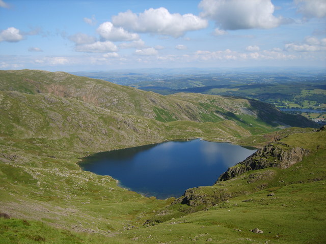
The hill offers spectacular panoramic views of the surrounding landscape, including the nearby Coniston Water, which is one of the largest lakes in the Lake District. From its summit, visitors can also enjoy stunning vistas of the neighboring peaks, such as the Old Man of Coniston and Dow Crag.

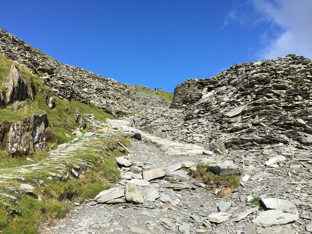
Brim Fell is a popular destination for outdoor enthusiasts, particularly hikers and hillwalkers. There are several well-marked trails that lead to the summit, providing a variety of options for different skill levels. The ascent can be challenging, with steep sections and rocky terrain, but the rewarding views make it worthwhile.

The hill is known for its rugged beauty and wild nature. Its slopes are covered in heather, grasses, and scattered rocky outcrops. The area is also home to a variety of wildlife, including birds of prey, such as peregrine falcons, and wild mountain goats.

Brim Fell is easily accessible from nearby towns and villages, with designated parking areas for visitors. It is a fantastic destination for those seeking a peaceful escape into nature, with opportunities for walking, photography, and enjoying the beauty of the Lake District.

If you have any feedback on the listing, please let us know in the comments section below.
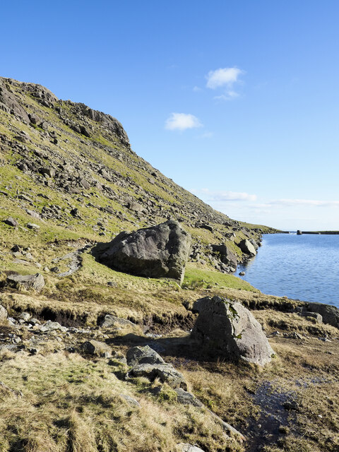
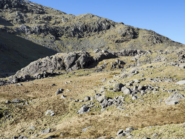
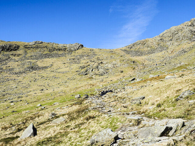
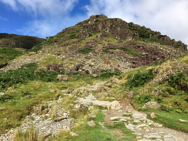
Brim Fell Images

Images are sourced within 2km of 54.37728/-3.1241427 or Grid Reference SD2798. Thanks to Geograph Open Source API. All images are credited.

The Pudding Stone in Pudding Cove
Goat's Water from Dow Crag View down Easter Gully to Goat’s Water from near the summit of Dow Crag.
Goat's Water from Dow Crag
View down Easter Gully to Goat’s Water from near the summit of Dow Crag.
Spoil terrace with ruined building A view from the 'Quarries Route', the main ascent path for the Old Man of Coniston. The grassed / mossed-over terrace of spoil is a very small one compared to a number of others along the way. Wetherlam is the mountain in the distance.
Spoil terrace with ruined building
A view from the 'Quarries Route', the main ascent path for the Old Man of Coniston. The grassed / mossed-over terrace of spoil is a very small one compared to a number of others along the way. Wetherlam is the mountain in the distance.
Crag rim at summit area of Coniston Old Man Snow residues lie at the edge of broken ground at the summit of the mountain. The crag rim and broad ridge extend initially to the north-west before turning north.
The Scafell group of mountains lie in the distance at the centre of the image.
Crag rim at summit area of Coniston Old Man
Snow residues lie at the edge of broken ground at the summit of the mountain. The crag rim and broad ridge extend initially to the north-west before turning north. The Scafell group of mountains lie in the distance at the centre of the image.
Northern slope of Dow Crag The darker slope rising to the left reaches Dow Crag. Goat's Hause is the col at the left side of the image from which a stream groove descends.
Harter Fell is the pyramidal peak at the centre of the image.
Northern slope of Dow Crag
The darker slope rising to the left reaches Dow Crag. Goat's Hause is the col at the left side of the image from which a stream groove descends. Harter Fell is the pyramidal peak at the centre of the image.
Boulders at shore of Goat's Water Goat's Water lies between two mountains of the Coniston group. The Old Man of Coniston rises unseen to the right, Dow Crag, to the left, across the lake.
Goat's Hause is the col in the distance.
Boulders at shore of Goat's Water
Goat's Water lies between two mountains of the Coniston group. The Old Man of Coniston rises unseen to the right, Dow Crag, to the left, across the lake. Goat's Hause is the col in the distance.
Large rocks at eastern shore of Levers Water Levers Water is an enlarged tarn, dammed to create a greater volume of water for the generation of power for use in the mines below. The dam can be seen in the distance.
Large rocks at eastern shore of Levers Water
Levers Water is an enlarged tarn, dammed to create a greater volume of water for the generation of power for use in the mines below. The dam can be seen in the distance.
Settling tanks at Bonsor upper mill The series of shallow depressions near to the Coppermines Youth Hostel is named as 'tanks' in the 1969 volume, 'Industrial Archaeology of the Lake Counties' - Marshall & Davies-Shiel. It's supposed that they were settling tanks in which small particles of rock etc. would be allowed to fall to the bottom before the then clearer water would be allowed to flow down to Coniston in the valley below.
Settling tanks at Bonsor upper mill
The series of shallow depressions near to the Coppermines Youth Hostel is named as 'tanks' in the 1969 volume, 'Industrial Archaeology of the Lake Counties' - Marshall & Davies-Shiel. It's supposed that they were settling tanks in which small particles of rock etc. would be allowed to fall to the bottom before the then clearer water would be allowed to flow down to Coniston in the valley below.
Coppermines Cottage In the past, when copper was being mined, the cottage was occupied by a mine official, presumably the site manager. In 1958 it was acquired by the Barrow Mountaineering and Ski Club which still uses it as a club hut.
Coppermines Cottage
In the past, when copper was being mined, the cottage was occupied by a mine official, presumably the site manager. In 1958 it was acquired by the Barrow Mountaineering and Ski Club which still uses it as a club hut.
Boulders on mountain slope Boulders, large, small and embedded below Sam Bottom in the valley of Swirl Hause Beck which runs down into Levers Water.
The slope rising beyond reaches Swirl How.
Boulders on mountain slope
Boulders, large, small and embedded below Sam Bottom in the valley of Swirl Hause Beck which runs down into Levers Water. The slope rising beyond reaches Swirl How.
Path rising towards Goat's Hause The path is partly constructed using rocks set into the ground to minimise erosion. More work on the route seems to be planned - along the path line, below the image centre there are bagged boulders awaiting use to improve or repair the way.
Goat's Hause is the obvious dip on the horizon.
Path rising towards Goat's Hause
The path is partly constructed using rocks set into the ground to minimise erosion. More work on the route seems to be planned - along the path line, below the image centre there are bagged boulders awaiting use to improve or repair the way. Goat's Hause is the obvious dip on the horizon.
Path towards The Old Man Of Coniston
Path up past Coniston Mines
Path between Brim Fell and Swirl How
Path on Savin Hill
Path on Savin Hill
Looking from Dow Crag towards Buck Pike
Path towards Buck Pike
Trig point atop The Old Man Of Coniston
Show me another place!

Brim Fell is located at Grid Ref: SD2798 (Lat: 54.37728, Lng: -3.1241427)

Administrative County: Cumbria

District: South Lakeland

Police Authority: Cumbria

What 3 Words

///bland.tasks.nuzzled. Near Ambleside, Cumbria

Related Wikis

Brim Fell

Brim Fell is a fell in the English Lake District. It stands to the west of Coniston village in the southern part of the District. == Topography == The...

Old Man of Coniston

The Old Man of Coniston is a fell in the Furness Fells of the Lake District in Cumbria, England, and is the highest point (county top) of the historic...

Goat's Water

Goat's Water is a small accessible tarn in the English Lake District, located between Dow Crag and The Old Man of Coniston to the Duddon Valley, near the...

Levers Water

Levers Water is a small lake in the English Lake District. It is located at the head of the Coppermines Valley, above Coniston village. To its south-west...

Nearby Amenities

Located within 500m of 54.37728,-3.1241427
Source: npe
Lat/Long: 54.374783/-3.1189853
Source: npe
Lat/Long: 54.3741319/-3.1188695
Savin Hill
Place: locality
Lat/Long: 54.378044/-3.1244002
Black Crag
Place: locality
Lat/Long: 54.3790951/-3.12894
Brim Fell Rake
Place: locality
Lat/Long: 54.3783726/-3.1222574
Brim Fell Haws
Place: locality
Lat/Long: 54.3761354/-3.1186955
Hurricane AG264 Crash Site
Historic: yes
Note: Location approx, probably within 100m. Hurricane 275 is also in the area but as of 2017 has not been found.
Lat/Long: 54.3769874/-3.1214479
Brim Fell Haws
Place: locality
Lat/Long: 54.3779262/-3.1168361
Brim Fell
Place: locality
Lat/Long: 54.3792277/-3.1183992
Buck Barrow
Place: locality
Lat/Long: 54.3729473/-3.1251006
Brim Fell
Ele: 796
Natural: peak
Source: npe
Wikidata: Q4968084
Wikipedia: en:Brim Fell
Lat/Long: 54.377296/-3.1241988
The data included in this document is from www.openstreetmap.org. The data is made available under ODbL.

Have you been to Brim Fell?

Leave your review of Brim Fell below (or comments, questions and feedback).