Carn an t-Suidhe

Hill, Mountain in Banffshire

Scotland

Carn an t-Suidhe

Heathery hillside Looking downhill towards Cadha Dubh
Heathery hillside Credit: David Lecore

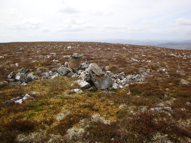
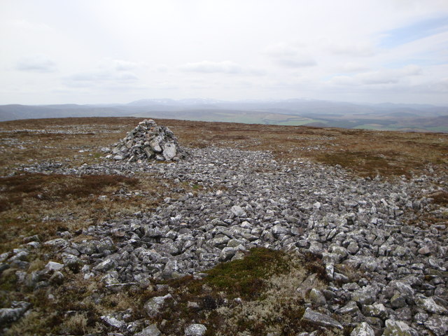
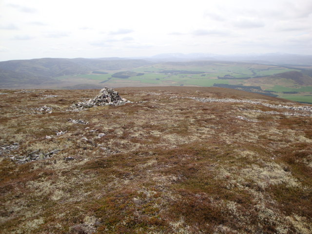
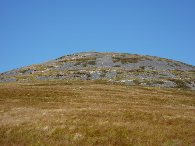
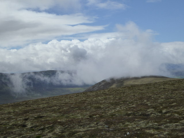
Carn an t-Suidhe is a prominent hill located in Banffshire, Scotland. It is part of the Grampian Mountains, specifically situated in the eastern region of the Cairngorms National Park. With an elevation of 845 meters (2,772 feet), it is not classified as a mountain but rather a hill. Despite this, it still offers breathtaking views and a rewarding hiking experience.

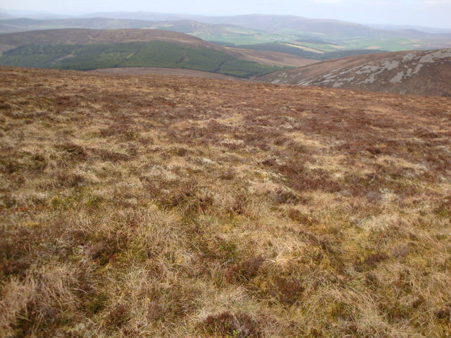
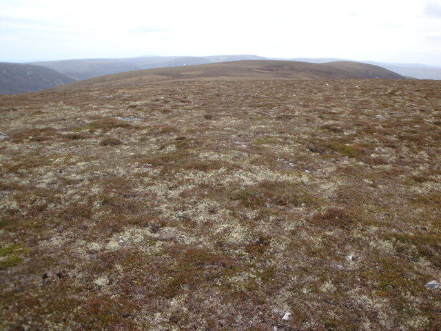
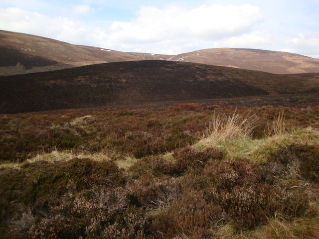
The hill is known for its distinctive shape, featuring a rounded summit and steep slopes covered in heather and grass. It is predominantly composed of granite, which adds to its rugged and picturesque appearance. The terrain is challenging but manageable, attracting outdoor enthusiasts seeking a moderate level of difficulty.

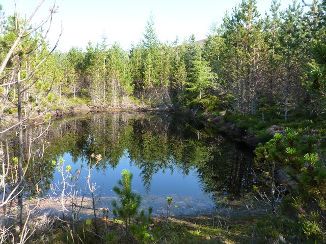
Carn an t-Suidhe is a popular destination for hikers, mountaineers, and nature lovers alike. Its location within the Cairngorms National Park ensures that it is surrounded by stunning landscapes and diverse wildlife. It is not uncommon to spot deer, mountain hares, and various bird species during a visit.

Reaching the summit of Carn an t-Suidhe rewards climbers with panoramic views of the surrounding area. On a clear day, one can admire the sweeping vistas of the Cairngorms, the Grampian Mountains, and even the North Sea in the distance.

Due to its accessibility and natural beauty, Carn an t-Suidhe is an ideal destination for those seeking an outdoor adventure in Banffshire. Whether it be a challenging hike or simply a peaceful stroll, this hill offers a memorable experience for all who visit.

If you have any feedback on the listing, please let us know in the comments section below.

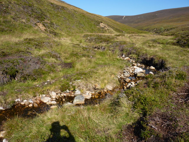
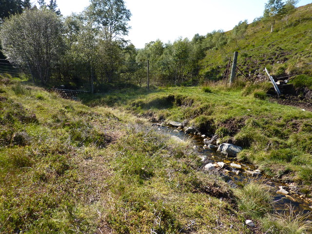
Carn an t-Suidhe Images

Images are sourced within 2km of 57.319296/-3.2154109 or Grid Reference NJ2626. Thanks to Geograph Open Source API. All images are credited.

Heathery hillside Looking downhill towards Cadha Dubh
Heathery hillside
Looking downhill towards Cadha Dubh
Hill top Top of hill, unnamed on both 25K and 50K OS maps, but with 731 spot height
Hill top
Top of hill, unnamed on both 25K and 50K OS maps, but with 731 spot height
Cairn near the top of a hill A cairn near the top a hill unnamed on the OS 50K, but marked with a 729m spot height on the 25K OS map
Cairn near the top of a hill
A cairn near the top a hill unnamed on the OS 50K, but marked with a 729m spot height on the 25K OS map
Carn an t-Suidhe summit cairn
Cairn near the top of Carn an t-Suidhe
Stream course Course of Allt nan Gamhainn stream
Stream course
Course of Allt nan Gamhainn stream
Track and scorched heather Track leading towards Craig Roy
Track and scorched heather
Track leading towards Craig Roy
Tor of Suie A scorched Tor of Suie from the track
Tor of Suie
A scorched Tor of Suie from the track
A pond in the wood 20yd long * 10yd wide. Not shown on the map, but visible by satellite. I was floundering in the wood from here on, trying to find a way north to NJ 25 26, and resorted to leaving a trail of broken twigs to guide me back. This failed me, and in the end I had to climb a 7' high gate in a deer fence. I'm getting too old for these games.
A pond in the wood
20yd long * 10yd wide. Not shown on the map, but visible by satellite. I was floundering in the wood from here on, trying to find a way north to NJ 25 26, and resorted to leaving a trail of broken twigs to guide me back. This failed me, and in the end I had to climb a 7' high gate in a deer fence. I'm getting too old for these games.
Cairn Dregnie The boggier lower slopes give way to a stoney final 200 feet
Cairn Dregnie
The boggier lower slopes give way to a stoney final 200 feet
Allt Dregnie Draining a large area of moorland between Cairn Dregnie and Carn an t-Suidhe
Allt Dregnie
Draining a large area of moorland between Cairn Dregnie and Carn an t-Suidhe
Allt Dregnie heading downstream Into the wood, through a major obstacle for hillwalkers - a deer fence.
Allt Dregnie heading downstream
Into the wood, through a major obstacle for hillwalkers - a deer fence.
Suie The last house in Glen Livet with Corryhabbie Hill and Cook's Cairn in the background. The pass between them goes over to Glenfiddich and is worth crossing (before the wind farmers strike).
Suie
The last house in Glen Livet with Corryhabbie Hill and Cook's Cairn in the background. The pass between them goes over to Glenfiddich and is worth crossing (before the wind farmers strike).
Cloud clearing from hillside south of Muckle Lapprach A view towards the Braes of Glenlivet from Corryhabbie Hill on a day of sunshine and showers.
Cloud clearing from hillside south of Muckle Lapprach
A view towards the Braes of Glenlivet from Corryhabbie Hill on a day of sunshine and showers.
Abandoned farm at the Suie An isolated house and outbuildings in Glenlivet, abandoned some time in the 20th Century, like many farms and crofts in the area.
Abandoned farm at the Suie
An isolated house and outbuildings in Glenlivet, abandoned some time in the 20th Century, like many farms and crofts in the area.
Abandoned farmhouse at Suie
The Suie The abandoned house at Suie must have one of the most magnificent situations in the country. It's on a ridge well out of reach of floods, sheltered by hills to the north and east, with a superb view south and west over the Braes of Glenlivet. The burn is the Suie Burn, which joins the Little Livet to form the River Livet. The gate has been replaced since <a href="https://www.geograph.org.uk/photo/2303082">NJ2724 : March gate near Suie</a> was taken.
The Suie
The abandoned house at Suie must have one of the most magnificent situations in the country. It's on a ridge well out of reach of floods, sheltered by hills to the north and east, with a superb view south and west over the Braes of Glenlivet. The burn is the Suie Burn, which joins the Little Livet to form the River Livet. The gate has been replaced since NJ2724 : March gate near Suie was taken.
Signpost near Suie We weren't quite sure what to make of the information on this signpost, not least because we planned to go to the Cabrach, not to Glenfiddich.
Signpost near Suie
We weren't quite sure what to make of the information on this signpost, not least because we planned to go to the Cabrach, not to Glenfiddich.
Show me another place!

Carn an t-Suidhe is located at Grid Ref: NJ2626 (Lat: 57.319296, Lng: -3.2154109)

Unitary Authority: Moray

Police Authority: North East

What 3 Words

///gobblers.dressings.sailors. Near Dufftown, Moray

Nearby Locations

Carn an t-Suidhe

Related Wikis

Battle of Glenlivet

The Battle of Glenlivet was a Scottish clan battle fought on 3 October 1594 near Glenlivet, Moray, Scotland. It was fought between Protestant forces loyal...

Church of The Incarnation, Tombae

The Church of The Incarnation was built between 1827 and 1829 as a Roman Catholic church, under the patronage of the Gordon family, in Banffshire, Scotland...

County of Moray

Moray; (Scottish Gaelic: Moireibh [ˈmɤɾʲəv]) or Morayshire, called Elginshire until 1919, is a historic county, registration county and lieutenancy area...

Tamnavulin distillery

Tamnavulin distillery is a producer of single malt Scotch whisky that was founded in 1966. The distillery is operated by Whyte & Mackay, which Philippines...

Nearby Amenities

Located within 500m of 57.319296,-3.2154109
Càrn an t-Suidhe
Ele: 734
Natural: peak
Lat/Long: 57.3193894/-3.2146138
The data included in this document is from www.openstreetmap.org. The data is made available under ODbL.

Have you been to Carn an t-Suidhe?

Leave your review of Carn an t-Suidhe below (or comments, questions and feedback).