Humby

Settlement in Lincolnshire South Kesteven

England

Humby

King Street; the Roman road through Hanby Dropping down the slight hill from Hanby Lodge, to pass 'Valley Cottage' at the bottom.
King Street; the Roman road through Hanby Credit: Tim Heaton

Humby is a small village located in the South Kesteven district of Lincolnshire, England. Situated approximately 6 miles southeast of Grantham, it is a peaceful rural settlement surrounded by picturesque countryside. The village falls within the civil parish of Irnham and has a population of around 200 residents.

The historic origins of Humby can be traced back to the Domesday Book, which records the settlement as "Humbi." Over the centuries, it has remained a predominantly agricultural community, with farming playing a significant role in its economy.

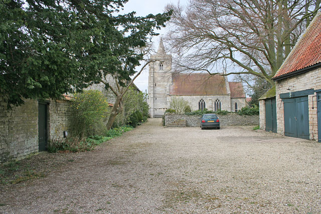
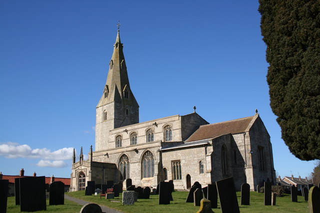
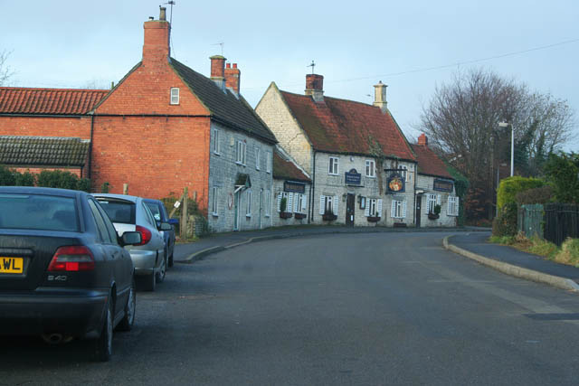
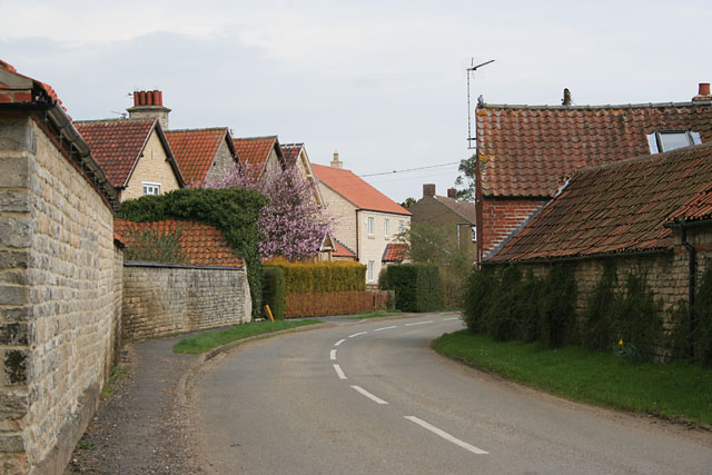
The village itself is characterized by a collection of traditional stone cottages and a few modern houses. There is no local shop or pub, but residents can find necessary amenities in nearby towns. The village does, however, have a well-maintained church, St. Andrew's, which dates back to the 12th century and serves as a focal point for the community.

Humby benefits from its rural location, offering a peaceful environment and opportunities for outdoor activities such as walking, cycling, and exploring the surrounding countryside. The village is also close to the popular Grimsthorpe Castle, a historic stately home with stunning gardens and parkland.

In summary, Humby is a small and tranquil village in Lincolnshire with a rich history and a close-knit community. Its rural setting and proximity to natural attractions make it an appealing destination for those seeking a peaceful retreat or an opportunity to explore the beauty of the English countryside.

If you have any feedback on the listing, please let us know in the comments section below.
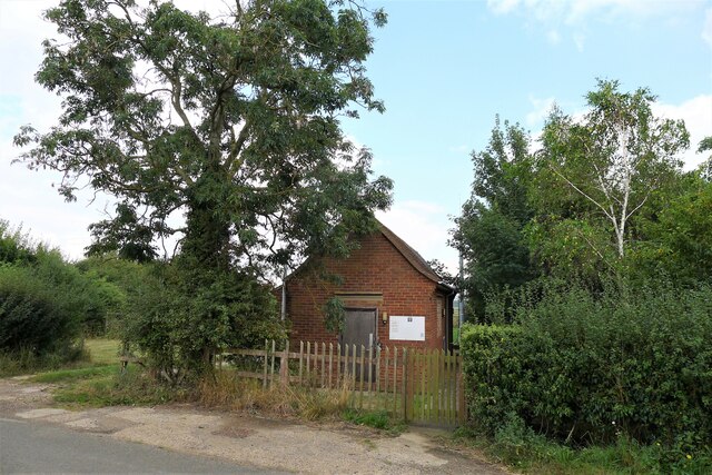
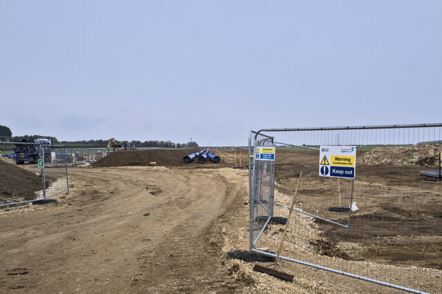
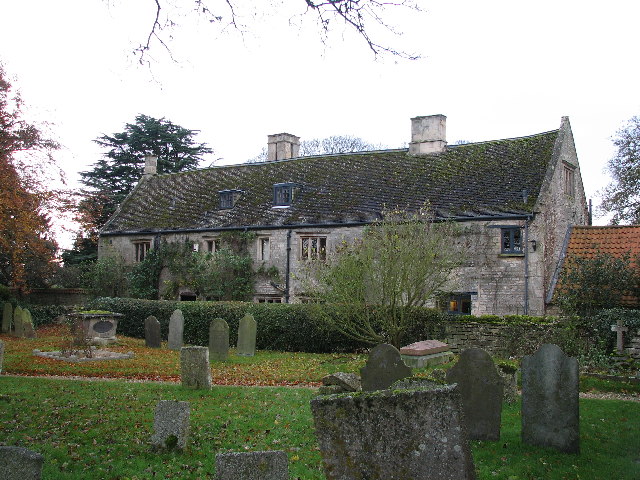
Humby Images

Images are sourced within 2km of 52.88487/-0.511053 or Grid Reference TF0032. Thanks to Geograph Open Source API. All images are credited.

King Street; the Roman road through Hanby Dropping down the slight hill from Hanby Lodge, to pass 'Valley Cottage' at the bottom.
King Street; the Roman road through Hanby
Dropping down the slight hill from Hanby Lodge, to pass 'Valley Cottage' at the bottom.
The Cross Britain Way leading off King Street The Cross Britain Way is a 279 mile, east-west trail across England and Wales, created to help raise money for Macmillan Cancer Support. Starting at Boston (where the original Macmillan Way starts), it crosses the Fens, the Vale of Belvoir, the Leicestershire/Nottinghamshire Wolds, the National Forest, Cannock Chase, East Shropshire along the Iron Bridge Gorge, the Shropshire Hills, the hills of mid Wales, the Berwyn Mountains, and Snowdonia National Park, to its end at Barmouth. <span class="nowrap"><a title="https://ldwa.org.uk/ldp/members/show_path.php?path_name=Macmillan+Way+-+Cross+Britain+Way" rel="nofollow ugc noopener" href="https://ldwa.org.uk/ldp/members/show_path.php?path_name=Macmillan+Way+-+Cross+Britain+Way">Link</a><img style="margin-left:2px;" alt="External link" title="External link - shift click to open in new window" src="https://s1.geograph.org.uk/img/external.png" width="10" height="10"/></span>
The Cross Britain Way leading off King Street
The Cross Britain Way is a 279 mile, east-west trail across England and Wales, created to help raise money for Macmillan Cancer Support. Starting at Boston (where the original Macmillan Way starts), it crosses the Fens, the Vale of Belvoir, the Leicestershire/Nottinghamshire Wolds, the National Forest, Cannock Chase, East Shropshire along the Iron Bridge Gorge, the Shropshire Hills, the hills of mid Wales, the Berwyn Mountains, and Snowdonia National Park, to its end at Barmouth. LinkExternal link
King Street north of Hanby The Roman road crossing the productive farmland of the Kesteven Uplands.
King Street north of Hanby
The Roman road crossing the productive farmland of the Kesteven Uplands.
Ingoldsby telephone exchange on Humby Road Network ID: EMINGOL, <span class="nowrap"><a title="https://telephone-exchange.co.uk/Ingoldsby-EMINGOL.html" rel="nofollow ugc noopener" href="https://telephone-exchange.co.uk/Ingoldsby-EMINGOL.html">Link</a><img style="margin-left:2px;" alt="External link" title="External link - shift click to open in new window" src="https://s1.geograph.org.uk/img/external.png" width="10" height="10"/></span>
Ingoldsby telephone exchange on Humby Road
Network ID: EMINGOL, LinkExternal link
Turn-off to Humby from Humby Road
Ford, Humby Disappeared after the driest summer in 50 years, but normally crossing a headwater stream of the East Glen River, with the footbridge carrying the Cross Britain Way. .
Ford, Humby
Disappeared after the driest summer in 50 years, but normally crossing a headwater stream of the East Glen River, with the footbridge carrying the Cross Britain Way. .
Pipe delivery This lorry is delivering pipe segments for Project SPAR - the Strategic Pipeline Alliance.  Anglian Water is arranging to pipe surplus water from Elsham in North Lincolnshire to Colchester in Essex, where there is a shortage.

As it happens, the lorry left again still loaded, as there was no crane to unload it.
Pipe delivery
This lorry is delivering pipe segments for Project SPAR - the Strategic Pipeline Alliance. Anglian Water is arranging to pipe surplus water from Elsham in North Lincolnshire to Colchester in Essex, where there is a shortage. As it happens, the lorry left again still loaded, as there was no crane to unload it.
Pipeline route The route for Project SPAR - the Strategic Pipeline Alliance.  Anglian Water is arranging to pipe surplus water from Elsham in North Lincolnshire to Colchester in Essex, where there is a shortage.

The pipe sections, 900mm in diameter, will be welded to form the pipeline.  The river has been covered and sheeted over to prevent contamination, and the archaeology cleared.  You can't open the soil anywhere round here without finding Roman remains or Anglo Saxon burials.  Medieval Lincolnshire was like one enormous village, scatted across the whole wold.
Pipeline route
The route for Project SPAR - the Strategic Pipeline Alliance. Anglian Water is arranging to pipe surplus water from Elsham in North Lincolnshire to Colchester in Essex, where there is a shortage. The pipe sections, 900mm in diameter, will be welded to form the pipeline. The river has been covered and sheeted over to prevent contamination, and the archaeology cleared. You can't open the soil anywhere round here without finding Roman remains or Anglo Saxon burials. Medieval Lincolnshire was like one enormous village, scatted across the whole wold.
Pipe laying site access The route for Project SPAR - the Strategic Pipeline Alliance.  Anglian Water is arranging to pipe surplus water from Elsham in North Lincolnshire to Colchester in Essex, where there is a shortage.
Pipe laying site access
The route for Project SPAR - the Strategic Pipeline Alliance. Anglian Water is arranging to pipe surplus water from Elsham in North Lincolnshire to Colchester in Essex, where there is a shortage.
River protected A temporary bridge has been laid across the East Glen River to allow the construction of this water pipe trunk line as part of project SPAR - an investment by Anglian Water to pipe water from North Lincolnshire to Essex.
River protected
A temporary bridge has been laid across the East Glen River to allow the construction of this water pipe trunk line as part of project SPAR - an investment by Anglian Water to pipe water from North Lincolnshire to Essex.
Manor House, Sapperton.
Saint Nicholas Church, Sapperton.
Ford at Little Humby
Little Humby Village Green
Chapel at Great Humby
Short Hollow near Braceby To the South of Braceby this old Roman route, King Street, turns into an unmetalled road with public access.  See <a href="https://www.geograph.org.uk/gridref/TF0035">TF0035</a> for more information.
Short Hollow near Braceby
To the South of Braceby this old Roman route, King Street, turns into an unmetalled road with public access. See TF0035 for more information.
Sapperton, Lincolnshire Once a minor Roman settlement a few 100 yards from King Street, the route from Peterborough to Ermine Street and the River Hull. It was probably founded on an earlier "village", see <span class="nowrap"><a title="http://www.roman-britain.org/places/sapperton.htm" rel="nofollow ugc noopener" href="http://www.roman-britain.org/places/sapperton.htm">Link</a><img style="margin-left:2px;" alt="External link" title="External link - shift click to open in new window" src="https://s1.geograph.org.uk/img/external.png" width="10" height="10"/></span>
Sapperton, Lincolnshire
Once a minor Roman settlement a few 100 yards from King Street, the route from Peterborough to Ermine Street and the River Hull. It was probably founded on an earlier "village", see LinkExternal link
St Nicholas' Church, Sapperton, Lincolnshire Sapperton parish church is dedicated to St. Nicholas and is of Norman origin but the foundations pre-date the Norman Conquest. This view is from the Manor House entrance.
St Nicholas' Church, Sapperton, Lincolnshire
Sapperton parish church is dedicated to St. Nicholas and is of Norman origin but the foundations pre-date the Norman Conquest. This view is from the Manor House entrance.
Show me another place!

Humby is located at Grid Ref: TF0032 (Lat: 52.88487, Lng: -0.511053)

Division: Parts of Kesteven

Administrative County: Lincolnshire

District: South Kesteven

Police Authority: Lincolnshire

What 3 Words

///troubled.october.overdone. Near Corby Glen, Lincolnshire

Nearby Locations

Humby Great Humby

Related Wikis

Little Humby

Little Humby or Humby is a hamlet in the South Kesteven district of Lincolnshire, England. It lies in the civil parish of Ropsley and Humby, 5 miles (8...

St Peter's Church, Ropsley

St Peter's Church is a Grade I listed Anglican parish church dedicated to Saint Peter, in Ropsley, Lincolnshire, England. The church is 5 miles (8 km)...

Great Humby

Great Humby is a hamlet in the South Kesteven district of Lincolnshire, England. It lies in the civil parish of Ropsley and Humby, 6 miles (9.7 km) east...

Ropsley

Ropsley is a village in the South Kesteven district of Lincolnshire, England. The village is situated approximately 5 miles (8 km) east from Grantham,...

Sapperton, Lincolnshire

Sapperton is a village in the South Kesteven district of Lincolnshire, England. The nearest town is Grantham, 6 miles (9.7 km) to the west. Adjacent villages...

Hanby, Lincolnshire

Hanby is a hamlet in the South Kesteven district of Lincolnshire, England. It is situated between Lenton and Ropsley Heath, on the line of the Roman...

Braceby and Sapperton

Braceby and Sapperton is a civil parish in the South Kesteven district of Lincolnshire, England. According to the 2001 census it had a population of 47...

Ropsley and Humby

Ropsley and Humby is a civil parish in the South Kesteven district of Lincolnshire, England. According to the 2001 Census it had a population of 808, increasing...

Nearby Amenities

Located within 500m of 52.88487,-0.511053
Little Humby
Is In: Lincolnshire, England, UK
Place: hamlet
Source: NPE
Lat/Long: 52.8851237/-0.5109369
Bus Stop
Old Manor House
Naptan AtcoCode: 270000008987
Naptan Bearing: S
Naptan CommonName: Old Manor House
Naptan Indicator: adj
Naptan Landmark: Old Manor House
Naptan NaptanCode: lingwmdg
Naptan Street: Main Street
Naptan Verified: no
Source: naptan_import
Lat/Long: 52.8845368/-0.5111901
Bus Stop
Old Manor House
Naptan AtcoCode: 2700LHG00531
Naptan Bearing: N
Naptan CommonName: Old Manor House
Naptan Indicator: opp
Naptan Landmark: Old Manor House
Naptan NaptanCode: linadtwa
Naptan Street: Main Street
Naptan Verified: no
Source: naptan_import
Lat/Long: 52.8845209/-0.5113542
Ford: yes
Lat/Long: 52.8841208/-0.5123468
Power: pole
Lat/Long: 52.8881638/-0.5145487
Power: pole
Lat/Long: 52.8885831/-0.5119225
Corner House Farm
Place: farm
Source: Bing
Lat/Long: 52.8838711/-0.5105467
Hare Park
Place: farm
Source: Bing
Lat/Long: 52.8837366/-0.5076809
Hill Top Farm
Place: farm
Source: Bing
Lat/Long: 52.8862884/-0.509435
Willow Tree Farm
Place: farm
Source: Bing
Lat/Long: 52.8855292/-0.5099115
Manor Barn
Place: farm
Source: Bing
Lat/Long: 52.8838996/-0.5135357
Telephone
Defibrillator
Booth: K6
Covered: booth
Defibrillator Location: inside old red phone box on The Green, Humby
Emergency: defibrillator
Man Made: telephone_box
Ref: CHT-13-693
Lat/Long: 52.8845508/-0.5113712
Post Box
Post Box Mounting: wooden_post
Post Box Type: lamp
Royal Cypher: EIIR
Royal Cypher Wikidata: Q33102113
Lat/Long: 52.8845375/-0.5113672
Advertising: board
Lat/Long: 52.8845771/-0.5113565
Generator Method: photovoltaic
Generator Output Electricity: yes
Generator Source: solar
Generator Type: solar_photovoltaic_panel
Location: roof
Power: generator
Lat/Long: 52.8845354/-0.5109878
Generator Method: photovoltaic
Generator Output Electricity: yes
Generator Source: solar
Generator Type: solar_photovoltaic_panel
Location: roof
Power: generator
Lat/Long: 52.8849513/-0.5114129
Generator Method: photovoltaic
Generator Output Electricity: yes
Generator Source: solar
Generator Type: solar_photovoltaic_panel
Location: roof
Power: generator
Lat/Long: 52.886077/-0.5104594
Generator Method: photovoltaic
Generator Output Electricity: yes
Generator Source: solar
Generator Type: solar_photovoltaic_panel
Location: roof
Power: generator
Lat/Long: 52.886463/-0.5101389
Generator Method: photovoltaic
Generator Output Electricity: yes
Generator Source: solar
Generator Type: solar_photovoltaic_panel
Location: roof
Power: generator
Lat/Long: 52.8861895/-0.5103682
The data included in this document is from www.openstreetmap.org. The data is made available under ODbL.

Have you been to Humby?

Leave your review of Humby below (or comments, questions and feedback).