Cefn y Galchen

Hill, Mountain in Monmouthshire

Wales

Cefn y Galchen

The Rifleman's Arms, Blaenavon
The Rifleman's Arms, Blaenavon Credit: Rob Purvis

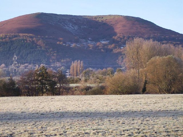
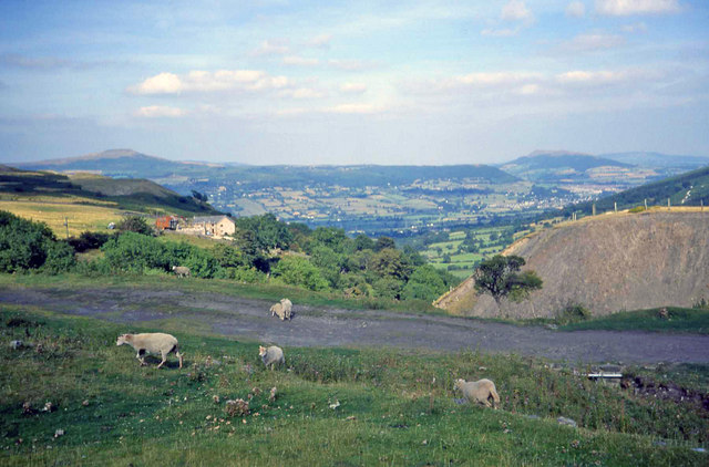
Cefn y Galchen is a prominent hill located in Monmouthshire, Wales. It lies within the Brecon Beacons National Park, approximately 8 miles northwest of Abergavenny. Standing at an elevation of 560 meters (1,837 feet), it offers stunning panoramic views of the surrounding countryside.

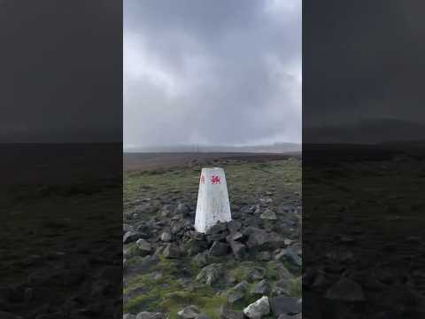
The hill is part of a ridge that runs east-west, with Cefn y Galchen forming the highest point. It is predominantly made up of sandstone and shale, with patches of grass and heather covering its slopes. The summit is marked by a trig point, which serves as a navigational aid for hikers and surveyors.

Cefn y Galchen is a popular destination for outdoor enthusiasts, particularly hikers and walkers. Several footpaths traverse the hill, allowing visitors to explore its diverse landscapes. The ascent can be challenging in places, but the reward is the breathtaking vista that awaits at the top.

The hill is also home to a variety of flora and fauna. It supports a diverse range of plant species, including heather, gorse, and bilberry. Birdwatchers may spot species such as red kites, buzzards, and ravens soaring overhead.

Due to its location within the national park, Cefn y Galchen is subject to conservation efforts to protect its natural beauty. Visitors are encouraged to respect the environment and adhere to designated trails to minimize their impact on the hill and its surroundings.

If you have any feedback on the listing, please let us know in the comments section below.

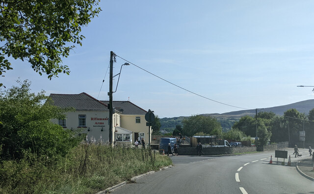
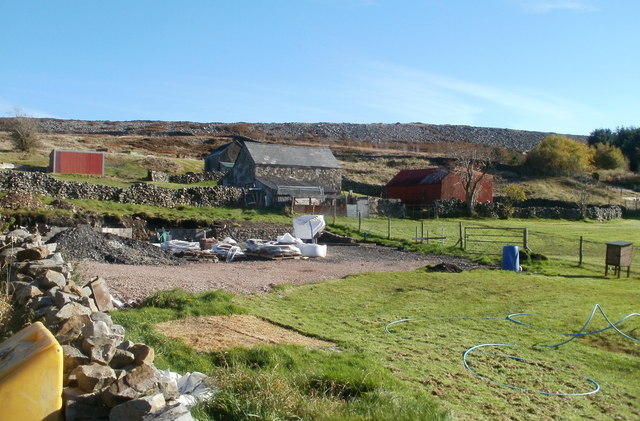
Cefn y Galchen Images

Images are sourced within 2km of 51.792173/-3.0701279 or Grid Reference SO2610. Thanks to Geograph Open Source API. All images are credited.

The Rifleman's Arms, Blaenavon
Covered Reservoir above Blaenavon The view shows a covered reservoir (bright green, covered with grass) on the right hand side with the service road to the reservoir in the foreground. The reservoir is located high above the industrial town of Blaenavon. Typical vegetation at this level on the hillsides is heather (in purple flower at this time of year, August) and the reservoir stands out quite distinctly, as can be seen compared with the terrain to the left. The activity on this side (N side) of the reservoir is the assembly and finish area for a large orienteering event, that was taking place on the day that the picture was taken.
Covered Reservoir above Blaenavon
The view shows a covered reservoir (bright green, covered with grass) on the right hand side with the service road to the reservoir in the foreground. The reservoir is located high above the industrial town of Blaenavon. Typical vegetation at this level on the hillsides is heather (in purple flower at this time of year, August) and the reservoir stands out quite distinctly, as can be seen compared with the terrain to the left. The activity on this side (N side) of the reservoir is the assembly and finish area for a large orienteering event, that was taking place on the day that the picture was taken.
Carn y Defaid On the broad ridge of Mynydd y Garn Fawr.  The cairn - its centre is hollowed like a dish - is composed of the same rough gritstone that is strewn around the slopes of this hill, making for rough going underfoot.  It is one of a pair of Bronze Age burial mounds. ('defaid' = 'sheep')
Carn y Defaid
On the broad ridge of Mynydd y Garn Fawr. The cairn - its centre is hollowed like a dish - is composed of the same rough gritstone that is strewn around the slopes of this hill, making for rough going underfoot. It is one of a pair of Bronze Age burial mounds. ('defaid' = 'sheep')
Rifle range on Gwaun Felen Gwaun Felen is a rough piece of moorland forming a part of Mynydd y Garn Fawr between Blaenavon and Blorenge characterised by tussocky heather and plentiful bleached white sandstone blocks.  This intrusion into the semi-wilderness is depicted but not named on the modern OS map.  Older maps reveal the presence of a rifle range of which this is the butts.  'Gwaun' means 'moor' and 'Garn Fawr' - the 'big cairn', presumably referring to Carn y Defaid in <a href="https://www.geograph.org.uk/gridref/SO2709">SO2709</a>.
Rifle range on Gwaun Felen
Gwaun Felen is a rough piece of moorland forming a part of Mynydd y Garn Fawr between Blaenavon and Blorenge characterised by tussocky heather and plentiful bleached white sandstone blocks. This intrusion into the semi-wilderness is depicted but not named on the modern OS map. Older maps reveal the presence of a rifle range of which this is the butts. 'Gwaun' means 'moor' and 'Garn Fawr' - the 'big cairn', presumably referring to Carn y Defaid in SO2709.
Old tips near Blaenavon
Alma Street, Blaenavon Houses on the NE side of the street, viewed from the corner of Ellick Street.
Alma Street, Blaenavon
Houses on the NE side of the street, viewed from the corner of Ellick Street.
Change of house type, Ellick Street, Blaenavon Northeastwards of Alma Street, <a title="https://www.geograph.org.uk/photo/2134211" href="https://www.geograph.org.uk/photo/2134211">Link</a> the housing type changes from terraced <a title="https://www.geograph.org.uk/photo/2134201" href="https://www.geograph.org.uk/photo/2134201">Link</a> to semi-detached.
Change of house type, Ellick Street, Blaenavon
Northeastwards of Alma Street, Link the housing type changes from terraced Link to semi-detached.
Looking towards Llanfoist Crescent, Blaenavon The view from the corner of Upper Woodland Street along a short unnamed connecting road to Llanfoist Crescent. The houses at right angles to the roadway are on Gilchrist Walk on the right and Morgan Rise on the left.
Looking towards Llanfoist Crescent, Blaenavon
The view from the corner of Upper Woodland Street along a short unnamed connecting road to Llanfoist Crescent. The houses at right angles to the roadway are on Gilchrist Walk on the right and Morgan Rise on the left.
Laburnum Cottage, Blaenavon Located on Upper Woodland Street, viewed from the corner of Ty Fry Close.
Laburnum Cottage, Blaenavon
Located on Upper Woodland Street, viewed from the corner of Ty Fry Close.
Bookies and 3 houses, Blaenavon Located on the north side of Upper Woodland Street. The single-storey building with the blue door is Owen Jenkins Betting Office.
Bookies and 3 houses, Blaenavon
Located on the north side of Upper Woodland Street. The single-storey building with the blue door is Owen Jenkins Betting Office.
Woodland Street, Blaenavon Houses on the west side of Woodland Street, viewed from the corner of Upper Woodland Street.
Woodland Street, Blaenavon
Houses on the west side of Woodland Street, viewed from the corner of Upper Woodland Street.
Moorland farm buildings, Blaenavon The buildings are on hillside on the NE side of Upper Coedcae Road, at about 1250 feet (roughly 380 metres) above sea level.
Moorland farm buildings, Blaenavon
The buildings are on hillside on the NE side of Upper Coedcae Road, at about 1250 feet (roughly 380 metres) above sea level.
Visitors not welcome in moorland field, Blaenavon A generous helping of barbed wire tops a padlocked gate at the entrance to a moorland field at the end of a path from Upper Coedcae Road, at the NE edge of Blaenavon.
Visitors not welcome in moorland field, Blaenavon
A generous helping of barbed wire tops a padlocked gate at the entrance to a moorland field at the end of a path from Upper Coedcae Road, at the NE edge of Blaenavon.
Moorland field, NE Blaenavon Viewed from the public side of a padlocked gate topped with barbed wire. <a title="https://www.geograph.org.uk/photo/2134462" href="https://www.geograph.org.uk/photo/2134462">Link</a>
Despite bright sunshine, a pocket of hoar frost remains in the lower right corner, in the shade of a stone wall, at 11.30 on a late October morning. The land nearest the camera is about 1250 feet (380 metres) above sea level.
Moorland field, NE Blaenavon
Viewed from the public side of a padlocked gate topped with barbed wire. Link Despite bright sunshine, a pocket of hoar frost remains in the lower right corner, in the shade of a stone wall, at 11.30 on a late October morning. The land nearest the camera is about 1250 feet (380 metres) above sea level.
Looking north from high ground, Upper Coedcae Looking north from ground at about 430 metres (1410 feet) above sea level.
On the horizon are radio masts. <a title="https://www.geograph.org.uk/photo/1910404" href="https://www.geograph.org.uk/photo/1910404">Link</a>
The view east <a title="https://www.geograph.org.uk/photo/2134768" href="https://www.geograph.org.uk/photo/2134768">Link</a>
south <a title="https://www.geograph.org.uk/photo/2134761" href="https://www.geograph.org.uk/photo/2134761">Link</a>
west <a title="https://www.geograph.org.uk/photo/2134755" href="https://www.geograph.org.uk/photo/2134755">Link</a> 
from the same spot.
Looking north from high ground, Upper Coedcae
Looking north from ground at about 430 metres (1410 feet) above sea level. On the horizon are radio masts. Link The view east Link south Link west Link from the same spot.
Hillside Avenue houses, Blaenavon Hillside Avenue ascends from the Middle Coedcae area of Blaenavon towards Upper Coedcae.
Hillside Avenue houses, Blaenavon
Hillside Avenue ascends from the Middle Coedcae area of Blaenavon towards Upper Coedcae.
Hillside Avenue, Blaenavon The houses are at 365 metres (almost 1,200 ft) above sea level. A postbox and phonebox are behind the car.
Hillside Avenue, Blaenavon
The houses are at 365 metres (almost 1,200 ft) above sea level. A postbox and phonebox are behind the car.
Woodland Street convenience store, Blaenavon This is one of about 2,000 Lifestyle Express stores in the UK. Each one is independently owned. Lifestyle Express is the Symbol Group of Landmark Wholesale, a major wholesale buying group. The Lifestyle Express website shows this quote from a Lifestyle Express retailer "Free to join, great retail advice, Own Brand ranges to match my fascia, 30% sales increase, I maintain my independence and best of all I get cash back!"
Woodland Street convenience store, Blaenavon
This is one of about 2,000 Lifestyle Express stores in the UK. Each one is independently owned. Lifestyle Express is the Symbol Group of Landmark Wholesale, a major wholesale buying group. The Lifestyle Express website shows this quote from a Lifestyle Express retailer "Free to join, great retail advice, Own Brand ranges to match my fascia, 30% sales increase, I maintain my independence and best of all I get cash back!"
Show me another place!

Cefn y Galchen is located at Grid Ref: SO2610 (Lat: 51.792173, Lng: -3.0701279)

Unitary Authority: Monmouthshire

Police Authority: Gwent

What 3 Words

///absorb.wreck.verges. Near Blaenavon, Torfaen

Related Wikis

Blorenge

Blorenge, also called The Blorenge (; Welsh: Blorens), is a prominent hill overlooking the valley of the River Usk near Abergavenny, Monmouthshire, southeast...

Garnddyrys Forge

Garnddyrys Forge was an iron foundry in Wales that operated from about 1817 to 1860 about 3 km (2 miles) north of Blaenavon in Wales, lying on a tramroad...

Pwll Du

Pwll Du (meaning a black or dark pool or pit) was a village in Monmouthshire, Wales. It was declared a slum in 1960 and demolished in 1963. The main employment...

Ogof Draenen

Ogof Draenen (Welsh for "hawthorn cave") is, at 66 km (official figure; the true length of passage is still being revised upward, with a modern estimate...

Related Videos

Hiking up the Blorenge

Situated in the southeastern corner of the Brecon Beacons, Blorenge sits above the market town of Abergavenny and overlooks ...

Follow the sun #nurselife #blorenge #hike #hikebritain

Follow the sun Let's go hiking dito sa aming lugar sa Wales mga kunars #nurselife #hiking #hikingadventures #kunars.

The Blorenge from Keepers Pond (Pen-ffordd-goch) | New Years Day Walk 2024

The best way to start the New Year is a walk with friends. This walk around The Blorenge starts at Keepers Pond ...

Blorenge Camp Aug 2020

Camp on the Blorenge last day of the holiday.

Nearby Amenities

Located within 500m of 51.792173,-3.0701279
Bench
Backrest: yes
Lat/Long: 51.7915841/-3.0696464
Man Made: tower
Tower Type: communication
Lat/Long: 51.7899705/-3.0688989
Man Made: tower
Tower Type: communication
Lat/Long: 51.789818/-3.0694981
Description: Foxhunter (the horse)
Information: board
Tourism: information
Lat/Long: 51.7907455/-3.0696271
Disused: yes
Man Made: mineshaft
Lat/Long: 51.790419/-3.0689245
Information: route_marker
Tourism: information
Lat/Long: 51.7942978/-3.0668002
Board Type: wildlife
Information: board
Source: survey
Tourism: information
Lat/Long: 51.791663/-3.0692996
Information: route_marker
Tourism: information
Lat/Long: 51.7914778/-3.0699014
The data included in this document is from www.openstreetmap.org. The data is made available under ODbL.

Have you been to Cefn y Galchen?

Leave your review of Cefn y Galchen below (or comments, questions and feedback).