Collie Law

Hill, Mountain in Peeblesshire

Scotland

Collie Law

Milestone, A703 The Peeblesshire mileposts on the Edinburgh road have been cleaned up and painted.  Distance (20 miles and 7 furlongs) to the GPO which was situated at the eastern end of Princes Street and was the meeting point of the A7 and A8 and the start of the Great North Road (A1) to London.
Milestone, A703 Credit: Richard Webb

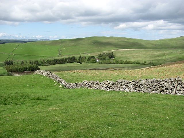
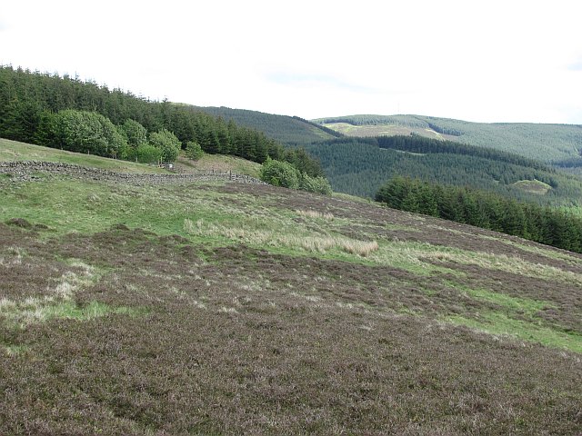
Collie Law is a prominent hill located in Peeblesshire, a historic county in the Scottish Borders region of Scotland. This hill is part of the broader Moorfoot Hills range, which forms a picturesque backdrop to the landscape of Peeblesshire.

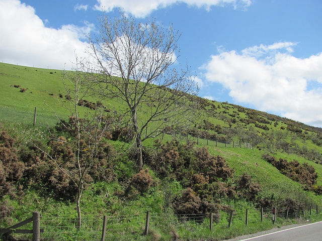
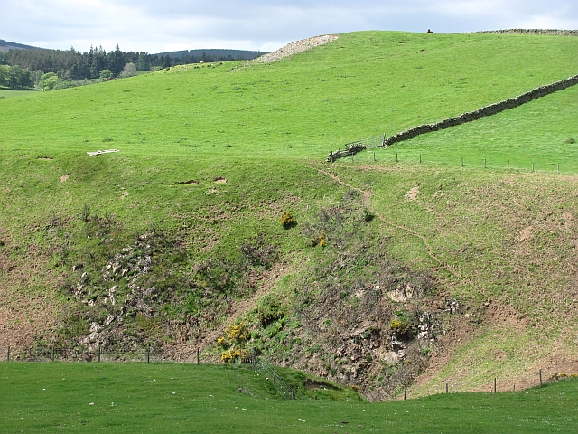
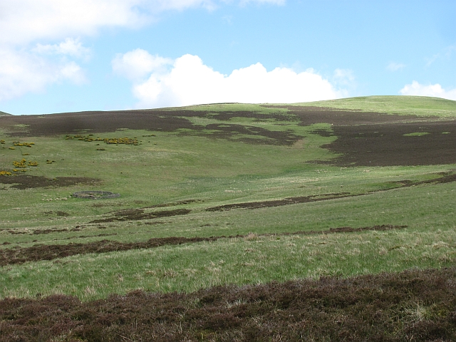
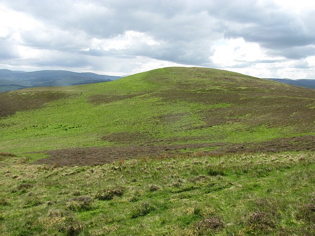
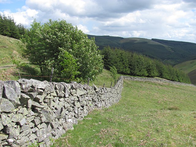
Rising to an elevation of approximately 1,759 feet (536 meters), Collie Law offers breathtaking panoramic views of the surrounding area. Its distinctive conical shape and lush green slopes make it a notable landmark in the region. The hill is composed primarily of sedimentary rock, with patches of heather and grass covering its surface.

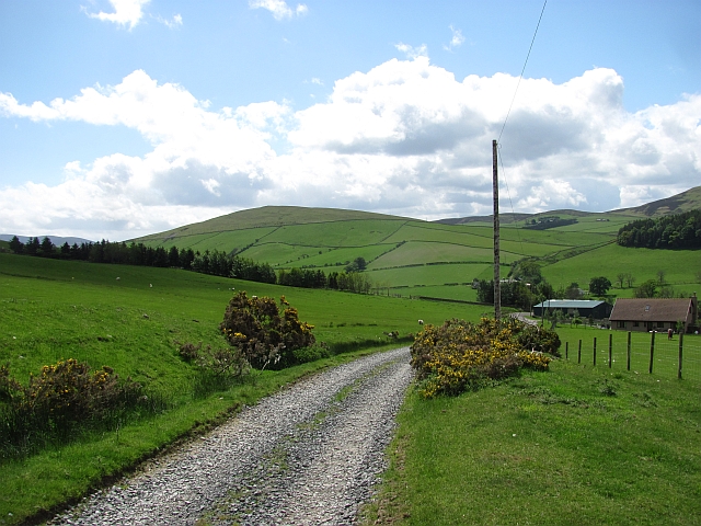
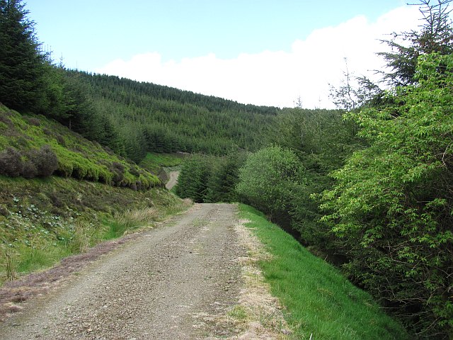
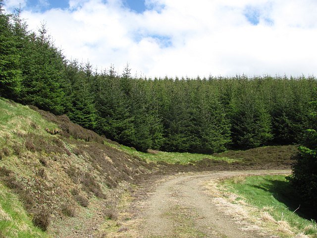
Collie Law is a popular destination for hikers, nature enthusiasts, and outdoor adventurers. Several well-marked footpaths and trails allow visitors to explore the hill and its surroundings. The ascent to the summit provides a moderate challenge, rewarding climbers with stunning vistas over the rolling hills, valleys, and moorlands of Peeblesshire.

Wildlife is abundant in the area, with various bird species, including peregrine falcons and golden eagles, frequently spotted soaring above Collie Law. The hill also supports a diverse range of plant life, including wildflowers, mosses, and lichens.

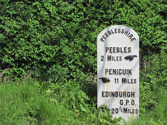
Given its accessibility and natural beauty, Collie Law attracts visitors throughout the year. Its proximity to nearby towns and villages, such as Peebles and Innerleithen, makes it an easily accessible destination for both locals and tourists. Whether for a leisurely walk, a challenging hike, or simply to enjoy the tranquility of the Scottish countryside, Collie Law offers a captivating experience for all who venture to its summit.

If you have any feedback on the listing, please let us know in the comments section below.

Collie Law Images

Images are sourced within 2km of 55.685865/-3.1801306 or Grid Reference NT2544. Thanks to Geograph Open Source API. All images are credited.

Milestone, A703 The Peeblesshire mileposts on the Edinburgh road have been cleaned up and painted.  Distance (20 miles and 7 furlongs) to the GPO which was situated at the eastern end of Princes Street and was the meeting point of the A7 and A8 and the start of the Great North Road (A1) to London.
Milestone, A703
The Peeblesshire mileposts on the Edinburgh road have been cleaned up and painted. Distance (20 miles and 7 furlongs) to the GPO which was situated at the eastern end of Princes Street and was the meeting point of the A7 and A8 and the start of the Great North Road (A1) to London.
Unhealthy whins The gorse above the A703 is not looking healthy. Probably an effect of the deep frosts experienced here at the end of 2010
Unhealthy whins
The gorse above the A703 is not looking healthy. Probably an effect of the deep frosts experienced here at the end of 2010
Windylaws Burn Steep ground above the Windylaws Burn.
Windylaws Burn
Steep ground above the Windylaws Burn.
Road, Winkston Hill Road up to Heathpool Common
Road, Winkston Hill
Road up to Heathpool Common
Heathpool Common An unexpected area of heather moorland amongst the fields and forestry. View towards Collie Law.
Heathpool Common
An unexpected area of heather moorland amongst the fields and forestry. View towards Collie Law.
Heathpool Common The dyke separates a heather moor from improved grazing. There is a gate at NT251439 which leads on to the moor.  If travelling with a horse, beware! There is a further gate at NT262443 which is locked. Not too helpful if trying to get into the forest.
Heathpool Common
The dyke separates a heather moor from improved grazing. There is a gate at NT251439 which leads on to the moor. If travelling with a horse, beware! There is a further gate at NT262443 which is locked. Not too helpful if trying to get into the forest.
Gate, Winkston Hill A gate allows movement from farmland to an area of moorland. A path heads towards White Law and the forest beyond, but the next gate, similar to this one is locked. No probs on foot or a bike, but a horse stopper.
Gate, Winkston Hill
A gate allows movement from farmland to an area of moorland. A path heads towards White Law and the forest beyond, but the next gate, similar to this one is locked. No probs on foot or a bike, but a horse stopper.
Path, Winkston Hill An area of rough grazing and moorland to the northwest of Collie Law (background).
Path, Winkston Hill
An area of rough grazing and moorland to the northwest of Collie Law (background).
Heathpool Common An area of moorland and rough grassland on Collie Law.
Heathpool Common
An area of moorland and rough grassland on Collie Law.
Collie Law A circular sheep fank beneath Collie Law.
Collie Law
A circular sheep fank beneath Collie Law.
Winkston Hill Spring grass on an upland pasture. Behind the camera is a contrasting area of heather.
Winkston Hill
Spring grass on an upland pasture. Behind the camera is a contrasting area of heather.
Ewes and lambs, Winkston Hill Sheep pasture above Peebles.
Ewes and lambs, Winkston Hill
Sheep pasture above Peebles.
Winkston Hill A view along the ridge.
Winkston Hill
A view along the ridge.
Forest and moor, White Hill Young plantation, an extension to the vast woodlands in the south west Moorfoot Hills.
Forest and moor, White Hill
Young plantation, an extension to the vast woodlands in the south west Moorfoot Hills.
Collie Law Moorland summit in the Moorfoot Hills.
Collie Law
Moorland summit in the Moorfoot Hills.
Dyke, White Law Edge of the forest above Soonhope.
Dyke, White Law
Edge of the forest above Soonhope.
Logging road, Crookshope View along one of the forest roads which contour the steep sides of some of the Moorfoot Hill glens.
Logging road, Crookshope
View along one of the forest roads which contour the steep sides of some of the Moorfoot Hill glens.
Forest, Crookshope Sitka spruce plantations at the head of Crookshope beneath Whiteside Edge.
Forest, Crookshope
Sitka spruce plantations at the head of Crookshope beneath Whiteside Edge.
Show me another place!

Collie Law is located at Grid Ref: NT2544 (Lat: 55.685865, Lng: -3.1801306)

Unitary Authority: The Scottish Borders

Police Authority: The Lothians and Scottish Borders

What 3 Words

///deflated.ranged.examples. Near Peebles, Scottish Borders

Nearby Locations

Collie Law

Related Wikis

Redscarhead

Redscarhead is a village in the Scottish Borders area of Scotland, off the A703, by the Eddleston Water, and close to Cringletie. In the village is a memorial...

Milkieston Rings

Milkieston Rings is a prehistoric site, a hillfort near the village of Eddleston and about 3 miles (5 km) north of Peebles, in the Scottish Borders, Scotland...

Cringletie

Cringletie is a Scottish Baronial house by the Eddleston Water, around 3 kilometres (1.9 mi) south of Eddleston in the Scottish Borders area of Scotland...

Glentress Forest

Glentress Forest is located near Peebles in the Scottish Borders, about 30 miles south of Edinburgh. Part of the Tweed Valley Forest Park along with Traquair...

Venlaw

Venlaw Castle, also known as Smithfield Castle, lies north of Peebles on the Edinburgh Road in the Borders of Scotland. Since 1949, it has been operated...

Eddleston

Eddleston (Scottish Gaelic: Baile Ghille Mhoire) is a small village and civil parish in the Scottish Borders area of Scotland. It lies 4 miles (6.4 km...

Eddleston railway station

Eddleston railway station served the village of Eddleston, Scottish Borders, Scotland from 1855 to 1962 on the Peebles Railway. == History == The station...

County Buildings, Peebles

County Hall is a municipal structure in Rosetta Road in Peebles, Scotland. The building, which was the meeting place of Peeblesshire County Council, is...

Nearby Amenities

Located within 500m of 55.685865,-3.1801306
Collie Law
Ele: 424
Natural: peak
Lat/Long: 55.6855712/-3.1804529
The data included in this document is from www.openstreetmap.org. The data is made available under ODbL.

Have you been to Collie Law?

Leave your review of Collie Law below (or comments, questions and feedback).