Glenkerry Hill

Hill, Mountain in Selkirkshire

Scotland

Glenkerry Hill

Over Dalgliesh Hope Scene of much recent tree harvesting.
Over Dalgliesh Hope Credit: Richard Webb

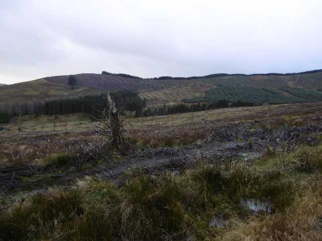
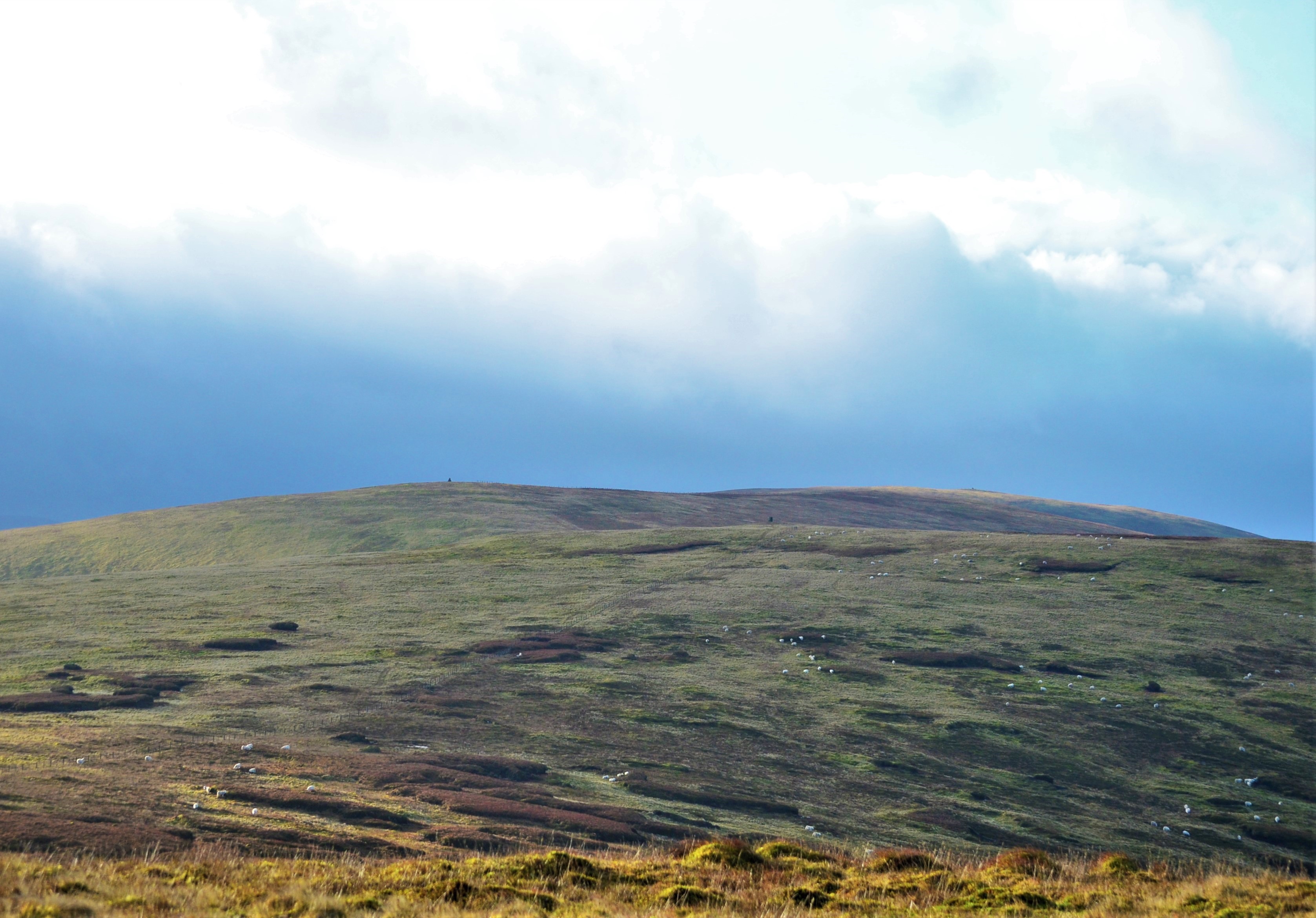
Glenkerry Hill is a prominent geological feature located in Selkirkshire, Scotland. Rising to an elevation of approximately 500 meters (1,640 feet), it is categorized as a hill rather than a mountain. Situated in the picturesque countryside, Glenkerry Hill offers breathtaking panoramic views of the surrounding landscape.

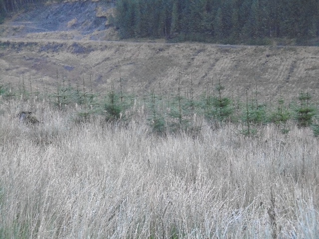
The hill is characterized by its gently sloping sides, covered in a patchwork of heather, grasses, and occasional clusters of trees. Its shape is conical, with a rounded summit that provides a perfect vantage point for visitors to admire the beauty of the Scottish Borders.

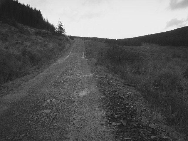
Glenkerry Hill is a popular destination for outdoor enthusiasts, offering various walking and hiking trails that cater to different skill levels. The paths meander through diverse habitats, including moorlands and woodlands, providing opportunities to observe a wide array of flora and fauna.

The hill is also known for its rich historical significance. Ruins of an ancient fort, believed to date back to the Iron Age, can be found near the summit. These remnants serve as a reminder of the area's past and offer a glimpse into the lives of the people who once inhabited the region.

Access to Glenkerry Hill is relatively easy, with well-maintained paths leading from nearby villages. Visitors can enjoy a peaceful and tranquil experience, immersing themselves in the natural beauty that Selkirkshire has to offer. Whether it's a leisurely stroll or a challenging hike, Glenkerry Hill provides an ideal setting for outdoor exploration and appreciation of Scotland's stunning landscapes.

If you have any feedback on the listing, please let us know in the comments section below.

Glenkerry Hill Images

Images are sourced within 2km of 55.384391/-3.1802737 or Grid Reference NT2510. Thanks to Geograph Open Source API. All images are credited.

Over Dalgliesh Hope Scene of much recent tree harvesting.
Over Dalgliesh Hope
Scene of much recent tree harvesting.
Nether Dalgliesh Hope Young trees, yet to block the view from the road.
Nether Dalgliesh Hope
Young trees, yet to block the view from the road.
Road, Nether Dalgliesh Hope The road on the north side of Carlin Hill.
Road, Nether Dalgliesh Hope
The road on the north side of Carlin Hill.
Road junction, Glenkerry Logging roads and a roadstone quarry in the rain.
Road junction, Glenkerry
Logging roads and a roadstone quarry in the rain.
Logging road, Glenkerry Rain and Sitka - lovely.
Logging road, Glenkerry
Rain and Sitka - lovely.
Nether Dalgliesh Hope Ruined shepherds cottage where there is no longer any need for shepherds, just interminable sitka spruce.
Nether Dalgliesh Hope
Ruined shepherds cottage where there is no longer any need for shepherds, just interminable sitka spruce.
Drowning Sike A gap in the trees near Drowning Sike, a small burn. Some token deciduous planting can be seen, a handful of tully tubes.
Drowning Sike
A gap in the trees near Drowning Sike, a small burn. Some token deciduous planting can be seen, a handful of tully tubes.
Storm damage, Over Dalgliesh Burn Area of windthrow. The trees here are ready to be felled.
Storm damage, Over Dalgliesh Burn
Area of windthrow. The trees here are ready to be felled.
Felled area, Over Dalgliesh Now replanted.
Felled area, Over Dalgliesh
Now replanted.
Over Dalgliesh Hope Ruins of a house from the days when this was sheep farming country.
Over Dalgliesh Hope
Ruins of a house from the days when this was sheep farming country.
Forestry Road Very grateful for this track which gave easy progress down to lower ground.
Forestry Road
Very grateful for this track which gave easy progress down to lower ground.
Forestry track, Over Dalgliesh This track is more open and welcoming than the one to the East of the Nether Dalgliesh Burn.
Forestry track, Over Dalgliesh
This track is more open and welcoming than the one to the East of the Nether Dalgliesh Burn.
Ark Law The ridgeline is unplanted, a big improvement from the total forestry on the east side of the Tima Water. The going is tough though, with only limited grazing by deer.
Ark Law
The ridgeline is unplanted, a big improvement from the total forestry on the east side of the Tima Water. The going is tough though, with only limited grazing by deer.
North side of Ark Law The connecting ridge between Ark Law/Windlestraw Law and Glenkerry Hill was not planted, thus keeping the ridge open. There is still a feeling of being shut in the forest though.
North side of Ark Law
The connecting ridge between Ark Law/Windlestraw Law and Glenkerry Hill was not planted, thus keeping the ridge open. There is still a feeling of being shut in the forest though.
Glen Kerry from Ark Law View of the forest from Ark Law. Glen Kerry below and a distant view of Law Kneis.  The summit area of Ark Law is clear of trees, but the long soft grass makes walking tiring.
Glen Kerry from Ark Law
View of the forest from Ark Law. Glen Kerry below and a distant view of Law Kneis. The summit area of Ark Law is clear of trees, but the long soft grass makes walking tiring.
North side of Ark Law The Glen Kerry flank, covered in sitka spruce, with a long clear strip running up to Glenkerry Hill.
North side of Ark Law
The Glen Kerry flank, covered in sitka spruce, with a long clear strip running up to Glenkerry Hill.
Glenkerry Hill View down the easy ridge towards Windlestraw Law. The long unplanted strip allows laborious walking up to Cauld Face with views. A drystone dyke runs the length of the ridge, so there has to be hard rock in the area - signs of quarrying for the dyking stone can be seen in the foreground.
Glenkerry Hill
View down the easy ridge towards Windlestraw Law. The long unplanted strip allows laborious walking up to Cauld Face with views. A drystone dyke runs the length of the ridge, so there has to be hard rock in the area - signs of quarrying for the dyking stone can be seen in the foreground.
Glenkerry Hill Glenkerry Hill is a spur running from Cauld Face (skyline with triangulation pillar).
Glenkerry Hill
Glenkerry Hill is a spur running from Cauld Face (skyline with triangulation pillar).
Show me another place!

Glenkerry Hill is located at Grid Ref: NT2510 (Lat: 55.384391, Lng: -3.1802737)

Unitary Authority: The Scottish Borders

Police Authority: The Lothians and Scottish Borders

What 3 Words

///project.certainly.rams. Near Ettrick, Scottish Borders

Related Wikis

Ettrick, Scotland

Ettrick (Scottish Gaelic: Eadaraig, IPA: [ˈet̪əɾɪkʲ]) is a small village and civil parish in the Scottish Borders area of Scotland. It is located on the...

Ettrick Pen

Ettrick Pen is a hill in the Ettrick Hills range, part of the Southern Uplands of Scotland. A remote peak, It lies southwest of the village of Ettrick...

Andrewhinney Hill

Andrewhinney Hill is a hill in the Ettrick Hills range, part of the Southern Uplands of Scotland. It is the highest summit of a ridge that runs parallel...

Southern Uplands

The Southern Uplands (Scottish Gaelic: Na Monaidhean a Deas) are the southernmost and least populous of mainland Scotland's three major geographic areas...

Have you been to Glenkerry Hill?

Leave your review of Glenkerry Hill below (or comments, questions and feedback).