Buck Pike

Hill, Mountain in Westmorland South Lakeland

England

Buck Pike

Rossett Pike Mid November day just passed the summit of the pike.
Rossett Pike Credit: DrewBull

Buck Pike is a prominent hill/mountain located in the district of Westmorland, in the county of Cumbria, England. It stands at an elevation of approximately 744 meters (2,441 feet) above sea level, making it one of the highest peaks in the area.

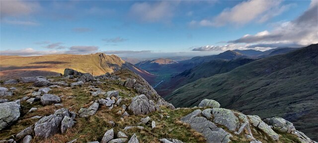
Situated within the beautiful Lake District National Park, Buck Pike offers breathtaking panoramic views of the surrounding countryside. On a clear day, visitors can enjoy stunning vistas of the rolling hills, lush valleys, and shimmering lakes that define the region's landscape.

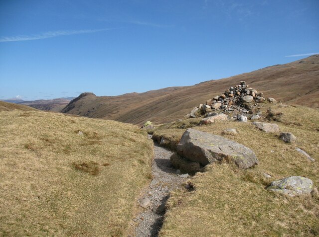
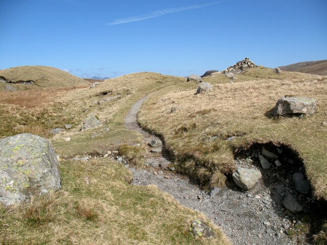
The hill/mountain is a popular destination for outdoor enthusiasts and nature lovers, attracting hikers, walkers, and climbers from all over. Its well-maintained trails provide various levels of difficulty, catering to both novice and experienced adventurers. The ascent to the summit can be challenging, but the rewarding vistas at the top make every step worthwhile.

The area surrounding Buck Pike is adorned with diverse flora and fauna, showcasing the natural beauty of the region. It is not uncommon to spot wildlife such as red deer, birds of prey, and even rare species like the red squirrel.

Additionally, Buck Pike holds historical significance, as it is believed to have been an important landmark for local communities in the past. The hill/mountain often features in local folklore and legends, adding to its mystical charm.

Overall, Buck Pike in Westmorland is a captivating natural landmark that offers both physical and visual delights for those who venture to its summit.

If you have any feedback on the listing, please let us know in the comments section below.
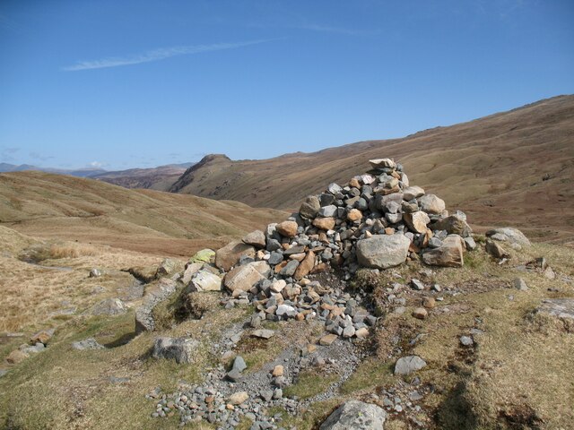
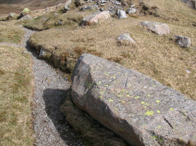
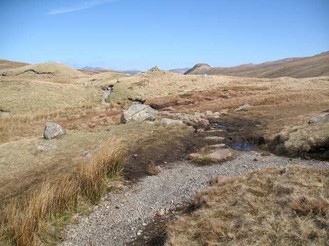
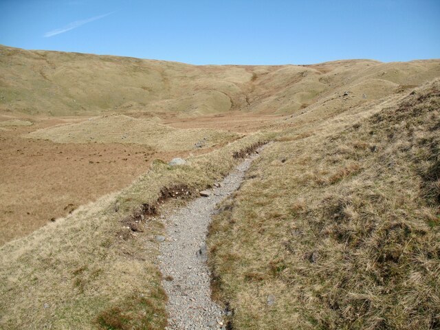
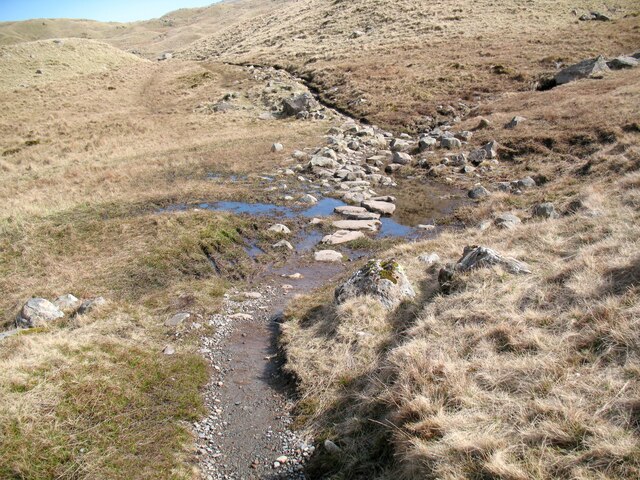
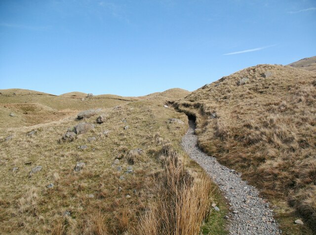
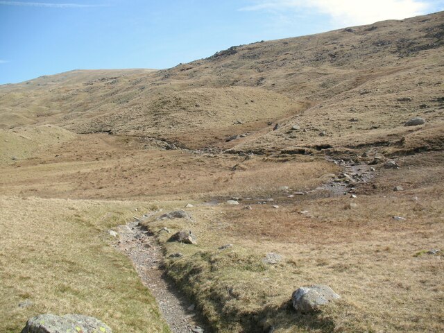
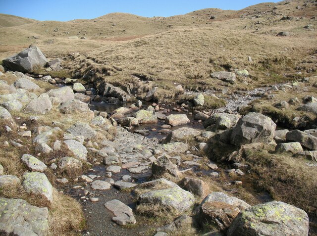
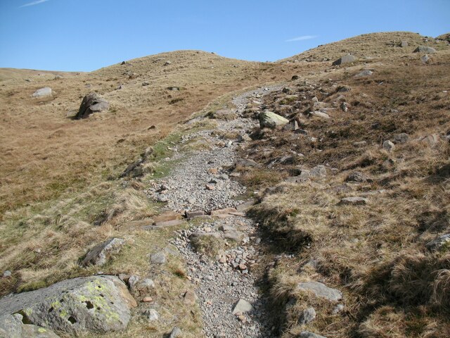
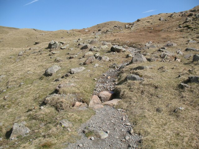
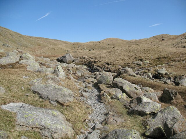
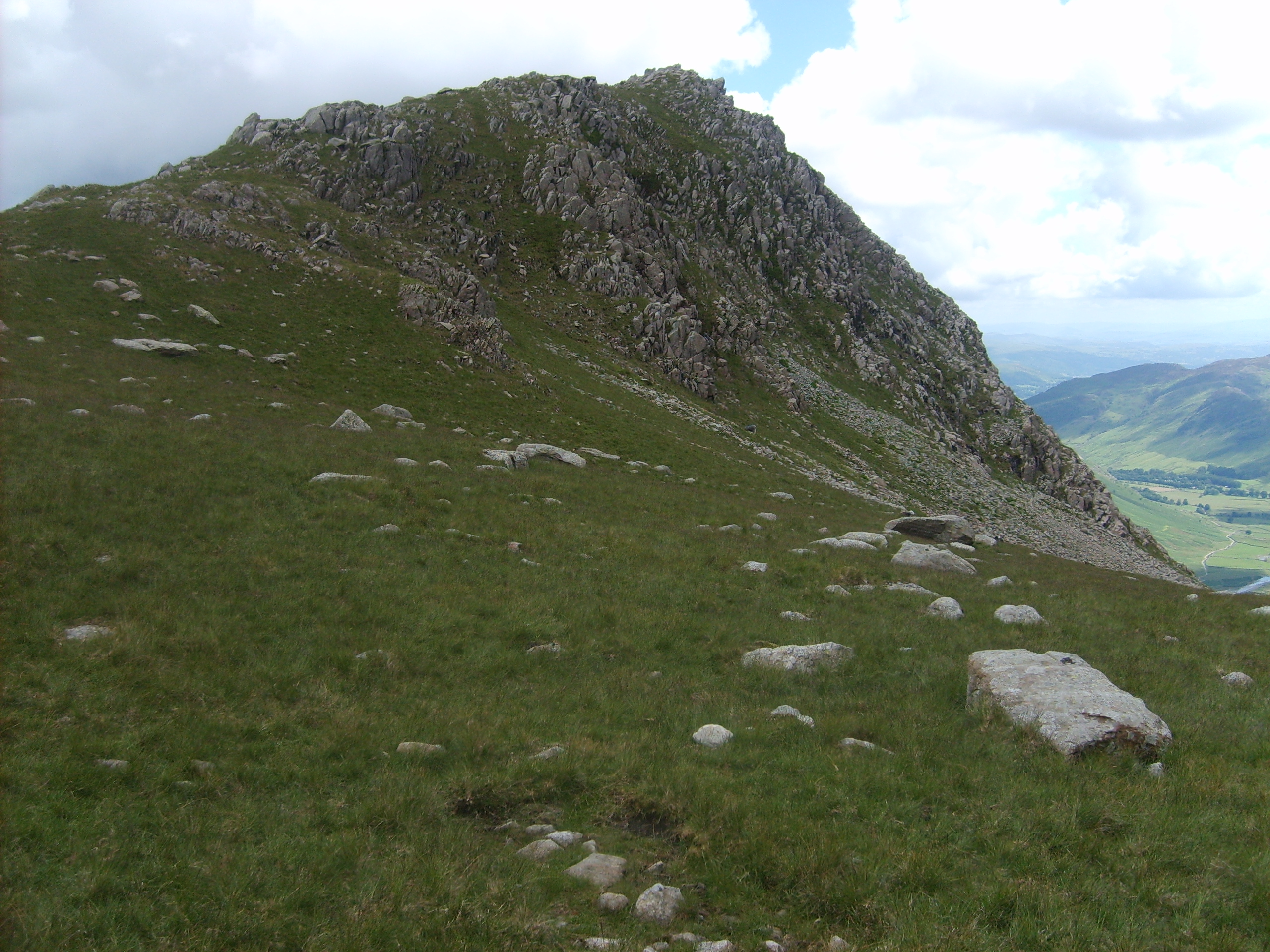
Buck Pike Images

Images are sourced within 2km of 54.459646/-3.1542752 or Grid Reference NY2507. Thanks to Geograph Open Source API. All images are credited.

Rossett Pike Mid November day just passed the summit of the pike.
Rossett Pike
Mid November day just passed the summit of the pike.
Benchmark, Stake Pass Summit Detail of the old, large Ordnance Survey pivot benchmark on a rock at the summit of Stake Pass. The benchmark, not recorded on the Ordnance Survey database, would appear to be that surveyed in 1860 and recorded on the 1864 edition Ordnance Survey map marking a height of 1575.8ft above sea level measured from the Ordnance Datum Liverpool (location photograph <a href="https://www.geograph.org.uk/photo/7101083">NY2608 : Benchmark, Stake Pass Summit</a>).
Benchmark, Stake Pass Summit
Detail of the old, large Ordnance Survey pivot benchmark on a rock at the summit of Stake Pass. The benchmark, not recorded on the Ordnance Survey database, would appear to be that surveyed in 1860 and recorded on the 1864 edition Ordnance Survey map marking a height of 1575.8ft above sea level measured from the Ordnance Datum Liverpool (location photograph NY2608 : Benchmark, Stake Pass Summit).
The Summit of Stake Pass The Cumbria Way long distance path from Ulverston to Carlisle breasts the summit of Stake Pass, marked by a cairn (photograph  <a href="https://www.geograph.org.uk/photo/7100351">NY2608 : Cairn, Stake Pass Summit</a>), before commencing the descent into Langstrath (next photograph <a href="https://www.geograph.org.uk/photo/7101248">NY2608 : The Cumbria Way, Stake Pass summit</a>).
The prominent summit in the middle distance is Eagle Crag and there is an old Ordnance Survey pivot benchmark on the large rock beside the path, marking a height of 1575.8ft (480.3m) above sea level (photograph <a href="https://www.geograph.org.uk/photo/7101083">NY2608 : Benchmark, Stake Pass Summit</a>).
The Summit of Stake Pass
The Cumbria Way long distance path from Ulverston to Carlisle breasts the summit of Stake Pass, marked by a cairn (photograph NY2608 : Cairn, Stake Pass Summit), before commencing the descent into Langstrath (next photograph NY2608 : The Cumbria Way, Stake Pass summit). The prominent summit in the middle distance is Eagle Crag and there is an old Ordnance Survey pivot benchmark on the large rock beside the path, marking a height of 1575.8ft (480.3m) above sea level (photograph NY2608 : Benchmark, Stake Pass Summit).
The Cumbria Way, Stake Pass The Cumbria Way long distance path from Ulverston to Carlisle approaches the summit of Stake Pass, marked by a prominent cairn.
The path to the left leads to Rossett Pike and Angle Tarn; northbound walkers on The Cumbria Way continue straight ahead towards the cairn (next photograph <a href="https://www.geograph.org.uk/photo/7099146">NY2608 : The Summit of Stake Pass</a>).
The Cumbria Way, Stake Pass
The Cumbria Way long distance path from Ulverston to Carlisle approaches the summit of Stake Pass, marked by a prominent cairn. The path to the left leads to Rossett Pike and Angle Tarn; northbound walkers on The Cumbria Way continue straight ahead towards the cairn (next photograph NY2608 : The Summit of Stake Pass).
Cairn, Stake Pass Summit This cairn sits at the highest point of Stake Pass, on the watershed between the Derwent and Leven catchments.  Marked on old Ordnance Survey maps simply as ‘Pile of Stones’, the grassed over base of the cairn indicates that it is probably of considerable antiquity possibly constructed as an aid to navigation. More recently it was used as a boundary marker between the former counties of Westmorland and Cumberland which were abolished in 1974 when the new county of Cumbria was created.
The Cumbria Way long distance path between Ulverston and Carlisle passes beside the cairn.
Cairn, Stake Pass Summit
This cairn sits at the highest point of Stake Pass, on the watershed between the Derwent and Leven catchments. Marked on old Ordnance Survey maps simply as ‘Pile of Stones’, the grassed over base of the cairn indicates that it is probably of considerable antiquity possibly constructed as an aid to navigation. More recently it was used as a boundary marker between the former counties of Westmorland and Cumberland which were abolished in 1974 when the new county of Cumbria was created. The Cumbria Way long distance path between Ulverston and Carlisle passes beside the cairn.
Benchmark, Stake Pass Summit On a rock beside the path at the summit of Stake Pass there is a large, old, Ordnance Survey Benchmark. The benchmark, not recorded on the Ordnance Survey database, would appear to be that surveyed in 1860 and recorded on the 1864 edition Ordnance Survey map marking a height of 1575.8ft above sea level measured from the Ordnance Datum Liverpool (detail photograph <a href="https://www.geograph.org.uk/photo/7099121">NY2608 : Benchmark, Stake Pass Summit</a>).
Benchmark, Stake Pass Summit
On a rock beside the path at the summit of Stake Pass there is a large, old, Ordnance Survey Benchmark. The benchmark, not recorded on the Ordnance Survey database, would appear to be that surveyed in 1860 and recorded on the 1864 edition Ordnance Survey map marking a height of 1575.8ft above sea level measured from the Ordnance Datum Liverpool (detail photograph NY2608 : Benchmark, Stake Pass Summit).
The Cumbria Way, Stake Pass summit The Cumbria Way starts to descend into the upper valley of Stake Beck following the public bridleway from the summit of Stake Pass (next photograph <a href="https://www.geograph.org.uk/photo/7101275">NY2608 : Path near Stake Pass summit</a>).
It is at this point that northbound walkers on The Cumbria Way enter the old county of Cumberland, abolished during local government reorganisation in 1974.
The far distant peak is Skiddaw.
The Cumbria Way, Stake Pass summit
The Cumbria Way starts to descend into the upper valley of Stake Beck following the public bridleway from the summit of Stake Pass (next photograph NY2608 : Path near Stake Pass summit). It is at this point that northbound walkers on The Cumbria Way enter the old county of Cumberland, abolished during local government reorganisation in 1974. The far distant peak is Skiddaw.
Path near Stake Pass summit The path is a public bridleway from Great Langdale to Borrowdale and it is the route of The Cumbria Way, descending into the upper valley of Stake Beck north of the summit of Stake Pass (next photograph <a href="https://www.geograph.org.uk/photo/7101290">NY2608 : Path near Stake Pass summit</a>).
Path near Stake Pass summit
The path is a public bridleway from Great Langdale to Borrowdale and it is the route of The Cumbria Way, descending into the upper valley of Stake Beck north of the summit of Stake Pass (next photograph NY2608 : Path near Stake Pass summit).
Path near Stake Pass summit The path is a public bridleway from Great Langdale to Borrowdale and it is the route of The Cumbria Way long distance trail.
The mountain in the left background is Glaramara.
Path near Stake Pass summit
The path is a public bridleway from Great Langdale to Borrowdale and it is the route of The Cumbria Way long distance trail. The mountain in the left background is Glaramara.
The Cumbria Way above Langdale Combe The Cumbria Way long distance path from Ulverston to Carlisle approaches the summit of Stake Pass.
The path to the right leads to Pike o’Stickle and the Langdale Pikes; northbound walkers on The Cumbria Way continue straight ahead across the stepping stones laid in the boggy ground (next photograph <a href="https://www.geograph.org.uk/photo/7099309">NY2608 : The Cumbria Way, Stake Pass</a>).
The Cumbria Way above Langdale Combe
The Cumbria Way long distance path from Ulverston to Carlisle approaches the summit of Stake Pass. The path to the right leads to Pike o’Stickle and the Langdale Pikes; northbound walkers on The Cumbria Way continue straight ahead across the stepping stones laid in the boggy ground (next photograph NY2608 : The Cumbria Way, Stake Pass).
Langdale Combe Langdale Combe is a boggy, glaciated, hanging valley at the head of Great Langdale.
The Cumbria Way passes through the valley, following the public bridleway over Stake Pass from Great Langdale to Borrowdale (next photograph <a href="https://www.geograph.org.uk/photo/7368521">NY2608 : The Cumbria Way, Langdale Combe</a>).
Langdale Combe
Langdale Combe is a boggy, glaciated, hanging valley at the head of Great Langdale. The Cumbria Way passes through the valley, following the public bridleway over Stake Pass from Great Langdale to Borrowdale (next photograph NY2608 : The Cumbria Way, Langdale Combe).
Stepping Stones, Langdale Combe The Stake Pass path crosses several areas of boggy ground by means of Stepping Stones as it passes through the boggy upland hanging valley of Langdale Combe.
This is the route of The Cumbria Way (next photograph <a href="https://www.geograph.org.uk/photo/7368597">NY2608 : The Cumbria Way, Langdale Combe</a>).
Stepping Stones, Langdale Combe
The Stake Pass path crosses several areas of boggy ground by means of Stepping Stones as it passes through the boggy upland hanging valley of Langdale Combe. This is the route of The Cumbria Way (next photograph NY2608 : The Cumbria Way, Langdale Combe).
The Cumbria Way, Langdale Combe The Cumbria Way follows the public bridleway from Great Langdale to Borrowdale, climbing out of Langdale Combe towards the summit of Stake Pass (next photograph <a href="https://www.geograph.org.uk/photo/7101298">NY2608 : The Cumbria Way above Langdale Combe</a>).
The Cumbria Way, Langdale Combe
The Cumbria Way follows the public bridleway from Great Langdale to Borrowdale, climbing out of Langdale Combe towards the summit of Stake Pass (next photograph NY2608 : The Cumbria Way above Langdale Combe).
The Cumbria Way, Langdale Combe The Cumbria Way follows the public bridleway from Great Langdale to Borrowdale, climbing through an area of boggy ground and drumlins (next photograph <a href="https://www.geograph.org.uk/photo/7102960">NY2608 : Stepping Stones, Langdale Combe</a>).
The Cumbria Way, Langdale Combe
The Cumbria Way follows the public bridleway from Great Langdale to Borrowdale, climbing through an area of boggy ground and drumlins (next photograph NY2608 : Stepping Stones, Langdale Combe).
Stake Gill Ford, Langdale Combe The public bridleway from Great Langdale to Borrowdale, which is also the route of the Cumbria Way, crosses Stake Gill Ford on the approach to Langdale Combe (next photograph <a href="https://www.geograph.org.uk/photo/7368422">NY2608 : Stake Pass path, Langdale Combe</a>).
Stake Gill Ford, Langdale Combe
The public bridleway from Great Langdale to Borrowdale, which is also the route of the Cumbria Way, crosses Stake Gill Ford on the approach to Langdale Combe (next photograph NY2608 : Stake Pass path, Langdale Combe).
Stake Pass path, Langdale Combe The public bridleway from Great Langdale to Borrowdale passes through an area of boulders and drumlins in Langdale Combe on the climb to the summit of Stake Pass.  This is the route of The Cumbria Way (next photograph <a href="https://www.geograph.org.uk/photo/7367907">NY2608 : The Cumbria Way, Langdale Combe</a>).
Stake Pass path, Langdale Combe
The public bridleway from Great Langdale to Borrowdale passes through an area of boulders and drumlins in Langdale Combe on the climb to the summit of Stake Pass. This is the route of The Cumbria Way (next photograph NY2608 : The Cumbria Way, Langdale Combe).
Stake Pass path, Langdale Combe The public bridleway from Great Langdale to Borrowdale passes through an area of boulders and drumlins in Langdale Combe.  This is the route of The Cumbria Way (next photograph <a href="https://www.geograph.org.uk/photo/7368419">NY2608 : Stake Pass path, Langdale Combe</a>).
Note the open stone drain across the path, designed to trap water flowing along the path and thus preventing erosion.  There are several others nearby.
Stake Pass path, Langdale Combe
The public bridleway from Great Langdale to Borrowdale passes through an area of boulders and drumlins in Langdale Combe. This is the route of The Cumbria Way (next photograph NY2608 : Stake Pass path, Langdale Combe). Note the open stone drain across the path, designed to trap water flowing along the path and thus preventing erosion. There are several others nearby.
The approach to Stake Gill Ford The public bridleway from Great Langdale to Borrowdale passes through an area of boulders on the approach to Stake Gill Ford.
An indistinct path which leads to the summit of Rossett Pike diverges to the left amongst the boulders before the ford.  Northbound walkers following The Cumbria Way cross the ford and continue to follow the main path east and north eastwards through Langdale Combe (next photograph <a href="https://www.geograph.org.uk/photo/7367958">NY2608 : Stake Gill Ford, Langdale Combe</a>).
The approach to Stake Gill Ford
The public bridleway from Great Langdale to Borrowdale passes through an area of boulders on the approach to Stake Gill Ford. An indistinct path which leads to the summit of Rossett Pike diverges to the left amongst the boulders before the ford. Northbound walkers following The Cumbria Way cross the ford and continue to follow the main path east and north eastwards through Langdale Combe (next photograph NY2608 : Stake Gill Ford, Langdale Combe).
Show me another place!

Buck Pike is located at Grid Ref: NY2507 (Lat: 54.459646, Lng: -3.1542752)

Administrative County: Cumbria

District: South Lakeland

Police Authority: Cumbria

What 3 Words

///strides.mindset.comically. Near Ambleside, Cumbria

Nearby Locations

Littlegill Head Buck Pike

Related Wikis

Rossett Pike

Rossett Pike is a fell in the English Lake District. It is located at the head of Mickleden, one of two tributary valleys of Great Langdale. == Topography... ==

Angle Tarn (Langstrath)

Angle Tarn is a tarn to the north of Bowfell in the English Lake District. It drains into Langstrath Beck.This should not be confused with Angle Tarn...
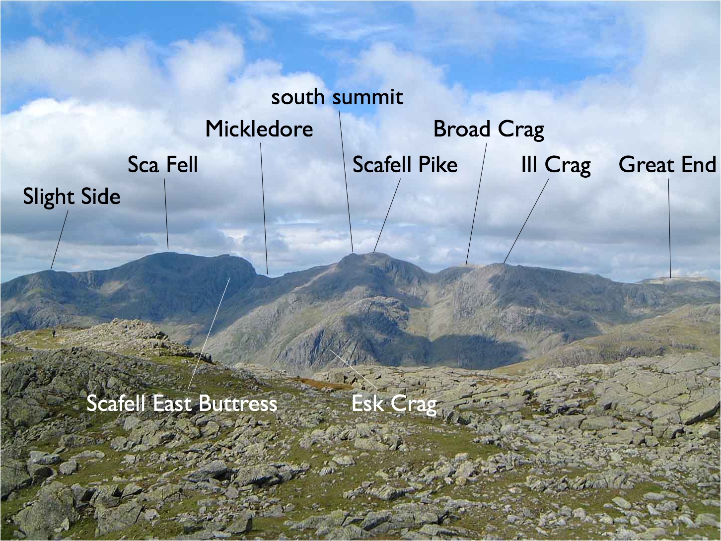
Scafells

The Scafells, or Scafell Massif, are range of fells in the Cumbrian Mountains of England, made up of the remains of a caldera volcano. Fells in the range...

Southern Fells

The Southern Fells are a part of the Cumbrian Mountains in the Lake District of England. Including Scafell Pike, the highest peak in England, they occupy...

Nearby Amenities

Located within 500m of 54.459646,-3.1542752
Buck Pike
Place: locality
Lat/Long: 54.4590265/-3.1550793
Littlegill Head
Place: locality
Lat/Long: 54.4613691/-3.1537117
Rossett Pike
Ele: 651
Natural: peak
Source: npe
Wikidata: Q7369808
Wikipedia: en:Rossett Pike
Lat/Long: 54.457936/-3.15979
The data included in this document is from www.openstreetmap.org. The data is made available under ODbL.

Have you been to Buck Pike?

Leave your review of Buck Pike below (or comments, questions and feedback).