Hundleshope Heights

Hill, Mountain in Peeblesshire

Scotland

Hundleshope Heights

Cloud shadows in upper Glen Sax Seen from the ridge N of Birkscairn Hill. The skyline is the high ground between Glenrath Heights and Hundleshope Heights.
Cloud shadows in upper Glen Sax Credit: Jim Barton

Hundleshope Heights is a prominent hill located in Peeblesshire, a historic county in the Scottish Borders region of Scotland. Rising to an impressive height of approximately 500 meters (1,640 feet), it is considered one of the notable peaks in the area.

Situated near the picturesque town of Peebles, Hundleshope Heights offers breathtaking panoramic views of the surrounding countryside. Its location within the Southern Uplands makes it a popular destination for outdoor enthusiasts, hikers, and hillwalkers. The hill is accessible by several well-marked trails, allowing visitors to explore its rugged terrain and enjoy the stunning vistas from the summit.

The landscape of Hundleshope Heights is characterized by rolling hills, heather-covered moorland, and scattered woodlands. The hill is home to a diverse range of flora and fauna, including wildflowers, birds, and small mammals. The area is also rich in historical and archaeological significance, with ancient cairns and remnants of Bronze Age settlements scattered throughout its slopes.

Hundleshope Heights offers a peaceful and tranquil environment, providing a welcome escape from the hustle and bustle of daily life. Visitors can immerse themselves in the natural beauty of the surrounding countryside, taking in the fresh air and enjoying the serenity of the hill.

Overall, Hundleshope Heights is a remarkable hill in Peeblesshire, offering outdoor enthusiasts and nature lovers an opportunity to experience the majestic beauty of the Scottish Borders region.

If you have any feedback on the listing, please let us know in the comments section below.

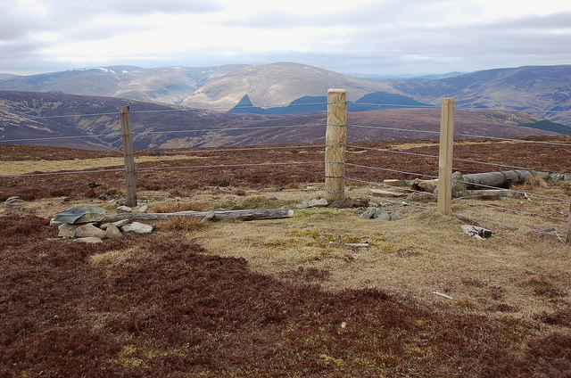
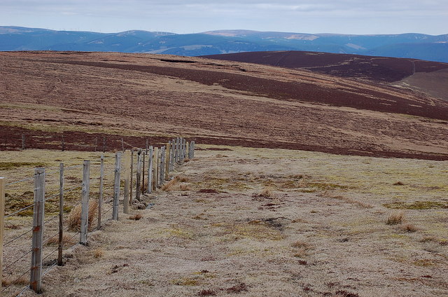
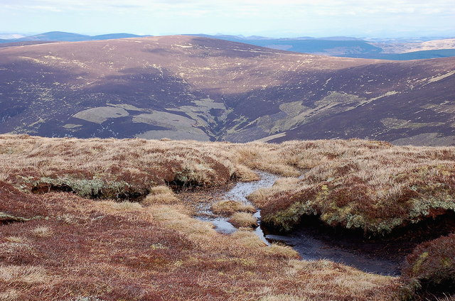
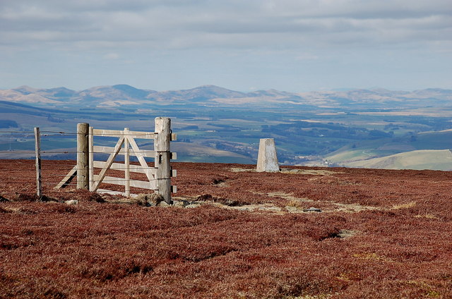
Hundleshope Heights Images

Images are sourced within 2km of 55.592784/-3.1918224 or Grid Reference NT2433. Thanks to Geograph Open Source API. All images are credited.

Cloud shadows in upper Glen Sax Seen from the ridge N of Birkscairn Hill. The skyline is the high ground between Glenrath Heights and Hundleshope Heights.
Cloud shadows in upper Glen Sax
Seen from the ridge N of Birkscairn Hill. The skyline is the high ground between Glenrath Heights and Hundleshope Heights.
Summit fence, Middle Hill Renewed fence at the summit, with Dollar Law and Cramalt Craig (with the snow) in the background.
Summit fence, Middle Hill
Renewed fence at the summit, with Dollar Law and Cramalt Craig (with the snow) in the background.
Hundleshope Heights from Middle Hill The route to Hundleshope Heights - the darker area of heather - keeps straight on here while the fence swings left towards Broom Hill and Stob Law. The Bowbeat wind farm is visible on the skyline.
Hundleshope Heights from Middle Hill
The route to Hundleshope Heights - the darker area of heather - keeps straight on here while the fence swings left towards Broom Hill and Stob Law. The Bowbeat wind farm is visible on the skyline.
Birkscairn Hill from Broom Hill Looking across Glen Sax to the Old Drove Road crossing Birkscairn below the summit.
Birkscairn Hill from Broom Hill
Looking across Glen Sax to the Old Drove Road crossing Birkscairn below the summit.
Dun Rig from Hundleshope Heights Dun Rig is the name on the map given to the ridge in view, but is also applied to the summit of the hill itself.
Dun Rig from Hundleshope Heights
Dun Rig is the name on the map given to the ridge in view, but is also applied to the summit of the hill itself.
Hundleshope Heights trig point The trig point is just inside this square and is a few metres below the true summit, which is marked by a small cairn out of shot on the left. The Pentland Hills make a shapely skyline to the north.
Hundleshope Heights trig point
The trig point is just inside this square and is a few metres below the true summit, which is marked by a small cairn out of shot on the left. The Pentland Hills make a shapely skyline to the north.
Summit cairn, Hundleshope Heights The small cairn that marks the highest point. Arthur's Seat in Edinburgh is just visible on the skyline, left of the trig point.
Summit cairn, Hundleshope Heights
The small cairn that marks the highest point. Arthur's Seat in Edinburgh is just visible on the skyline, left of the trig point.
Cloud shadows in Waddens Hope, Glen Sax Light and shade on the patchwork heather of the hillsides here and on the plantations across the Tweed in Glentress Forest. The rocky peak catching the sun is Newby Kipps.
Cloud shadows in Waddens Hope, Glen Sax
Light and shade on the patchwork heather of the hillsides here and on the plantations across the Tweed in Glentress Forest. The rocky peak catching the sun is Newby Kipps.
Upper Glen Sax The glen narrows down south of Glensax farm. In the background are the lower slopes of Birkscairn and Yellow Mire Hill.
Upper Glen Sax
The glen narrows down south of Glensax farm. In the background are the lower slopes of Birkscairn and Yellow Mire Hill.
Birch plantation, Glen Sax Trees planted by an unnamed cleuch on the E side of Hundleshope Heights.
Birch plantation, Glen Sax
Trees planted by an unnamed cleuch on the E side of Hundleshope Heights.
Rock outcrop by Glensax Burn On rare occasions in these hills the underlying rock can be exposed in steep sections like this, where the burn has eroded into the bank. The track up the glen crosses to the other side to avoid this, and recrosses back higher up.
Rock outcrop by Glensax Burn
On rare occasions in these hills the underlying rock can be exposed in steep sections like this, where the burn has eroded into the bank. The track up the glen crosses to the other side to avoid this, and recrosses back higher up.
Track in upper Glen Sax There is a small patch of snow lingering in Middle Hinty Cleuch.
Track in upper Glen Sax
There is a small patch of snow lingering in Middle Hinty Cleuch.
Cleuch on Scawd Law A cleuch on the SE side of Scawd Law, not named on the 1:25,000 map. The snow patches are at about 550m.
Cleuch on Scawd Law
A cleuch on the SE side of Scawd Law, not named on the 1:25,000 map. The snow patches are at about 550m.
Upper Glen Sax Steep slopes above the Glensax Burn seen from the hillside N of Middle Hinty Cleuch.
Upper Glen Sax
Steep slopes above the Glensax Burn seen from the hillside N of Middle Hinty Cleuch.
Glensax Burn from above The twists and turns of the burn between Dun Rig (R) and Hundleshope Heights in the upper part of the glen.
Glensax Burn from above
The twists and turns of the burn between Dun Rig (R) and Hundleshope Heights in the upper part of the glen.
Inversion haze layer seen from Hundleshope Heights The characteristic level top of an inversion layer trapping haze in a high pressure system; here and there a few small cumulus clouds are forming where there is some convection. Although it was calm in the glen, at 600m there was a brisk and chilly SW wind.
Inversion haze layer seen from Hundleshope Heights
The characteristic level top of an inversion layer trapping haze in a high pressure system; here and there a few small cumulus clouds are forming where there is some convection. Although it was calm in the glen, at 600m there was a brisk and chilly SW wind.
Frosted heather, Hundleshope Heights The wide open spaces of this high ridge, about 670m, with Middle Hill on the near skyline.
Frosted heather, Hundleshope Heights
The wide open spaces of this high ridge, about 670m, with Middle Hill on the near skyline.
Summit cairn, Hundleshope Heights A January afternoon on this windswept top between Glen Sax and the Manor Valley.
Summit cairn, Hundleshope Heights
A January afternoon on this windswept top between Glen Sax and the Manor Valley.
Show me another place!

Hundleshope Heights is located at Grid Ref: NT2433 (Lat: 55.592784, Lng: -3.1918224)

Unitary Authority: The Scottish Borders

Police Authority: The Lothians and Scottish Borders

What 3 Words

///tips.downturn.triangles. Near Peebles, Scottish Borders

Related Wikis

Manor Hills

The Manor Hills, also known as the Tweedsmuir Hills, are a range of hills south of Peebles in the Scottish Borders, one of the ranges which collectively...

Dun Rig

Dun Rig is a hill in the Manor Hills range, part of the Southern Uplands of Scotland. It is the highest hill in the northernmost cluster of the Manor Hills...
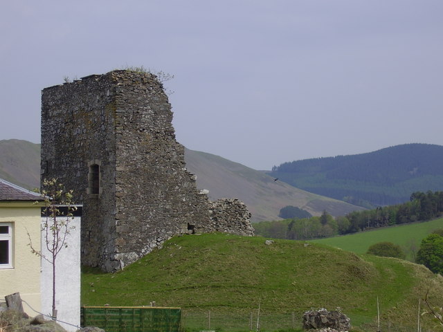
Castlehill Tower

Castlehill Tower, also known as Castle Hill of Manor, is a ruined oblong tower house dating from the end of the 15th century, situated in the parish of...

John Buchan Way

The John Buchan Way is a walking route from Peebles to Broughton in the Scottish Borders, a distance of approximately 22 km (13 miles). The route is waymarked...

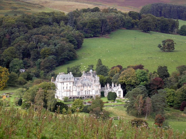
The Glen, Scottish Borders

The Glen, also known as Glen House, is an estate and country house in the parish of Traquair, southern Scotland. It is located in the glen of the Quair...

Posso Tower

Posso Tower is a 16th-century tower house, about 6.0 miles (9.7 km) south and west of Peebles, Scottish Borders, Scotland, and west of Manor Water. �...

Manor, Scottish Borders

Manor is a parish in Peeblesshire in the Scottish Borders, whose church lies on the west bank of Manor Water 3 miles south-west of Peebles.The parish...

Manor Water

Manor Water is a river in the parish of Manor, Peeblesshire in the Scottish Borders. It rises in the Ettrick Forest and flows down through the Maynor valley...

Related Videos

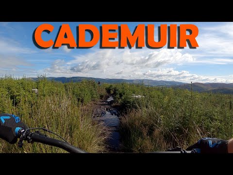
Cademuir, Tweed Valley

Great hidden Gem in the Tweed Valley that often gets overlooked with Glentress being only 10 mins away. Very steep and ...

Cademuir MTB | Two NEW challenging features!

Welcome to Cademuir forest, home of the Cademuir MTB trails. The tracks here are all off-piste in their nature and offer some ...

The Best MTB Mudguard just got better: MK2 Rear Mudhugger

Welcome to another product test video. In this video I will be testing the lates mudguard from the team at Mudhugger, the MK2 rear ...

Cademuir MTB Trails nr Peebles // Pre lockdown Ride

If you haven't been to Cademuir, put it on your bucket list! It's a gem of a place with some STEEP and techy trails that are really ...

Nearby Amenities

Located within 500m of 55.592784,-3.1918224
Hundleshope Heights
Ele: 685
Ele Ft: 2249
Natural: peak
Lat/Long: 55.5929723/-3.1915215
The data included in this document is from www.openstreetmap.org. The data is made available under ODbL.

Have you been to Hundleshope Heights?

Leave your review of Hundleshope Heights below (or comments, questions and feedback).