Skelgill Bank

Hill, Mountain in Cumberland Allerdale

England

Skelgill Bank

Derwent Water seen from Brandlehow Landing Stage Bleaberry Fell and Castlerigg Fell can be seen on the other side of the lake.
Derwent Water seen from Brandlehow Landing Stage Credit: Clive Nicholson

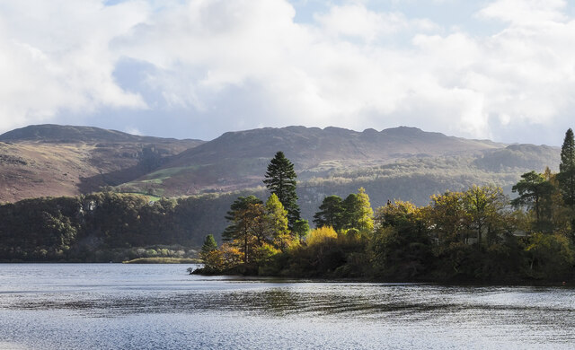
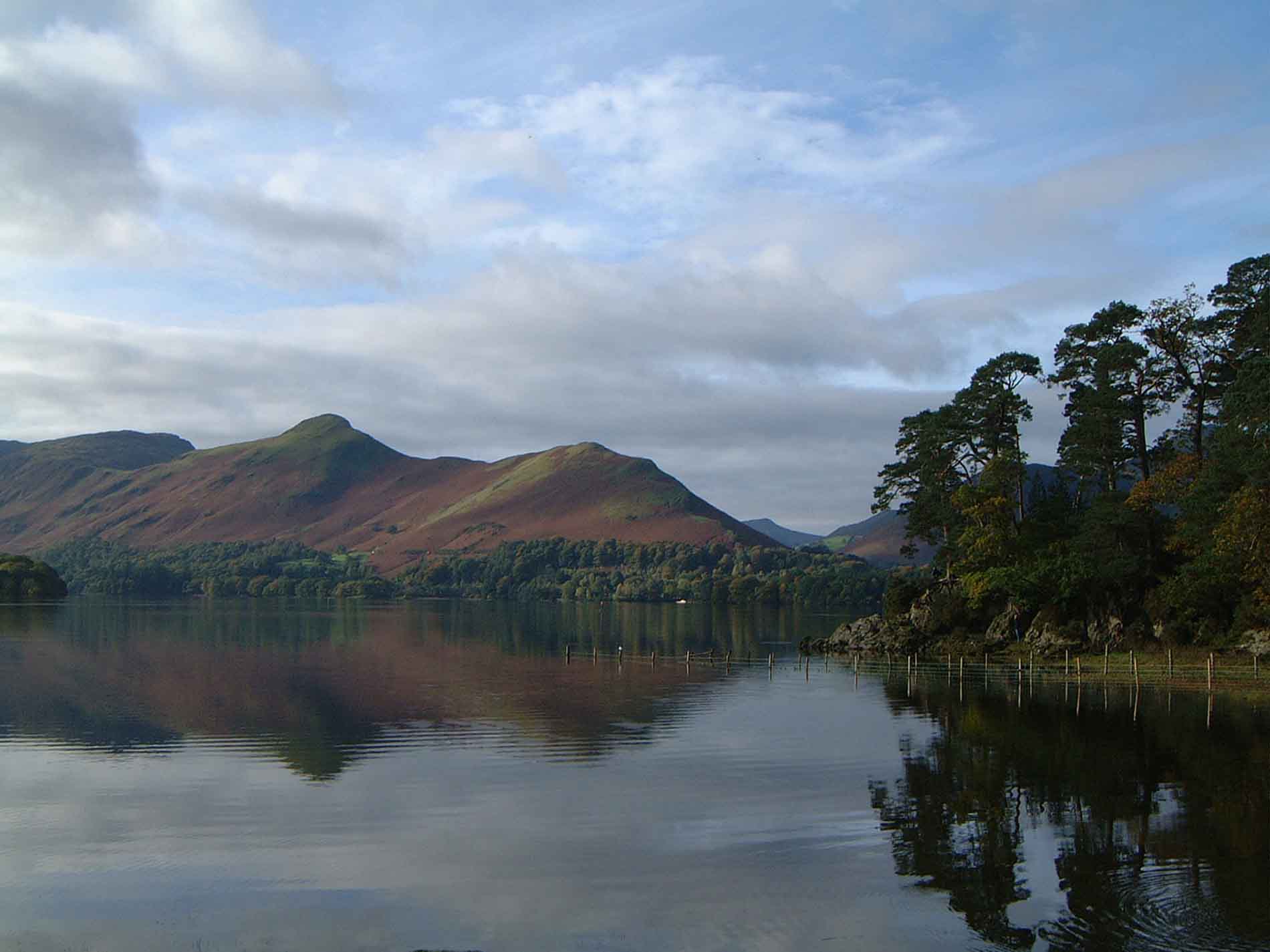
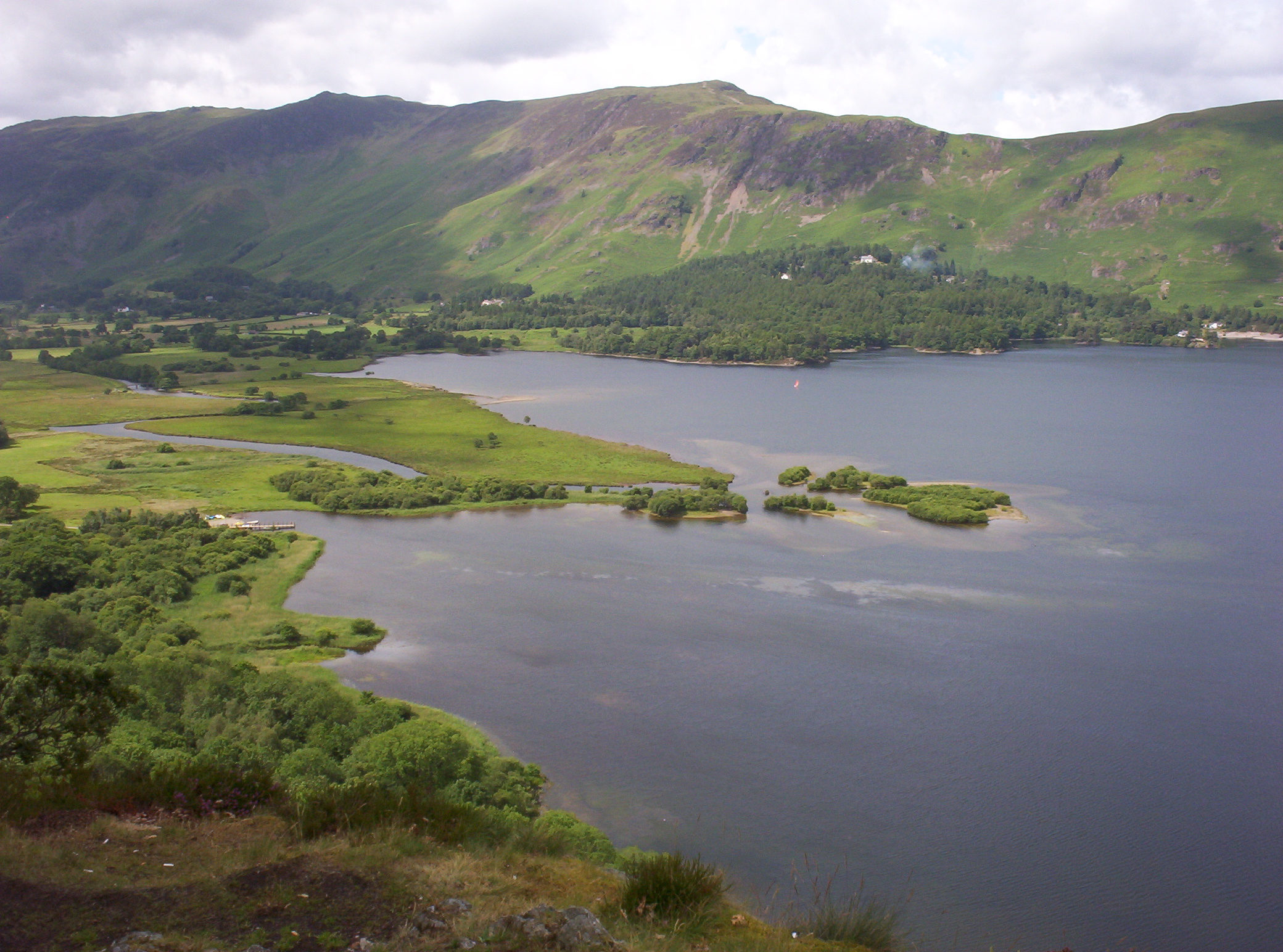
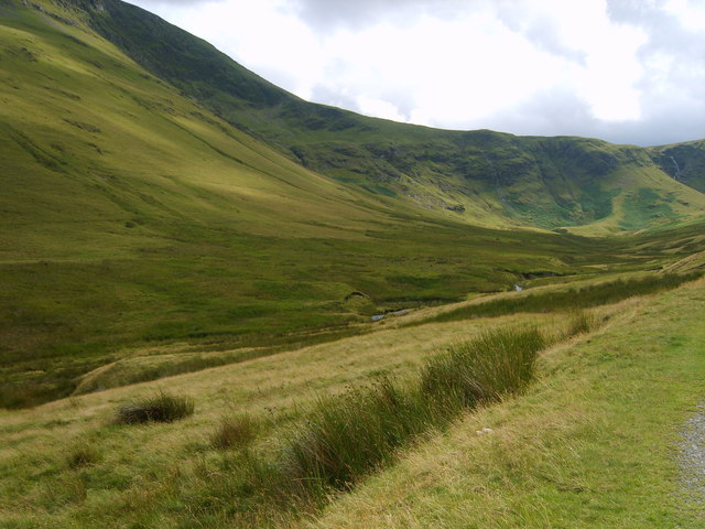
Skelgill Bank is a prominent hill located in the county of Cumberland, England. Situated in the northern part of the Lake District National Park, it forms part of the stunning landscape that attracts hikers, nature enthusiasts, and tourists alike.

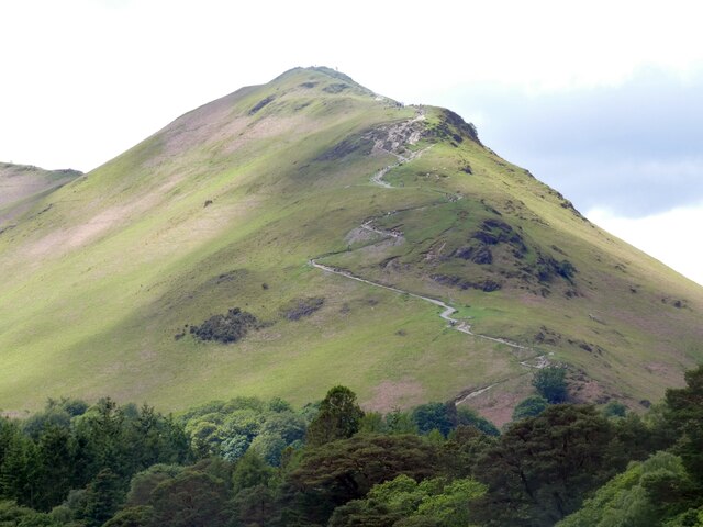
Rising to an elevation of approximately 388 meters (1,273 feet), Skelgill Bank offers breathtaking views of the surrounding countryside. It is nestled among the fells and valleys of the Lake District, providing a picturesque panorama of the region. The hill's summit is marked by a cairn, which serves as a point of interest for visitors.

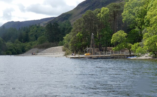
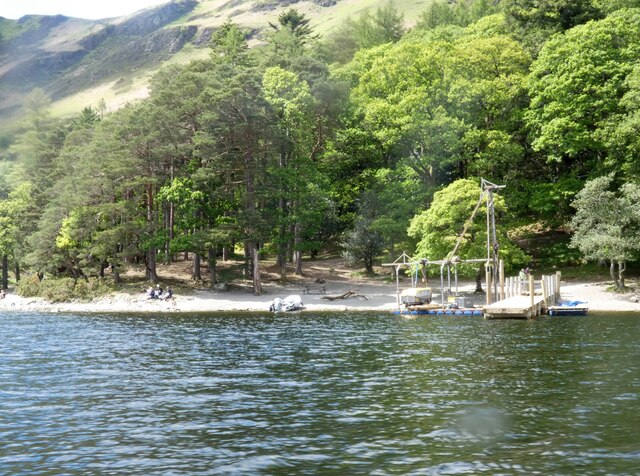
The ascent to Skelgill Bank is accessible via various paths, including those from the nearby village of Portinscale and the popular Catbells Fell. The route is well-maintained, making it suitable for walkers of various abilities. From the summit, hikers can enjoy vistas that stretch across the Derwentwater and its surrounding valleys, offering a rewarding experience for those who make the climb.

The hill is home to a diverse range of flora and fauna, including heather, grasses, and wildflowers. The surrounding area provides a habitat for numerous bird species, such as buzzards and red kites, adding to the natural beauty of Skelgill Bank.

Overall, Skelgill Bank is an enchanting hill that showcases the splendor of the Lake District. Its accessibility, stunning views, and diverse wildlife make it a popular destination for outdoor enthusiasts seeking to immerse themselves in the natural wonders of Cumberland.

If you have any feedback on the listing, please let us know in the comments section below.

Skelgill Bank Images

Images are sourced within 2km of 54.574673/-3.1695756 or Grid Reference NY2420. Thanks to Geograph Open Source API. All images are credited.

Derwent Water seen from Brandlehow Landing Stage Bleaberry Fell and Castlerigg Fell can be seen on the other side of the lake.
Derwent Water seen from Brandlehow Landing Stage
Bleaberry Fell and Castlerigg Fell can be seen on the other side of the lake.
Newlands Church The small church with attached former schoolroom in an isolated setting in the Newlands Valley.
Newlands Church
The small church with attached former schoolroom in an isolated setting in the Newlands Valley.
Yewthwaite Gill The course of Yewthwaite Gill, the sides of the channel showing sides of extensive erosion.
Yewthwaite Gill
The course of Yewthwaite Gill, the sides of the channel showing sides of extensive erosion.
The pastures of Yewthwaite Looking across the grassy pastures of Yewthwaite. After a day of heavy rain the sun is beginning to break through the clouds above the valley.
The pastures of Yewthwaite
Looking across the grassy pastures of Yewthwaite. After a day of heavy rain the sun is beginning to break through the clouds above the valley.
Path to Catbells The zig-zag path up to Catbells as viewed from Derwentwater.
Path to Catbells
The zig-zag path up to Catbells as viewed from Derwentwater.
High Brandelhow The jetty here is currently undergoing repair.
High Brandelhow
The jetty here is currently undergoing repair.
High Brandelhow The landing stage is presently undergoing repair.
High Brandelhow
The landing stage is presently undergoing repair.
Brandelhow Point Housing at Brandelhow Point.
Brandelhow Point
Housing at Brandelhow Point.
Housing at Brandelhow Point
Skiddaw and Derwentwater from Lodore On of the classic views.
Skiddaw and Derwentwater from Lodore
On of the classic views.
Duckboarding of path near to Great Bay Great Bay is at the southern end of Derwentwater. A public footpath crosses marshy land there and for a significant distance it's raised on plastic duckboarding.
Cat Bells is the hill rising above the woodland.
Duckboarding of path near to Great Bay
Great Bay is at the southern end of Derwentwater. A public footpath crosses marshy land there and for a significant distance it's raised on plastic duckboarding. Cat Bells is the hill rising above the woodland.
Otter Island Otter Island is a small feature of Derwent Water; it's in Abbot's Bay at the south-western corner of the lake.
Otter Island
Otter Island is a small feature of Derwent Water; it's in Abbot's Bay at the south-western corner of the lake.
Brandelhow Point Brandelhow Point is a relatively minor wooded promontory into Derwent Water separating two bays, Abbot's Bay and Brandelhow Bay.
Bleaberry Fell is in the distance at the left side of the image. Ashness Fell is to the right of it concealing the higher ground of High Seat.
Brandelhow Point
Brandelhow Point is a relatively minor wooded promontory into Derwent Water separating two bays, Abbot's Bay and Brandelhow Bay. Bleaberry Fell is in the distance at the left side of the image. Ashness Fell is to the right of it concealing the higher ground of High Seat.
Near the Summit of Catbells Here we see Derwent Water.
Near the Summit of Catbells
Here we see Derwent Water.
View from near Summit of Catbells Almost no other walkers were up here today. The rich brown colour of the bracken was wonderful. It was quite cold up here but fortunately not raining.
View from near Summit of Catbells
Almost no other walkers were up here today. The rich brown colour of the bracken was wonderful. It was quite cold up here but fortunately not raining.
Mine spoil on slope of Cat Bells The spoil is from old mine workings in and around Yewthwaite Comb; it's beside a path heading towards Hause Gate.
The mountains in the distance are from left to right, Wandope, Eel Crag, Sail and Causey Pike; Scar Crags is part of that group but is largely hidden.
Mine spoil on slope of Cat Bells
The spoil is from old mine workings in and around Yewthwaite Comb; it's beside a path heading towards Hause Gate. The mountains in the distance are from left to right, Wandope, Eel Crag, Sail and Causey Pike; Scar Crags is part of that group but is largely hidden.
South ridge of Cat Bells The broad ridge south from close to the summit of Cat Bells, looking towards Maiden Moor.
South ridge of Cat Bells
The broad ridge south from close to the summit of Cat Bells, looking towards Maiden Moor.
Slope of Cat Bells with bracken and rock outcrops The view is across the eastern side of Cat Bells. The lake is Derwent Water with Latrigg beyond it at the centre of the image.
Blencathra is to the right with Skiddaw and its satellite tops to the left.
Slope of Cat Bells with bracken and rock outcrops
The view is across the eastern side of Cat Bells. The lake is Derwent Water with Latrigg beyond it at the centre of the image. Blencathra is to the right with Skiddaw and its satellite tops to the left.
Show me another place!

Skelgill Bank is located at Grid Ref: NY2420 (Lat: 54.574673, Lng: -3.1695756)

Administrative County: Cumbria

District: Allerdale

Police Authority: Cumbria

What 3 Words

///basher.promotion.puncture. Near Keswick, Cumbria

Nearby Locations

Skelgill Bank

Related Wikis

Cat Bells

Cat Bells is a fell in the English Lake District in the county of Cumbria. It has a height of 451 metres (1,480 ft) and is one of the most popular fells...
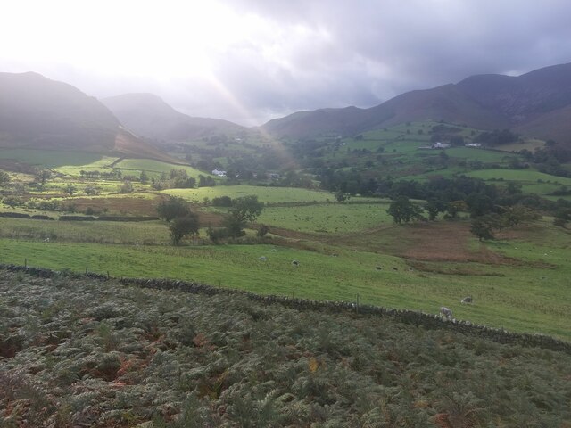
Newlands Valley

The Newlands Valley is in the Lake District National Park in Cumbria, England. It is regarded as one of the most picturesque and quiet valleys in the national...
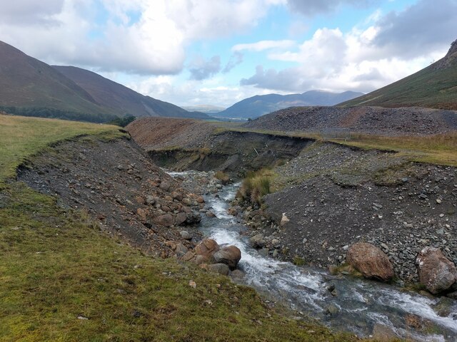
Rigg Beck

Rigg Beck is a minor river of Cumbria in England. Rigg Beck is also the name of a famous dwelling – the Purple House – placed where the Beck crosses the...
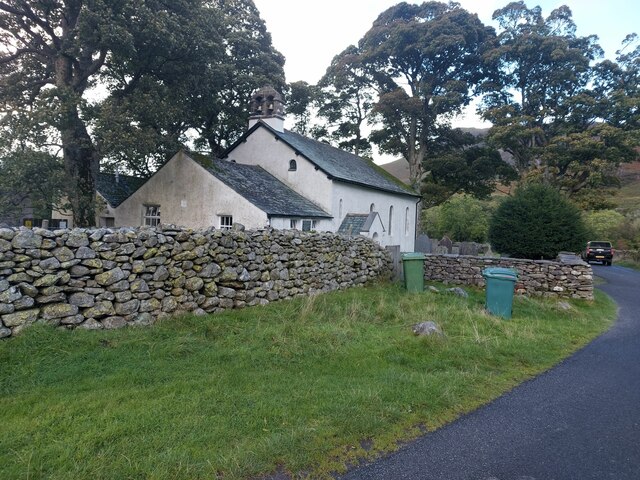
Stair, Cumbria

Stair is a village in Cumbria, England. It is situated in the Newlands Valley, to the west of Derwent Water and within the Lake District National Park...

Little Town, Cumbria

Little Town is a hamlet in the civil parish of Above Derwent, in the Allerdale district of Cumbria, England. It is in the Workington constituency of the...
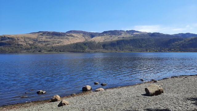
Derwentwater

Derwentwater, or Derwent Water, is a lake in the Lake District in North West England, immediately south of Keswick. It is in the unitary authority of Cumberland...

Keskadale Beck

Keskadale Beck is a minor river of Cumbria, England. The beck rises at the confluence of High Hole Beck (which rises beneath Robinson Crags) and Moss Beck...

Swinside (Derwent Water)

Swinside is a hill in the northwestern area of the English Lake District. It is small, wooded and surrounded by much bigger and more popular fells, meaning...

Nearby Amenities

Located within 500m of 54.574673,-3.1695756
Thomas Arthur Leonard
Contact Website: https://www.hfholidays.co.uk/our-community/history/
Historic: memorial
Memorial: plaque
Note: "Father of the Open-Air Movement"
Source: GPS Survey
Wikidata: Q16750787
Wikipedia: en:Thomas Arthur Leonard
Lat/Long: 54.5774233/-3.1672075
Hiking: yes
Information: guidepost
Source: GPS Survey
Tourism: information
Lat/Long: 54.577402/-3.1730005
Skellgill Copper Mine
Abandoned: yes
Historic: mine
Man Made: mine
Mineral: copper
Lat/Long: 54.5746577/-3.1687386
Old Brandley Lead Mine
Abandoned: yes
Historic: mine
Man Made: mine
Mineral: lead
Lat/Long: 54.5734757/-3.1660079
Skelgill Bank
Place: locality
Lat/Long: 54.5754458/-3.169113
Brandlehow Park
Place: locality
Lat/Long: 54.5731207/-3.1633697
Skelgill
Place: locality
Lat/Long: 54.5765073/-3.174941
Abandoned: yes
Direction: 280
Man Made: adit
Lat/Long: 54.5747467/-3.168921
Power: pole
Lat/Long: 54.5771817/-3.174484
The data included in this document is from www.openstreetmap.org. The data is made available under ODbL.

Have you been to Skelgill Bank?

Leave your review of Skelgill Bank below (or comments, questions and feedback).