Craiglea Hill

Hill, Mountain in Angus

Scotland

Craiglea Hill

Small loch A gravel path leads from the minor road over Kilry Hill to Islaview Cottage. This lochan is about halfway on this path. The Cateran Trail cuts over this track at this point, although it is difficult to discern what exactly it is doing around here.
Small loch Credit: Aleks Scholz

Craiglea Hill is a prominent hill located in the county of Angus, Scotland. It is situated approximately 4 miles northwest of the town of Forfar and stands at an elevation of 1,100 feet (335 meters) above sea level. The hill is part of the broader Sidlaw Hills range, which runs through the eastern part of the county.

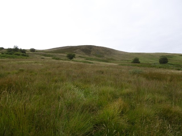
Craiglea Hill is characterized by its distinctive conical shape, with a pointed summit that offers breathtaking panoramic views of the surrounding countryside. The hill is predominantly covered in heather and grass, giving it a green and vibrant appearance, especially during the summer months.

The ascent to the summit of Craiglea Hill is relatively moderate, making it a popular destination for hikers and outdoor enthusiasts. There are several well-marked paths and trails that lead to the top, allowing visitors to explore the hill's diverse flora and fauna.

The hill also holds historical significance, as there are remnants of an ancient hillfort at its summit. These archaeological remains suggest that Craiglea Hill may have been used as a defensive fortification during early Iron Age times.

The picturesque beauty and tranquil atmosphere of Craiglea Hill make it a favorite spot for locals and tourists alike. Its accessibility and stunning views make it an ideal location for outdoor activities such as picnicking, photography, and birdwatching. Whether it is for leisurely walks or more challenging hikes, Craiglea Hill offers a rewarding experience for nature enthusiasts seeking to immerse themselves in the natural splendor of Angus.

If you have any feedback on the listing, please let us know in the comments section below.

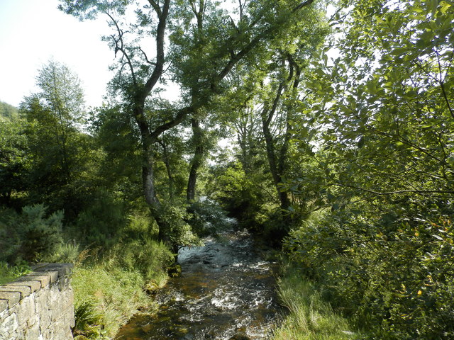
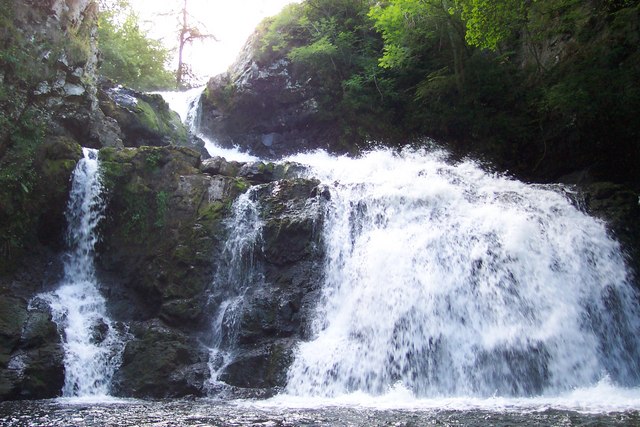
Craiglea Hill Images

Images are sourced within 2km of 56.696463/-3.2360694 or Grid Reference NO2456. Thanks to Geograph Open Source API. All images are credited.

Small loch A gravel path leads from the minor road over Kilry Hill to Islaview Cottage. This lochan is about halfway on this path. The Cateran Trail cuts over this track at this point, although it is difficult to discern what exactly it is doing around here.
Small loch
A gravel path leads from the minor road over Kilry Hill to Islaview Cottage. This lochan is about halfway on this path. The Cateran Trail cuts over this track at this point, although it is difficult to discern what exactly it is doing around here.
The Back Water at Dykend
Scrubland and forest near The Back Water
Near Pitewan Grass field above the Melgam Water.
Near Pitewan
Grass field above the Melgam Water.
Crossroads, Dykend The B951/B954 junction with a yellow road for Blackwater Reservoir.
Crossroads, Dykend
The B951/B954 junction with a yellow road for Blackwater Reservoir.
B951 Leaving Glen Isla for Kirriemuir.
B951
Leaving Glen Isla for Kirriemuir.
Young trees, Fornethy The name Fornethy has disappeared from maps.  The signs for the school have gone as well - presumably because of closure.
Young trees, Fornethy
The name Fornethy has disappeared from maps. The signs for the school have gone as well - presumably because of closure.
Milestone, B954
Milestone, B954
Milestone, B954 On the Alyth to Glenisla road.
Milestone, B954
On the Alyth to Glenisla road.
Woodland, Glen Isla Looking down the Melgam Water from the B954.
Woodland, Glen Isla
Looking down the Melgam Water from the B954.
Fornethy Woods From the Middleton road.
Fornethy Woods
From the Middleton road.
Road to Middleton Farm access in the woods around Fornethy.
Road to Middleton
Farm access in the woods around Fornethy.
Woodland near Dykend A narrow woodland between moors and the B951.
Woodland near Dykend
A narrow woodland between moors and the B951.
Craiglea Hill Rough grazing on Craiglea Hill.
Craiglea Hill
Rough grazing on Craiglea Hill.
Telephone box, Dykend A pheasant crosses the B951.
Telephone box, Dykend
A pheasant crosses the B951.
Field near Dykend One of a row of fields within the woodland.
Field near Dykend
One of a row of fields within the woodland.
The winding B951 The B951 undulating westwards towards Glen Isla.
The winding B951
The B951 undulating westwards towards Glen Isla.
Melgam Water at Dykend Melgam Water flowing southwards between the Backwater Reservoir and the Loch of Lintrathen, viewed from the bridge on the B951 at Dykend.
Melgam Water at Dykend
Melgam Water flowing southwards between the Backwater Reservoir and the Loch of Lintrathen, viewed from the bridge on the B951 at Dykend.
Show me another place!

Craiglea Hill is located at Grid Ref: NO2456 (Lat: 56.696463, Lng: -3.2360694)

Unitary Authority: Angus

Police Authority: Tayside

What 3 Words

///curvy.anchorman.cutback. Near Alyth, Perth & Kinross

Nearby Locations

Craiglea Hill

Related Wikis

Kilry Glen

Kilry Glen, in Angus, Scotland, is the glen of the Burn of Kilry, a tributary of the River Isla. It is situated west of the B954 road, approximately four...

Backwater Reservoir

Backwater Reservoir is a reservoir in north west Angus, Scotland. The reservoir's sole purpose is to provide drinking water, and as such, it supplies Angus...

Bridge of Craigisla

Bridge of Craigisla is a hamlet in Angus, Scotland. The bridge crosses the River Isla. This settlement lies along the B954 road. == References ==

Knockshannoch Lodge

Knockshannoch Lodge is a Category B listed building in the Scottish village of Glenisla, Angus, built around 1888. It is a small, single-storey cottage...

Nearby Amenities

Located within 500m of 56.696463,-3.2360694
Craiglea Hill
Ele: 388
Natural: peak
Lat/Long: 56.6966369/-3.2359084
The data included in this document is from www.openstreetmap.org. The data is made available under ODbL.

Have you been to Craiglea Hill?

Leave your review of Craiglea Hill below (or comments, questions and feedback).