Byrgwm

Hill, Mountain in Monmouthshire

Wales

Byrgwm

57 pigeons A flock of pigeons circling over Abertillery.
57 pigeons Credit: Alan Hughes

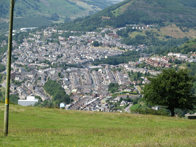
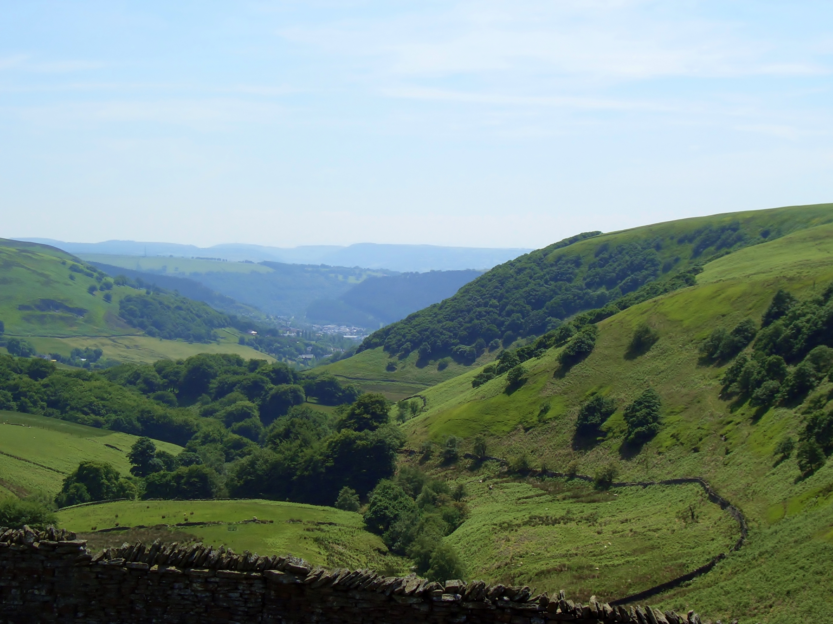
Byrgwm is a small hill located in Monmouthshire, Wales. Situated near the village of Llantilio Crossenny, it forms a prominent feature in the local landscape. With an elevation of approximately 550 feet, Byrgwm offers stunning panoramic views of the surrounding countryside.

The hill is characterized by its gentle slopes and lush greenery, making it a popular destination for hikers and nature enthusiasts. Its location within the Brecon Beacons National Park ensures that visitors are treated to a diverse range of flora and fauna. From wildflowers to ancient woodlands, Byrgwm boasts a rich biodiversity that attracts both locals and tourists alike.

The summit of Byrgwm provides a breathtaking vantage point, offering unobstructed views of the rolling hills and deep valleys that define the Monmouthshire landscape. On clear days, it is possible to see as far as the Black Mountains and Sugar Loaf Mountain in the distance.

Byrgwm is also steeped in history, with remnants of ancient settlements and burial mounds scattered across its slopes. These archaeological sites offer a glimpse into the area's past and provide a sense of intrigue for history enthusiasts.

Due to its accessibility and natural beauty, Byrgwm is a popular spot for outdoor activities such as walking, picnicking, and photography. It provides a peaceful retreat for those seeking a break from the hustle and bustle of everyday life.

If you have any feedback on the listing, please let us know in the comments section below.
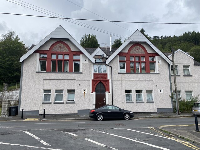
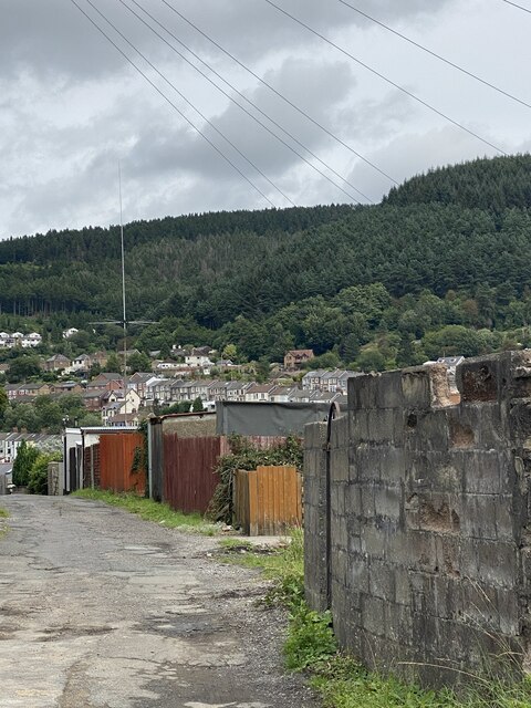
Byrgwm Images

Images are sourced within 2km of 51.725758/-3.1045664 or Grid Reference SO2303. Thanks to Geograph Open Source API. All images are credited.

57 pigeons A flock of pigeons circling over Abertillery.
57 pigeons
A flock of pigeons circling over Abertillery.
Darran Road A typical street in the Welsh valleys.
Darran Road
A typical street in the Welsh valleys.
Chapel Road, Six Bells Tŷ Ebbw Fach alongside the river of the same name.
Chapel Road, Six Bells
Tŷ Ebbw Fach alongside the river of the same name.
Blue plaque on Chapel Road The plaque honours Mervyn Griffiths, international football referee.
Blue plaque on Chapel Road
The plaque honours Mervyn Griffiths, international football referee.
Six Bells Primary Campus Abertillery Learning Community
Six Bells Primary Campus
Abertillery Learning Community
Formerly the Six Bells Institute
Bethany Baptist Church, Six Bells
Back lane and garages
Ordnance Survey Cut Mark This OS cut mark can be found on the wall east side of Cwm Farm Road. It marks a point 251.832m above mean sea level.
Ordnance Survey Cut Mark
This OS cut mark can be found on the wall east side of Cwm Farm Road. It marks a point 251.832m above mean sea level.
Ordnance Survey Cut Mark This OS cut mark can be found on the wall of the school on Bryn Gwyn Road. It marks a point 243.032m above mean sea level.
Ordnance Survey Cut Mark
This OS cut mark can be found on the wall of the school on Bryn Gwyn Road. It marks a point 243.032m above mean sea level.
Ordnance Survey Rivet This OS rivet can be found on the stone at the junction of Cwm Farm Road & Coronation Road. It marks a point 243.182m above mean sea level.
Ordnance Survey Rivet
This OS rivet can be found on the stone at the junction of Cwm Farm Road & Coronation Road. It marks a point 243.182m above mean sea level.
Ordnance Survey Cut Mark This OS cut mark can be found on the wall of No12 Coronation Road. It marks a point 229.551m above mean sea level.
Ordnance Survey Cut Mark
This OS cut mark can be found on the wall of No12 Coronation Road. It marks a point 229.551m above mean sea level.
Ordnance Survey Cut Mark This OS cut mark can be found on the dividing wall between No10 & No11 Marlborough Road. It marks a point 220.221m above mean sea level.
Ordnance Survey Cut Mark
This OS cut mark can be found on the dividing wall between No10 & No11 Marlborough Road. It marks a point 220.221m above mean sea level.
Ordnance Survey Cut Mark This OS cut mark can be found on the wall of No50 Windsor Road. It marks a point 235.385m above mean sea level.
Ordnance Survey Cut Mark
This OS cut mark can be found on the wall of No50 Windsor Road. It marks a point 235.385m above mean sea level.
Ordnance Survey Cut Mark This OS cut mark can be found on No40 New High Street. It marks a point 215.899m above mean sea level.
Ordnance Survey Cut Mark
This OS cut mark can be found on No40 New High Street. It marks a point 215.899m above mean sea level.
Ordnance Survey Cut Mark This OS cut mark can be found on the wall of the old school on Victoria Road. It marks a point 192.000m above mean sea level.
Ordnance Survey Cut Mark
This OS cut mark can be found on the wall of the old school on Victoria Road. It marks a point 192.000m above mean sea level.
Near the head of Cwm Ddu Looking across the valley over colliery waste towards a disused brick building <a href="https://www.geograph.org.uk/photo/5707880">SO2402 : Derelict building, Blaenserchan Colliery site</a> that served the former Blaenserchan Colliery.
Near the head of Cwm Ddu
Looking across the valley over colliery waste towards a disused brick building SO2402 : Derelict building, Blaenserchan Colliery site that served the former Blaenserchan Colliery.
Towards the head of Cwm Ddu Looking across waste from former Blaenserchan Colliery to more natural woodland.
Towards the head of Cwm Ddu
Looking across waste from former Blaenserchan Colliery to more natural woodland.
Show me another place!

Byrgwm is located at Grid Ref: SO2303 (Lat: 51.725758, Lng: -3.1045664)

Unitary Authority: Torfaen

Police Authority: Gwent

What 3 Words

///imprints.lock.factored. Near Abertillery, Blaenau Gwent

Nearby Locations

Byrgwm

Related Wikis

Abertillery Bluebirds F.C.

Abertillery Bluebirds are a Welsh football team based in the town of Abertillery. They currently have a senior side in the Cymru South, tier two of the...

Six Bells

Six Bells (Welsh: Chwe Chloch) is an electoral ward and neighbourhood in Abertillery, Blaenau Gwent, Wales. It was originally a village that grew up around...

Six Bells Halt railway station

Six Bells Halt railway station was a station which served the Six Bells Colliery near Abertillery in the Welsh county of Monmouthshire. == History == The...

Abertillery

Abertillery (; Welsh: Abertyleri) is a town and a community of the Ebbw Fach valley in the historic county of Monmouthshire, Wales. Following local government...
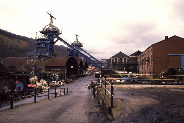
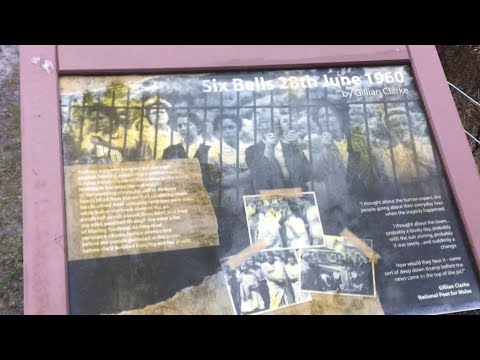
Six Bells Colliery

Six Bells Colliery was a colliery located in Six Bells, Abertillery, Gwent, Wales. On 28 June 1960 it was the site of an underground explosion which killed...

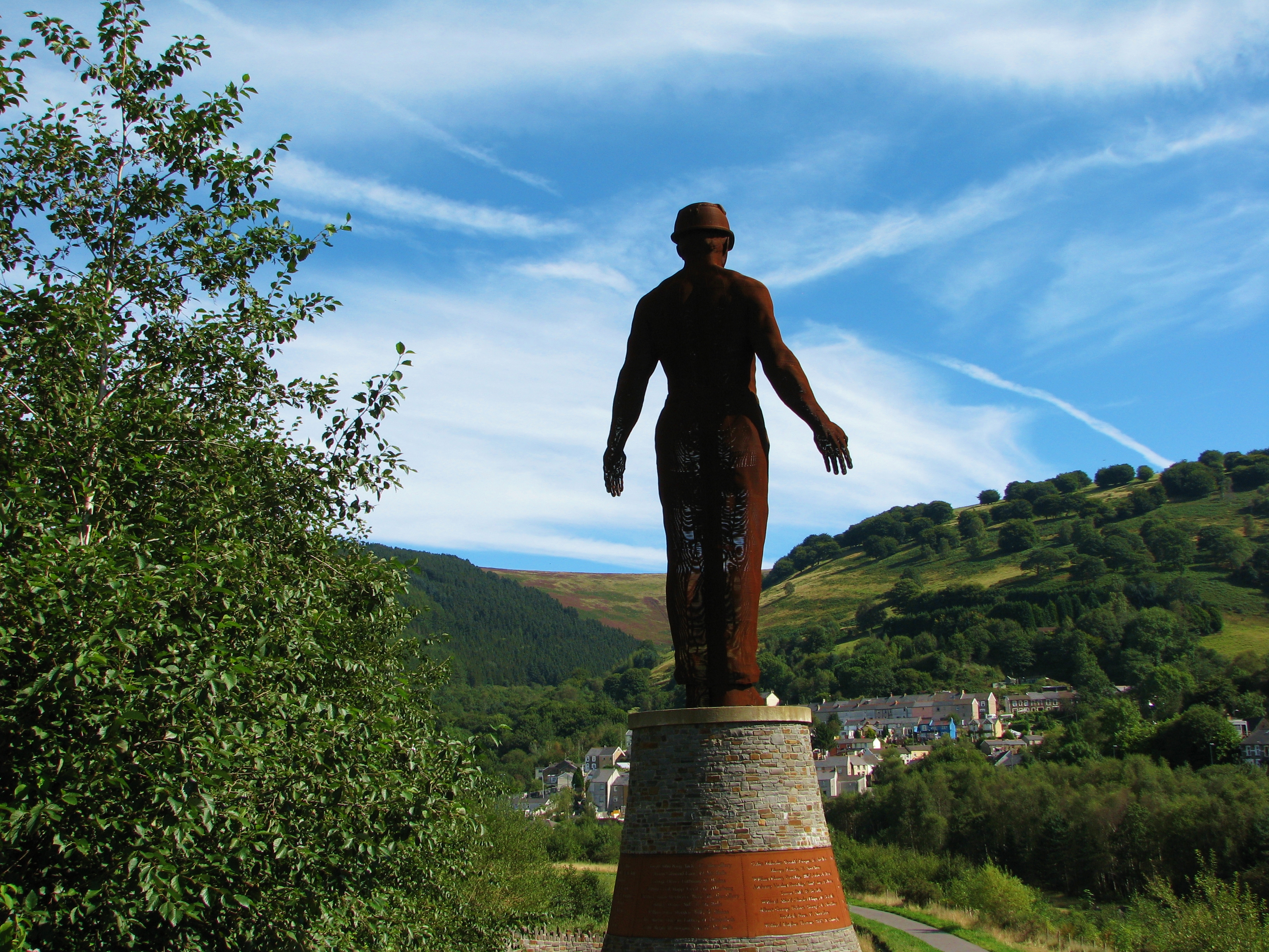
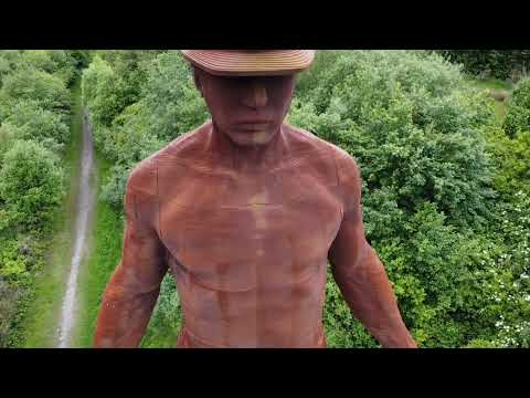
Guardian (sculpture)

The Guardian is a 20 m (66 ft) tall statue overlooking Parc Arael Griffin, the landscaped former Six Bells Colliery site, in the South Wales mining town...

Abersychan and Talywain railway station

Abersychan and Talywain station served the town of Abersychan in the Welsh county of Monmouthshire. The station was the meeting point for two major pre...

Abertillery Learning Community

Abertillery Learning Community is an all-through school in Abertillery, Wales. The school was formed by merging several schools in 2016. Abertillery Comprehensive...

Related Videos

Hiking for Health - Guardian Of The Valleys

02/03/2022 - Out and about in the South of Wales again. This time I went walking in an area of Abertillery known as Six Bells.

Guardian - Six Bells Miners Memorial

Guardian is the largest large scale mining memorial in Wales which commemorates the 50th anniversary of the 1960 Six Bells ...

The Guardian

Flying around the Guardian of Six Bells Colliery, South Wales.

Out shooting sunset which is a fail

I am a photographer from the south wales valleys join me as i explore abandoned buildings nature landscapes and so much more ...

Nearby Amenities

Located within 500m of 51.725758,-3.1045664
Generator Method: wind_turbine
Generator Source: wind
Power: generator
Lat/Long: 51.7247234/-3.1098291
The data included in this document is from www.openstreetmap.org. The data is made available under ODbL.

Have you been to Byrgwm?

Leave your review of Byrgwm below (or comments, questions and feedback).