Allen Crags

Hill, Mountain in Cumberland Allerdale

England

Allen Crags

Borrowdale from Ruddy Gill Looking down the valley from alongside Ruddy Gill. Derwent Water is just visible in the distance.
Borrowdale from Ruddy Gill Credit: Ian Taylor

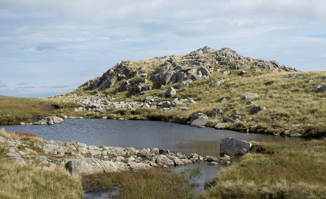
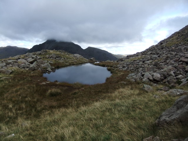
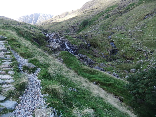
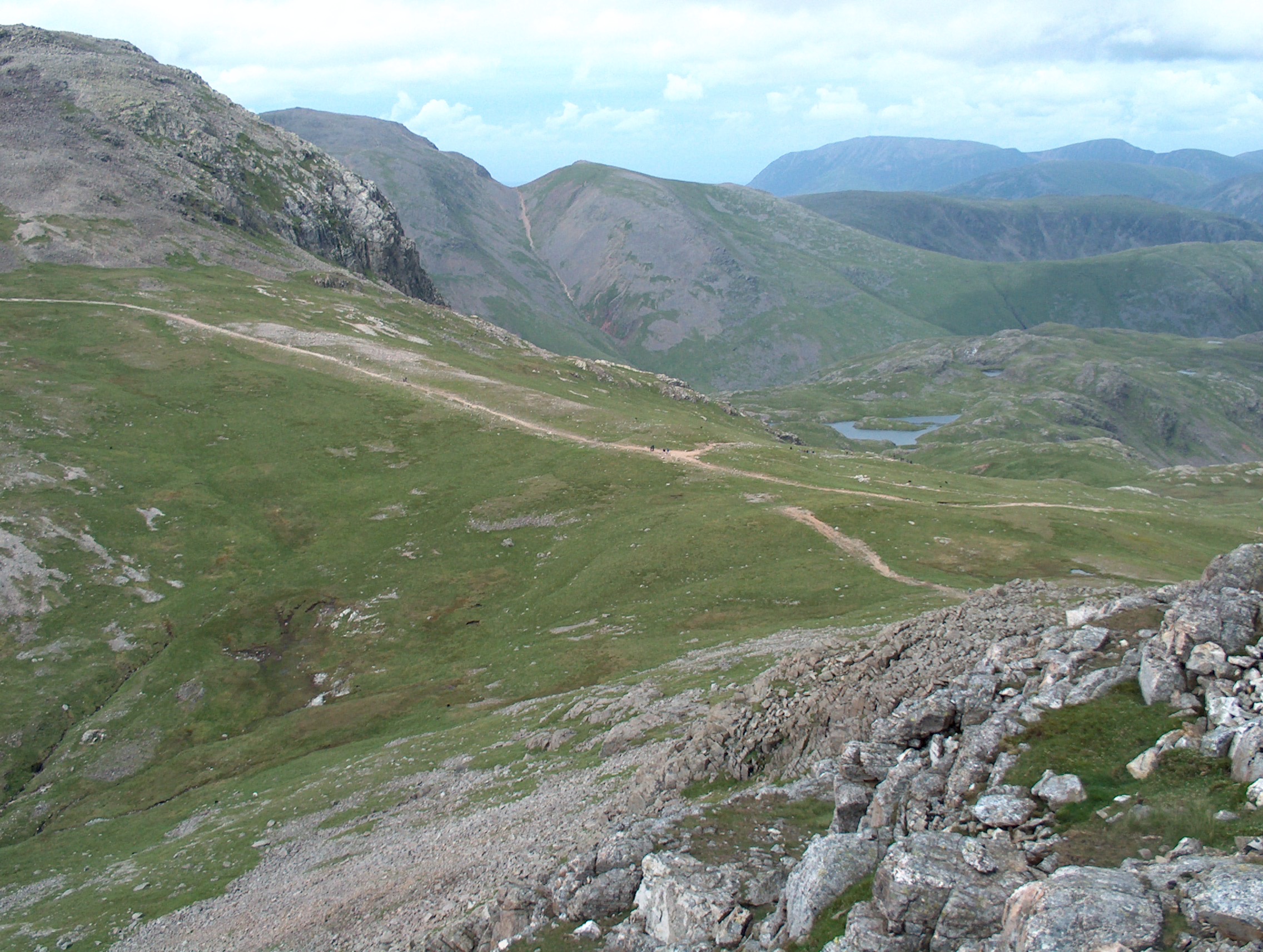
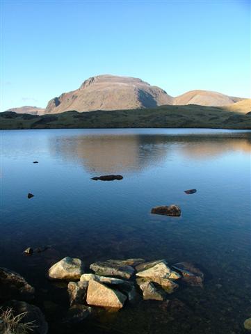
Allen Crags is a prominent hill located in the Lake District National Park in Cumberland, England. Standing at an elevation of 785 meters (2,575 feet), it is considered a popular destination for hikers and outdoor enthusiasts. Situated in the Central Fells region of the national park, Allen Crags offers breathtaking panoramic views of the surrounding landscape, including nearby peaks such as Great End, Glaramara, and Scafell Pike.

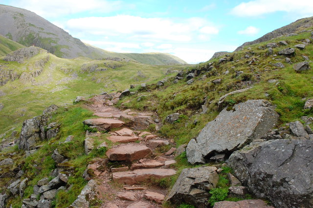
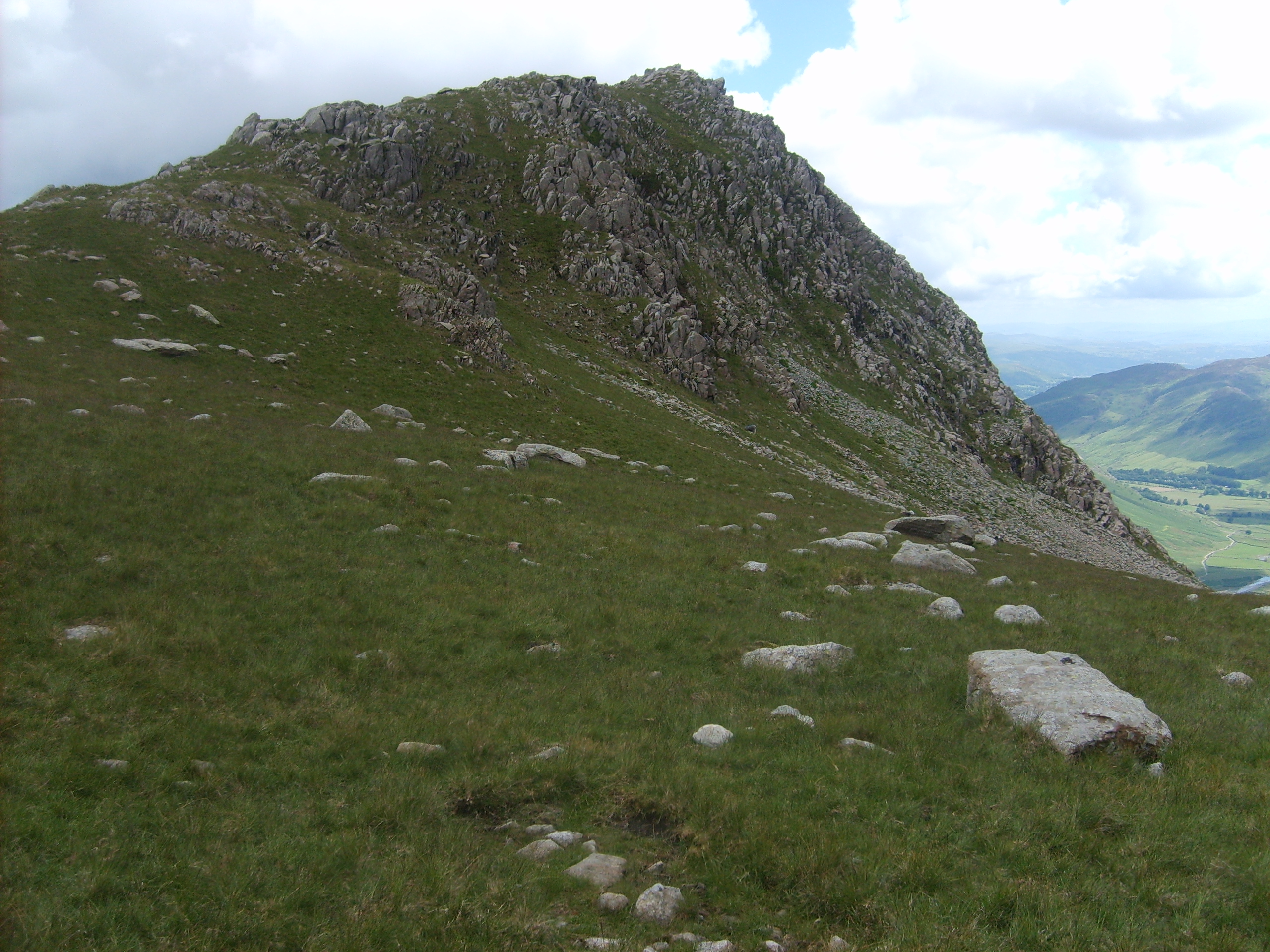
The hill is predominantly composed of volcanic rocks, which were formed during ancient volcanic activity in the area. As a result, the terrain features steep slopes and craggy outcrops, providing a challenging yet rewarding hiking experience. The ascent to Allen Crags can be approached from various directions, with popular starting points being Seathwaite and Borrowdale.

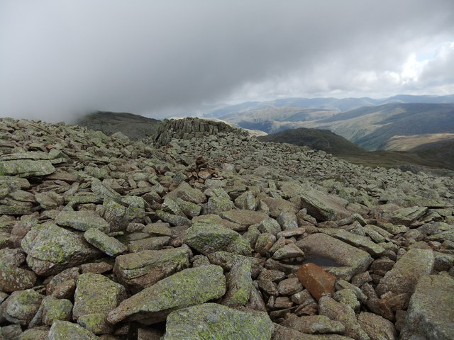
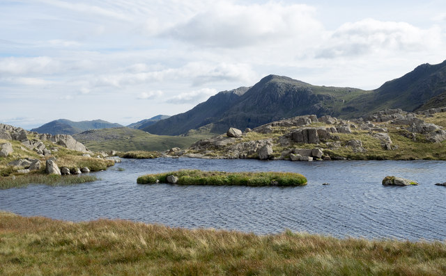
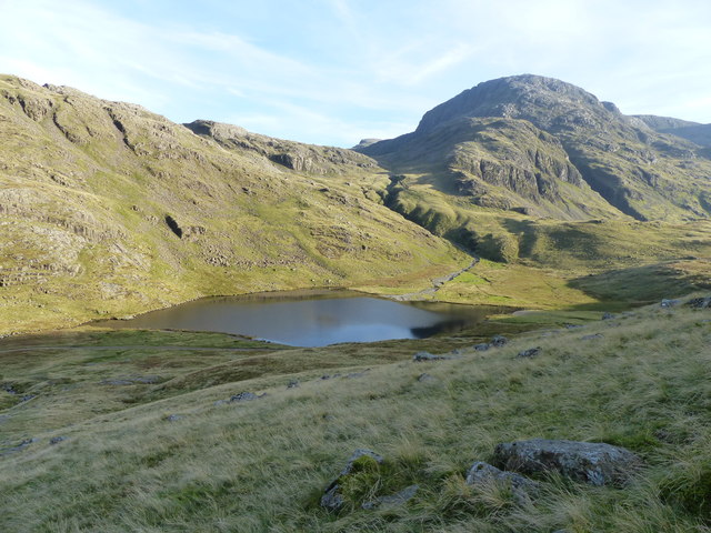
The summit of Allen Crags boasts a trig point, which serves as a marker and offers a great vantage point to admire the surrounding scenery. On clear days, visitors can enjoy views that stretch across the picturesque valleys, shimmering lakes, and rugged mountains that define the Lake District.

Due to its proximity to other notable peaks, many hikers choose to include Allen Crags as part of a longer trek, such as the popular route known as the Coledale Horseshoe. This circular walk allows adventurers to explore several summits, taking in the beauty of the Lake District's diverse landscapes.

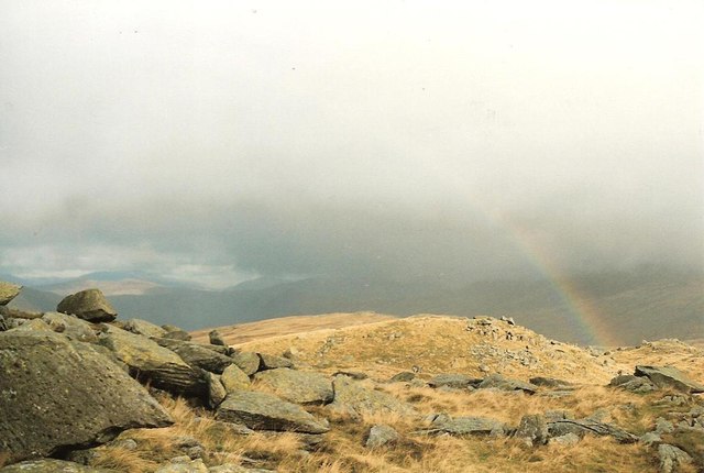
Overall, Allen Crags is a captivating hill in Cumberland's Lake District, with its rugged beauty, challenging trails, and outstanding views making it a favorite among outdoor enthusiasts seeking an immersive experience in nature.

If you have any feedback on the listing, please let us know in the comments section below.
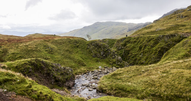
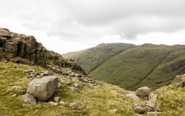
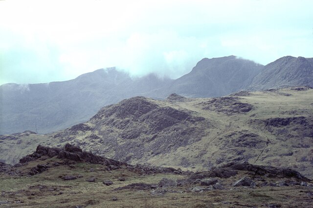
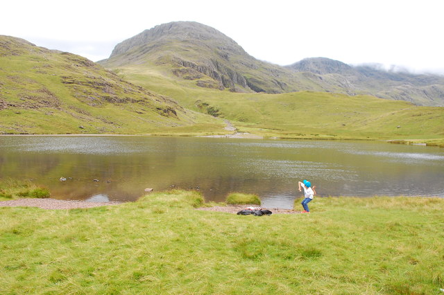
Allen Crags Images

Images are sourced within 2km of 54.466353/-3.1791353 or Grid Reference NY2308. Thanks to Geograph Open Source API. All images are credited.

Borrowdale from Ruddy Gill Looking down the valley from alongside Ruddy Gill. Derwent Water is just visible in the distance.
Borrowdale from Ruddy Gill
Looking down the valley from alongside Ruddy Gill. Derwent Water is just visible in the distance.
Rossett Pike Mid November day just passed the summit of the pike.
Rossett Pike
Mid November day just passed the summit of the pike.
Ruddy Gill Ruddy Gill about to enter its gorge which is on the eastern side of Sprinkling Tarn. To the right slopes rise towards Allen Crags, Glaramara is distant at the centre.
Ruddy Gill
Ruddy Gill about to enter its gorge which is on the eastern side of Sprinkling Tarn. To the right slopes rise towards Allen Crags, Glaramara is distant at the centre.
Boulders and rock outcrops on Seathwaite Fell There are many minor outcrops on Seathwaite Fell, topping its knolls and projecting from slopes. The outcrop in the image overlooks the valley of Ruddy Gill / Grains Gill, beyond which is Glaramara.
Boulders and rock outcrops on Seathwaite Fell
There are many minor outcrops on Seathwaite Fell, topping its knolls and projecting from slopes. The outcrop in the image overlooks the valley of Ruddy Gill / Grains Gill, beyond which is Glaramara.
The Scafell range from Bow Fell The grassy hill in the middle distance is Pike de Bield. On the skyline are Sca Fell (in cloud), the gap at Mickledore, and Scafell Pike (clear), with Ill Crag on the right.
The Scafell range from Bow Fell
The grassy hill in the middle distance is Pike de Bield. On the skyline are Sca Fell (in cloud), the gap at Mickledore, and Scafell Pike (clear), with Ill Crag on the right.
Styhead Tarn A stone is about to join the fishes. Great End is seen beyond the tarn but the rest of the Scafell Pike ridge is shrouded in low cloud.
Styhead Tarn
A stone is about to join the fishes. Great End is seen beyond the tarn but the rest of the Scafell Pike ridge is shrouded in low cloud.
On the Corridor Route Looking back towards Sty Head with the slopes of Green Gable beyond.
On the Corridor Route
Looking back towards Sty Head with the slopes of Green Gable beyond.
On a faint path below Spout Head Marked as a path on some scales of the map, and even as a bridleway a little further downhill, this track is well cairned but little used.
On a faint path below Spout Head
Marked as a path on some scales of the map, and even as a bridleway a little further downhill, this track is well cairned but little used.
Tarn between Glaramara and Allen Crags A fine high level walk can be made between Glaramara and Allen Crags. A good number of tarns is passed on the way; this is one of the smaller ones.
Tarn between Glaramara and Allen Crags
A fine high level walk can be made between Glaramara and Allen Crags. A good number of tarns is passed on the way; this is one of the smaller ones.
Boulderfield at northern end of Ill Crag One of the main paths to and from Scafell Pike passes between two satellite tops of the mountain, Broad Crag and Ill Crag. Boulders abound everywhere; those seen here are close to the path as it passes north of Ill Crag. Esk Pike and Bow Fell are the two mountains beyond the boulders.
Boulderfield at northern end of Ill Crag
One of the main paths to and from Scafell Pike passes between two satellite tops of the mountain, Broad Crag and Ill Crag. Boulders abound everywhere; those seen here are close to the path as it passes north of Ill Crag. Esk Pike and Bow Fell are the two mountains beyond the boulders.
Rocks embedded in grass The location is below the north face of Great End and north-west of Esk Hause.
Great Gable and Green Gable are in the distance.
Rocks embedded in grass
The location is below the north face of Great End and north-west of Esk Hause. Great Gable and Green Gable are in the distance.
Small tarn by Round How
Lambfoot Dub Charming. Well worth the detour.
Lambfoot Dub
Charming. Well worth the detour.
Blunt Top
Blunt Top
Ruddy Gill
Ruddy Gill
Island in High House Tarn High House Tarn is one of the larger pools along the broad ridge connecting Glaramara with Allen Crags. The view is near to south where Bow Fell is seen centrally. The pale area beyond the declining left profile of the mountain could be taken for another hill behind but it is in fact the Great Slab, part of Bow Fell itself.
Island in High House Tarn
High House Tarn is one of the larger pools along the broad ridge connecting Glaramara with Allen Crags. The view is near to south where Bow Fell is seen centrally. The pale area beyond the declining left profile of the mountain could be taken for another hill behind but it is in fact the Great Slab, part of Bow Fell itself.
Styhead Tarn
Styhead Tarn
Rainbow over Black Crags
Show me another place!

Allen Crags is located at Grid Ref: NY2308 (Lat: 54.466353, Lng: -3.1791353)

Administrative County: Cumbria

District: Allerdale

Police Authority: Cumbria

What 3 Words

///liked.flaunting.hasten. Near Ambleside, Cumbria

Nearby Locations

Allen Crags

Related Wikis

Nearby Amenities

Located within 500m of 54.466353,-3.1791353
Allen Crags
Ele: 784
Natural: peak
Source: survey
Wikidata: Q4731605
Wikipedia: en:Allen Crags
Lat/Long: 54.4664309/-3.179497
Ford: yes
Lat/Long: 54.4651899/-3.1839245
Landmark: cairn
Man Made: cairn
Lat/Long: 54.4644758/-3.1818922
Ford: yes
Lat/Long: 54.4625816/-3.1754282
Ford: yes
Lat/Long: 54.4633308/-3.1773946
Ford: yes
Lat/Long: 54.4634677/-3.1782835
The data included in this document is from www.openstreetmap.org. The data is made available under ODbL.

Have you been to Allen Crags?

Leave your review of Allen Crags below (or comments, questions and feedback).