The Binn
Hill, Mountain in Fife
Scotland
The Binn
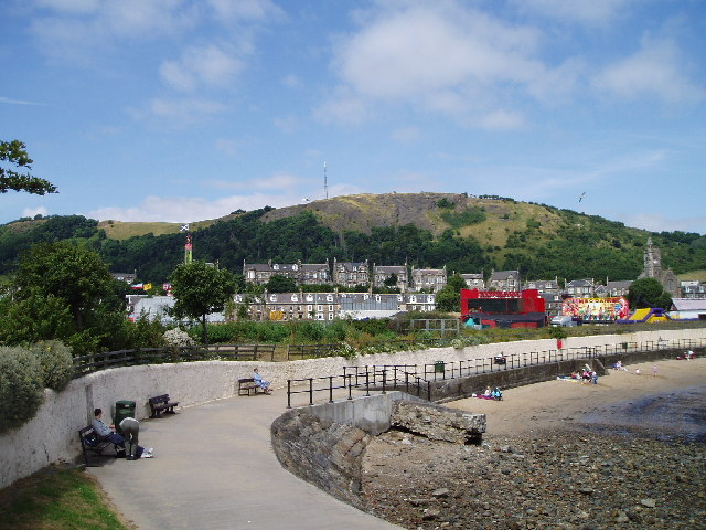
The Binn is a prominent hill located in Fife, Scotland. Rising to an impressive height of 193 meters (633 feet), it is considered one of the most iconic landmarks in the region. Situated near the town of Burntisland, The Binn offers breathtaking panoramic views of the surrounding countryside, the Firth of Forth, and even glimpses of Edinburgh on a clear day.
Formed during the last Ice Age, The Binn is primarily composed of volcanic rock, giving it a unique geological character. The hill is known for its distinct conical shape and steep slopes, which make it a popular destination for hikers, climbers, and nature enthusiasts.
The Binn is home to a diverse range of flora and fauna, including heather, gorse, and various species of birds. The hill is also part of the Fife Coastal Path, a long-distance footpath that stretches for 117 miles along the scenic coastline of Fife.
Visitors to The Binn can enjoy a variety of outdoor activities, such as hillwalking, birdwatching, and photography. The hill is easily accessible, with well-marked trails leading to the summit. The ascent can be challenging at times, but the reward of reaching the top and experiencing the breathtaking views is well worth the effort.
Overall, The Binn is a natural gem in Fife, offering a unique blend of natural beauty, geological significance, and recreational opportunities for all who venture to explore its slopes.
If you have any feedback on the listing, please let us know in the comments section below.
The Binn Images
Images are sourced within 2km of 56.069725/-3.2301318 or Grid Reference NT2387. Thanks to Geograph Open Source API. All images are credited.
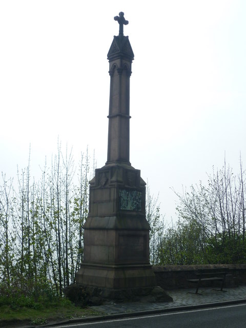
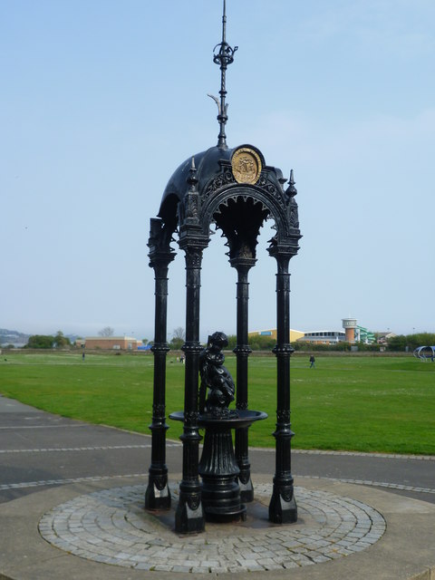
![Alexander III Monument at Kinghorn Looking towards the King&#039;s Crag. It is traditionally believed that Alexander fell from the cliffs, though his fatal accident may have been less dramatic.
&quot;For in the same year [1296] on 19 March the king was delayed by the ferry at [South] Queensferry until dusk on a dark night. When advised by his companions not to go beyond Iverkeithing that night, he spurned their counsel, and with an escort of knights hurried by a precipitous track towards Kinghorn Regis. To the west of that place beside the shore his horse stumbled in the sand, and alas! the noble king, too negligently attended by his followers, broke his neck and expired.&quot; -- Scotichronicon, c.1440
<a href="https://www.geograph.org.uk/photo/2370739">NT2586 : Alexander III Monument poem</a>](https://s0.geograph.org.uk/geophotos/02/37/07/2370736_23adf40b.jpg)
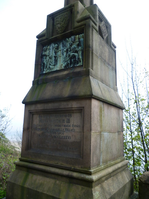
![Alexander III Monument poem The earliest extant poem in the Scots language laments the death of King Alexander III and the end of the &#039;golden age&#039; associated with his reign.
Quhen Alysandyr oure kyng wes dede
That Scotland led in luive and le.
Away wes sonce of ale and brede,
Of wyne and wax, of gamyn and gle;
Oure gold wes changed into lede.
Cryst! Borne into Virgynyte,
Succour Scotland and remede,
That stad is in perplexyte.
[When Alexander our King was dead,
That Scotland led in love and peace,
Away the abundance of ale and bread,
Of wine and wax, of game and merriment.
Our gold was changed into lead—
Christ! born into virginity,
Help Scotland and cure
That troubled state.]
Andrew de Wyntoun,
Orygynale Cronykil of Scotland, 14thC](https://s3.geograph.org.uk/geophotos/02/37/07/2370739_b498c840.jpg)
The Binn is located at Grid Ref: NT2387 (Lat: 56.069725, Lng: -3.2301318)
Unitary Authority: Fife
Police Authority: Fife
What 3 Words
///rival.reckons.director. Near Burntisland, Fife
Nearby Locations
Related Wikis
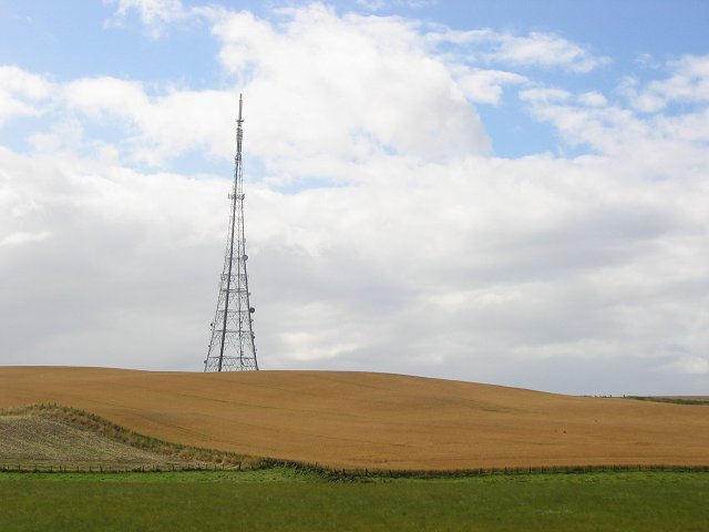
Craigkelly transmitting station
The Craigkelly transmitting station is a broadcasting and telecommunications facility located at Craigkelly (grid reference NT233872) north of the Firth...

Binnend
Binnend, also known as Binnend Village and The Binn, is an abandoned industrial village located two miles north of Burntisland in Fife. It was established...

Burntisland Shipyard F.C.
Burntisland Shipyard Football Club are a Scottish football club based in the town of Burntisland, Fife. The club competes in the East of Scotland League...
Battle of Kinghorn
The Battle of Kinghorn was fought on 6 August 1332 at Wester Kinghorn (now Burntisland), Fife, Scotland. An invading seaborne force of 1,500 men was commanded...
Burntisland
Burntisland ( , Scots: Bruntisland) is a former royal burgh and parish in Fife, Scotland, on the northern shore of the Firth of Forth. According to the...
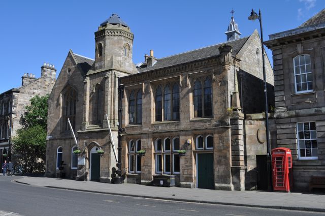
Burntisland Burgh Chambers
Burntisland Burgh Chambers is a municipal structure in the High Street, Burntisland, Fife, Scotland. The building, which is the meeting place of the Burntisland...

Burntisland Parish Church
Burntisland Parish Church (also known as St Columba's, Burntisland) is a church building in the Fife burgh of Burntisland, constructed for the Church of...

Rossend Castle
Rossend Castle is a historic building in Burntisland, a town on the south coast of Fife, Scotland. == History == A keep, known as the Tower of Kingorne...
Nearby Amenities
Located within 500m of 56.069725,-3.2301318Have you been to The Binn?
Leave your review of The Binn below (or comments, questions and feedback).