Cairn Lunkard

Hill, Mountain in Angus

Scotland

Cairn Lunkard

Jock's Road in Glen Doll The Jock's Road path climbing through Glen Doll seen from where it exits the coniferous plantation astride the White Water at around 430 metres.
The rocks of Craig Maud are at the left side of the image.
Jock's Road in Glen Doll Credit: Trevor Littlewood

Cairn Lunkard is a prominent hill located in Angus, Scotland. It stands at an elevation of 477 meters (1,565 feet) and is part of the southern Grampian Mountains. The hill is situated approximately 5 kilometers (3 miles) southeast of the village of Kirriemuir.

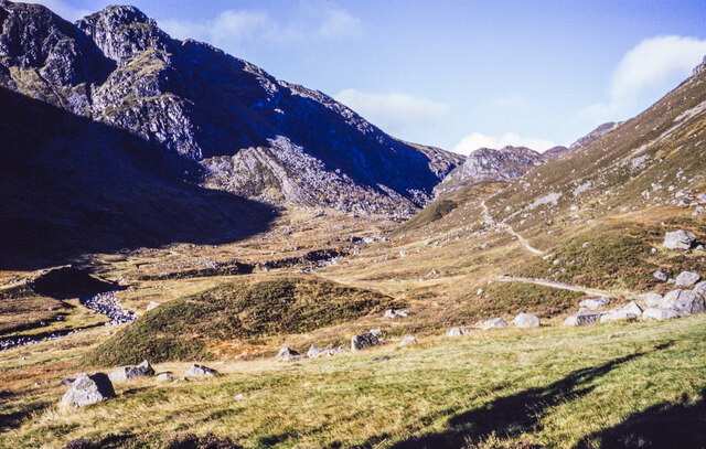
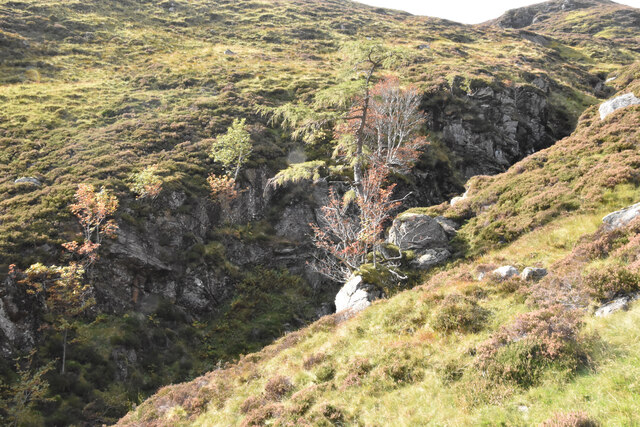
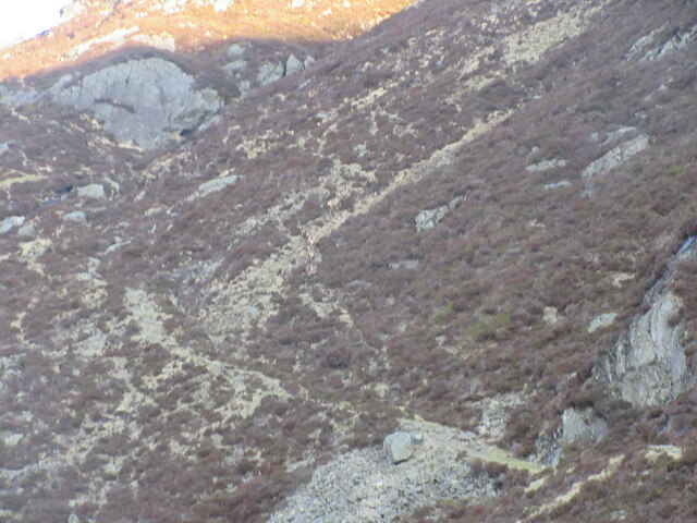
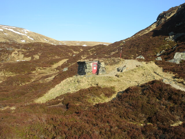
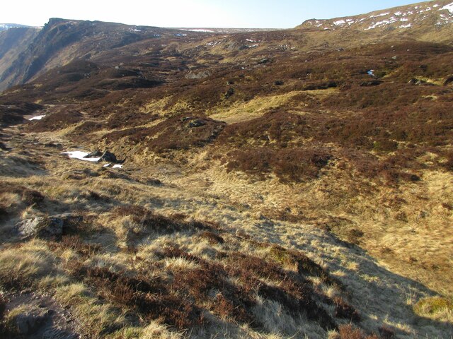
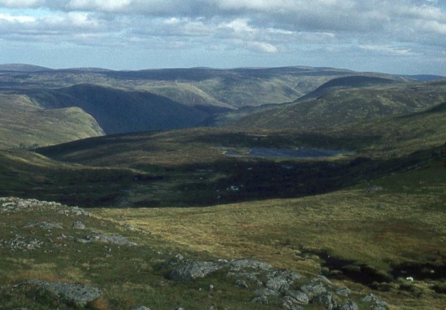
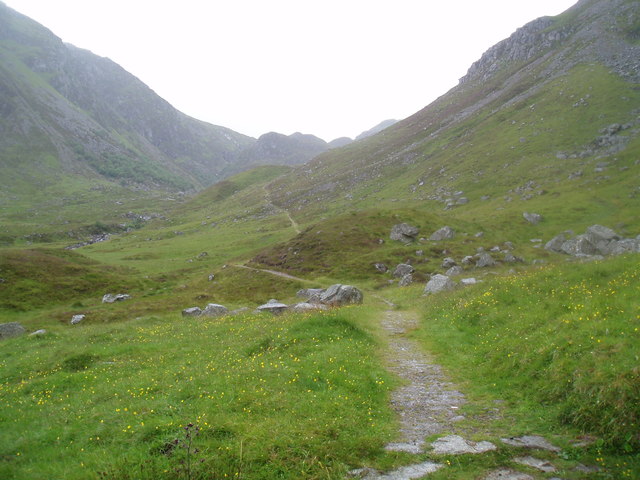
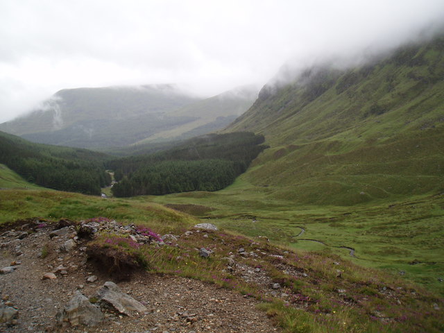
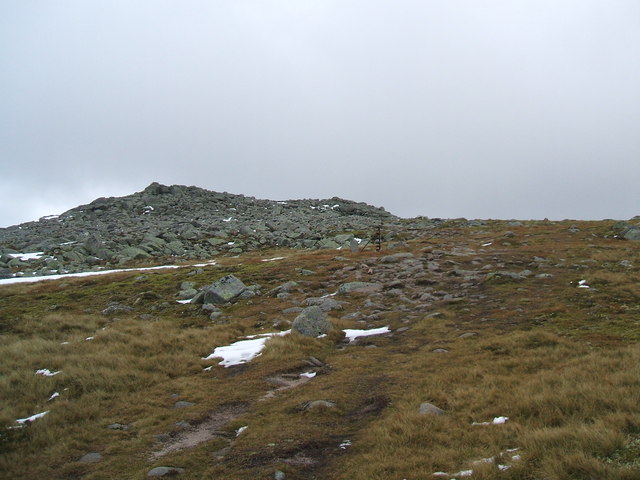
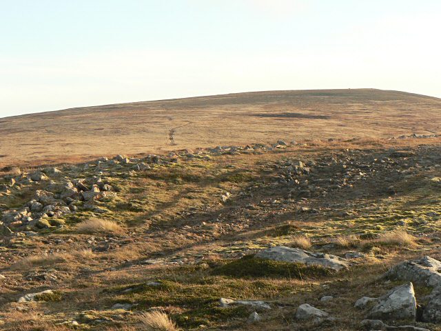
Cairn Lunkard is known for its distinctive shape and rugged terrain, making it a popular destination for hikers and outdoor enthusiasts. The hill is characterized by its steep slopes, rocky outcrops, and heather-covered moorland. The summit offers panoramic views of the surrounding countryside, including the nearby Sidlaw Hills and the rolling Angus Glens.

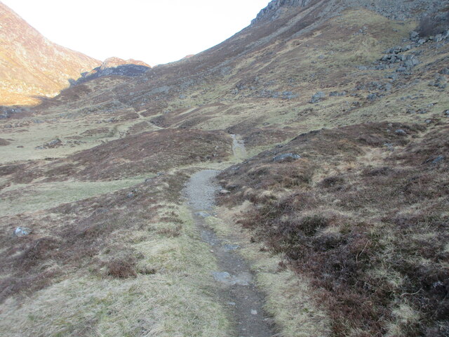
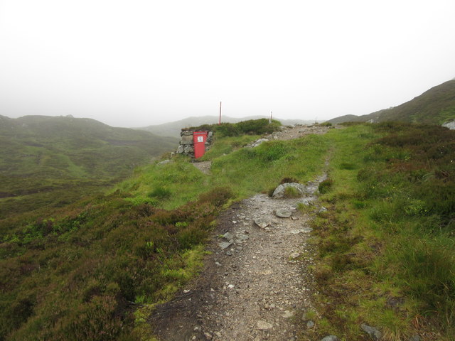
The ascent of Cairn Lunkard can be challenging, with no designated paths or trails. However, experienced walkers often navigate their way through the hill's rocky terrain, taking advantage of natural features and sheep tracks. The hill is also home to several species of wildlife, including red grouse, mountain hares, and various bird species.

The name "Cairn Lunkard" originates from the Gaelic language, with "cairn" referring to a pile of stones and "lunkard" believed to mean "lazy" or "idle." This name may have been given due to the hill's rugged appearance or the challenging nature of its ascent.

Overall, Cairn Lunkard offers a rewarding experience for those seeking a challenging hike and stunning panoramic views in the picturesque Angus countryside.

If you have any feedback on the listing, please let us know in the comments section below.

Cairn Lunkard Images

Images are sourced within 2km of 56.888683/-3.2604325 or Grid Reference NO2378. Thanks to Geograph Open Source API. All images are credited.

Jock's Road in Glen Doll The Jock's Road path climbing through Glen Doll seen from where it exits the coniferous plantation astride the White Water at around 430 metres.
The rocks of Craig Maud are at the left side of the image.
Jock's Road in Glen Doll
The Jock's Road path climbing through Glen Doll seen from where it exits the coniferous plantation astride the White Water at around 430 metres. The rocks of Craig Maud are at the left side of the image.
Heather rib outside shelter along Jock's Road Jock's Road climbs out of Glen Doll to arrive at the shelter -  'Davy's Bourach', by the obvious hollow to the left side of the image. The heather rib of ground extends into Glen Doll and is known as the Lunkard; a path can be seen leading to a cairn at the extreme right: (it's not Jock's Road).
Heather rib outside shelter along Jock's Road
Jock's Road climbs out of Glen Doll to arrive at the shelter - 'Davy's Bourach', by the obvious hollow to the left side of the image. The heather rib of ground extends into Glen Doll and is known as the Lunkard; a path can be seen leading to a cairn at the extreme right: (it's not Jock's Road).
Summit of Tom Buidhe
Lone tree hanging on Jocks Road
Lone tree hanging on
Jocks Road
Jock's Road The beginning of Jock's Road beyond the forest section in Glen Doll.
Jock's Road
The beginning of Jock's Road beyond the forest section in Glen Doll.
Camouflaged deer Six deer in the centre of the picture blending into the hillside above Jock's Road.
Camouflaged deer
Six deer in the centre of the picture blending into the hillside above Jock's Road.
Davy's Bourach The shelter on Jock's Road at the top of Glen Doll.
Davy's Bourach
The shelter on Jock's Road at the top of Glen Doll.
Heather-clad knolls Heathery knolls at the top of Jock's Road above Glen Doll.
Heather-clad knolls
Heathery knolls at the top of Jock's Road above Glen Doll.
Upper reach of White Water White Water heading northwards in the valley between Tom Buidhe and Cairn Lunkard.
Upper reach of White Water
White Water heading northwards in the valley between Tom Buidhe and Cairn Lunkard.
Summit of Tom Buidhe Looking northwards to the summit cairn of Tom Buidhe, with the snow-clad Cairngorms on the horizon.
Summit of Tom Buidhe
Looking northwards to the summit cairn of Tom Buidhe, with the snow-clad Cairngorms on the horizon.
Crow Craigies looking east Loch Esk below.
Crow Craigies looking east
Loch Esk below.
Tom Buidhe summit cairn The least exciting of the six peaks climbed from the A93 that day.
Tom Buidhe summit cairn
The least exciting of the six peaks climbed from the A93 that day.
Davy Glen's Bourach, Glen Doll This shelter was constructed in 1966 by Davy Glen following a tragedy in 1959 when four hikers died near this spot.
Davy Glen's Bourach, Glen Doll
This shelter was constructed in 1966 by Davy Glen following a tragedy in 1959 when four hikers died near this spot.
Jock's Road, Glen Doll
Jock's Road above Glen Doll Forest
Davy Glen's Burach on Jock's Road The shelter was constructed by the late Davy Glen a dry stane dyker of renown.
This summer shot can be compared with an earlier winter shot. 
See <a href="https://www.geograph.org.uk/photo/2880152">NO2377 : Davy's Burach on Jock's Road</a> 
For more on Davy Glen see <span class="nowrap"><a title="http://www.tealingvillage.org/davieglen.html" rel="nofollow ugc noopener" href="http://www.tealingvillage.org/davieglen.html">Link</a><img style="margin-left:2px;" alt="External link" title="External link - shift click to open in new window" src="https://s1.geograph.org.uk/img/external.png" width="10" height="10"/></span>
Davy Glen's Burach on Jock's Road
The shelter was constructed by the late Davy Glen a dry stane dyker of renown. This summer shot can be compared with an earlier winter shot. See NO2377 : Davy's Burach on Jock's Road For more on Davy Glen see LinkExternal link
The Mounth Looking north-east from the Mayar plateau towards The Mounth
The Mounth
Looking north-east from the Mayar plateau towards The Mounth
Loch Esk Loch Esk seen from its eastern shore. In the very dry, warm summer of 2018, the water level has fallen significantly, exposing some of the greens on the loch floor.
Loch Esk
Loch Esk seen from its eastern shore. In the very dry, warm summer of 2018, the water level has fallen significantly, exposing some of the greens on the loch floor.
Show me another place!

Cairn Lunkard is located at Grid Ref: NO2378 (Lat: 56.888683, Lng: -3.2604325)

Unitary Authority: Angus

Police Authority: Tayside

What 3 Words

///attend.testers.releasing. Near Inverey, Aberdeenshire

Related Wikis

Caenlochan

Caenlochan (Scottish Gaelic: Cadha an Lochain) is a glen in the Grampian Mountains of Scotland. Under EU Natura 2000 legislation it is a Special Area of...

Broad Cairn

Broad Cairn is a mountain in the Grampians of Scotland, located about sixteen miles south of the River Dee near Balmoral.

Corrie Fee

Corrie Fee is a glacier-carved corrie situated at the head of Glen Clova in the Angus Glens of Scotland. It forms part of Corrie Fee National Nature Reserve...

Glen Doll

Glen Doll, also sometimes spelt Glendoll, lies within the Cairngorms National Park, Scotland, at the top of Glen Clova, in an area of steep hills, corries...

Cairn Bannoch

Cairn Bannoch (Scottish Gaelic: Càrn a' Bheannaich) is a mountain in the White Mounth, a mountainous plateau in the Scottish Highlands. It is about seventeen...

Mayar (mountain)

Mayar is a mountain in the Grampians, in Angus, Scotland. It is usually climbed together with its near neighbour, Driesh. At an elevation of 928 m, it...

Dubh Loch (Glen Muick)

Dubh Loch is a small upland loch situated within the Balmoral Estate, in Aberdeenshire, Scotland. It is at an altitude of 637 metres (2,090 ft), with a...

Cairn of Claise

Cairn of Claise is a mountain in the Grampians of Scotland, located about three miles from the Glenshee Ski Center near Braemar. == References ==

Nearby Amenities

Located within 500m of 56.888683,-3.2604325
Access: yes
Entrance: yes
Note: Nice bright red door, essential for hillwalkers if they hit a spot of bad weather.
Lat/Long: 56.8849708/-3.2586313
Cairn Lunkard
Alt Name: Craig Lunkard
Ele: 856
Name Gd: Càrn Longairt
Natural: peak
Lat/Long: 56.8891868/-3.2618718
Universal Hiking Club Glasgow
Historic: memorial
Inscription: Universal Hiking Club Glasgow Erected to the memory of five members who died New Year 1959 R.I.P.
Memorial: plaque
Lat/Long: 56.8850606/-3.2586934
Tourism: viewpoint
Lat/Long: 56.8844915/-3.2576037
The data included in this document is from www.openstreetmap.org. The data is made available under ODbL.

Have you been to Cairn Lunkard?

Leave your review of Cairn Lunkard below (or comments, questions and feedback).