Huddington

Settlement in Worcestershire Wychavon

England

Huddington

Sale Green Methodist Church I am not sure whether this is currently a functioning church/chapel.
Sale Green Methodist Church Credit: Chris Allen

Huddington is a small village located in Worcestershire, England. Situated in the district of Wychavon, it lies approximately 8 miles southwest of Worcester, the county town. Huddington has a population of around 200 people and is characterized by its picturesque rural setting.

The village is rich in history, with evidence of human habitation dating back to the ancient Roman period. It is best known for its historic manor house, Huddington Court, which dates back to the 16th century. The manor house has a significant connection to the Gunpowder Plot of 1605, as it was owned by Thomas Wintour, one of the conspirators. Today, the manor house is a private residence and is not open to the public.

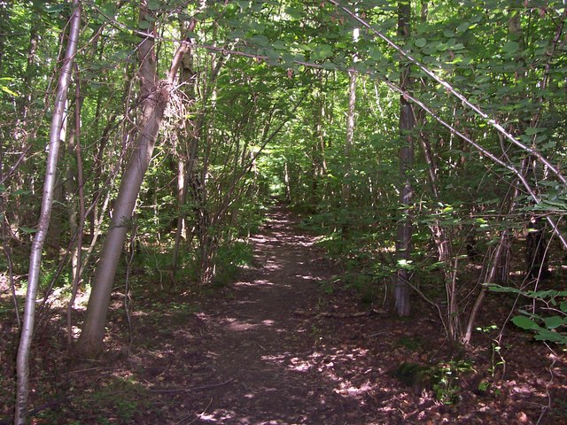
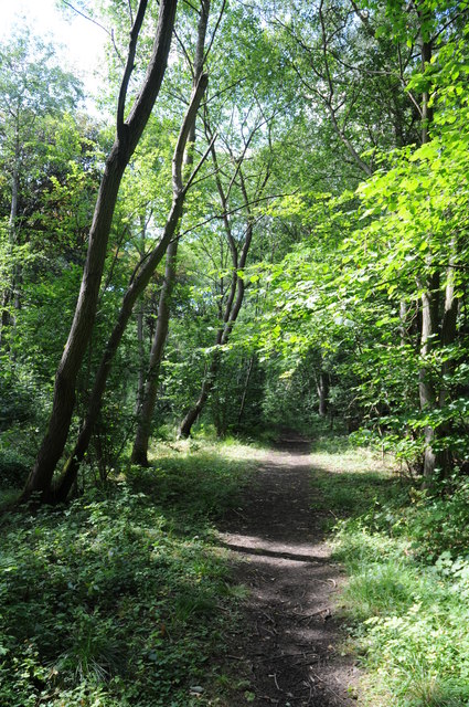
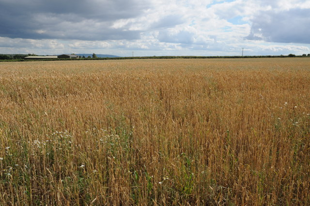
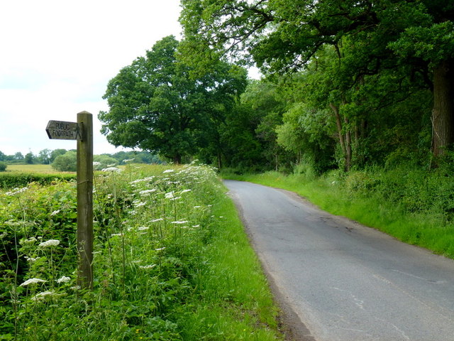
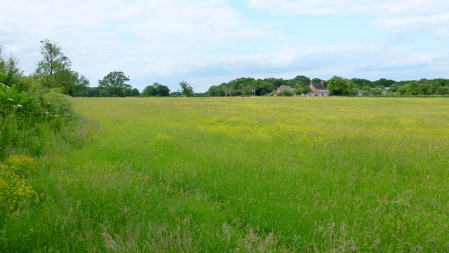
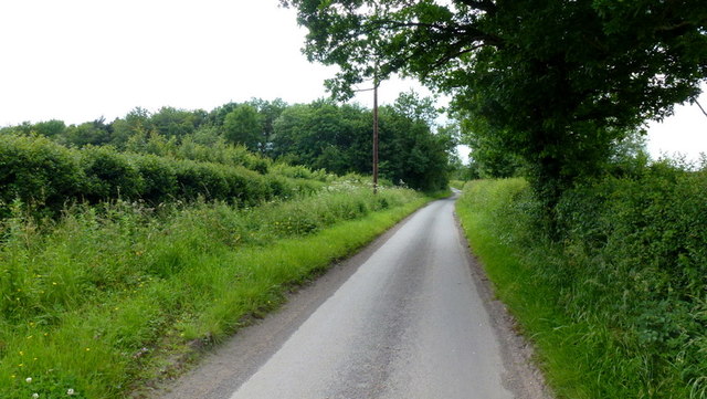
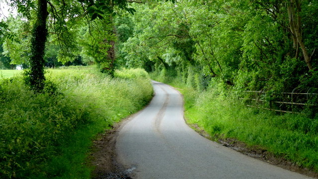
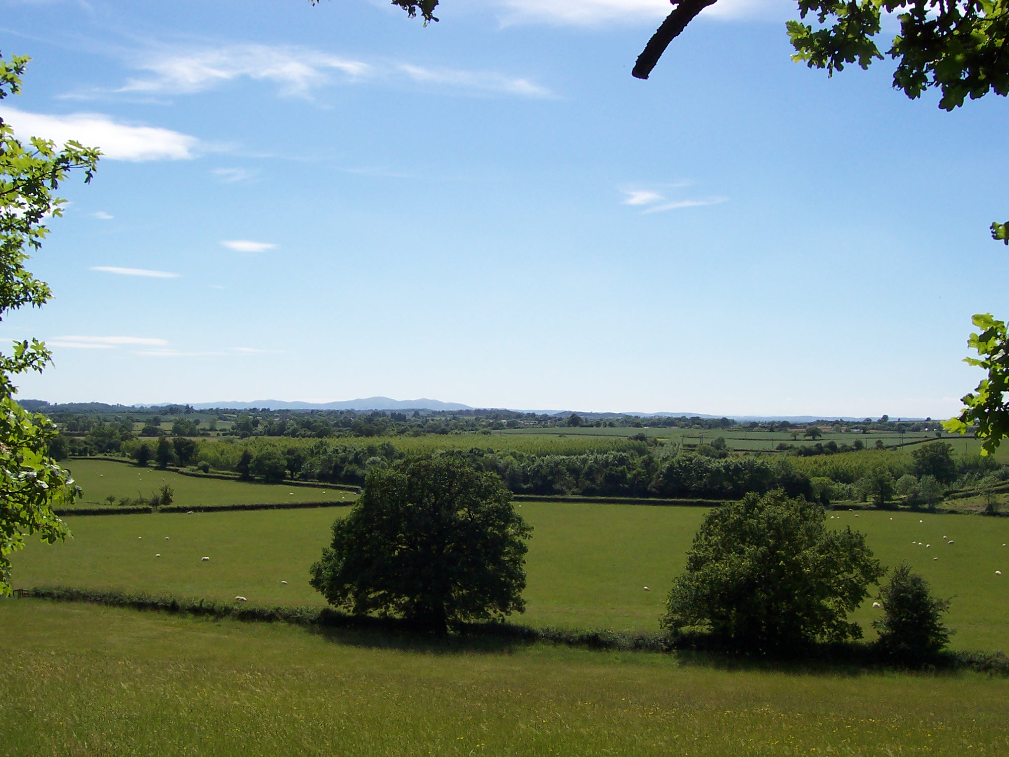
Huddington is surrounded by beautiful countryside, offering residents and visitors ample opportunities for outdoor activities. The village is situated near several walking and cycling trails, allowing nature enthusiasts to explore the scenic Worcestershire landscape. The nearby River Salwarpe also provides a tranquil spot for fishing and boating.

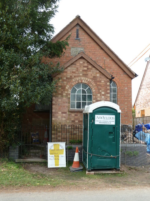
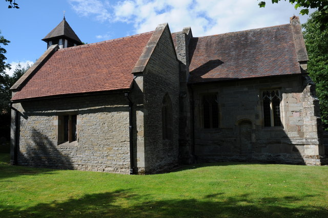
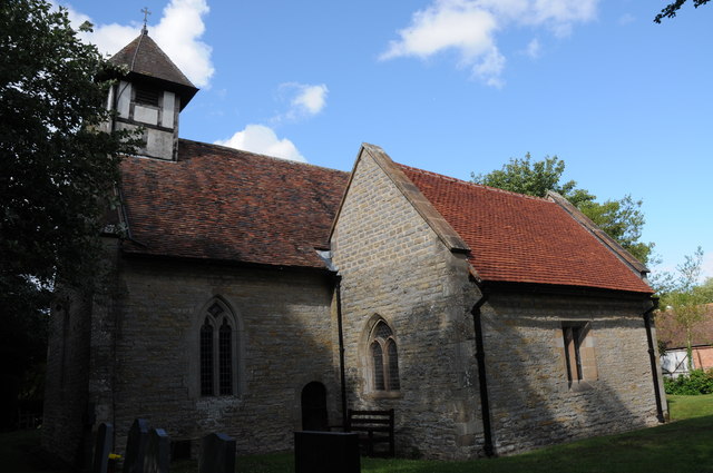
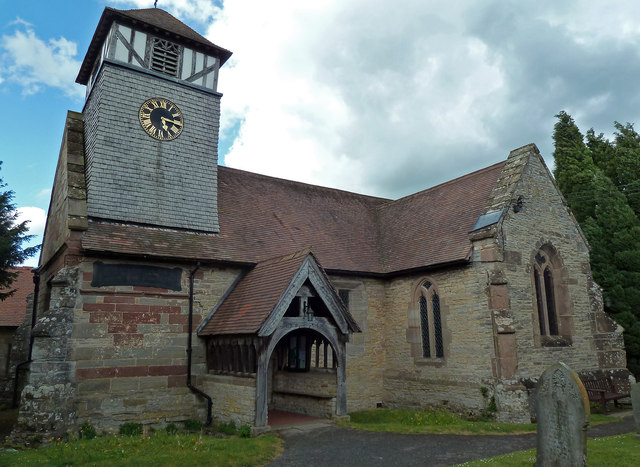
Despite its small size, Huddington boasts a close-knit community. The village has a local church, St. James the Great, which serves as a focal point for religious and community gatherings. Additionally, there is a village hall that hosts various events and social activities throughout the year.

While Huddington may be a peaceful and idyllic village, it is conveniently located near larger towns and cities. Worcester provides access to a wider range of amenities, including shopping centers, restaurants, and entertainment venues, and is easily accessible by car or public transport.

If you have any feedback on the listing, please let us know in the comments section below.

Huddington Images

Images are sourced within 2km of 52.21449/-2.084435 or Grid Reference SO9457. Thanks to Geograph Open Source API. All images are credited.

Sale Green Methodist Church I am not sure whether this is currently a functioning church/chapel.
Sale Green Methodist Church
I am not sure whether this is currently a functioning church/chapel.
Path in Trench Wood
Path in Trench Wood
Froxmere Court chimneys All the chimneys on Froxmere Court are different, showing beautiful brickwork.
Froxmere Court chimneys
All the chimneys on Froxmere Court are different, showing beautiful brickwork.
Path through Pope's Wood Path through Pope's Wood, part of the Worcestershire Wildlife Nature Reserve of Trench Wood near Sale Green.
Path through Pope's Wood
Path through Pope's Wood, part of the Worcestershire Wildlife Nature Reserve of Trench Wood near Sale Green.
Wheatfield at Sale Green View across a field of wheat from a footpath near Sale Green.  The buildings of Diamond Hall Farm can be seen in the middle distance with Bredon Hill on the distant horizon.
Wheatfield at Sale Green
View across a field of wheat from a footpath near Sale Green. The buildings of Diamond Hall Farm can be seen in the middle distance with Bredon Hill on the distant horizon.
Huddington church Huddington church is dedicated to St James and it is situated close to Huddington Court, so close in fact that to access it one has to cross the lawn of the court.  The nave of church dates back to the Norman period.
Huddington church
Huddington church is dedicated to St James and it is situated close to Huddington Court, so close in fact that to access it one has to cross the lawn of the court. The nave of church dates back to the Norman period.
Minor road from Dunhampstead to near Sale Green & Himbleton Trench Wood is on the right.
Minor road from Dunhampstead to near Sale Green & Himbleton
Trench Wood is on the right.
View to Sale Green From the footpath beside Salegreen Wood.
View to Sale Green
From the footpath beside Salegreen Wood.
A long time since this was used Old stile at the path junction/division near Salegreen Wood.
A long time since this was used
Old stile at the path junction/division near Salegreen Wood.
Path between houses and gardens,  Sale Green
Path between houses and gardens, Sale Green
Lane alongside Rabbit Wood Looking north towards Himbleton.
Lane alongside Rabbit Wood
Looking north towards Himbleton.
Footpath across pasture to Saldons Farm This scene is not surprisingly very similar to <a href="https://www.geograph.org.uk/photo/846703">SO9558 : Saldons Farm, near Himbleton</a> taken 5 years previously.
Footpath across pasture to Saldons Farm
This scene is not surprisingly very similar to SO9558 : Saldons Farm, near Himbleton taken 5 years previously.
Mill Lane, Huddington This minor road had a surprisingly small amount of traffic using it on this June afternoon.
Mill Lane, Huddington
This minor road had a surprisingly small amount of traffic using it on this June afternoon.
Leafy lane Minor road from Grafton to Huddington.
Leafy lane
Minor road from Grafton to Huddington.
Church - Himbleton Dedicated to St Mary Magdalene with a weather-boarded tower dating to the 15th century (allegedly) One of many pretty churches in Worcestershire.
Church - Himbleton
Dedicated to St Mary Magdalene with a weather-boarded tower dating to the 15th century (allegedly) One of many pretty churches in Worcestershire.
Access to the sewage works near Froxmere
Disused windpump near Crowle One of several disused windpumps in this corner of Worcestershire.
Disused windpump near Crowle
One of several disused windpumps in this corner of Worcestershire.
Show me another place!

Huddington is located at Grid Ref: SO9457 (Lat: 52.21449, Lng: -2.084435)

Administrative County: Worcestershire

District: Wychavon

Police Authority: West Mercia

What 3 Words

///lookout.acoustics.bills. Near Kington, Worcestershire

Related Wikis

Huddington

Huddington is a village in Worcestershire, England. == Location == Huddington is located 5 miles (8.0 km) east of Worcester and 5 miles (8.0 km) south...
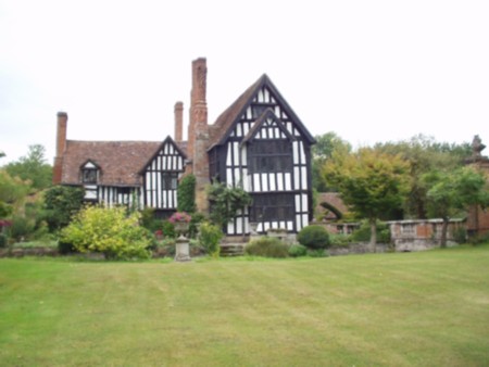
Huddington Court

Huddington Court is a 15th-century moated manor house in the village of Huddington in Worcestershire, England, some six miles east of Worcester. It was...

Himbleton

Himbleton is a village in Worcestershire, England. It lies about 5 miles (8.0 km) south-east of Droitwich and 7.5 miles (12.1 km) north-east of Worcester...

Grafton Flyford

Grafton Flyford is a village about 6 miles (9.7 km) east of Worcester, in Worcestershire, England. It neighbours Stock Green, with the large farm house...

Earls Common

Earls Common is a village in Worcestershire, England. Villages nearby include Himbleton and Stock Green.

Trench Wood

Trench Wood is a woodland area part managed by the Worcestershire Wildlife Trust and Butterfly Conservation. It is located around 6 miles (9.7 km) miles...

Dunhampstead railway station

Dunhampstead railway station served the village of Dunhampstead, Worcestershire, England, from 1841 to 1855 on the Birmingham and Gloucester Railway....

Crowle, Worcestershire

Crowle (rhymes with coal) is a village in Worcestershire, England situated 4 miles (6.4 km) east of the City of Worcester. Crowle is known for its Church...

Nearby Amenities

Located within 500m of 52.21449,-2.084435
Barrier: stile
Foot: yes
Lat/Long: 52.2172235/-2.0806975
Power: pole
Lat/Long: 52.2169901/-2.0790415
Power: pole
Lat/Long: 52.2176138/-2.0825114
Barrier: stile
Foot: yes
Lat/Long: 52.2178769/-2.080839
Power: pole
Lat/Long: 52.2172341/-2.0810964
Barrier: stile
Foot: yes
Lat/Long: 52.2161124/-2.0804209
Post Box
Collection Times: Mo-Fr 16:00; Sa 08:45
Post Box Type: lamp
Ref: WR9 319
Royal Cypher: EIIR
Royal Cypher Wikidata: Q33102113
Lat/Long: 52.2146228/-2.084821
Power: pole
Lat/Long: 52.2160352/-2.0893359
Power: pole
Lat/Long: 52.2138356/-2.0908197
Power: pole
Lat/Long: 52.2131486/-2.091265
Power: pole
Lat/Long: 52.2182233/-2.0875367
Power: pole
Lat/Long: 52.217741/-2.0879251
Power: pole
Lat/Long: 52.2145685/-2.0903745
Power: pole
Lat/Long: 52.2155159/-2.0897758
Power: pole
Lat/Long: 52.218394/-2.0853856
Barrier: stile
Foot: yes
Lat/Long: 52.2132457/-2.0820822
Huddington
Place: hamlet
Source: OS_OpenData_StreetView
Lat/Long: 52.2149023/-2.0844224
Power: pole
Lat/Long: 52.2113935/-2.0800665
Power: pole
Lat/Long: 52.2119893/-2.0805949
Power: pole
Lat/Long: 52.2125957/-2.0811488
Power: pole
Lat/Long: 52.2132597/-2.0813218
Power: pole
Lat/Long: 52.2137585/-2.0819145
Power: pole
Lat/Long: 52.2143057/-2.082573
Power: pole
Lat/Long: 52.2148242/-2.0831645
Power: pole
Lat/Long: 52.2153288/-2.0837908
Huddington
Power: pole
Transformer: distribution
Voltage Primary: 11000
Lat/Long: 52.2149902/-2.0848884
Power: pole
Lat/Long: 52.2151757/-2.0853184
Power: pole
Lat/Long: 52.2154089/-2.0858587
Power: pole
Lat/Long: 52.2158316/-2.0868277
Power: pole
Lat/Long: 52.2162581/-2.0878053
Power: pole
Lat/Long: 52.2166673/-2.0888266
The data included in this document is from www.openstreetmap.org. The data is made available under ODbL.

Have you been to Huddington?

Leave your review of Huddington below (or comments, questions and feedback).