Bridge End Hill

Hill, Mountain in Peeblesshire

Scotland

Bridge End Hill

Paddle boarders at St Mary’s Loch This telephoto shot was taken from a clear fell area on Oxcleuch Rig.
Paddle boarders at St Mary’s Loch Credit: Walter Baxter

Bridge End Hill is a prominent hill located in Peeblesshire, a county in the Scottish Borders region of Scotland. It is situated near the town of Peebles and is part of the stunning landscape of the Southern Uplands. With an elevation of approximately 346 meters (1,135 feet), Bridge End Hill offers breathtaking panoramic views of the surrounding countryside.

The hill is easily accessible and popular among hikers and nature enthusiasts. It features well-maintained trails that wind through its gentle slopes, making it an ideal destination for both experienced walkers and those seeking a leisurely stroll in nature. The paths are surrounded by lush greenery, colorful wildflowers, and diverse wildlife, providing visitors with a serene and tranquil atmosphere.

At the summit of Bridge End Hill, walkers are rewarded with remarkable vistas that stretch across the rolling hills and valleys of Peeblesshire. On clear days, it is possible to see as far as the Pentland Hills to the north and the Moffat Hills to the south. The view of the nearby River Tweed meandering through the landscape adds to the scenic beauty of the area.

Bridge End Hill holds historical significance as well. The hill is believed to have been an Iron Age hillfort, with remnants of ancient earthworks still visible in some areas. These archaeological features provide a glimpse into the rich history of the region.

Overall, Bridge End Hill in Peeblesshire is a captivating destination for nature lovers, history enthusiasts, and anyone seeking a peaceful escape in the picturesque Scottish countryside.

If you have any feedback on the listing, please let us know in the comments section below.

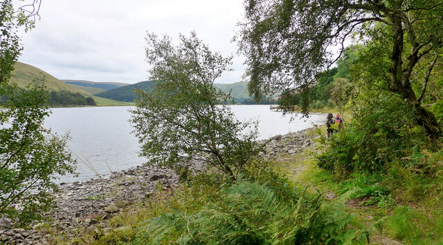
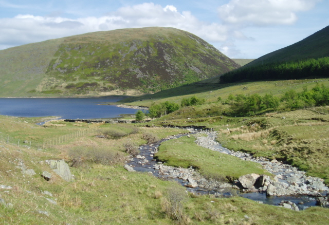
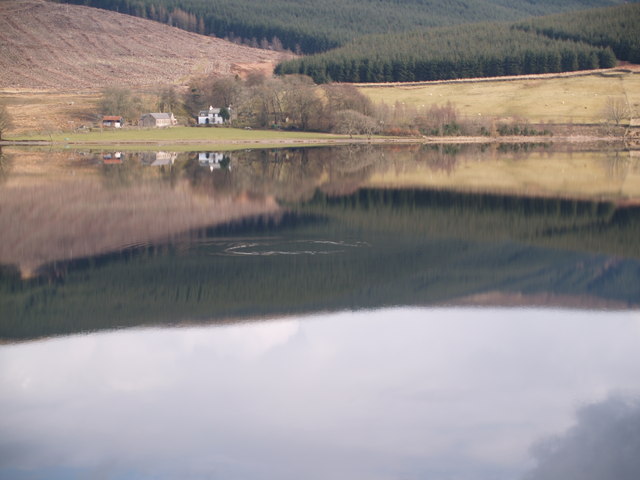
Bridge End Hill Images

Images are sourced within 2km of 55.487528/-3.2175717 or Grid Reference NT2322. Thanks to Geograph Open Source API. All images are credited.

Paddle boarders at St Mary’s Loch This telephoto shot was taken from a clear fell area on Oxcleuch Rig.
Paddle boarders at St Mary’s Loch
This telephoto shot was taken from a clear fell area on Oxcleuch Rig.
Tess and Skye having a ball I photographed these dogs at the Loch of the Lowes as they were having fun chasing a ball. Their owner said they were called Tess and Skye.
Tess and Skye having a ball
I photographed these dogs at the Loch of the Lowes as they were having fun chasing a ball. Their owner said they were called Tess and Skye.
The road to Tibbie Shiels Inn Sadly no longer an inn.
The road to Tibbie Shiels Inn
Sadly no longer an inn.
Camping at Loch of the Lowes Low cloud lies over the loch;  it was to clear later to a warm humid day.
Camping at Loch of the Lowes
Low cloud lies over the loch; it was to clear later to a warm humid day.
Misty day on St Mary's Loch The sailing club pontoon just visible to the right.
Misty day on St Mary's Loch
The sailing club pontoon just visible to the right.
The St Mary's Loch Sailing Club Getting ready for Saturday racing.
The St Mary's Loch Sailing Club
Getting ready for Saturday racing.
From March Wood looking back to the sailing club A blink of sun is breaking through the morning low cloud.
From March Wood looking back to the sailing club
A blink of sun is breaking through the morning low cloud.
St Mary's Loch Looking across to Cappercleuch.
St Mary's Loch
Looking across to Cappercleuch.
Looking over St Mary's Loch to Rodono House
Sculpture by St Mary's Loch This is part of Matt Baker's sculpture "Shinglehook".  This is one of the original oak anchors
Sculpture by St Mary's Loch
This is part of Matt Baker's sculpture "Shinglehook". This is one of the original oak anchors
On the Ring of the Loch walk around St Mary's Loch
War memorial at the road junction The minor road up to the Megget Reservoir and Talla meets the A708 here.
War memorial at the road junction
The minor road up to the Megget Reservoir and Talla meets the A708 here.
The A708 crosses the Megget Water St Mary's Loch is just visible in the distance.
The A708 crosses the Megget Water
St Mary's Loch is just visible in the distance.
On the Ring of the Loch walk around St Mary's Loch At this point there is just room for a path between the A708 and St Mary's Loch itself.
On the Ring of the Loch walk around St Mary's Loch
At this point there is just room for a path between the A708 and St Mary's Loch itself.
On the Ring of the Loch walk around St Mary's Loch At this point the path follows the shore of the loch closely.  If the water level is high walking on the road would be required.  After the period of drought just experienced, this is not a problem here.
On the Ring of the Loch walk around St Mary's Loch
At this point the path follows the shore of the loch closely. If the water level is high walking on the road would be required. After the period of drought just experienced, this is not a problem here.
Large boathouse by St Mary's Loch
Rodono Cottage on the A708
Dinghy sailing at the St Mary's Loch Sailing Club
Show me another place!

Bridge End Hill is located at Grid Ref: NT2322 (Lat: 55.487528, Lng: -3.2175717)

Unitary Authority: The Scottish Borders

Police Authority: The Lothians and Scottish Borders

What 3 Words

///prouder.sudden.bill. Near Ettrick, Scottish Borders

Nearby Locations

Bridge End Hill

Related Wikis

Megget Water

Megget Water is a river in the parish of Yarrow, Selkirkshire in the Scottish Borders area of Scotland. The Water rises at Broad Law (2,760 ft), passes...

Cappercleuch

Cappercleuch is a settlement on the A708, at St. Mary's Loch in the Scottish Borders area of Scotland, in the historic county of Selkirkshire. Places nearby...

St Mary's Loch

St Mary's Loch is the largest natural loch in the Scottish Borders, and is situated on the south side of the A708 road between Selkirk and Moffat, about...

Bowerhope

Bowerhope is a village off the A708, in the Scottish Borders area of Scotland, on the banks of St Mary's Loch in Ettrick Forest. == See also == List of...

Nearby Amenities

Located within 500m of 55.487528,-3.2175717
Bridge End Hill
Corbett: no
Graham: no
Munro: no
Natural: peak
Lat/Long: 55.4876945/-3.2192508
The data included in this document is from www.openstreetmap.org. The data is made available under ODbL.

Have you been to Bridge End Hill?

Leave your review of Bridge End Hill below (or comments, questions and feedback).