White Cleuch Hill

Hill, Mountain in Selkirkshire

Scotland

White Cleuch Hill

ATV track and a grouse butt on Waddyside Rig Looking along the ridge to Langhaugh Hill.
ATV track and a grouse butt on Waddyside Rig Credit: wrobison

White Cleuch Hill is a prominent landmark located in Selkirkshire, Scotland. It stands at an elevation of approximately 475 meters (1560 feet) above sea level and is classified as a hill rather than a mountain.

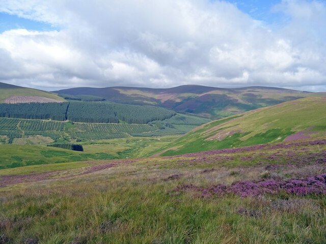
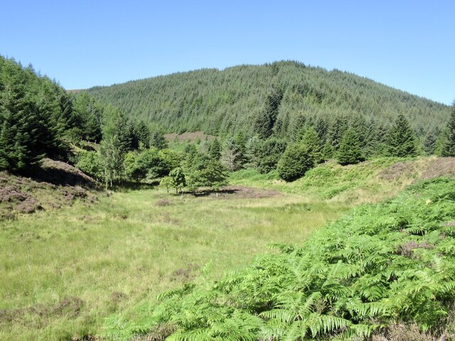
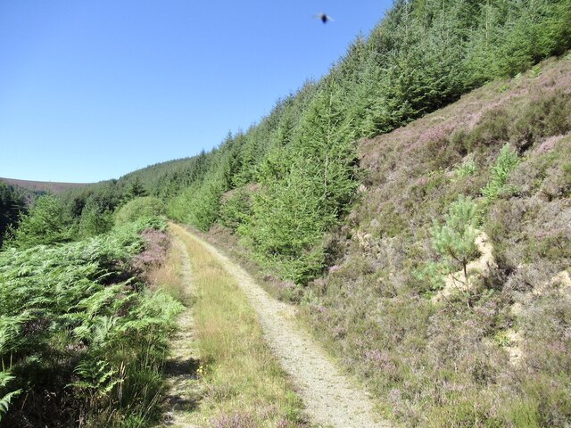
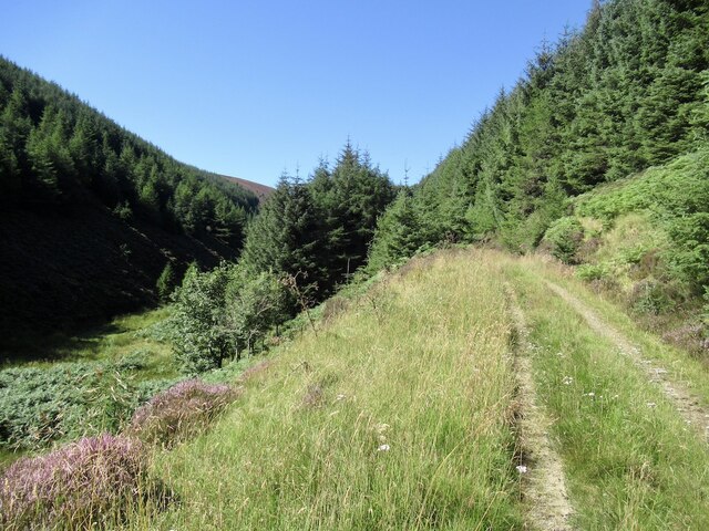
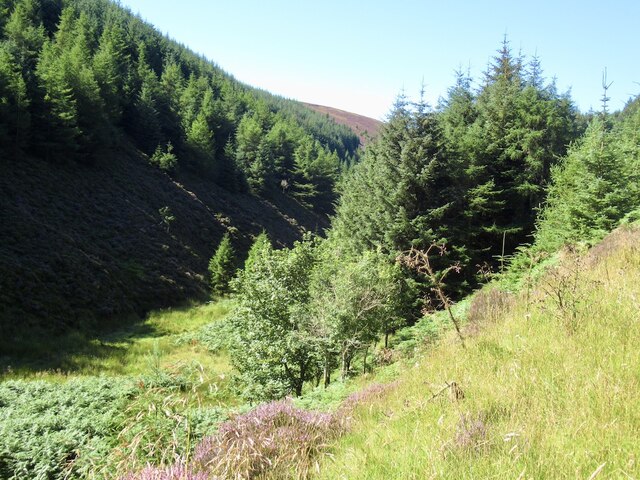
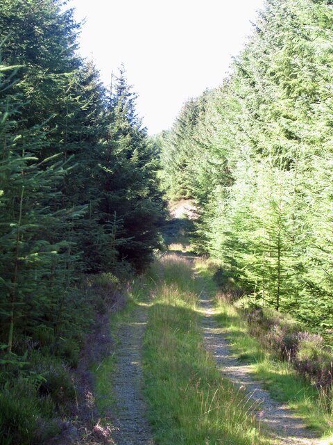
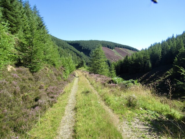
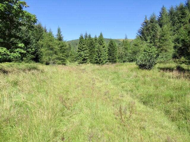
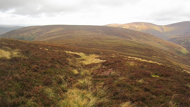
The hill is characterized by its distinctive conical shape and is part of the Moffat Hills range. It is situated in a rural area, surrounded by picturesque landscapes and rolling countryside. It lies to the south of the village of Tweedsmuir and is easily accessible via a network of footpaths and trails.

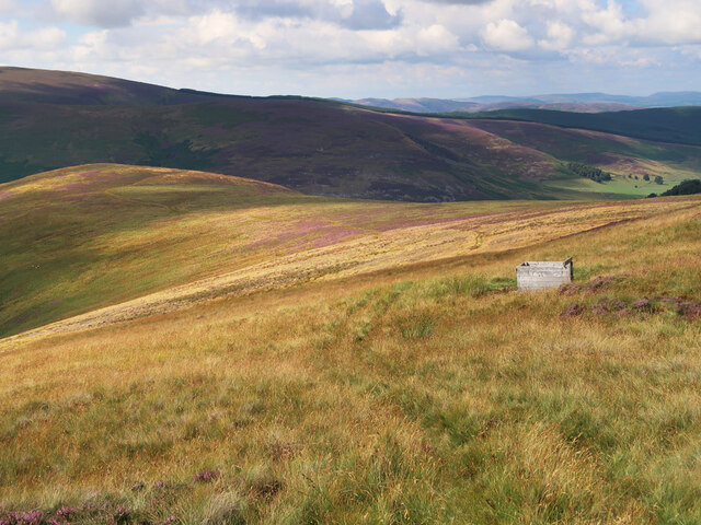
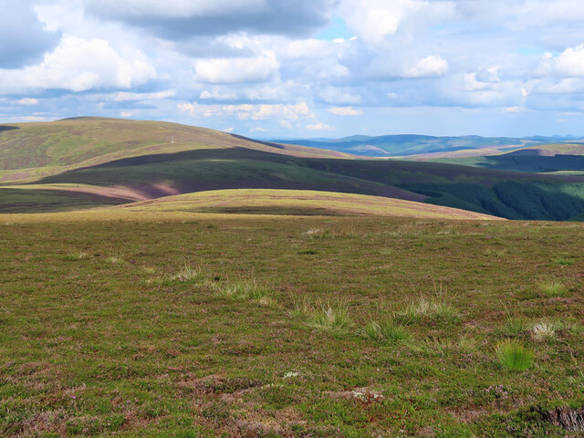
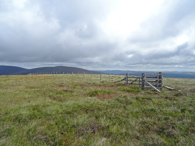
The summit of White Cleuch Hill offers panoramic views of the surrounding countryside, including the nearby Talla Reservoir and the Moffat Water Valley. On a clear day, it is possible to see as far as the Southern Uplands and the Pentland Hills. The hill is a popular destination for hikers and nature enthusiasts, offering a peaceful and tranquil setting away from the hustle and bustle of urban life.

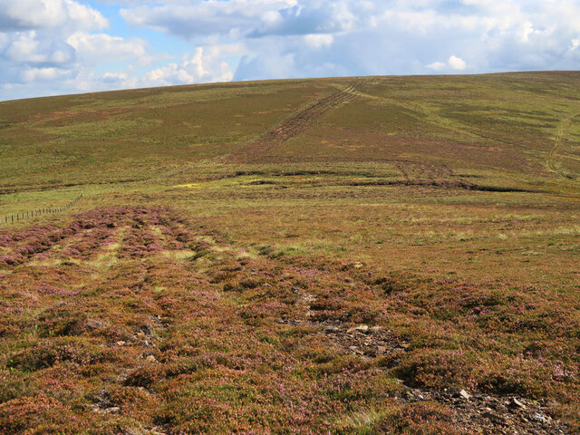
The vegetation on White Cleuch Hill is primarily heather and grassland, providing habitat for various species of birds and wildlife. It is not uncommon to spot red grouse, skylarks, and pheasants during a visit to the hill. The area is also rich in historical and archaeological significance, with remnants of ancient settlements and structures scattered across the landscape.

Overall, White Cleuch Hill is an enchanting natural feature, offering breathtaking views, diverse flora and fauna, and a sense of tranquility that attracts visitors from near and far.

If you have any feedback on the listing, please let us know in the comments section below.

White Cleuch Hill Images

Images are sourced within 2km of 55.555687/-3.2231349 or Grid Reference NT2229. Thanks to Geograph Open Source API. All images are credited.

ATV track and a grouse butt on Waddyside Rig Looking along the ridge to Langhaugh Hill.
ATV track and a grouse butt on Waddyside Rig
Looking along the ridge to Langhaugh Hill.
View ENE from Black Cleuch Hill A view along the ridge to Dun Rig on the left and the distant Eildon Hills on the extreme right.
View ENE from Black Cleuch Hill
A view along the ridge to Dun Rig on the left and the distant Eildon Hills on the extreme right.
Tracks on Blackhouse Heights The broad track goes round the boggy area at the col then follows the fence line over Blackhouse Heights.
Tracks on Blackhouse Heights
The broad track goes round the boggy area at the col then follows the fence line over Blackhouse Heights.
Waddyside Rig Climbing Waddyside Rig above Manor Valley on the way to Black Law. Pykestone Hill is the prominent one on the skyline. Colours in the vegetation starting to look autumnal.
Waddyside Rig
Climbing Waddyside Rig above Manor Valley on the way to Black Law. Pykestone Hill is the prominent one on the skyline. Colours in the vegetation starting to look autumnal.
Black Cleuch Hill Summit On the summit of the subsidiary Donald top of Black Cleuch Hill looking towards Dun Rig - a Graham.
Black Cleuch Hill Summit
On the summit of the subsidiary Donald top of Black Cleuch Hill looking towards Dun Rig - a Graham.
Whitegrain Rig Between two headwaters of the Douglas Burn.
Whitegrain Rig
Between two headwaters of the Douglas Burn.
Track up White Grain
White Grain A headwater of the Douglas Burn
White Grain
A headwater of the Douglas Burn
Track up the White Grain
Road, White Grain Photobombed by one of the cloud of flies that accompanied me up the cleuch.
Road, White Grain
Photobombed by one of the cloud of flies that accompanied me up the cleuch.
View up Long Grain A very North American feel here. There is a road but it is well grassed over.
View up Long Grain
A very North American feel here. There is a road but it is well grassed over.
An old path An old path cut into the side of the hill provided a brief respite from the heavy going through heather and bogs. The hill in the background is Horse Hope Hill.
An old path
An old path cut into the side of the hill provided a brief respite from the heavy going through heather and bogs. The hill in the background is Horse Hope Hill.
Black Cleuch Hill A mix of heather and tussocky grass on Blackhouse Heights.
Black Cleuch Hill
A mix of heather and tussocky grass on Blackhouse Heights.
Black Cleuch Hill Many of the ridges around Glenrath Hope have deep furrows along them. I am not sure if they are dug deliberately or the result of careless vehicle use. They are healing slowly.
Black Cleuch Hill
Many of the ridges around Glenrath Hope have deep furrows along them. I am not sure if they are dug deliberately or the result of careless vehicle use. They are healing slowly.
Black Cleuch Hill The west ridge shortly after the furrowed strip left the decaying fence for Linghope.
Black Cleuch Hill
The west ridge shortly after the furrowed strip left the decaying fence for Linghope.
Black Cleuch Hill Furrows on Black Cleuch Hill. Not sure if dug deliberately or vehicle erosion.
Black Cleuch Hill
Furrows on Black Cleuch Hill. Not sure if dug deliberately or vehicle erosion.
Black Cleuch Hill The summit, where a decayed fence meets a newer one in good condition.
Black Cleuch Hill
The summit, where a decayed fence meets a newer one in good condition.
Show me another place!

White Cleuch Hill is located at Grid Ref: NT2229 (Lat: 55.555687, Lng: -3.2231349)

Unitary Authority: The Scottish Borders

Police Authority: The Lothians and Scottish Borders

What 3 Words

///awaited.values.barstool. Near Peebles, Scottish Borders

Related Wikis

Black Law (hill)

Black Law is a hill in the Manor Hills range, part of the Southern Uplands of Scotland. One of the more remote Donalds, it does not easily combine into...

Manor Hills

The Manor Hills, also known as the Tweedsmuir Hills, are a range of hills south of Peebles in the Scottish Borders, one of the ranges which collectively...

Dun Rig

Dun Rig is a hill in the Manor Hills range, part of the Southern Uplands of Scotland. It is the highest hill in the northernmost cluster of the Manor Hills...
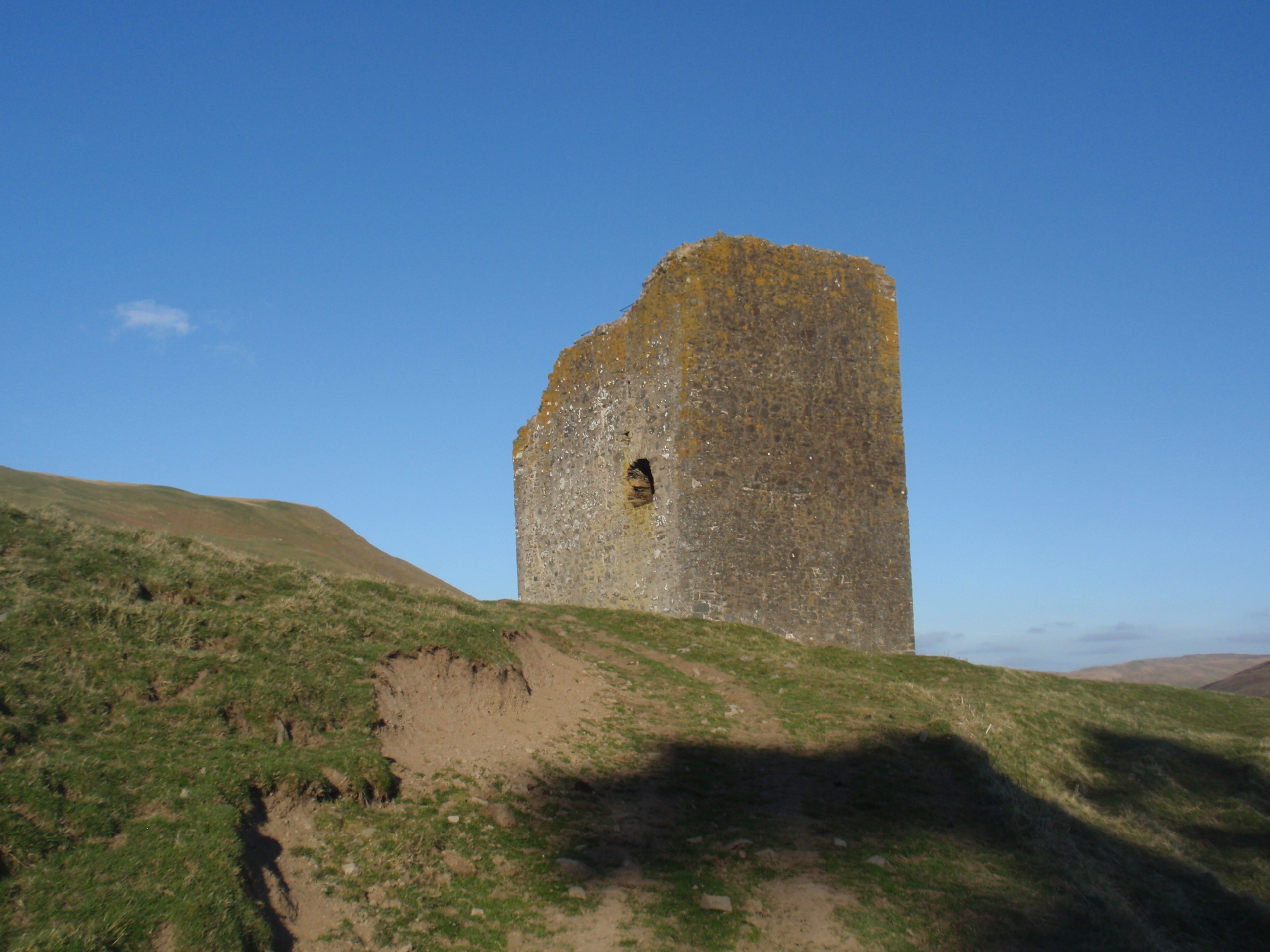
Posso Tower

Posso Tower is a 16th-century tower house, about 6.0 miles (9.7 km) south and west of Peebles, Scottish Borders, Scotland, and west of Manor Water. �...
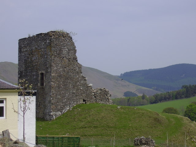
Castlehill Tower

Castlehill Tower, also known as Castle Hill of Manor, is a ruined oblong tower house dating from the end of the 15th century, situated in the parish of...

Dryhope Tower

Dryhope Tower is a ruined Scottish peel tower in the valley of the Yarrow Water, in the historic county of Selkirkshire, now part of the Scottish Borders...

Dryhope

Dryhope is a village in the Scottish Borders area of Scotland, by St. Mary's Loch, on the A708. Known for its rolling green hills and ample walking paths...

Craigierig

Craigierig is a village on the Megget Reservoir, in the Scottish Borders area of Scotland, in the former Selkirkshire. Places nearby include the Glengaber...

Have you been to White Cleuch Hill?

Leave your review of White Cleuch Hill below (or comments, questions and feedback).