Hucclecote

Settlement in Gloucestershire Gloucester

England

Hucclecote

Barnwood The Church of St Lawrence
Barnwood Credit: David Stowell

Hucclecote is a suburban area located in the county of Gloucestershire, England. Situated approximately four miles east of the city center of Gloucester, Hucclecote falls within the borough of Tewkesbury. The area is primarily residential, characterized by a mix of housing types including detached and semi-detached houses, as well as some modern apartment complexes.

Hucclecote benefits from its proximity to major transportation routes, including the M5 motorway and the A417 dual carriageway, providing convenient access to neighboring towns and cities. The area is well-served by public transportation, with regular bus services connecting Hucclecote to Gloucester, Cheltenham, and other nearby towns.

Residents of Hucclecote enjoy a range of amenities and services within the area. The local shopping center offers a variety of stores, supermarkets, and eateries, ensuring that daily needs are easily met. There are also several schools in the area, providing education options for families with children.

For recreational activities, Hucclecote benefits from its proximity to the beautiful Cotswolds, a designated Area of Outstanding Natural Beauty. The Cotswold Hills offer stunning landscapes, charming villages, and numerous walking and cycling routes for outdoor enthusiasts.

Overall, Hucclecote offers a peaceful suburban lifestyle with easy access to both urban amenities and the natural beauty of the surrounding countryside.

If you have any feedback on the listing, please let us know in the comments section below.
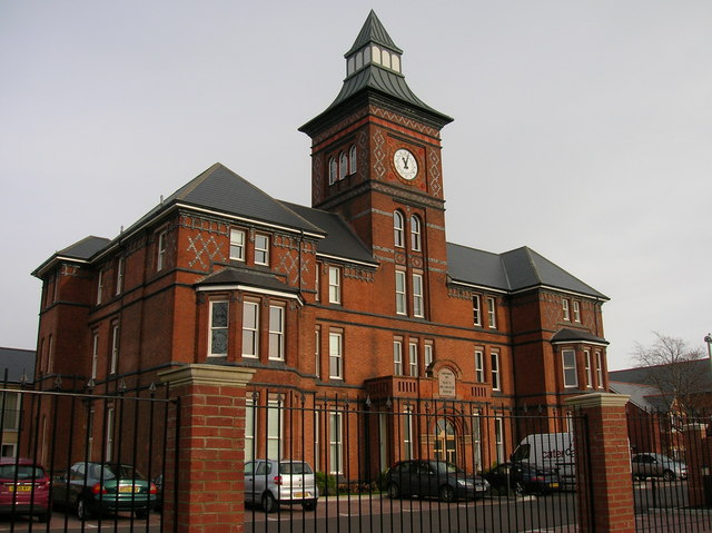
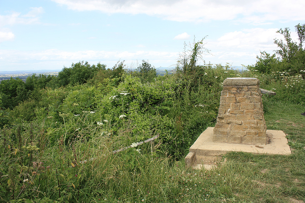
Hucclecote Images

Images are sourced within 2km of 51.852647/-2.195681 or Grid Reference SO8617. Thanks to Geograph Open Source API. All images are credited.

Barnwood The Church of St Lawrence
Barnwood
The Church of St Lawrence
Barnwood Barnwood Avenue, complete with May Blossom
Barnwood
Barnwood Avenue, complete with May Blossom
Gloucester Business Park - Montpellier Court Built on the site of the wartime Gloster Aircraft factory the Gloucester Business Park sprawls over four grid squares.  This section of the park contains modern office buildings.
Gloucester Business Park - Montpellier Court
Built on the site of the wartime Gloster Aircraft factory the Gloucester Business Park sprawls over four grid squares. This section of the park contains modern office buildings.
Gloucester Business Park Built on the site of the wartime Gloster Aircraft factory, this section of the Gloucester Business Park contains light industrial and warehousing buildings
Gloucester Business Park
Built on the site of the wartime Gloster Aircraft factory, this section of the Gloucester Business Park contains light industrial and warehousing buildings
Plaque Commemorating Gloster Aircraft Factory The Gloster B28/39

First British Jet Aircraft

Designed and constructed by Gloster Aircraft Company Ltd. a member of the Hawker Siddeley Group on this site during 1940-41 and powered by the first jet engine invented by Sir Frank Whittle

This plaque is also a tribute to all GAC personnel who contributed so much to the 1939-45 war effort

Commemorative plaque designed by Gloster Design Services (e&b) ltd.
Plaque Commemorating Gloster Aircraft Factory
The Gloster B28/39 First British Jet Aircraft Designed and constructed by Gloster Aircraft Company Ltd. a member of the Hawker Siddeley Group on this site during 1940-41 and powered by the first jet engine invented by Sir Frank Whittle This plaque is also a tribute to all GAC personnel who contributed so much to the 1939-45 war effort Commemorative plaque designed by Gloster Design Services (e&b) ltd.
Kingscroft Road, Hucclecote Some of the older houses on this road. Hucclecote was at one time a village on the   road from Gloucester to Cirencester but has now been absorbed as the suburbs of Gloucester.
Kingscroft Road, Hucclecote
Some of the older houses on this road. Hucclecote was at one time a village on the road from Gloucester to Cirencester but has now been absorbed as the suburbs of Gloucester.
Kingscroft Road, Hucclecote Looking west along Kingscroft Road.
Kingscroft Road, Hucclecote
Looking west along Kingscroft Road.
Royal Oak, Hucclecote This public house was in the centre of the village of Hucclecote and was extended in the 1960s to serve the housing developments that accompanied the growth of the boundaries of Gloucester to engulf the village.
Royal Oak, Hucclecote
This public house was in the centre of the village of Hucclecote and was extended in the 1960s to serve the housing developments that accompanied the growth of the boundaries of Gloucester to engulf the village.
Hucclecote Millennium Garden Located in the corner of Hucclecote Road and Porchester Road, with Hucclecote Court on the right.
Hucclecote Millennium Garden
Located in the corner of Hucclecote Road and Porchester Road, with Hucclecote Court on the right.
Hucclecote Court Once a country house, this building right on the eastern edge of the square is now home to a firm of solicitors.
Hucclecote Court
Once a country house, this building right on the eastern edge of the square is now home to a firm of solicitors.
Supermarket Barnwood On a badly designed business estate with only one road exit onto a bypass
Supermarket Barnwood
On a badly designed business estate with only one road exit onto a bypass
Tenpin bowling centre Barnwood leisure area View from Sainsbury's carpark across Corinium Avenue
Tenpin bowling centre Barnwood leisure area
View from Sainsbury's carpark across Corinium Avenue
Zoons Court Farm from bridge over A417
Zoons Court Roundabout A417 from overbridge A very awkward roundabout joining the Brockworth bypass to the older Hucclecote bypass
Zoons Court Roundabout A417 from overbridge
A very awkward roundabout joining the Brockworth bypass to the older Hucclecote bypass
The Turmut Hoer Abbeymead A turmut hoer hoes turnips!
The Turmut Hoer Abbeymead
A turmut hoer hoes turnips!
Abbeymead Primary School
Curlew Road Gloucester The houses in this part of town all face onto the wrong road, the address being the vehicle access at the back, very confusing for visitors and deliverymen.
Curlew Road Gloucester
The houses in this part of town all face onto the wrong road, the address being the vehicle access at the back, very confusing for visitors and deliverymen.
Noake Court Farm Very close to the complex Junction 11A on the M5.
Noake Court Farm
Very close to the complex Junction 11A on the M5.
Show me another place!

Hucclecote is located at Grid Ref: SO8617 (Lat: 51.852647, Lng: -2.195681)

Administrative County: Gloucestershire

District: Gloucester

Police Authority: Gloucestershire

What 3 Words

///soda.scope.joke. Near Barnwood, Gloucestershire

Nearby Locations

Hucclecote

Related Wikis

Abbeydale and Abbeymead

Abbeydale and Abbeymead are modern suburbs of the city of Gloucester in the county of Gloucestershire, England. They lie approximately 3 miles south-east...

Hucclecote (parish)

Hucclecote is a civil parish in the Tewkesbury district, in the county of Gloucestershire, England. As of 2019, it has a population of 2,703. The parish...

Coney Hill Hospital

Coney Hill Hospital (also known as Second Gloucestershire County Asylum) was a mental health facility in Gloucester, England. == History == The hospital...

Barnwood House Hospital

Barnwood House Hospital was a private mental hospital in Barnwood, Gloucester, England. It was founded by the Gloucester Asylum Trust in 1860 as Barnwood...

Nearby Amenities

Located within 500m of 51.852647,-2.195681
Traffic Signals
Lat/Long: 51.8535387/-2.2016723
Barrier: kissing_gate
Bicycle: no
Foot: yes
Horse: no
Motor Vehicle: no
Lat/Long: 51.8513644/-2.195093
Barrier: kissing_gate
Lat/Long: 51.8523554/-2.197818
Turning Circle
Lat/Long: 51.850052/-2.1909182
Crossing
Bicycle: designated
Crossing: traffic_lights
Foot: designated
Lat/Long: 51.8509629/-2.20042
Created By: Potlatch 0.10f
Shop: convenience
Lat/Long: 51.8530504/-2.1911859
Bus Stop
Roman Road
Bus: yes
Departures Board: timetable
Naptan AtcoCode: 1600GL13
Naptan Bearing: S
Naptan CommonName: Roman Rd
Naptan NaptanCode: glodjdat
Naptan PlusbusZoneRef: GLOSTER
Naptan Street: Abbeymead Ave
Naptan Verified: no
Public Transport: platform
Shelter: yes
Source: naptan_import
Lat/Long: 51.8520485/-2.200006
Bus Stop
Roman Road
Bus: yes
Departures Board: timetable
Naptan AtcoCode: 1600GL14
Naptan Bearing: N
Naptan CommonName: Roman Rd
Naptan Indicator: Opp
Naptan NaptanCode: glodjdaj
Naptan PlusbusZoneRef: GLOSTER
Naptan Street: Abbeymead Ave
Naptan Verified: no
Public Transport: platform
Shelter: yes
Source: naptan_import
Lat/Long: 51.8523901/-2.2001915
Bus Stop
Bishops Road
Bus: yes
Departures Board: no
Naptan AtcoCode: 1600GL19
Naptan Bearing: S
Naptan CommonName: Bishops Rd
Naptan NaptanCode: glodjatw
Naptan PlusbusZoneRef: GLOSTER
Naptan Street: Abbeymead Ave
Naptan Verified: no
Public Transport: platform
Shelter: no
Source: naptan_import
Lat/Long: 51.8495407/-2.2007342
Bus Stop
North Upton Lane
Bus: yes
Departures Board: no
Naptan AtcoCode: 1600GL23
Naptan Bearing: E
Naptan CommonName: North Upton Ln
Naptan NaptanCode: glodjadg
Naptan PlusbusZoneRef: GLOSTER
Naptan Street: Abbeymead Ave
Naptan Verified: no
Public Transport: platform
Shelter: no
Source: naptan_import
Lat/Long: 51.8536804/-2.2024171
Bus Stop
Quail Close School stop
Naptan AtcoCode: 1600GLA06380
Naptan Bearing: SW
Naptan BusStopType: CUS
Naptan CommonName: Quail Close School stop
Naptan NaptanCode: glogpmgw
Naptan Street: North Upton Lane
Naptan Verified: no
Source: naptan_import
Lat/Long: 51.854463/-2.2007899
Bus Stop
Newstead Road school stop
Naptan AtcoCode: 1600GLA90878
Naptan Bearing: NE
Naptan BusStopType: CUS
Naptan CommonName: Newstead Road school stop
Naptan NaptanCode: glogptjg
Naptan Street: North Upton Lane
Naptan Verified: no
Source: naptan_import
Lat/Long: 51.854895/-2.200574
Post Box
Collection Times: Mo-Fr 17:45; Sa 12:30
Ref: GL4 143
Source: survey
Lat/Long: 51.8515068/-2.1992855
Barrier: kissing_gate
Lat/Long: 51.8533797/-2.1977605
Post Box
Lat/Long: 51.8549446/-2.1965667
Source: Bing
Tactile Paving: yes
Lat/Long: 51.8516012/-2.2015796
Source: Bing
Tactile Paving: yes
Lat/Long: 51.8515051/-2.2016762
Crossing
Bicycle: designated
Crossing: traffic_lights
Foot: designated
Lat/Long: 51.8536762/-2.2015631
Source: Bing
Tactile Paving: yes
Lat/Long: 51.8500355/-2.2008045
Tactile Paving: yes
Lat/Long: 51.8536952/-2.2016565
Source: Bing
Tactile Paving: yes
Lat/Long: 51.8500177/-2.2006703
Source: Bing
Tactile Paving: yes
Lat/Long: 51.8515996/-2.2014429
Tactile Paving: yes
Lat/Long: 51.8514753/-2.1999864
Tactile Paving: yes
Lat/Long: 51.8515432/-2.1999623
Source: Bing
Tactile Paving: yes
Lat/Long: 51.8514521/-2.2006811
Source: Bing
Tactile Paving: yes
Lat/Long: 51.8516476/-2.2006892
Source: Bing
Tactile Paving: yes
Lat/Long: 51.8515618/-2.2006624
Tactile Paving: yes
Lat/Long: 51.8536589/-2.2014643
Tactile Paving: yes
Lat/Long: 51.848888/-2.1995335
Barrier: kissing_gate
Bicycle: no
Foot: yes
Horse: no
Motor Vehicle: no
Lat/Long: 51.8516445/-2.1945278
Crossing
Crossing: unmarked
Tactile Paving: yes
Lat/Long: 51.8517409/-2.2001691
Crossing
Crossing: unmarked
Tactile Paving: yes
Lat/Long: 51.851773/-2.2003132
Barrier: kissing_gate
Lat/Long: 51.8546495/-2.1942542
Barrier: kissing_gate
Bicycle: yes
Foot: yes
Horse: no
Motor Vehicle: no
Lat/Long: 51.8536255/-2.193443
KGV Cricket Pitch
Description: KGV Cricket Pitch
Lat/Long: 51.8529951/-2.1963347
Bus Stop
The Oaks
Bus: yes
Departures Board: timetable
Public Transport: platform
Shelter: yes
Lat/Long: 51.8502449/-2.2007543
The data included in this document is from www.openstreetmap.org. The data is made available under ODbL.

Have you been to Hucclecote?

Leave your review of Hucclecote below (or comments, questions and feedback).