Castlelaw Hill

Hill, Mountain in Midlothian

Scotland

Castlelaw Hill

Memorial to C.T.R. Wilson, Nobel Prize Winner See <a title="https://www.geograph.org.uk/photo/903255" href="https://www.geograph.org.uk/photo/903255">Link</a>
Memorial to C.T.R. Wilson, Nobel Prize Winner Credit: Becky Williamson

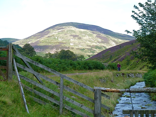
Castlelaw Hill is a prominent landmark located in Midlothian, Scotland. It is part of the Pentland Hills range and is situated approximately 10 miles south of Edinburgh city center. The hill, also known as Castlelaw Hillfort, stands at an elevation of 488 meters (1,601 feet) and offers panoramic views of the surrounding countryside.

The name Castlelaw is derived from the Old English words "castel" meaning fort or castle, and "hlaew" meaning hill. This suggests that the hill may have once been the site of a fortification or defensive structure. Archaeological evidence supports this theory, as there are remains of an Iron Age hillfort on the summit of Castlelaw.

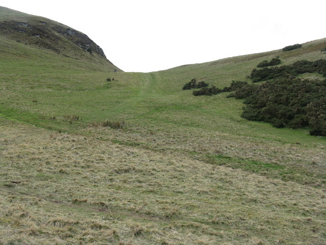
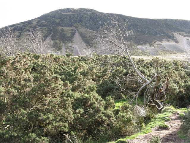
The hill is a popular destination for hikers, nature enthusiasts, and history buffs alike. Several well-marked trails lead to the summit, allowing visitors to explore the scenic countryside and take in the breathtaking vistas. The hill is home to a diverse range of plant and animal species, including heather, gorse, and various bird species.

In addition to its natural beauty, Castlelaw Hill has historical significance. The hillfort on its summit is believed to have been occupied from the Iron Age through the Roman period. It is a scheduled monument and is protected by law, ensuring its preservation for future generations.

Overall, Castlelaw Hill offers a unique blend of natural beauty, historical significance, and recreational opportunities, making it a must-visit destination for anyone exploring the Midlothian region.

If you have any feedback on the listing, please let us know in the comments section below.

Castlelaw Hill Images

Images are sourced within 2km of 55.870114/-3.2407208 or Grid Reference NT2264. Thanks to Geograph Open Source API. All images are credited.

Memorial to C.T.R. Wilson, Nobel Prize Winner See <a title="https://www.geograph.org.uk/photo/903255" href="https://www.geograph.org.uk/photo/903255">Link</a>
Memorial to C.T.R. Wilson, Nobel Prize Winner
See Link
Entrance to Kirkton Farm
Skeletal tree on north-east flanks of Turnhouse Hill Looking north-east towards Edinburgh.
Skeletal tree on north-east flanks of Turnhouse Hill
Looking north-east towards Edinburgh.
Path to Caerketton Up the embryonic Swanston Burn, this path leads under Caerketton Crags to a col between Caerketton and Allermuir Hills.
Path to Caerketton
Up the embryonic Swanston Burn, this path leads under Caerketton Crags to a col between Caerketton and Allermuir Hills.
Caerketton Hill and Craigs Looking up the Swanston Burn from the path leading down to Swanston.
Caerketton Hill and Craigs
Looking up the Swanston Burn from the path leading down to Swanston.
Easy Life Rowing boat, I think available for hire, parked on Glencorse reservoir.
Easy Life
Rowing boat, I think available for hire, parked on Glencorse reservoir.
A Stell This is a representation of a stell built by a dry stone walling group whose name now escapes me.  A stell is a shelter for animals on the hillside.  The full size version would have been bigger with a turf roof.  This one has been constructed with a stone seat for 2 legged visitors.
A Stell
This is a representation of a stell built by a dry stone walling group whose name now escapes me. A stell is a shelter for animals on the hillside. The full size version would have been bigger with a turf roof. This one has been constructed with a stone seat for 2 legged visitors.
Flotterstone Inn The Flotterstone Inn, viewed from the west.  Unfortunately I never got to sample its wares.
Flotterstone Inn
The Flotterstone Inn, viewed from the west. Unfortunately I never got to sample its wares.
Countryside Information Centre - Pentland Hills Unmanned Ranger Station with maps, local information, leaflets and toilets
Countryside Information Centre - Pentland Hills
Unmanned Ranger Station with maps, local information, leaflets and toilets
Memorial plaque to C.T.R.Wilson, physicist Born in the vicinity, at a farm near Glencorse and Easter Howgate.
Memorial plaque to C.T.R.Wilson, physicist
Born in the vicinity, at a farm near Glencorse and Easter Howgate.
Finger post at the start of several Pentland walks
Track to old filter beds plus the route to Scald Law via Turnhouse Hill - seen in the distance.
Track to old filter beds plus the route to Scald Law
via Turnhouse Hill - seen in the distance.
On the track to Turnhouse Hill, Pentlands
M.O.D. firing range on Castlelaw Hill, Pentlands Taken from the eastern slopes of Turnhouse Hill: the row of targets can be clearly seen below the dark green vegetation.
M.O.D. firing range on Castlelaw Hill, Pentlands
Taken from the eastern slopes of Turnhouse Hill: the row of targets can be clearly seen below the dark green vegetation.
Path to the upper slopes of Turnhouse Hill, Pentlands
Castlelaw Hill seen from Logan Burn Much of the hill is a restricted area due to regular military training by the M.O.D.
Castlelaw Hill seen from Logan Burn
Much of the hill is a restricted area due to regular military training by the M.O.D.
Glencorse Reservoir Built in the 19th century by the great Victorian civil engineer Thomas Telford to supply drinking water to Edinburgh. Castlelaw ahead and Turnhouse Hill to the right. The tarmacked private road leads all the way to Flotterstones and the main road to Edinburgh.
Glencorse Reservoir
Built in the 19th century by the great Victorian civil engineer Thomas Telford to supply drinking water to Edinburgh. Castlelaw ahead and Turnhouse Hill to the right. The tarmacked private road leads all the way to Flotterstones and the main road to Edinburgh.
Luxuriant heather clothes the hillside above Glencorse North-western slopes of Turnhouse Hill.
Luxuriant heather clothes the hillside above Glencorse
North-western slopes of Turnhouse Hill.
Show me another place!

Castlelaw Hill is located at Grid Ref: NT2264 (Lat: 55.870114, Lng: -3.2407208)

Unitary Authority: Midlothian

Police Authority: The Lothians and Scottish Borders

What 3 Words

///waged.tour.range. Near Bilston, Midlothian

Nearby Locations

Castlelaw Hill

Related Wikis

Castle Law

Castle Law is a hill south west of Fairmilehead in the Pentland Hills in Midlothian, Scotland. It is best known for the Iron Age hill fort on its slopes...

Glencorse Reservoir

Glencorse Reservoir is a reservoir in Midlothian, Scotland, two miles west of Glencorse, in the Pentland Hills. It is retained by an earth dam, and it...

Caerketton Hill

Caerketton Hill is a hill in the Pentland Hills range of Scotland. Standing at 478 m, it is at the northeast end of the approximately 25 km (16 mi) long...

Easter Howgate

Easter Howgate is a settlement in Midlothian, Scotland, UK, on the A702, two miles north of Penicuik. The Scottish Agricultural College maintains a teaching...

Nearby Amenities

Located within 500m of 55.870114,-3.2407208
Castlelaw Hill
Cairn: yes
Ele: 488
Munro: no
Natural: peak
Lat/Long: 55.8699321/-3.2405781
Military: warning_flag
Note: Flag/light shown when firing range in use
Lat/Long: 55.8699266/-3.2404867
The data included in this document is from www.openstreetmap.org. The data is made available under ODbL.

Have you been to Castlelaw Hill?

Leave your review of Castlelaw Hill below (or comments, questions and feedback).