Balduff Hill

Hill, Mountain in Perthshire

Scotland

Balduff Hill

View across the valley At the bottom of the glen is the Kilry burn. In this picture are Wester Derry (on the right), Burnside and Cottertown (left of centre), and Little Kilry (right of centre). Picture taken at half past eight on a mid June evening.
View across the valley Credit: Aleks Scholz

The requested URL returned error: 429 Too Many Requests

If you have any feedback on the listing, please let us know in the comments section below.
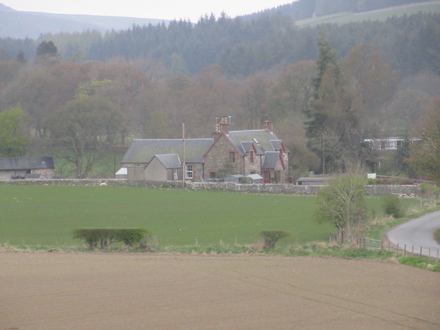
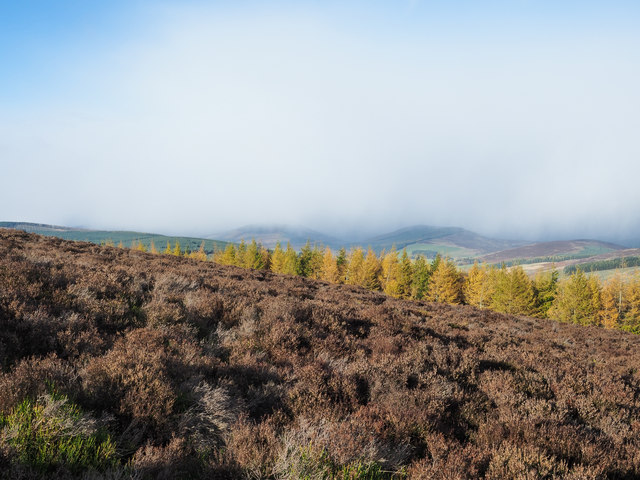
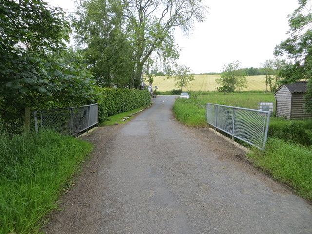
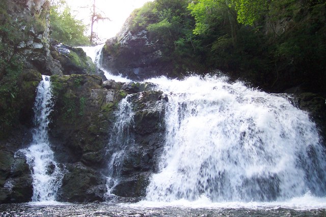
Balduff Hill Images

Images are sourced within 2km of 56.667717/-3.2669304 or Grid Reference NO2253. Thanks to Geograph Open Source API. All images are credited.

View across the valley At the bottom of the glen is the Kilry burn. In this picture are Wester Derry (on the right), Burnside and Cottertown (left of centre), and Little Kilry (right of centre). Picture taken at half past eight on a mid June evening.
View across the valley
At the bottom of the glen is the Kilry burn. In this picture are Wester Derry (on the right), Burnside and Cottertown (left of centre), and Little Kilry (right of centre). Picture taken at half past eight on a mid June evening.
The track to Over Drumhead A wind turbine on Balduff Hill on the left.
The track to Over Drumhead
A wind turbine on Balduff Hill on the left.
Ardormie Farm Ardormie Farm in morning light from the east.
Ardormie Farm
Ardormie Farm in morning light from the east.
Cateran trail signpost Signpost near Ardormie Farm on the Cateran Trail.
Cateran trail signpost
Signpost near Ardormie Farm on the Cateran Trail.
Deer on Balduff Hill Single deer on the eastern flank of Balduff Hill.
Deer on Balduff Hill
Single deer on the eastern flank of Balduff Hill.
Pillar on Balduff Hill Approaching the trig pillar on the flat summit of Balduff Hill.
Pillar on Balduff Hill
Approaching the trig pillar on the flat summit of Balduff Hill.
Trig pillar, Balduff Hill The triangulation pillar on the summit of Balduff Hill, looking south-east.
Trig pillar, Balduff Hill
The triangulation pillar on the summit of Balduff Hill, looking south-east.
Wooden bridge on the Cateran Trail Wooden Bridge constructed over a ditch on the Cateran Trail.
Wooden bridge on the Cateran Trail
Wooden Bridge constructed over a ditch on the Cateran Trail.
Sheared sheep Recently sheared sheep near Easter Derry.
Sheared sheep
Recently sheared sheep near Easter Derry.
Mid Derry Mid Derry Farm with unusual sign.
Mid Derry
Mid Derry Farm with unusual sign.
Kilry Primary School The school at Kilry from the south.
Kilry Primary School
The school at Kilry from the south.
Little Kilry Little Kilry farm, viewed from the north with Balduff Hill beyond.
Little Kilry
Little Kilry farm, viewed from the north with Balduff Hill beyond.
Cateran Way near to Ardormie The roughly vegetated route of the Cateran Way climbing between fields as it heads away from the farm at Adormie.
Cateran Way near to Ardormie
The roughly vegetated route of the Cateran Way climbing between fields as it heads away from the farm at Adormie.
Heather on northern slope of Balduff Hill Sunshine on the heather and on the golden larch trees beyond but with a shower approaching from the north.
(The shower passed over swiftly and for the first time for us in the 'winter' of 2018 / 2019, there were snowflakes mixed in with the raindrops.)
Heather on northern slope of Balduff Hill
Sunshine on the heather and on the golden larch trees beyond but with a shower approaching from the north. (The shower passed over swiftly and for the first time for us in the 'winter' of 2018 / 2019, there were snowflakes mixed in with the raindrops.)
Knaptam Hill The wooded dome of Knaptam Hill seen across the shallow valley separating it from Ardormie Hill; both hills are lesser features on ridges of the more significant Balduff Hill.
Knaptam Hill
The wooded dome of Knaptam Hill seen across the shallow valley separating it from Ardormie Hill; both hills are lesser features on ridges of the more significant Balduff Hill.
Deer fence built across hill track The rough but useable track develops on the southern slope of Balduff Hill, however the  recently installed deer fence has been constructed across the line of it so obstructing its use. What appears to be a convenient gate is not openable! It's not hinged and has the lower mesh fence attached to it! A climb is necessary!
Deer fence built across hill track
The rough but useable track develops on the southern slope of Balduff Hill, however the recently installed deer fence has been constructed across the line of it so obstructing its use. What appears to be a convenient gate is not openable! It's not hinged and has the lower mesh fence attached to it! A climb is necessary!
Minor road at Whinloans Looking north-westward.
Minor road at Whinloans
Looking north-westward.
Minor road and bridge crossing the Burn of Kilry Looking northward towards the road junction at The Old School House.
Minor road and bridge crossing the Burn of Kilry
Looking northward towards the road junction at The Old School House.
Show me another place!

Balduff Hill is located at Grid Ref: NO2253 (Lat: 56.667717, Lng: -3.2669304)

Unitary Authority: Perth and Kinross

Police Authority: Tayside

What 3 Words

///modest.bleaker.stylists. Near Alyth, Perth & Kinross

Nearby Locations

Balduff Hill

Related Wikis

Kilry Glen

Kilry Glen, in Angus, Scotland, is the glen of the Burn of Kilry, a tributary of the River Isla. It is situated west of the B954 road, approximately four...
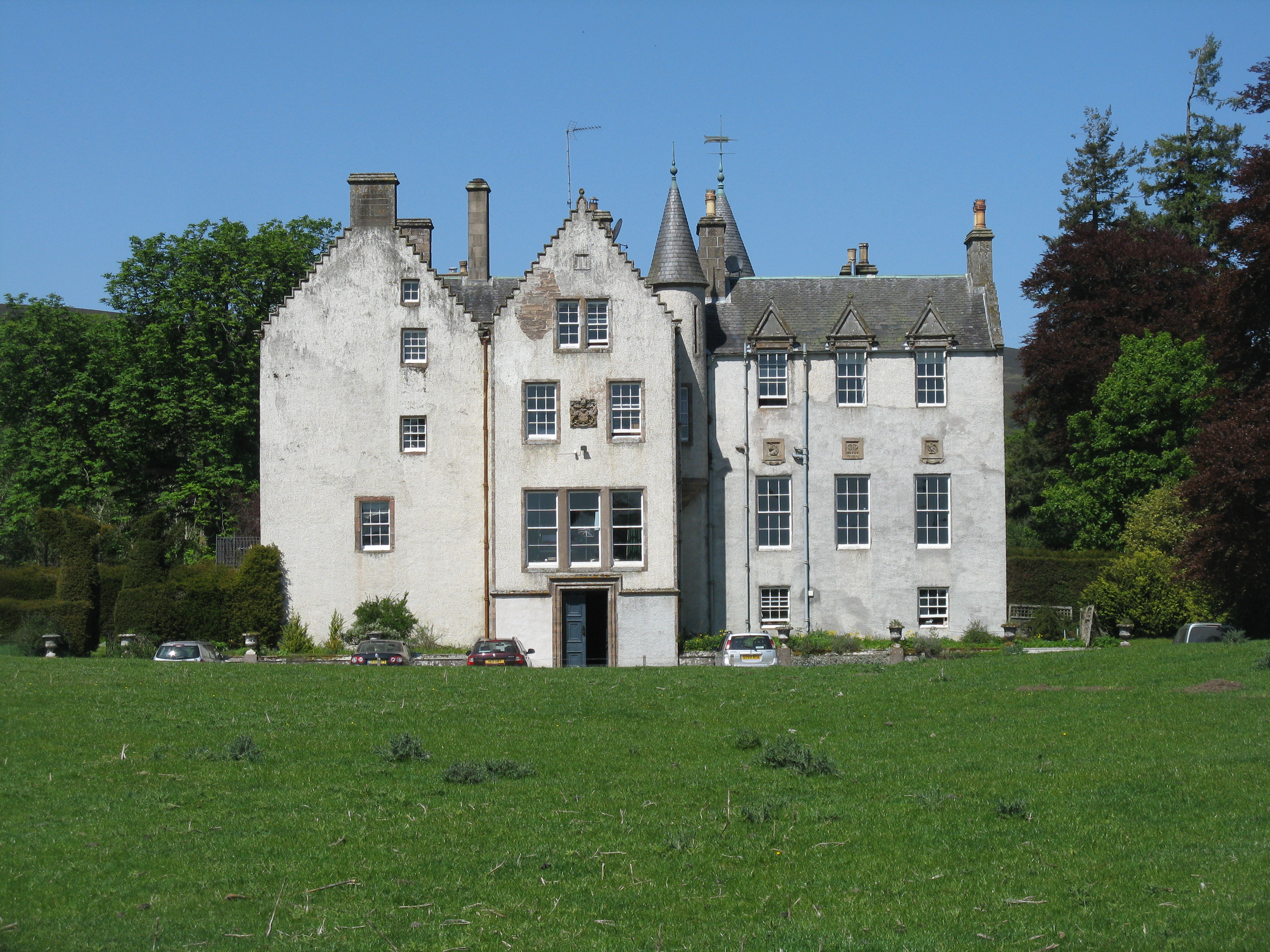
Bamff

Bamff House is the home of the Ramsays of Bamff, and is located within a 1,300-acre (5.3 km2) estate in Perthshire, Scotland. Bamff House began as a fortified...

Bridge of Craigisla

Bridge of Craigisla is a hamlet in Angus, Scotland. The bridge crosses the River Isla. This settlement lies along the B954 road. == References ==

Alyth market cross

Alyth market cross is a mercat cross located in Alyth, Perth and Kinross, Scotland. Now Category B listed, it dates to 1670. It has a rectangular shaft...

Nearby Amenities

Located within 500m of 56.667717,-3.2669304
Balduff Hill
Ele: 424
Natural: peak
Lat/Long: 56.6680694/-3.2674039
The data included in this document is from www.openstreetmap.org. The data is made available under ODbL.

Have you been to Balduff Hill?

Leave your review of Balduff Hill below (or comments, questions and feedback).