Black Hill

Hill, Mountain in Fife

Scotland

Black Hill

West Lomond from track east of Craigmead
West Lomond from track east of Craigmead Credit: Becky Williamson

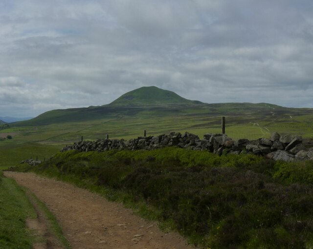
Black Hill is a prominent hill located in the county of Fife, Scotland. It is part of the larger Ochil Hills range and stands at an impressive height of 339 meters (1,112 feet) above sea level. The hill is situated in the northeast of Fife, near the village of Auchtermuchty.

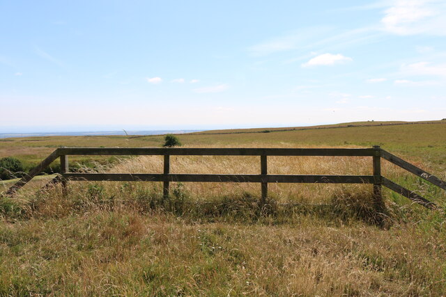
Black Hill offers breathtaking panoramic views of the surrounding countryside, with its summit providing a vantage point to observe the picturesque landscapes of Fife, as well as glimpses of the nearby Lomond Hills and even the Firth of Tay on clear days. The hill is covered in heather and grass, giving it a distinct green and purple hue during the summer months.

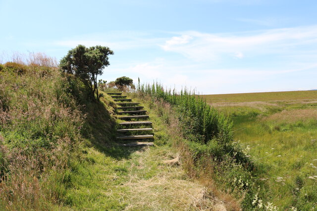
It is a popular destination for outdoor enthusiasts, as there are various walking routes and trails leading up to the summit. The most common starting point for these hikes is the car park near the village of Auchtermuchty, from where a well-marked path guides visitors through the lush countryside and up the hill.

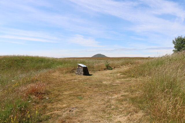
The ascent to the top is relatively moderate, making it accessible to all levels of fitness. Upon reaching the summit, visitors are greeted with a stone cairn, which serves as a marker and offers a spot to rest and take in the magnificent views.

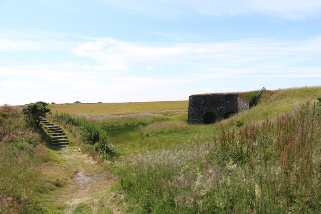
Black Hill is not only a scenic destination but also holds historical significance. In the past, it was used as a signaling point, where beacons were lit to communicate messages across the region during times of conflict.

Overall, Black Hill in Fife is a captivating natural landmark that provides visitors with an opportunity to immerse themselves in the beauty of the Scottish countryside while enjoying a rewarding hike.

If you have any feedback on the listing, please let us know in the comments section below.

Black Hill Images

Images are sourced within 2km of 56.251403/-3.2537557 or Grid Reference NO2207. Thanks to Geograph Open Source API. All images are credited.
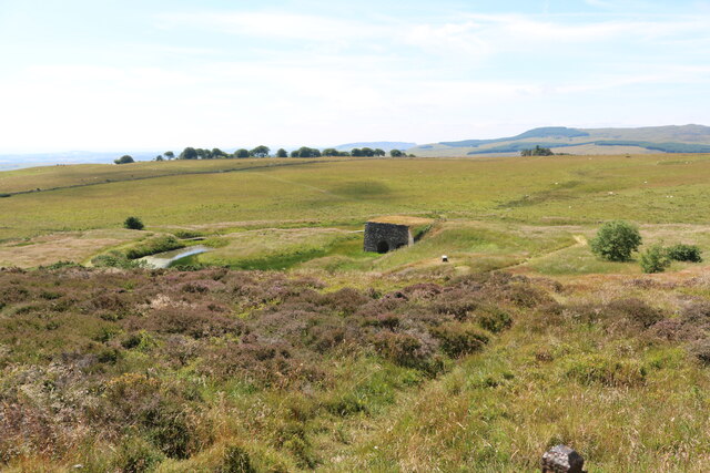
West Lomond from track east of Craigmead
Bridge over Maspie Burn in Maspie Den
The limekiln From the path from Purin Hill car park the limekiln comes into view.
See limekiln article <a title="https://www.geograph.org.uk/article/Old-Limekilns-Lomond-Hills" href="https://www.geograph.org.uk/article/Old-Limekilns-Lomond-Hills">Link</a>
The limekiln
From the path from Purin Hill car park the limekiln comes into view. See limekiln article Link
Gate to limekiln The area of the limekiln is fenced-off to keep out curious sheep and cattle.
See limekiln article <a title="https://www.geograph.org.uk/article/Old-Limekilns-Lomond-Hills" href="https://www.geograph.org.uk/article/Old-Limekilns-Lomond-Hills">Link</a>
Gate to limekiln
The area of the limekiln is fenced-off to keep out curious sheep and cattle. See limekiln article Link
The limekiln A grassy path leads towards the limekiln. It passes several information boards giving details of the history of the limekiln.
See limekiln article <a title="https://www.geograph.org.uk/article/Old-Limekilns-Lomond-Hills" href="https://www.geograph.org.uk/article/Old-Limekilns-Lomond-Hills">Link</a>
The limekiln
A grassy path leads towards the limekiln. It passes several information boards giving details of the history of the limekiln. See limekiln article Link
The limekiln The path guides visitors around the limekiln. The steps are handy!
See limekiln article <a title="https://www.geograph.org.uk/article/Old-Limekilns-Lomond-Hills" href="https://www.geograph.org.uk/article/Old-Limekilns-Lomond-Hills">Link</a>
The limekiln
The path guides visitors around the limekiln. The steps are handy! See limekiln article Link
The limekiln These wooden steps, as well as several sections of duckboards over boggy areas, give visitors safe passage around the limekiln.
See limekiln article <a title="https://www.geograph.org.uk/article/Old-Limekilns-Lomond-Hills" href="https://www.geograph.org.uk/article/Old-Limekilns-Lomond-Hills">Link</a>
The limekiln
These wooden steps, as well as several sections of duckboards over boggy areas, give visitors safe passage around the limekiln. See limekiln article Link
Information board at the limekiln This is one of several information boards around the limekiln, These boards have a chequered history. Originally they were made from metal but they were constantly being ripped off their mounts and stolen for scrap! After replacing some boards several times the park authority finally wised up and the latest versions are plastic with no scrap value. Sadly, they are still occasionally vandalised.
See limekiln article <a title="https://www.geograph.org.uk/article/Old-Limekilns-Lomond-Hills" href="https://www.geograph.org.uk/article/Old-Limekilns-Lomond-Hills">Link</a>
Information board at the limekiln
This is one of several information boards around the limekiln, These boards have a chequered history. Originally they were made from metal but they were constantly being ripped off their mounts and stolen for scrap! After replacing some boards several times the park authority finally wised up and the latest versions are plastic with no scrap value. Sadly, they are still occasionally vandalised. See limekiln article Link
The limekiln With one of the information boards.
See limekiln article <a title="https://www.geograph.org.uk/article/Old-Limekilns-Lomond-Hills" href="https://www.geograph.org.uk/article/Old-Limekilns-Lomond-Hills">Link</a>
The limekiln
With one of the information boards. See limekiln article Link
The limekiln See limekiln article <a title="https://www.geograph.org.uk/article/Old-Limekilns-Lomond-Hills" href="https://www.geograph.org.uk/article/Old-Limekilns-Lomond-Hills">Link</a>
The limekiln
See limekiln article Link
The limekiln This fence is intended to block access to the top of the limekiln although it's not much of an obstacle!
See limekiln article <a title="https://www.geograph.org.uk/article/Old-Limekilns-Lomond-Hills" href="https://www.geograph.org.uk/article/Old-Limekilns-Lomond-Hills">Link</a>
The limekiln
This fence is intended to block access to the top of the limekiln although it's not much of an obstacle! See limekiln article Link
Information board at the limekiln The hill is West Lomond (522m).
See limekiln article <a title="https://www.geograph.org.uk/article/Old-Limekilns-Lomond-Hills" href="https://www.geograph.org.uk/article/Old-Limekilns-Lomond-Hills">Link</a>
Information board at the limekiln
The hill is West Lomond (522m). See limekiln article Link
The limekiln One of the information boards. The rubble plinth for all of the boards at the limekiln is constructed from local stone.
See limekiln article <a title="https://www.geograph.org.uk/article/Old-Limekilns-Lomond-Hills" href="https://www.geograph.org.uk/article/Old-Limekilns-Lomond-Hills">Link</a>
The limekiln
One of the information boards. The rubble plinth for all of the boards at the limekiln is constructed from local stone. See limekiln article Link
Fife Coast and Countryside Trust car parking Fife Coast and Countryside Trust have instituted a limited number of overnight parking facilities for motorhomes at three of their car parks - Kingsbarns, Ruby Bay and Craigmead. Kingsbarns and Ruby Bay have a charge for overnight parking but Craigmead, in the Fife Regional Park near the village of Falkland, is currently free although donations are welcomed via an honesty box <span class="nowrap"><a title="https://fifecoastandcountrysidetrust.co.uk/plan-your-trip/overnight-parking/" rel="nofollow ugc noopener" href="https://fifecoastandcountrysidetrust.co.uk/plan-your-trip/overnight-parking/">Link</a><img style="margin-left:2px;" alt="External link" title="External link - shift click to open in new window" src="https://s1.geograph.org.uk/img/external.png" width="10" height="10"/></span>
Fife Coast and Countryside Trust car parking
Fife Coast and Countryside Trust have instituted a limited number of overnight parking facilities for motorhomes at three of their car parks - Kingsbarns, Ruby Bay and Craigmead. Kingsbarns and Ruby Bay have a charge for overnight parking but Craigmead, in the Fife Regional Park near the village of Falkland, is currently free although donations are welcomed via an honesty box LinkExternal link
Standing stone, Balharvie Moss Recognised as prehistoric. ‘Balharvie Moss | Canmore’. 2022. Canmore.org.uk <<span class="nowrap"><a title="https://canmore.org.uk/site/29932/balharvie-moss" rel="nofollow ugc noopener" href="https://canmore.org.uk/site/29932/balharvie-moss">Link</a><img style="margin-left:2px;" alt="External link" title="External link - shift click to open in new window" src="https://s1.geograph.org.uk/img/external.png" width="10" height="10"/></span> > [accessed 29 October 2022]
Standing stone, Balharvie Moss
Recognised as prehistoric. ‘Balharvie Moss | Canmore’. 2022. Canmore.org.uk <LinkExternal link > [accessed 29 October 2022]
Show me another place!

Black Hill is located at Grid Ref: NO2207 (Lat: 56.251403, Lng: -3.2537557)

Unitary Authority: Fife

Police Authority: Fife

What 3 Words

///basis.packing.dentures. Near Falkland, Fife

Nearby Locations

Green Hill Black Hill

Related Wikis

Lomond Hills

The Lomond Hills (meaning either beacon hills or bare hills), also known outside the locality as the Paps of Fife, are a range of hills in central Scotland...

West Lomond

West Lomond is the highest point in the county of Fife, Scotland and the highest peak in the Lomond Hills. Its cone-shaped summit, which is the remains...

Brunton House, Falkland

Brunton House is a Category A listed building in the village of Falkland in Fife, Scotland. It was formerly the residence of the hereditary falconers to...

Falkland Town Hall

Falkland Town Hall is a municipal building in the High Street, Falkland, Fife, Scotland. The structure, which has been converted for use as offices and...

Related Videos

Get Fit Falkland - Couch to 5k Winter 2024 Week 1

This was the first week of a new course of Couch to 5K. All these brave souls took their first tentative steps, with a jog/walk through ...

Falkland and East Lomond Hill

A walk through the Lomond Hills Regional Park to Falkland.

Johnny Cash walking the trail 011

Falkland House School and Johnny Cash Every Thursday at Falkland House School our pupils can choose to be involved in ...

Get Fit Falkland - Couch to 5k Autumn 2023 Week 3

This was week 3 of Couch to 5K. The workout was 1.5 minutes jog, followed by 1.5 minutes of brisk walking walk 1.5 minutes.

Nearby Amenities

Located within 500m of 56.251403,-3.2537557
Green Hill
Ele: 313
Natural: peak
Lat/Long: 56.2503548/-3.2541286
Maiden Castle
Historic: archaeological_site
Lat/Long: 56.2480632/-3.257145
The data included in this document is from www.openstreetmap.org. The data is made available under ODbL.

Have you been to Black Hill?

Leave your review of Black Hill below (or comments, questions and feedback).