Black Law

Hill, Mountain in Selkirkshire

Scotland

Black Law

A typical Border Cleuch. A Border Cleuch, (pronounced clooch, as in loch), is a steep sided ravine and is a common feature of the Border hills. They can be quite deep and dangerous, especially in mist and after heavy rain. This one carries the Thrashie Burn, a very minor tributary of the Manor Water.
A typical Border Cleuch. Credit: John R Whitehead

Black Law is a prominent hill located in the county of Selkirkshire, Scotland. Situated at an elevation of approximately 1,473 feet (449 meters), it is part of the Southern Uplands range. The hill is positioned approximately 7 miles (11 kilometers) northwest of the town of Selkirk, making it easily accessible for outdoor enthusiasts and hikers.

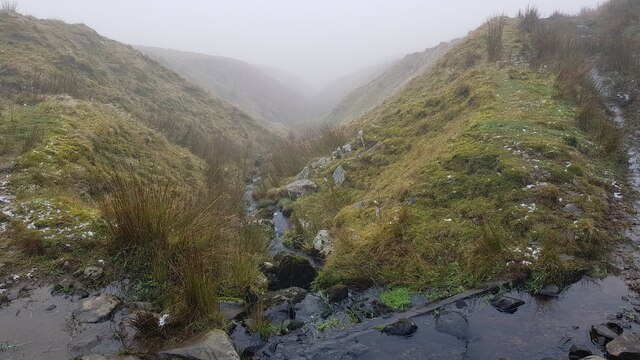
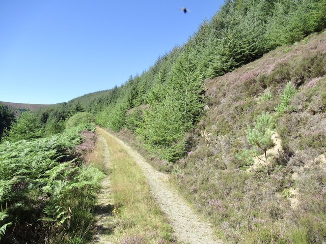
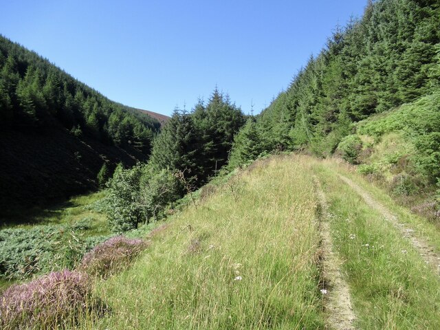
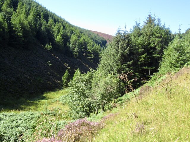
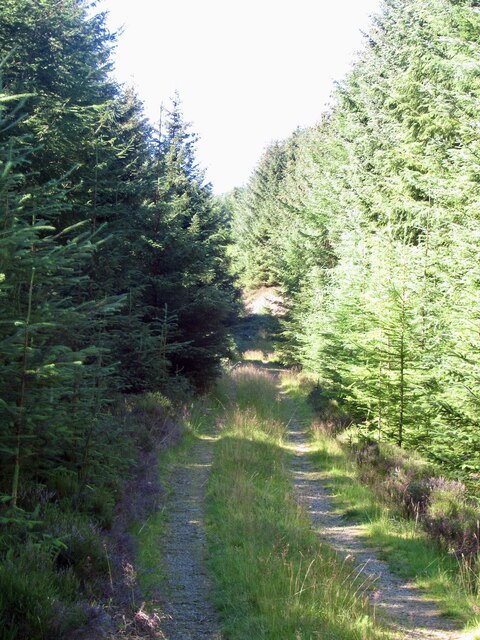
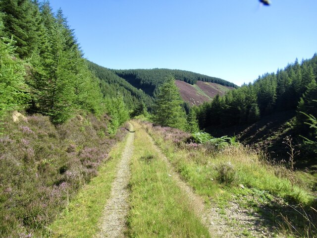
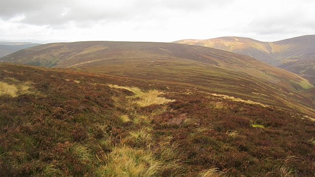
Black Law boasts a distinctive rounded summit, covered in heather and grass, offering breathtaking panoramic views of the surrounding countryside. On a clear day, visitors can enjoy sweeping vistas of the rolling hills, valleys, and forests that characterize the Selkirkshire landscape.

The hill is a popular destination for both locals and tourists, attracting outdoor enthusiasts, hikers, and nature lovers year-round. Its relatively moderate gradient and well-defined paths make it suitable for individuals of various fitness levels. The ascent typically takes around two to three hours, depending on the chosen route and individual pace.

The summit of Black Law is marked by a small cairn, providing a sense of achievement for those who reach it. Additionally, the hill is known for its diverse wildlife, including a variety of bird species, such as kestrels and buzzards, as well as occasional sightings of deer and other mammals.

Black Law offers an opportunity for visitors to immerse themselves in the natural beauty of Selkirkshire, allowing them to enjoy a peaceful and invigorating outdoor experience.

If you have any feedback on the listing, please let us know in the comments section below.

Black Law Images

Images are sourced within 2km of 55.538907/-3.2332628 or Grid Reference NT2227. Thanks to Geograph Open Source API. All images are credited.

A typical Border Cleuch. A Border Cleuch, (pronounced clooch, as in loch), is a steep sided ravine and is a common feature of the Border hills. They can be quite deep and dangerous, especially in mist and after heavy rain. This one carries the Thrashie Burn, a very minor tributary of the Manor Water.
A typical Border Cleuch.
A Border Cleuch, (pronounced clooch, as in loch), is a steep sided ravine and is a common feature of the Border hills. They can be quite deep and dangerous, especially in mist and after heavy rain. This one carries the Thrashie Burn, a very minor tributary of the Manor Water.
Track up White Grain
White Grain A headwater of the Douglas Burn
White Grain
A headwater of the Douglas Burn
Track up the White Grain
Road, White Grain Photobombed by one of the cloud of flies that accompanied me up the cleuch.
Road, White Grain
Photobombed by one of the cloud of flies that accompanied me up the cleuch.
An old path An old path cut into the side of the hill provided a brief respite from the heavy going through heather and bogs. The hill in the background is Horse Hope Hill.
An old path
An old path cut into the side of the hill provided a brief respite from the heavy going through heather and bogs. The hill in the background is Horse Hope Hill.
Black Cleuch Hill A mix of heather and tussocky grass on Blackhouse Heights.
Black Cleuch Hill
A mix of heather and tussocky grass on Blackhouse Heights.
Black Cleuch Hill Many of the ridges around Glenrath Hope have deep furrows along them. I am not sure if they are dug deliberately or the result of careless vehicle use. They are healing slowly.
Black Cleuch Hill
Many of the ridges around Glenrath Hope have deep furrows along them. I am not sure if they are dug deliberately or the result of careless vehicle use. They are healing slowly.
Black Cleuch Hill The west ridge shortly after the furrowed strip left the decaying fence for Linghope.
Black Cleuch Hill
The west ridge shortly after the furrowed strip left the decaying fence for Linghope.
Black Cleuch Hill Furrows on Black Cleuch Hill. Not sure if dug deliberately or vehicle erosion.
Black Cleuch Hill
Furrows on Black Cleuch Hill. Not sure if dug deliberately or vehicle erosion.
Black Cleuch Hill The summit, where a decayed fence meets a newer one in good condition.
Black Cleuch Hill
The summit, where a decayed fence meets a newer one in good condition.
Summit, Black Cleuch Hill A small moorland top at the junction of a rotten fence with the Peebleshire - Selkirkshire march fence, which is in good condition.
Summit, Black Cleuch Hill
A small moorland top at the junction of a rotten fence with the Peebleshire - Selkirkshire march fence, which is in good condition.
Fence, Blackhouse Heights A fence below the top of Black Cleuch Hill.
Fence, Blackhouse Heights
A fence below the top of Black Cleuch Hill.
Moorland, Blackhouse Heights Wet ground on an ill defined ridge on the Peeblesshire - Selkirkshire march.
Moorland, Blackhouse Heights
Wet ground on an ill defined ridge on the Peeblesshire - Selkirkshire march.
Summit, Black Law The highest ground on Blackhouse Heights is a short distance beyond the fence junction on the southern, Selkirkshire side of the fence.
Summit, Black Law
The highest ground on Blackhouse Heights is a short distance beyond the fence junction on the southern, Selkirkshire side of the fence.
Fence junction A fence junction near the summit of Black Law (698m/103m)
Fence junction
A fence junction near the summit of Black Law (698m/103m)
Black Law west top The march fence on Blackhouse Heights.
Black Law west top
The march fence on Blackhouse Heights.
Show me another place!

Black Law is located at Grid Ref: NT2227 (Lat: 55.538907, Lng: -3.2332628)

Unitary Authority: The Scottish Borders

Police Authority: The Lothians and Scottish Borders

What 3 Words

///jetliner.germinate.whites. Near Peebles, Scottish Borders

Nearby Locations

Layer Knowe Black Law

Related Wikis

Black Law (hill)

Black Law is a hill in the Manor Hills range, part of the Southern Uplands of Scotland. One of the more remote Donalds, it does not easily combine into...

Craigierig

Craigierig is a village on the Megget Reservoir, in the Scottish Borders area of Scotland, in the former Selkirkshire. Places nearby include the Glengaber...

Dun Rig

Dun Rig is a hill in the Manor Hills range, part of the Southern Uplands of Scotland. It is the highest hill in the northernmost cluster of the Manor Hills...

Manor Hills

The Manor Hills, also known as the Tweedsmuir Hills, are a range of hills south of Peebles in the Scottish Borders, one of the ranges which collectively...

Nearby Amenities

Located within 500m of 55.538907,-3.2332628
Ele: 698
Natural: peak
Lat/Long: 55.5393655/-3.2328054
The data included in this document is from www.openstreetmap.org. The data is made available under ODbL.

Have you been to Black Law?

Leave your review of Black Law below (or comments, questions and feedback).