Conscleuch Head

Hill, Mountain in Peeblesshire

Scotland

Conscleuch Head

View towards Layer Knowe from Black Law With the Yarrow Valley near St Mary's Loch just visible to the left.
View towards Layer Knowe from Black Law Credit: wrobison

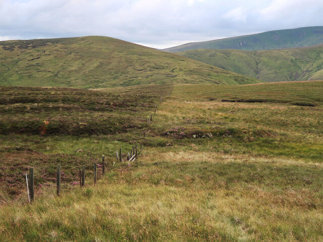
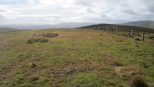
Conscleuch Head is a prominent hill located in Peeblesshire, a historic county in the Scottish Borders region of Scotland. Situated near the small village of Stobo, the hill is part of the scenic Moorfoot Hills range.

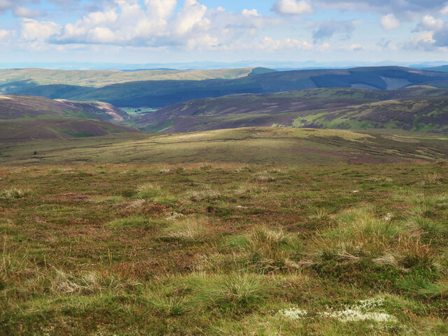
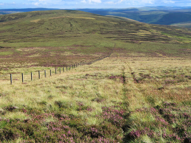
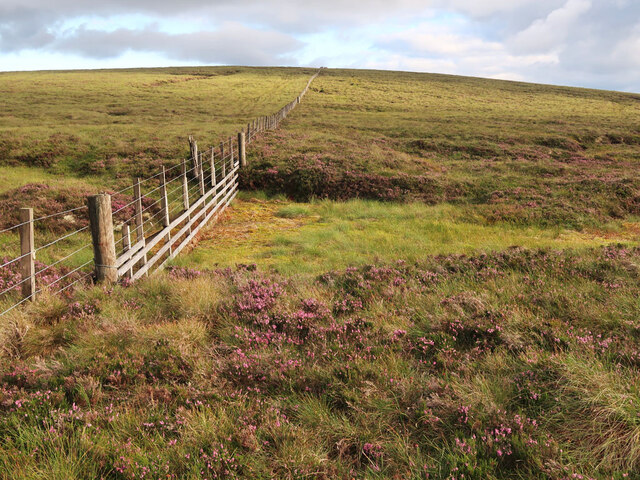
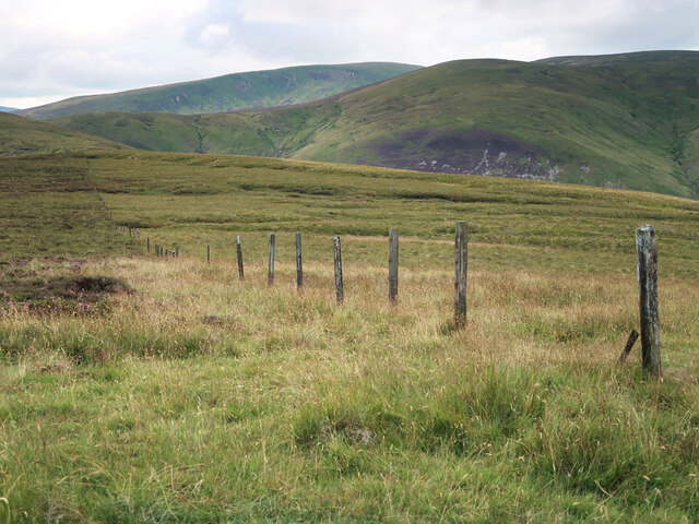
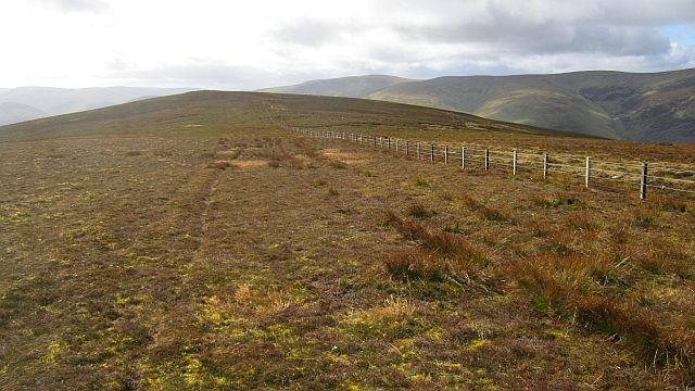
Rising to an elevation of approximately 563 meters (1,847 feet), Conscleuch Head offers stunning panoramic views of the surrounding landscape. Its distinctive shape, with a gently sloping southern side and a steeper northern face, makes it easily recognizable from a distance. The hill is covered in heather and grass, providing a picturesque setting for hikers and nature enthusiasts.

Access to Conscleuch Head is relatively straightforward, with various walking routes available to visitors. The most popular approach is from Stobo, where a well-marked trail leads through a mixture of farmland and moorland before ascending to the summit. The ascent is moderate, making it suitable for individuals with a reasonable level of fitness.

At the top of Conscleuch Head, walkers are rewarded with breathtaking views of the surrounding countryside, including the rolling hills and valleys of the Scottish Borders. On clear days, it is even possible to see as far as the Pentland Hills to the north and the Moffat Hills to the south.

Conscleuch Head is an excellent destination for those seeking a peaceful outdoor experience and a chance to immerse themselves in the natural beauty of Peeblesshire. Whether it's a leisurely hike or a more challenging adventure, this hill offers something for everyone.

If you have any feedback on the listing, please let us know in the comments section below.

Conscleuch Head Images

Images are sourced within 2km of 55.523994/-3.2364553 or Grid Reference NT2226. Thanks to Geograph Open Source API. All images are credited.

View towards Layer Knowe from Black Law With the Yarrow Valley near St Mary's Loch just visible to the left.
View towards Layer Knowe from Black Law
With the Yarrow Valley near St Mary's Loch just visible to the left.
Fence and track on Black Law Looking south to Conscleuch Head and Deer Law.
Fence and track on Black Law
Looking south to Conscleuch Head and Deer Law.
Track to the col between Deer Law and Conscleuch Head Looking towards Conscleuch Head and Black Law.
Track to the col between Deer Law and Conscleuch Head
Looking towards Conscleuch Head and Black Law.
Moorland on Deer Law Megget Reservoir in the distance.
Moorland on Deer Law
Megget Reservoir in the distance.
Moorland on Conscleuch Head Looking towards Layer Knowe.
Moorland on Conscleuch Head
Looking towards Layer Knowe.
Fence and bog between Black Law and Conscleuch Head A good fence and an area of bog to be avoided.
Fence and bog between Black Law and Conscleuch Head
A good fence and an area of bog to be avoided.
Old fence on Redsike Head No longer intact but still marking the change from heather moorland on the left to grassy moorland on the right, see <a href="https://www.geograph.org.uk/photo/6194886">NT2027 : Fence west of Black Law</a> and <a href="https://www.geograph.org.uk/photo/3518363">NT2027 : The western ridge of Black Law</a> for other views.
Old fence on Redsike Head
No longer intact but still marking the change from heather moorland on the left to grassy moorland on the right, see NT2027 : Fence west of Black Law and NT2027 : The western ridge of Black Law for other views.
A typical Border Cleuch. A Border Cleuch, (pronounced clooch, as in loch), is a steep sided ravine and is a common feature of the Border hills. They can be quite deep and dangerous, especially in mist and after heavy rain. This one carries the Thrashie Burn, a very minor tributary of the Manor Water.
A typical Border Cleuch.
A Border Cleuch, (pronounced clooch, as in loch), is a steep sided ravine and is a common feature of the Border hills. They can be quite deep and dangerous, especially in mist and after heavy rain. This one carries the Thrashie Burn, a very minor tributary of the Manor Water.
Moorland fence on Foulbrig Looking towards Black Law.
Moorland fence on Foulbrig
Looking towards Black Law.
Summit, Black Law The highest ground on Blackhouse Heights is a short distance beyond the fence junction on the southern, Selkirkshire side of the fence.
Summit, Black Law
The highest ground on Blackhouse Heights is a short distance beyond the fence junction on the southern, Selkirkshire side of the fence.
Fence junction A fence junction near the summit of Black Law (698m/103m)
Fence junction
A fence junction near the summit of Black Law (698m/103m)
Black Law west top The march fence on Blackhouse Heights.
Black Law west top
The march fence on Blackhouse Heights.
Sting Rig A ridge descends from Black Law to the Manor Water. An easy way up or down.
Sting Rig
A ridge descends from Black Law to the Manor Water. An easy way up or down.
Sting Rig Peaty ground on a broad ridge. There is a view of Black Cleuch Head.
Sting Rig
Peaty ground on a broad ridge. There is a view of Black Cleuch Head.
Summit, Black Law The eastern top is now mapped as higher than the western top. It is almost unmarked, save for a few stones.
Summit, Black Law
The eastern top is now mapped as higher than the western top. It is almost unmarked, save for a few stones.
Black Law A slight dip on the ridge between the two summits.
Black Law
A slight dip on the ridge between the two summits.
Moorland, Black Law A wide view over some of Selkirkshire's hill country from the summit ridge.
Moorland, Black Law
A wide view over some of Selkirkshire's hill country from the summit ridge.
Show me another place!

Conscleuch Head is located at Grid Ref: NT2226 (Lat: 55.523994, Lng: -3.2364553)

Unitary Authority: The Scottish Borders

Police Authority: The Lothians and Scottish Borders

What 3 Words

///lunge.petulant.fail. Near Ettrick, Scottish Borders

Nearby Locations

Conscleuch Head

Related Wikis

Black Law (hill)

Black Law is a hill in the Manor Hills range, part of the Southern Uplands of Scotland. One of the more remote Donalds, it does not easily combine into...

Craigierig

Craigierig is a village on the Megget Reservoir, in the Scottish Borders area of Scotland, in the former Selkirkshire. Places nearby include the Glengaber...

Cappercleuch

Cappercleuch is a settlement on the A708, at St. Mary's Loch in the Scottish Borders area of Scotland, in the historic county of Selkirkshire. Places nearby...

Megget

Megget is a former chapelry or parish containing the valley of Megget Water, now forming the westernmost part of the parish of Yarrow, Selkirkshire in...

Nearby Amenities

Located within 500m of 55.523994,-3.2364553
Conscleuch Head
Ele: 624
Natural: peak
Lat/Long: 55.5245499/-3.2354661
The data included in this document is from www.openstreetmap.org. The data is made available under ODbL.

Have you been to Conscleuch Head?

Leave your review of Conscleuch Head below (or comments, questions and feedback).