Black Law

Hill, Mountain in Perthshire

Scotland

Black Law

Old milepost This post was discovered in 2021 when a trench on the verge of the A926 for services to a new house was being dug.  It was probably toppled and covered over in 1940.  Kirriemuir and Alyth are both to the east with Blairgowrie, on the bevel, 2¼ miles to the west.  This milepost is typical of the milemarkers in this area but it is not known at which foundry they were cast.
Old milepost Credit: John Riddell

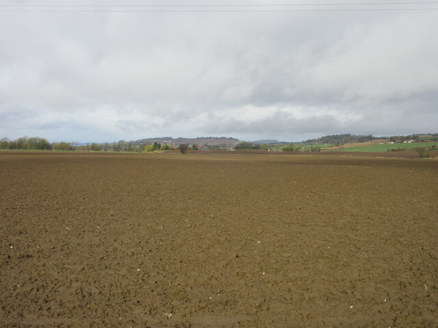
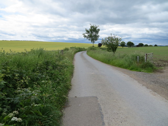
Black Law is a prominent hill located in the county of Perthshire, Scotland. Standing at an impressive height of approximately 1,102 feet (336 meters), it lies on the eastern edge of the Ochil Hills, near the town of Auchterarder. The hill offers stunning panoramic views of the surrounding landscape, including the picturesque Strathearn Valley and the rolling Perthshire countryside.

Covered in heather and grass, Black Law is a favorite destination for hikers and nature enthusiasts. Its relatively gentle slopes and well-maintained trails make it accessible to both experienced climbers and beginners alike. The hill is part of the vast network of paths and tracks that crisscross the Ochil Hills, providing ample opportunities for exploration and outdoor activities.

Black Law also holds historical significance as it is home to the remains of an Iron Age fort. The fort, known as Blacklaw Hill Fort, dates back thousands of years and gives visitors a glimpse into the region's ancient past. Archaeologists have uncovered traces of defensive walls and dwellings, providing valuable insights into the lives of those who once inhabited the area.

Whether it is for a leisurely hike, a historical journey, or simply to enjoy the breathtaking views, Black Law offers a captivating experience for all who visit. Its natural beauty, rich history, and accessibility make it a popular destination for locals and tourists alike, adding to the allure of Perthshire's diverse landscape.

If you have any feedback on the listing, please let us know in the comments section below.

Black Law Images

Images are sourced within 2km of 56.595215/-3.2718476 or Grid Reference NO2245. Thanks to Geograph Open Source API. All images are credited.

Old milepost This post was discovered in 2021 when a trench on the verge of the A926 for services to a new house was being dug.  It was probably toppled and covered over in 1940.  Kirriemuir and Alyth are both to the east with Blairgowrie, on the bevel, 2¼ miles to the west.  This milepost is typical of the milemarkers in this area but it is not known at which foundry they were cast.
Old milepost
This post was discovered in 2021 when a trench on the verge of the A926 for services to a new house was being dug. It was probably toppled and covered over in 1940. Kirriemuir and Alyth are both to the east with Blairgowrie, on the bevel, 2¼ miles to the west. This milepost is typical of the milemarkers in this area but it is not known at which foundry they were cast.
Kitty Swanson's Bridge Kitty Swanson's Bridge linking both sides of the River Ericht Path over the waterway.
Kitty Swanson's Bridge
Kitty Swanson's Bridge linking both sides of the River Ericht Path over the waterway.
River Ericht The River Ericht looking upstream near Aberbothrie.
River Ericht
The River Ericht looking upstream near Aberbothrie.
Large field near Black Law Looking west over a large field near Black Law in the direction of Blairgowrie.
Large field near Black Law
Looking west over a large field near Black Law in the direction of Blairgowrie.
Static caravans beside dirt road There was little sign of occupation at these caravans when the image was recorded. It's imagined that they're used as accommodation for seasonal workers picking fruit and / or vegetables from nearby fields - a large area of land in adjacent fields is covered with poly-tunnels.
Static caravans beside dirt road
There was little sign of occupation at these caravans when the image was recorded. It's imagined that they're used as accommodation for seasonal workers picking fruit and / or vegetables from nearby fields - a large area of land in adjacent fields is covered with poly-tunnels.
Poly-tunnel framing One of a number of fields in the vicinity where crops are grown inside plastic tunnels; as the image was recorded of course, no plastic was in place on the hooped frames.
Poly-tunnel framing
One of a number of fields in the vicinity where crops are grown inside plastic tunnels; as the image was recorded of course, no plastic was in place on the hooped frames.
Minor road between Bothrie and Burnhead Looking southward.
Minor road between Bothrie and Burnhead
Looking southward.
Farm track leading to Red Brae Looking northward
Farm track leading to Red Brae
Looking northward
Track leading to Easter Parkhead Looking north-eastward from Wester Parkhead
Track leading to Easter Parkhead
Looking north-eastward from Wester Parkhead
C425 (Perth & Kinross), Blacklaw Road Looking westwards along the C425 road between Aberbothrie and Blacklaw.
C425 (Perth & Kinross), Blacklaw Road
Looking westwards along the C425 road between Aberbothrie and Blacklaw.
Pile of wood at Bothrie Wood cuttings in a pile by the roadside at Bothrie.
Pile of wood at Bothrie
Wood cuttings in a pile by the roadside at Bothrie.
Ringlet (Aphantopus hyperantus), near Coupar Grange A common butterfly of open grassy areas, here seen along the path to Kitty Swanson's bridge over the River Ericht.
Ringlet (Aphantopus hyperantus), near Coupar Grange
A common butterfly of open grassy areas, here seen along the path to Kitty Swanson's bridge over the River Ericht.
Barley, near Coupar Grange
Roe deer near New Alyth Roe Deer (Capreolus capreolus)

This small, graceful deer reaches up to 28 inches at the shoulder and is the most attractive deer in Britain, delicately built and with an intelligent soft expression.  The males have short forked antlers and both the male and females coat is foxy red from May to September but turn dark grey-brown with a white rump in winter.  Roe deer are common in England and widespread in Scotland.
Roe deer near New Alyth
Roe Deer (Capreolus capreolus) This small, graceful deer reaches up to 28 inches at the shoulder and is the most attractive deer in Britain, delicately built and with an intelligent soft expression. The males have short forked antlers and both the male and females coat is foxy red from May to September but turn dark grey-brown with a white rump in winter. Roe deer are common in England and widespread in Scotland.
Kitty Swanson's Bridge, near Blairgowrie The bridge is named after a woman who used to run a ferry across the River Ericht at this point.
Kitty Swanson's Bridge, near Blairgowrie
The bridge is named after a woman who used to run a ferry across the River Ericht at this point.
Kitty Swanson's Bridge, near Blairgowrie Footbridge across the River Ericht.
Kitty Swanson's Bridge, near Blairgowrie
Footbridge across the River Ericht.
River Ericht from Kitty Swanson's Bridge, near Blairgowrie Looking upstream.
River Ericht from Kitty Swanson's Bridge, near Blairgowrie
Looking upstream.
Riparian woodland beside the Ericht at Kitty Swanson's Bridge, near Blairgowrie
Show me another place!

Black Law is located at Grid Ref: NO2245 (Lat: 56.595215, Lng: -3.2718476)

Unitary Authority: Perth and Kinross

Police Authority: Tayside

What 3 Words

///straddled.crash.hired. Near Alyth, Perth & Kinross

Nearby Locations

Black Law

Related Wikis

Strathmore meteorite

The Strathmore meteorite landed in the Strathmore area of Perthshire on 3 December 1917. It was reported to have been in four fragments, subsequently named...

Monk Myre

Monk Myre is a small shallow freshwater lochan and is located 2.5 miles southeast of Blairgowrie in Perth and Kinross. == Geography == Monk Myre is of...

Blairgowrie F.C.

Blairgowrie Junior Football Club is a Scottish Junior football club based in Blairgowrie and Rattray, Perth and Kinross. Their home ground is Davie Park...

Rosemount Halt railway station

Rosemount Halt railway station served the suburb of Rosemount, Perth and Kinross, Scotland, from 1857 to 1955 on the Scottish Midland Junction Railway...

Alyth Town Hall

Alyth Town Hall is a municipal structure in Albert Street in Alyth, Scotland. The structure, which is currently used as a community events venue, is not...

Blairgowrie railway station

Blairgowrie railway station served the burgh of Blairgowrie and Rattray, Perth and Kinross, Scotland from 1855 to 1955 on the Scottish Midland Junction...

Stormont Loch Halt railway station

Stormont Loch Halt railway station served the area of Stormont, Perth and Kinross, Scotland from 1920 to 1955 on the Scottish Midland Junction Railway...

Alyth railway station

The Alyth railway station served the town of Alyth in the Scottish county of Perth and Kinross. The station was the terminus of a branch line from Alyth...

Nearby Amenities

Located within 500m of 56.595215,-3.2718476
Mill of Blacklaw
1860name: Mill of Blacklaw
Pont: no
Stobie1783: Blacklaw
Designation: Historic mill
Historic: archaeological_site
Source: OS Six inch 1st series
Lat/Long: 56.5941003/-3.2741162
Power: pole
Lat/Long: 56.5929993/-3.2653164
Power: pole
Lat/Long: 56.5935952/-3.2659927
Power: pole
Lat/Long: 56.5942034/-3.2666669
Power: pole
Lat/Long: 56.5947111/-3.2668292
Power: pole
Lat/Long: 56.5952486/-3.2669983
Power: pole
Lat/Long: 56.5958841/-3.2663715
Power: pole
Lat/Long: 56.596537/-3.265756
Power: pole
Lat/Long: 56.597175/-3.265118
Power: pole
Lat/Long: 56.598109/-3.2765605
Power: pole
Lat/Long: 56.5974979/-3.2759214
Power: pole
Lat/Long: 56.5968657/-3.2752641
Power: pole
Lat/Long: 56.5962609/-3.2746228
Material: wood
Power: pole
Lat/Long: 56.5956411/-3.2739519
Power: pole
Lat/Long: 56.5951916/-3.273754
Power: pole
Lat/Long: 56.5947709/-3.2735698
Power: pole
Lat/Long: 56.5937103/-3.2781639
Power: pole
Lat/Long: 56.5940383/-3.2769199
Power: pole
Lat/Long: 56.5943814/-3.2756417
Power: pole
Lat/Long: 56.5947057/-3.2744113
Power: pole
Lat/Long: 56.5948548/-3.2724622
Power: pole
Lat/Long: 56.5949274/-3.2713637
Power: pole
Lat/Long: 56.595025/-3.2700332
Power: pole
Lat/Long: 56.595139/-3.2684821
The data included in this document is from www.openstreetmap.org. The data is made available under ODbL.

Have you been to Black Law?

Leave your review of Black Law below (or comments, questions and feedback).