Broom Hill

Hill, Mountain in Fife

Scotland

Broom Hill

Ruined buildings at Parknook
Ruined buildings at Parknook Credit: Steven Brown

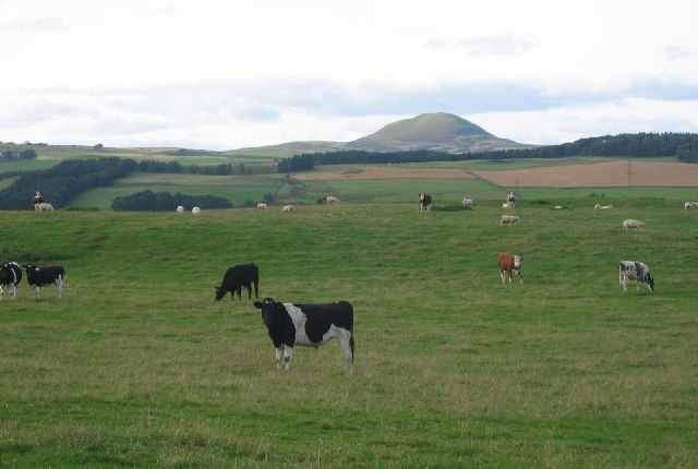
Broom Hill is a prominent hill located in the Fife region of Scotland. With an elevation of approximately 217 meters (712 feet), it is considered a notable landmark in the area. Situated near the town of Dunfermline, Broom Hill offers breathtaking views of the surrounding countryside, making it a popular destination for hikers, nature enthusiasts, and photographers.

Covered in lush greenery and adorned with a variety of flora and fauna, Broom Hill is an ideal spot for outdoor activities and exploration. The hill is home to a diverse range of plant species, including heather, gorse, and various types of wildflowers, creating a vibrant and colorful landscape throughout the year.

The hill is easily accessible, with several footpaths and trails leading to its summit. These routes offer varying degrees of difficulty, catering to both experienced hikers and casual walkers. Along the way, visitors can enjoy the tranquil atmosphere, with the sounds of birdsong and the gentle rustling of leaves providing a serene backdrop.

At the top of Broom Hill, visitors are rewarded with stunning panoramic views of the surrounding countryside. On clear days, it is possible to see as far as the Firth of Forth and the nearby city of Edinburgh. The hill's vantage point also offers an excellent opportunity for stargazing during the night, away from the light pollution of urban areas.

Overall, Broom Hill in Fife is a picturesque and accessible natural landmark, attracting visitors from both near and far who seek to immerse themselves in the beauty of Scotland's countryside.

If you have any feedback on the listing, please let us know in the comments section below.
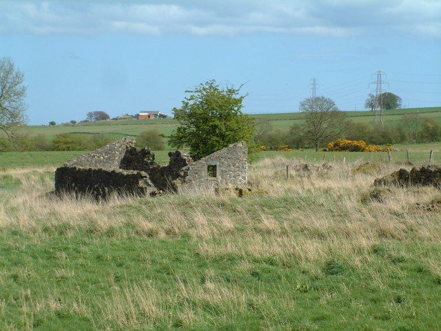
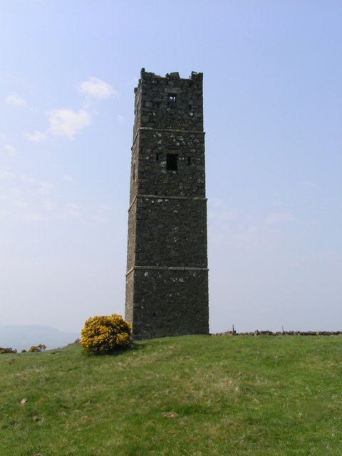
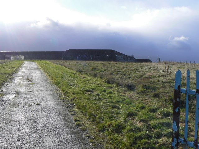
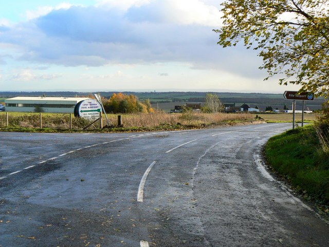
Broom Hill Images

Images are sourced within 2km of 56.181116/-3.2631106 or Grid Reference NT2199. Thanks to Geograph Open Source API. All images are credited.

Ruined buildings at Parknook
B921 approaching Kinglassie
Pasture, Auchmuir. Cattle graze beneath West Lomond, Fife's highest hill.
Pasture, Auchmuir.
Cattle graze beneath West Lomond, Fife's highest hill.
Kinglassie Miners Welfare Institute Kinglassie grew up as a weaving and mining town and in this building built in 1931 the Fife Mining Archives can be viewed.
Kinglassie Miners Welfare Institute
Kinglassie grew up as a weaving and mining town and in this building built in 1931 the Fife Mining Archives can be viewed.
Pond below the surface Parts of the Westfield open-cast coal site have been allowed to flood, forming 'lochs' hundreds of feet below the natural land surface. This huge hole was the deepest excavation of its kind in the UK with a depth of 215m (705 feet).
Pond below the surface
Parts of the Westfield open-cast coal site have been allowed to flood, forming 'lochs' hundreds of feet below the natural land surface. This huge hole was the deepest excavation of its kind in the UK with a depth of 215m (705 feet).
Open cast mining The alternating strata of coal and rock can clearly be seen in these workings near the eastern end of the 705 feet deep Westfield opencast mine
Open cast mining
The alternating strata of coal and rock can clearly be seen in these workings near the eastern end of the 705 feet deep Westfield opencast mine
Dozer and dumper A bulldozer and dump-truck cooperating to extract the coal, deep down inside the lip of the Westfield open-cast coal mine.
Dozer and dumper
A bulldozer and dump-truck cooperating to extract the coal, deep down inside the lip of the Westfield open-cast coal mine.
Craigend Farm The craig at the end of which the farm is located is visible behind the trees
Craigend Farm
The craig at the end of which the farm is located is visible behind the trees
Strathruddie Nicely manicured drive into the farm buildings
Strathruddie
Nicely manicured drive into the farm buildings
All that's left of Parknook An old ruin of a farm that has all but disappeared. Modern maps don't even carry its name.
All that's left of Parknook
An old ruin of a farm that has all but disappeared. Modern maps don't even carry its name.
Blythes Tower
Blythes Tower
Burnlea Terrace Housing on the south side of Kinglassie village.
Burnlea Terrace
Housing on the south side of Kinglassie village.
Reservoir wall Concrete reservoir tanks on Whitehill which hold water supplies for Glenrothes.
Reservoir wall
Concrete reservoir tanks on Whitehill which hold water supplies for Glenrothes.
Approach to Fife Airport The side road left leads to Fife Airport. The circular sign advertises the Airport restaurant, the 'Tipsy Nipper', named, not after an inebriated youngster, but after the first aeroplane owned by the flying club, a single-seat machine known as a Nipper, manufactured by the Belgian Tipsy aircraft company.
Approach to Fife Airport
The side road left leads to Fife Airport. The circular sign advertises the Airport restaurant, the 'Tipsy Nipper', named, not after an inebriated youngster, but after the first aeroplane owned by the flying club, a single-seat machine known as a Nipper, manufactured by the Belgian Tipsy aircraft company.
Westfield Opencast Coal Site during restoration Taken from the embankment of one of the internal haulage roads, this view shows the phased restoration of the former opencast site.  Coal extraction from the land to the left of the railway line was completed several years ago; the pit has been backfilled and vegetation is now colonising the surface.  To the right of the railway line, extraction ended more recently; the pit has been filled in but awaits a topsoil covering to enable plants to grow.  The railway line seen here is a deviation constructed in 1992; the original line followed a route more to the right, making directly for the end of the wooded hill near the upper right corner.
Westfield Opencast Coal Site during restoration
Taken from the embankment of one of the internal haulage roads, this view shows the phased restoration of the former opencast site. Coal extraction from the land to the left of the railway line was completed several years ago; the pit has been backfilled and vegetation is now colonising the surface. To the right of the railway line, extraction ended more recently; the pit has been filled in but awaits a topsoil covering to enable plants to grow. The railway line seen here is a deviation constructed in 1992; the original line followed a route more to the right, making directly for the end of the wooded hill near the upper right corner.
Westfield Opencast Site restoration This is the extreme south-eastern corner of the opencast coal site.  Gorse and other shrubs are recolonising the land to the right of the railway line but much less so to the left, where parts of the former excavations are still under water.  When the railway was deviated in 1992 it was provided with two concrete tube tunnels beneath internal haulage roads, one of which can be seen in the middle distance. In the far distance are the silver chimney of the Lurgi gasification plant and beyond that the massive hump of Benarty Hill.
Westfield Opencast Site restoration
This is the extreme south-eastern corner of the opencast coal site. Gorse and other shrubs are recolonising the land to the right of the railway line but much less so to the left, where parts of the former excavations are still under water. When the railway was deviated in 1992 it was provided with two concrete tube tunnels beneath internal haulage roads, one of which can be seen in the middle distance. In the far distance are the silver chimney of the Lurgi gasification plant and beyond that the massive hump of Benarty Hill.
Coal from Westfield open cast On a grey cold day a coal train  loaded at Westfield opencast  heads down the branch line to Thornton Junction. Here it will reverse and then head through Dunfermaline to Longannet Power station.
Coal from Westfield open cast
On a grey cold day a coal train loaded at Westfield opencast heads down the branch line to Thornton Junction. Here it will reverse and then head through Dunfermaline to Longannet Power station.
Craigend Hill Craigend Hill at sunset.
Craigend Hill
Craigend Hill at sunset.
Show me another place!

Broom Hill is located at Grid Ref: NT2199 (Lat: 56.181116, Lng: -3.2631106)

Unitary Authority: Fife

Police Authority: Fife

What 3 Words

///fearfully.native.handle. Near Kinglassie, Fife

Nearby Locations

Broom Hill

Related Wikis

Kinglassie

Kinglassie (Scottish Gaelic: Cill Ghlaise) is a small village and parish in central Fife, Scotland. It is located two miles southwest of Glenrothes. It...
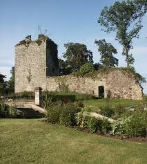
Arnot Tower

Arnot Tower is a ruined 16th-century castle located in the grounds of Arnot Tower House, less than 1 mile (1.6 km) from Scotlandwell, Perth and Kinross...
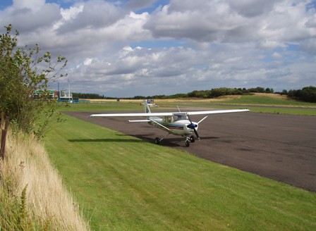
Fife Airport

Fife Airport (ICAO: EGPJ) (Scottish Gaelic: Port-adhair Fìobha) is an unlicensed aerodrome located 2 nautical miles (3.7 km; 2.3 mi) west of Glenrothes...

Fife power station

Fife power station was a 120 megawatt gas-fired combined cycle gas turbine generating station at Cardenden in Fife, Scotland. It was a 1+1 configuration...

Nearby Amenities

Located within 500m of 56.181116,-3.2631106
Power: pole
Lat/Long: 56.1823935/-3.2699459
Power: pole
Lat/Long: 56.1819972/-3.2689645
Power: pole
Lat/Long: 56.1813821/-3.2682501
Power: pole
Lat/Long: 56.1807706/-3.2675662
Power: pole
Lat/Long: 56.1804818/-3.2672405
Power: pole
Lat/Long: 56.1804685/-3.2661244
Power: pole
Lat/Long: 56.1805555/-3.2650779
Power: pole
Lat/Long: 56.1806485/-3.2639792
Power: pole
Lat/Long: 56.1807452/-3.262937
Power: pole
Lat/Long: 56.1808419/-3.2618145
Power: pole
Lat/Long: 56.1809386/-3.260718
Power: pole
Lat/Long: 56.1807235/-3.259691
Power: pole
Lat/Long: 56.1805071/-3.2586553
Power: pole
Lat/Long: 56.1802824/-3.2575262
Power: pole
Lat/Long: 56.18006/-3.2564558
Power: pole
Lat/Long: 56.1794751/-3.2562235
The data included in this document is from www.openstreetmap.org. The data is made available under ODbL.

Have you been to Broom Hill?

Leave your review of Broom Hill below (or comments, questions and feedback).