Churchstanton Hill

Hill, Mountain in Devon Somerset West and Taunton

England

Churchstanton Hill

Churchstanton : Trickey Warren Lane Looking along the track.
Churchstanton : Trickey Warren Lane Credit: Lewis Clarke

Churchstanton Hill is a prominent natural landmark located in the county of Devon, England. Also known as Churchstanton Beacon, it is situated near the village of Churchstanton, approximately 10 miles northeast of the town of Honiton. While not classified as a mountain, it is often referred to as a hill due to its significant elevation and commanding presence in the surrounding landscape.

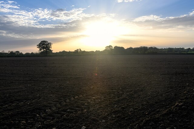
Standing at a height of around 833 feet (254 meters), Churchstanton Hill offers breathtaking panoramic views of the neighboring Blackdown Hills Area of Outstanding Natural Beauty. Its summit provides an excellent vantage point to appreciate the lush rolling hills, picturesque farmland, and charming villages that make up the region's rural scenery.

The hill itself is covered with a mixture of grasses, heather, and scattered shrubs, creating a diverse and vibrant habitat for local flora and fauna. It is a popular destination for nature enthusiasts, hikers, and walkers who are drawn to the area's natural beauty and tranquility.

Historically, Churchstanton Hill played a significant role as a beacon, serving as a navigational aid for ships along the English Channel. The hill's strategic location made it an ideal spot for signaling and communication during times of conflict and emergency.

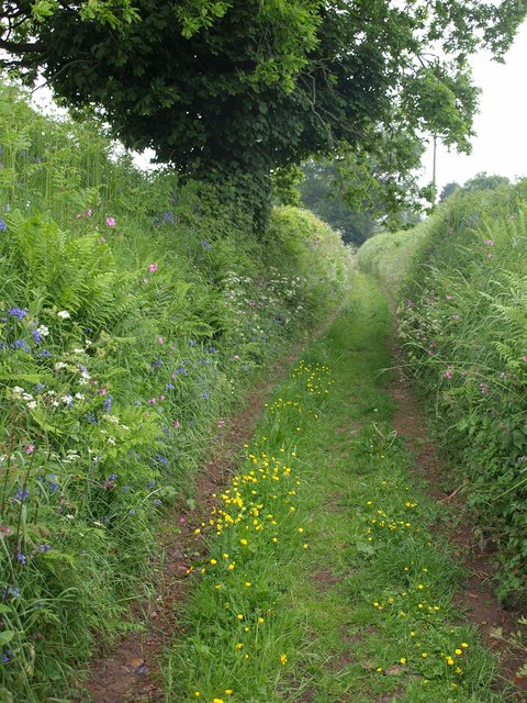
Accessible via footpaths and bridleways, Churchstanton Hill offers a peaceful retreat for those seeking a quiet escape in nature. Its stunning views, rich biodiversity, and historical significance make it a cherished landmark in the Devon countryside.

If you have any feedback on the listing, please let us know in the comments section below.

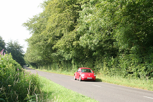
Churchstanton Hill Images

Images are sourced within 2km of 50.922248/-3.1172099 or Grid Reference ST2114. Thanks to Geograph Open Source API. All images are credited.

Churchstanton : Trickey Warren Lane Looking along the track.
Churchstanton : Trickey Warren Lane
Looking along the track.
Churchstanton : Trickey Warren Lane Looking along a lane.
Churchstanton : Trickey Warren Lane
Looking along a lane.
Churchstanton : Field The sun is setting over the fields.
Churchstanton : Field
The sun is setting over the fields.
Churchstanton : Church Road Looking along Church Road.
Churchstanton : Church Road
Looking along Church Road.
Green lane near Churchstanton Green lane on the footpath from Hunter's Lodge to Churchstanton.
Green lane near Churchstanton
Green lane on the footpath from Hunter's Lodge to Churchstanton.
Churchstanton House Seen from footpath T6/16. Past the tree and foliage on the left can be glimpsed part of <a href="https://www.geograph.org.uk/photo/1216015">ST1914 : Church of St Peter and St Paul, Churchstanton</a>.
Churchstanton House
Seen from footpath T6/16. Past the tree and foliage on the left can be glimpsed part of ST1914 : Church of St Peter and St Paul, Churchstanton.
Cattle at Churchstanton "What shall we do with him, girls?" There is actually an electric fence between these cattle and their calves, and me, though keeping this side of it involves a close encounter with the trees bordering the field at this point. This is on footpath T 6/17.
Cattle at Churchstanton
"What shall we do with him, girls?" There is actually an electric fence between these cattle and their calves, and me, though keeping this side of it involves a close encounter with the trees bordering the field at this point. This is on footpath T 6/17.
Green Lane, Churchstanton Footpath T 6/17 continues along Green Lane (both its name and the type of feature it represents), having crossed the motorable lane near Triangle Farm. It's raining steadily but I seem to have wiped the drops off the lens.
Green Lane, Churchstanton
Footpath T 6/17 continues along Green Lane (both its name and the type of feature it represents), having crossed the motorable lane near Triangle Farm. It's raining steadily but I seem to have wiped the drops off the lens.
Footpath near Willand Footpath T 6/17 follows a very green lane (it's raining, so it's hardly surprising it's green) past flower-bedecked banks and an oak tree.
Footpath near Willand
Footpath T 6/17 follows a very green lane (it's raining, so it's hardly surprising it's green) past flower-bedecked banks and an oak tree.
Churchstanton: Taunton – Honiton road Looking south-south-west in the Honiton direction on a cold overcast May day
Churchstanton: Taunton – Honiton road
Looking south-south-west in the Honiton direction on a cold overcast May day
Churchstanton: a Blackdown crossroads The road ahead leads to Churchstanton, now barely a hamlet with church, rectory and a defunct public house. Looking north west
Churchstanton: a Blackdown crossroads
The road ahead leads to Churchstanton, now barely a hamlet with church, rectory and a defunct public house. Looking north west
Churchstanton: Churchinford The York Inn: where the Honiton Road, Royston Road, Red Lane and Moor Lane meet. On the extreme right is the local shop and Post Office. Looking east
Churchstanton: Churchinford
The York Inn: where the Honiton Road, Royston Road, Red Lane and Moor Lane meet. On the extreme right is the local shop and Post Office. Looking east
Churchstanton: Churchinford Converted barns in Moor Lane, including Mill Cottage, centre. This was presumably a farm mill before conversion. Looking north east
Churchstanton: Churchinford
Converted barns in Moor Lane, including Mill Cottage, centre. This was presumably a farm mill before conversion. Looking north east
Churchstanton: the Honiton road North of Churchingford, looking north-north-east
Churchstanton: the Honiton road
North of Churchingford, looking north-north-east
Churchstanton: Hunter’s Lodge Looking east from the road to Honiton via Churchingford
Churchstanton: Hunter’s Lodge
Looking east from the road to Honiton via Churchingford
Churchstanton: the road to Churchingford Near Hunter’s Lodge, looking south
Churchstanton: the road to Churchingford
Near Hunter’s Lodge, looking south
Otterford: St Leonard’s church Looking south-south-east. The church and Church Farm form an isolated nucleus for the parish, not even qualifying as a hamlet
Otterford: St Leonard’s church
Looking south-south-east. The church and Church Farm form an isolated nucleus for the parish, not even qualifying as a hamlet
Otterford: entrance to Yalham Farmhouse And to Yalham Hayes. The farm has been converted to residential use; nearby Yalham Barton has a separate, gated, entrance. Looking west
Otterford: entrance to Yalham Farmhouse
And to Yalham Hayes. The farm has been converted to residential use; nearby Yalham Barton has a separate, gated, entrance. Looking west
Show me another place!

Churchstanton Hill is located at Grid Ref: ST2114 (Lat: 50.922248, Lng: -3.1172099)

Administrative County: Somerset

District: Somerset West and Taunton

Police Authority: Avon and Somerset

What 3 Words

///tarred.clutches.bleat. Near Hemyock, Devon

Related Wikis

Church of St Leonard, Otterford

The Anglican Church of St Leonard in Otterford, Somerset, England was built in the 14th century. It is a Grade II* listed building. == History == The church...

Otterford

Otterford is a village and civil parish in Somerset, England. It is situated on the Blackdown Hills, 7 miles (11.3 km) south of Taunton. The village has...

Otterhead Lakes

Otterhead Lakes are a pair of reservoirs in the Blackdown Hills Area of Outstanding Natural Beauty south of Otterford in Somerset, England. They are fed...

RAF Culmhead

Royal Air Force Culmhead or more simply RAF Culmhead is a former Royal Air Force station, situated at Churchstanton on the Blackdown Hills in Somerset...

Nearby Amenities

Located within 500m of 50.922248,-3.1172099
Give Way
Direction: forward
Lat/Long: 50.9241962/-3.1231786
Generator Method: wind_turbine
Generator Source: wind
Power: generator
Lat/Long: 50.9263062/-3.1201614
Power: pole
Source: bing
Transformer: distribution
Lat/Long: 50.9219314/-3.1183147
Power: pole
Source: bing
Lat/Long: 50.9216237/-3.1170917
Power: pole
Source: bing
Lat/Long: 50.9221014/-3.1168328
Power: pole
Source: bing
Lat/Long: 50.9218038/-3.1164184
Power: pole
Source: bing
Lat/Long: 50.9217666/-3.1163675
Power: pole
Source: bing
Lat/Long: 50.9195372/-3.1132185
Power: pole
Source: bing
Lat/Long: 50.9203539/-3.1143692
Power: pole
Source: bing
Lat/Long: 50.9212754/-3.1156728
Power: pole
Source: bing
Lat/Long: 50.9207935/-3.1174082
Power: pole
Source: bing
Lat/Long: 50.9203471/-3.1190819
Power: pole
Source: bing
Transformer: distribution
Lat/Long: 50.9199134/-3.1206711
Power: pole
Source: bing
Lat/Long: 50.919604/-3.1217802
Power: pole
Source: bing
Lat/Long: 50.9194839/-3.1222428
The data included in this document is from www.openstreetmap.org. The data is made available under ODbL.

Have you been to Churchstanton Hill?

Leave your review of Churchstanton Hill below (or comments, questions and feedback).