Bad nan Cuileag

Hill, Mountain in Aberdeenshire

Scotland

Bad nan Cuileag

Large area of moorland bog feeding the Crathie Burn
Large area of moorland bog feeding the Crathie Burn Credit: Peter Aikman

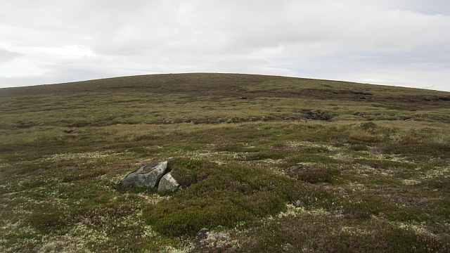
Bad nan Cuileag is a hill located in Aberdeenshire, Scotland. Situated within the Cairngorms National Park, it is part of the Grampian Mountains range. The hill's name translates to "clump of the flies" in Gaelic, which is believed to refer to the abundance of insects found in the area during the warmer months.

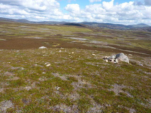
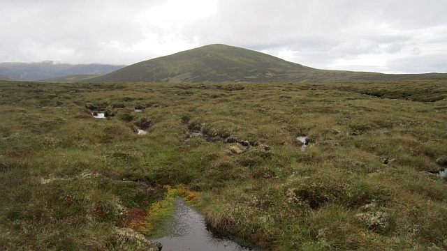
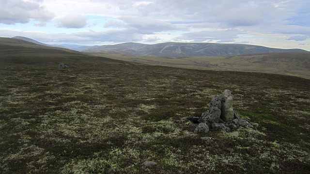
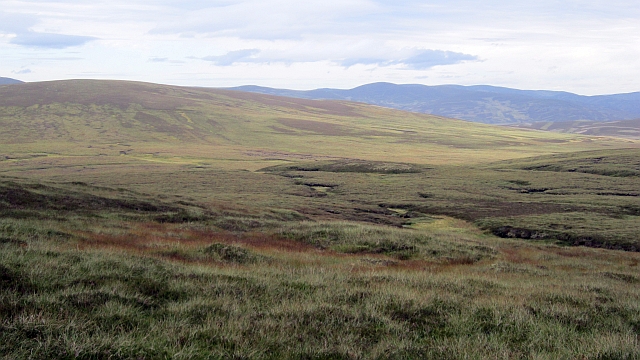
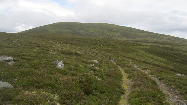
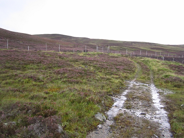
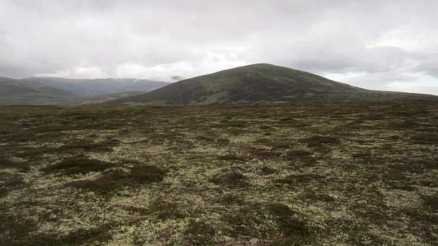
Rising to an elevation of approximately 719 meters (2,359 feet), Bad nan Cuileag offers breathtaking panoramic views of the surrounding landscape. Its summit provides a vantage point from which visitors can admire the rugged beauty of the Scottish Highlands. The hill is characterized by its rocky terrain and heather-covered slopes, which create a dramatic and picturesque setting.

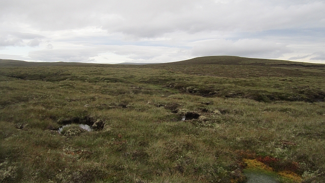
The area surrounding Bad nan Cuileag is rich in biodiversity, supporting a variety of flora and fauna. Heather, grasses, and mosses dominate the vegetation, while birds such as golden eagles, ptarmigans, and red grouse can often be spotted in the skies above. The hill is also home to various small mammals, including mountain hares and red deer.

Bad nan Cuileag attracts outdoor enthusiasts who enjoy hiking, hillwalking, and nature photography. Its accessibility from nearby villages and towns makes it a popular destination for both locals and tourists seeking to explore the natural beauty of the Cairngorms. However, the hill's remote location requires visitors to be adequately prepared with appropriate gear and navigation skills.

Overall, Bad nan Cuileag offers a captivating and challenging outdoor experience, showcasing the raw beauty of the Aberdeenshire countryside.

If you have any feedback on the listing, please let us know in the comments section below.

Bad nan Cuileag Images

Images are sourced within 2km of 57.06312/-3.3024712 or Grid Reference NO2197. Thanks to Geograph Open Source API. All images are credited.

Large area of moorland bog feeding the Crathie Burn
A faint track leading up to the top of Carn Moine an Tighearn The heather here is short, indicating that the area is still managed by burning.
A faint track leading up to the top of Carn Moine an Tighearn
The heather here is short, indicating that the area is still managed by burning.
Carn Moine an Tighearn The upper heathery slope with a few rocks
Carn Moine an Tighearn
The upper heathery slope with a few rocks
Heather moorland on the southern slopes of Carn Moine an Tighearn In the distance, ten miles south, are the corries of Lochnager
Heather moorland on the southern slopes of Carn Moine an Tighearn
In the distance, ten miles south, are the corries of Lochnager
Moorland, Glen Feardar A grouse moor above the fertile Glen Feardar. There is a good view of Lochnagar and much of the Balmoral Forest from here. When you get higher you also get a good appreciation of how vast Ben Avon is.
Moorland, Glen Feardar
A grouse moor above the fertile Glen Feardar. There is a good view of Lochnagar and much of the Balmoral Forest from here. When you get higher you also get a good appreciation of how vast Ben Avon is.
Bog, Bad na Dearcaig There is a lot of surface water on these hills, but the bogs are usually easily crossed. The hill is Culardoch 900m/312m
Bog, Bad na Dearcaig
There is a lot of surface water on these hills, but the bogs are usually easily crossed. The hill is Culardoch 900m/312m
Summit of Bad na Cuileag A bump on the moors  east of Culardoch.
Summit of Bad na Cuileag
A bump on the moors east of Culardoch.
Monaltrie Moss A big area of boggy moorland between Glen Gairn and Glen Feardar.
Monaltrie Moss
A big area of boggy moorland between Glen Gairn and Glen Feardar.
A track east of Culardoch Under Culardoch (900m/312m) on moorland between Glen Feardar and Glen Gairn.
A track east of Culardoch
Under Culardoch (900m/312m) on moorland between Glen Feardar and Glen Gairn.
Moorland, Auchtavan A track runs up from grassy fields towards grouse butts on Creag Bhalg.
Moorland, Auchtavan
A track runs up from grassy fields towards grouse butts on Creag Bhalg.
Moorland, Glen Feardar The track fades away on the 600m plateau north of Glen Feardar. It follows a line of grouse butts up the hillside.
Moorland, Glen Feardar
The track fades away on the 600m plateau north of Glen Feardar. It follows a line of grouse butts up the hillside.
Grouse butts A faint track rises towards Bad na Deargag past a line of simple grouse butts.
Grouse butts
A faint track rises towards Bad na Deargag past a line of simple grouse butts.
Bogs, Bad na Dearcag A view across waterlogged land towards the minor top of Bad na Cuileag.
Bogs, Bad na Dearcag
A view across waterlogged land towards the minor top of Bad na Cuileag.
Moss, Bad na Dearcag The ring contour corresponds to an island of dry heath, surrounded by bogs. Culardoch is in the background.
Moss, Bad na Dearcag
The ring contour corresponds to an island of dry heath, surrounded by bogs. Culardoch is in the background.
Bad na Cuileag Moorland bump near Culardoch, there is quite a lot of peat bog here as well as drier montane heath.
Bad na Cuileag
Moorland bump near Culardoch, there is quite a lot of peat bog here as well as drier montane heath.
Bog, Bad na Cuileag Pools in the peat bogs beside a big deer fence. The fence has been badly damaged in places where it crosses the site of big snow drifts. The two winters of 2010 were extremely snowy and there was a lot of damage to property from the weight of the snow.
Bog, Bad na Cuileag
Pools in the peat bogs beside a big deer fence. The fence has been badly damaged in places where it crosses the site of big snow drifts. The two winters of 2010 were extremely snowy and there was a lot of damage to property from the weight of the snow.
Damaged fence, Monaltrie Moss The fence has almost certainly been wrecked by snow. No one would climb a fence from a pool and the damage is on a large scale.  This must be the site of a big drift during one or both of the big snow winters of 2010.
Damaged fence, Monaltrie Moss
The fence has almost certainly been wrecked by snow. No one would climb a fence from a pool and the damage is on a large scale. This must be the site of a big drift during one or both of the big snow winters of 2010.
Track, Monaltrie Moss The hill road becomes more defined further north. It can be followed to Glen Gairn.
Track, Monaltrie Moss
The hill road becomes more defined further north. It can be followed to Glen Gairn.
Show me another place!

Bad nan Cuileag is located at Grid Ref: NO2197 (Lat: 57.06312, Lng: -3.3024712)

Unitary Authority: Aberdeenshire

Police Authority: North East

What 3 Words

///smiles.clashes.elbowing. Near Inverey, Aberdeenshire

Nearby Locations

Bad nan Cuileag

Related Wikis

Culardoch

Culardoch (900 m) is a mountain in the Cairngorms of Scotland, located northeast of Braemar in Aberdeenshire. A smooth and heathery peak southeast of the...
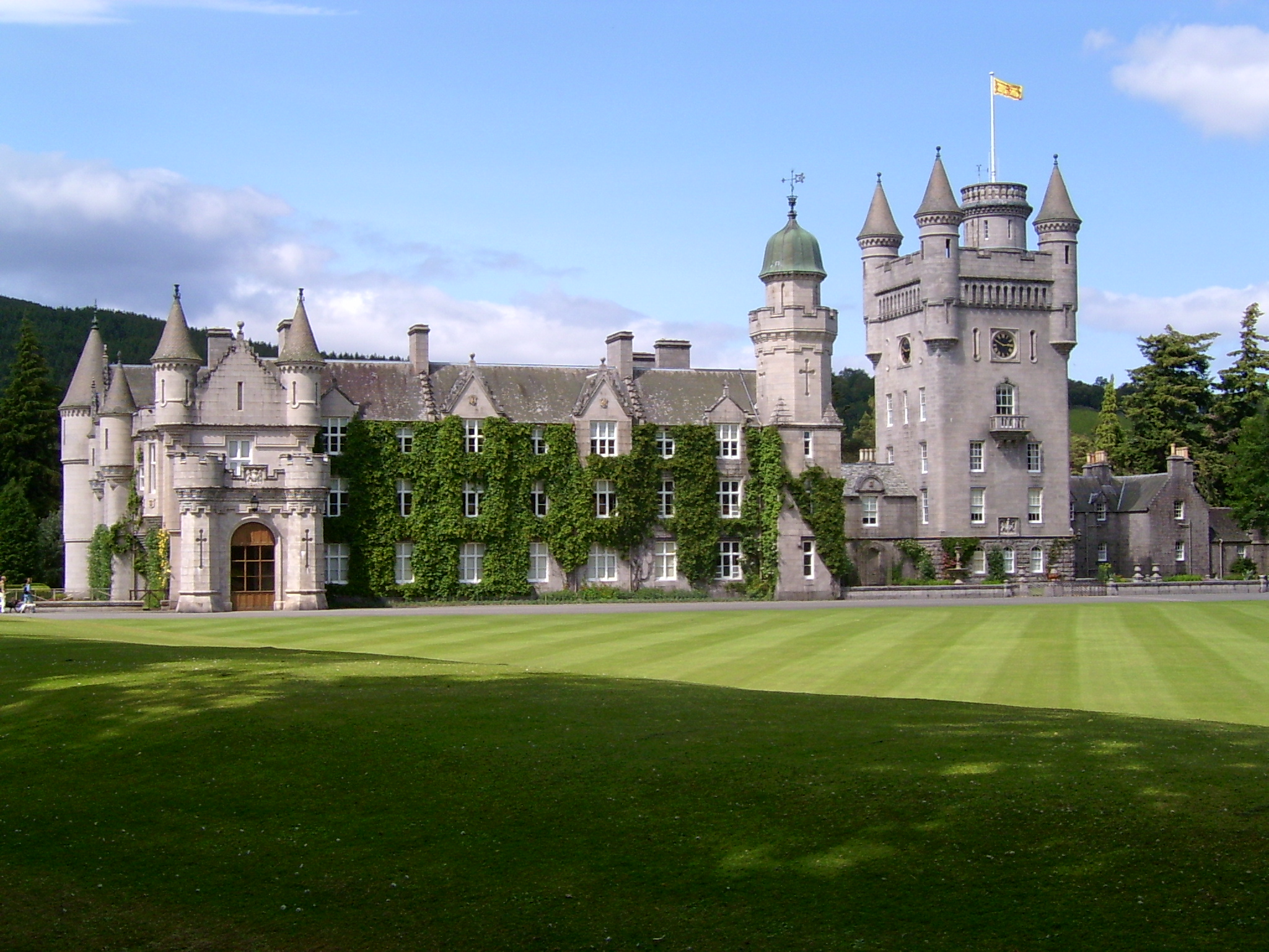
Balmoral Castle

Balmoral Castle () is a large estate house in Aberdeenshire, Scotland, and a residence of the British royal family. It is near the village of Crathie,...

Balmoral cairns

There are sixteen stone cairns on the Balmoral estate in Deeside, Scotland, including a single cairn on the adjoining Birkhall estate. The cairns commemorate...

Crathie, Aberdeenshire

Crathie (Scottish Gaelic: Craichidh) is a village in Aberdeenshire, Scotland. It stands on the north bank of the River Dee. Abergeldie Castle is 1 mile...

Have you been to Bad nan Cuileag?

Leave your review of Bad nan Cuileag below (or comments, questions and feedback).