Ball Hill

Hill, Mountain in Devon East Devon

England

Ball Hill

Moorplash Farm, north of Southleigh
Moorplash Farm, north of Southleigh Credit: David Smith

Ball Hill is a prominent hill located in the county of Devon, England. Situated near the town of Exmouth, it forms a distinct feature of the region's landscape. Rising to an elevation of approximately 134 meters (440 feet), it is considered a significant hill in the area.

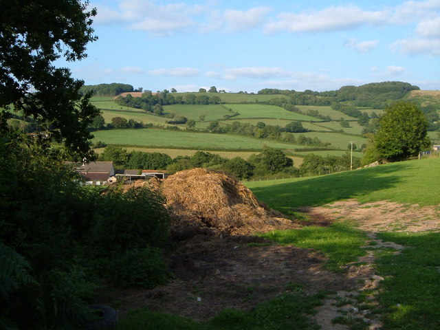
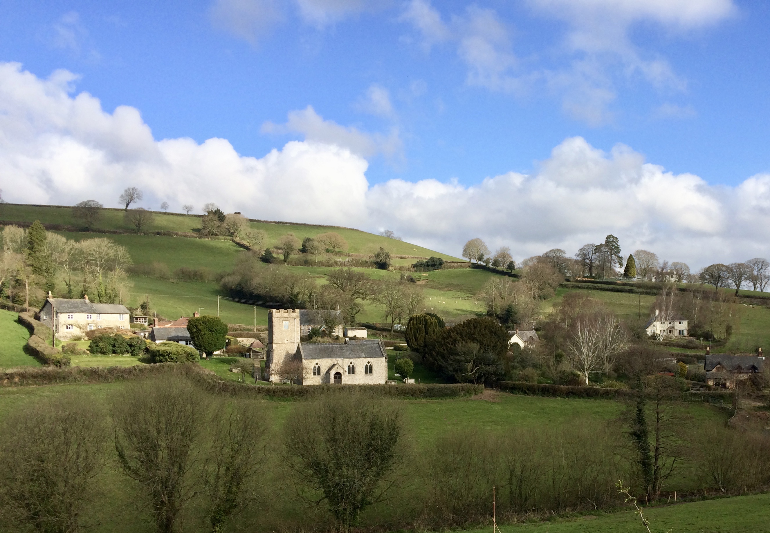
Ball Hill offers breathtaking panoramic views of the surrounding countryside, making it a popular destination for locals and tourists alike. From its summit, visitors can enjoy stunning vistas of the Devonshire countryside, including rolling hills, meandering rivers, and charming villages. On clear days, it is even possible to catch a glimpse of the nearby coastline.

The hill is covered in a variety of vegetation, adding to its natural beauty. Lush green fields, scattered trees, and wildflowers create a picturesque scene that changes with the seasons. The area is also home to diverse wildlife, including birds, rabbits, and deer, making it an ideal spot for nature enthusiasts.

For those seeking outdoor activities, Ball Hill offers several walking and hiking trails that cater to different fitness levels. These paths allow visitors to explore the hill's terrain while taking in the breathtaking scenery. Additionally, the hill is often used by paragliders and hang gliders who take advantage of the favorable winds and expansive views.

Overall, Ball Hill in Devon is a remarkable natural landmark that showcases the region's beauty and offers a range of recreational opportunities. Whether it is for a leisurely walk, a challenging hike, or simply to enjoy the tranquility of nature, this hill is a must-visit destination for anyone exploring the Devon countryside.

If you have any feedback on the listing, please let us know in the comments section below.
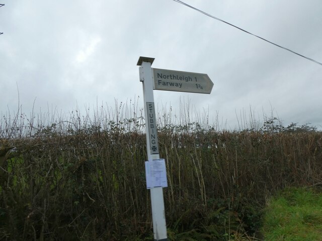
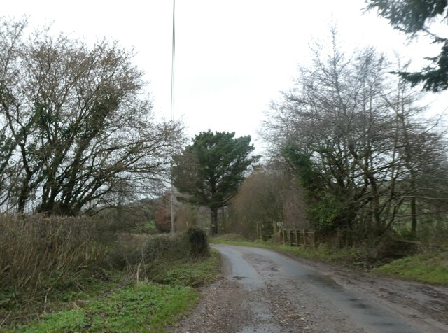
Ball Hill Images

Images are sourced within 2km of 50.757697/-3.1246567 or Grid Reference SY2095. Thanks to Geograph Open Source API. All images are credited.

Moorplash Farm, north of Southleigh
Winter trees north of Southleigh
Signpost at Stubbing Cross
Ford and bridge on Suddon's Lane There is a small footbridge on the right for when the stream flows over the road
Ford and bridge on Suddon's Lane
There is a small footbridge on the right for when the stream flows over the road
Kissing Gate and Public Footpath This photo was taken by the bridge over the River Col near Road Pitt Farm.
Kissing Gate and Public Footpath
This photo was taken by the bridge over the River Col near Road Pitt Farm.
Farwood Barton, Northleigh, Devon View across farmland towards Farwood Barton.
Farwood Barton, Northleigh, Devon
View across farmland towards Farwood Barton.
Moorplash Farm, Devon This farm is just north of soulthleigh.
Moorplash Farm, Devon
This farm is just north of soulthleigh.
View near Smallicombe Farm The farm's buildings are on the left. Behind is the valley of the Offwell Brook. The wooded hill on the right is Suttonthorn Covert.
View near Smallicombe Farm
The farm's buildings are on the left. Behind is the valley of the Offwell Brook. The wooded hill on the right is Suttonthorn Covert.
At Baker's Gate A ridge lane twists and turns past Baker's Gate on its way from Honiton to Farwood Cross.
At Baker's Gate
A ridge lane twists and turns past Baker's Gate on its way from Honiton to Farwood Cross.
Bluebells near Carswells Moor These drifts are in a small wood that runs up a valley beside the green lane from Lawdeshayne to Crookham Cross.
Bluebells near Carswells Moor
These drifts are in a small wood that runs up a valley beside the green lane from Lawdeshayne to Crookham Cross.
Cottage near Rockerhayne The lane from Rockerhayne Cross down to the Offwell Brook passes this C17 cottage, which is described at <span class="nowrap"><a title="http://list.english-heritage.org.uk/resultsingle.aspx?uid=1098536&searchtype=mapsearch" rel="nofollow ugc noopener" href="http://list.english-heritage.org.uk/resultsingle.aspx?uid=1098536&searchtype=mapsearch">Link</a><img style="margin-left:2px;" alt="External link" title="External link - shift click to open in new window" src="https://s1.geograph.org.uk/img/external.png" width="10" height="10"/></span> .
Cottage near Rockerhayne
The lane from Rockerhayne Cross down to the Offwell Brook passes this C17 cottage, which is described at LinkExternal link .
Baker's Gate A green lane from the Offwell Brook valley drops to meet the lane shown in <a href="https://www.geograph.org.uk/photo/422270">SY2096 : At Baker's Gate</a>. The village below is Northleigh.
Baker's Gate
A green lane from the Offwell Brook valley drops to meet the lane shown in SY2096 : At Baker's Gate. The village below is Northleigh.
Bonehayne A large farm in the Coly valley, seen from the edge of Bonehayne Covert. Ball Hill rises behind.
Bonehayne
A large farm in the Coly valley, seen from the edge of Bonehayne Covert. Ball Hill rises behind.
View from Baker's Gate Looking along the ridge towards Ball Hill. The combe on the left drops to the Offwell Brook valley.
View from Baker's Gate
Looking along the ridge towards Ball Hill. The combe on the left drops to the Offwell Brook valley.
Hillside near Baker's Gate Evening shadows stretch across a hillside above a green lane from Baker's Gate to Tricombe Farm.
Hillside near Baker's Gate
Evening shadows stretch across a hillside above a green lane from Baker's Gate to Tricombe Farm.
Looking towards the Offwell Brook valley Taken from the track between Baker's Gate and Tricombe, and looking down the western slopes of the Offwell Brook valley. On the far side of the valley is Hamberhayne Copse.
Looking towards the Offwell Brook valley
Taken from the track between Baker's Gate and Tricombe, and looking down the western slopes of the Offwell Brook valley. On the far side of the valley is Hamberhayne Copse.
Blamphayne Farm A farm on the western slopes of the Offwell Brook valley, seen from above. The farm on the opposite side of the valley is Summerway, in <a href="https://www.geograph.org.uk/gridref/SX2196">SX2196</a>.
Blamphayne Farm
A farm on the western slopes of the Offwell Brook valley, seen from above. The farm on the opposite side of the valley is Summerway, in SX2196.
Offwell Brook valley Looking across the valley from Summerway. The higher slopes opposite are in <a href="https://www.geograph.org.uk/gridref/SY2096">SY2096</a>.
Offwell Brook valley
Looking across the valley from Summerway. The higher slopes opposite are in SY2096.
Show me another place!

Ball Hill is located at Grid Ref: SY2095 (Lat: 50.757697, Lng: -3.1246567)

Administrative County: Devon

District: East Devon

Police Authority: Devon and Cornwall

What 3 Words

///doghouse.panel.shielding. Near Colyton, Devon

Nearby Locations

Ball Hill

Related Wikis

Northleigh

Northleigh is a village and civil parish in the East Devon district of Devon, England. Its nearest town is Colyton, which lies approximately 3.5 miles...

Woodbridge, Devon

Woodbridge is a hamlet in Farway civil parish, south-south-east of the town of Honiton, in the English county of Devon. The OS grid reference is SY1895...

Southleigh

Southleigh is a village and civil parish in the East Devon district of Devon, England. Its nearest town is Colyton, which lies approximately 3 miles (4...

Farway

Farway is a small village, civil parish and former manor in the East Devon district of Devon, England. The village is situated about 3+1⁄2 miles (5.6 km...

Bolshayne Fen

Bolshayne Fen (grid reference SY222938) is a wetland in southeast Devon, England. It has an area of 1.62 hectares. The site was designated as a Site of...

Church Green, Devon

Church Green is a hamlet in the civil parish of Farway in the East Devon district of Devon, England. Its nearest town is Honiton, which lies approximately...

Widworthy

Widworthy is a village, parish and former manor in Devon, England. The village is 3 1/2 miles east of Honiton and the parish is surrounded clockwise from...

Wiscombe Park Hillclimb

Wiscombe Park Hillclimb is a British hillclimb, situated in Colyton, Devon. The course, which is 1000 yards (914 metres) in length — the same as Shelsley...

Nearby Amenities

Located within 500m of 50.757697,-3.1246567
The data included in this document is from www.openstreetmap.org. The data is made available under ODbL.

Have you been to Ball Hill?

Leave your review of Ball Hill below (or comments, questions and feedback).