Cefn Bach

Hill, Mountain in Monmouthshire

Wales

Cefn Bach

Ebbw Vale 1978 This historical view of Ebbw Vale looking north along the valley pre-dates the closure of the steel mill.
Ebbw Vale 1978 Credit: Val Vannet

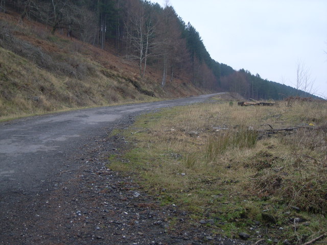
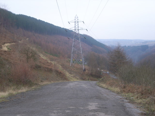
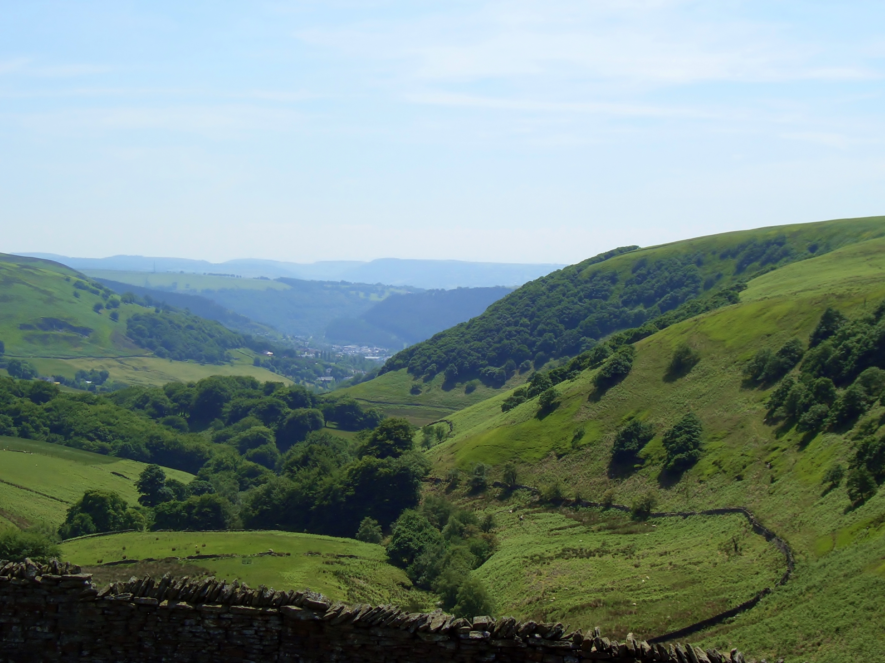
Cefn Bach is a prominent hill located in Monmouthshire, Wales. It stands at an elevation of approximately 429 meters (1,407 feet) above sea level, making it a notable landmark in the region. The hill is part of the Black Mountains range, which is known for its picturesque landscapes and challenging hiking trails.

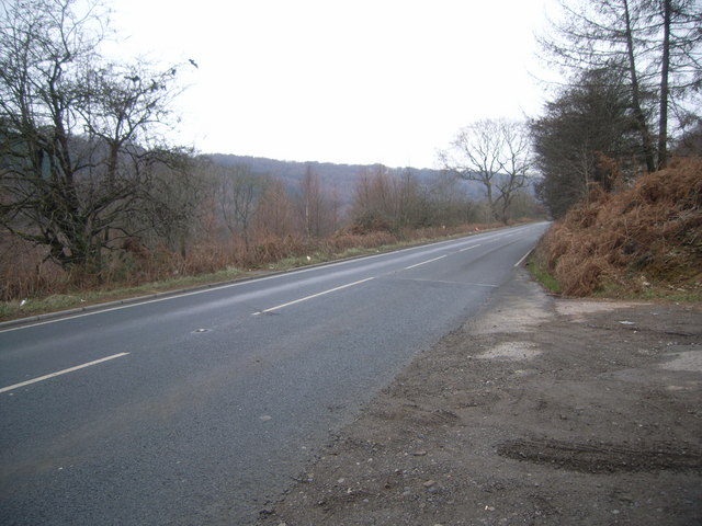
Cefn Bach offers breathtaking panoramic views of the surrounding countryside, including the nearby towns of Abergavenny and Crickhowell. Its location within the Brecon Beacons National Park adds to its appeal, as it provides visitors with an opportunity to explore the diverse flora and fauna of the area.

The hill is predominantly covered in heather and grass, creating a rich tapestry of colors throughout the seasons. It is home to various species of wildlife, including birds of prey such as buzzards and kestrels, as well as small mammals like rabbits and foxes.

Hikers and outdoor enthusiasts are drawn to Cefn Bach for its range of walking trails and paths. The ascent to the summit can be challenging, but the rewarding views make it a popular destination for both experienced and novice walkers. It is also a great spot for picnics, photography, and nature appreciation.

Cefn Bach is easily accessible by car, with parking facilities available at the base of the hill. Additionally, there are several nearby accommodation options for those looking to explore the area further.

If you have any feedback on the listing, please let us know in the comments section below.

Cefn Bach Images

Images are sourced within 2km of 51.731446/-3.1491015 or Grid Reference SO2004. Thanks to Geograph Open Source API. All images are credited.

Ebbw Vale 1978 This historical view of Ebbw Vale looking north along the valley pre-dates the closure of the steel mill.
Ebbw Vale 1978
This historical view of Ebbw Vale looking north along the valley pre-dates the closure of the steel mill.
Steam Pump Monster steam pump, once used at Cwm Colliery, near Ebbw Vale. Pump now preserved on site.
Steam Pump
Monster steam pump, once used at Cwm Colliery, near Ebbw Vale. Pump now preserved on site.
Oaks on a 45 deg incline The photo makes it look quite flat, but it's not.
Oaks on a 45 deg incline
The photo makes it look quite flat, but it's not.
Looking up the forestry road
Pylons stretching across the countryside
A road to nowhere This road is another victim of new road layouts.  As you can see it now just stops.
A road to nowhere
This road is another victim of new road layouts. As you can see it now just stops.
The railway at Cwm This is taken from the old railway bridge of the A4046
The railway at Cwm
This is taken from the old railway bridge of the A4046
New railway tunnel under A4046 at Cwm
Disused road (A4046) at Cwm
Road to Cwm This road is not marked on OS maps - maybe it's a new road or an old road or a temporary road.
Road to Cwm
This road is not marked on OS maps - maybe it's a new road or an old road or a temporary road.
Looking along the A4046
Davey pumping engine, Marine Colliery A non-rotative Davey "differential" pumping engine in the foundations of a largely demolished winding engine house. This operated pumps in the shaft across a roadway by mean of connecting rods and angle bobs. Engine built 1895 and stopped around 1914-18. It then remained in its cave like building until the colliery closed and it was removed for preservation. See <a href="https://www.geograph.org.uk/photo/289002">SO1804 : Steam Pump</a>. It is currently somewhere in Ebbw Vale.
Davey pumping engine, Marine Colliery
A non-rotative Davey "differential" pumping engine in the foundations of a largely demolished winding engine house. This operated pumps in the shaft across a roadway by mean of connecting rods and angle bobs. Engine built 1895 and stopped around 1914-18. It then remained in its cave like building until the colliery closed and it was removed for preservation. See SO1804 : Steam Pump. It is currently somewhere in Ebbw Vale.
Marine Colliery haulage engine This lived in the foundations of a winding house that had been largely demolished and was alongside that containing the remains of the pumping engine. This was built in 1863 by the Ebbw Vale Iron Co and probably installed here in the 1890s. It drove an underground haulage with a wire rope passing down the shaft opposite. This is now on display in the open at Afan Argoed <a href="https://www.geograph.org.uk/photo/611812">SS8295 : Steam haulage engine, Afan Argoed Miners' Museum</a>.
Marine Colliery haulage engine
This lived in the foundations of a winding house that had been largely demolished and was alongside that containing the remains of the pumping engine. This was built in 1863 by the Ebbw Vale Iron Co and probably installed here in the 1890s. It drove an underground haulage with a wire rope passing down the shaft opposite. This is now on display in the open at Afan Argoed SS8295 : Steam haulage engine, Afan Argoed Miners' Museum.
New road lay out
New road lay out
Marine Colliery near Cwm Steel coil for the Ebbw Vale tinplate works passes the colliery at Marine which was the last deep mine to work in the Ebbw valleys; it had closed in March 1989 just a few weeks before this picture was taken. Steel and coal once were the great industries which made South Wales so busy.
Marine Colliery near Cwm
Steel coil for the Ebbw Vale tinplate works passes the colliery at Marine which was the last deep mine to work in the Ebbw valleys; it had closed in March 1989 just a few weeks before this picture was taken. Steel and coal once were the great industries which made South Wales so busy.
Show me another place!

Cefn Bach is located at Grid Ref: SO2004 (Lat: 51.731446, Lng: -3.1491015)

Unitary Authority: Blaenau Gwent

Police Authority: Gwent

What 3 Words

///galloping.calibrate.angers. Near Abertillery, Blaenau Gwent

Nearby Locations

Cefn Bach

Related Wikis

Abertillery railway station

Abertillery railway station was a station which served Abertillery, in the Welsh county of Monmouthshire. == History == Among the lines built by the Monmouthshire...

Steelhouse Festival

Steelhouse Festival is an independent rock festival held annually in late July at Aberbeeg in South Wales, U.K. == History == Located on the edge of the...

Abertillery Learning Community

Abertillery Learning Community is an all-through school in Abertillery, Wales. The school was formed by merging several schools in 2016. Abertillery Comprehensive...
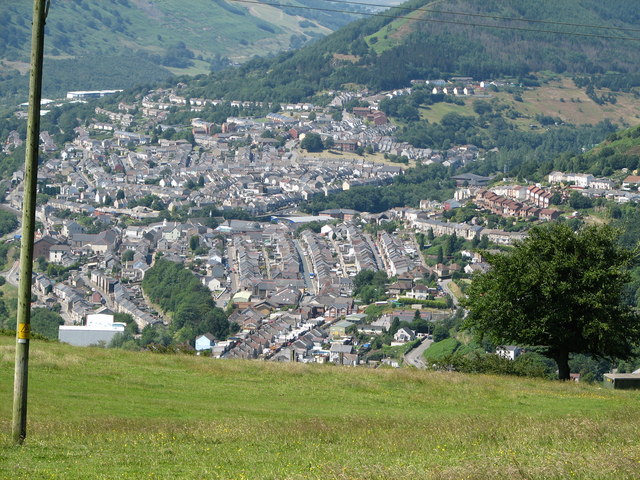
Abertillery

Abertillery (; Welsh: Abertyleri) is a town and a community of the Ebbw Fach valley in the historic county of Monmouthshire, Wales. Following local government...

Cwmtillery

Cwmtillery (from Welsh Cwmtyleri) (population 2011. 4800) is a ward of Abertillery. Located within the historic boundaries of Monmouthshire, it is part...
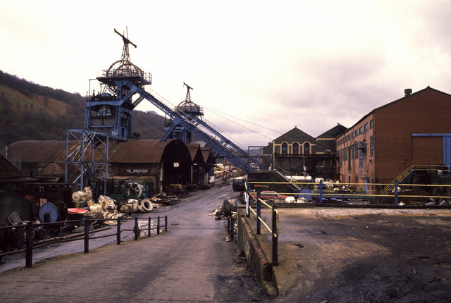
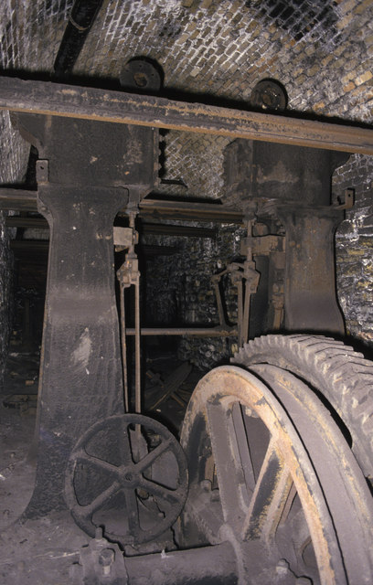
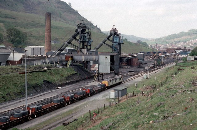
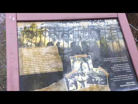
Six Bells Colliery

Six Bells Colliery was a colliery located in Six Bells, Abertillery, Gwent, Wales. On 28 June 1960 it was the site of an underground explosion which killed...

Six Bells

Six Bells (Welsh: Chwe Chloch) is an electoral ward and neighbourhood in Abertillery, Blaenau Gwent, Wales. It was originally a village that grew up around...

Llan-dafel

Llan-dafel (also referred to as Llandafal) is a village in the community of Cwm, in the Ebbw Valley in Blaenau Gwent. It is located 4 miles (6.4 km) south...

Related Videos

Hiking For Health - Roseheyworth & Cwmtillery Trail

Whilst spending time in Wales I had to do more hiking and decided to meet up with Initial80 again to scale up Mynydd James ...

Cwm Coke Works #shorts

To donate and support our channel: https://www.buymeacoffee.com/TheyhadadaA We love exploring this beautiful land and all it ...

Hiking for Health - Guardian Of The Valleys

02/03/2022 - Out and about in the South of Wales again. This time I went walking in an area of Abertillery known as Six Bells.

Aberbeeg Parkrun route #Parkruntourism

Aberbeeg Parkrun Flat out and back course on tarmac.

Nearby Amenities

Located within 500m of 51.731446,-3.1491015
Direction: SW
Generator Method: photovoltaic
Generator Output Electricity: yes
Generator Solar Modules: 7
Generator Source: solar
Generator Type: solar_photovoltaic_panel
Location: roof
Power: generator
Lat/Long: 51.7333262/-3.1428656
Direction: SW
Generator Method: photovoltaic
Generator Output Electricity: yes
Generator Solar Modules: 7
Generator Source: solar
Generator Type: solar_photovoltaic_panel
Location: roof
Power: generator
Lat/Long: 51.733091/-3.1424877
Direction: SW
Generator Method: photovoltaic
Generator Output Electricity: yes
Generator Solar Modules: 7
Generator Source: solar
Generator Type: solar_photovoltaic_panel
Location: roof
Power: generator
Lat/Long: 51.7342249/-3.1442875
Direction: SW
Generator Method: photovoltaic
Generator Output Electricity: yes
Generator Solar Modules: 7
Generator Source: solar
Generator Type: solar_photovoltaic_panel
Location: roof
Power: generator
Lat/Long: 51.7340645/-3.1440304
Direction: SW
Generator Method: photovoltaic
Generator Output Electricity: yes
Generator Solar Modules: 7
Generator Source: solar
Generator Type: solar_photovoltaic_panel
Location: roof
Power: generator
Lat/Long: 51.7335783/-3.1432649
Direction: SW
Generator Method: photovoltaic
Generator Output Electricity: yes
Generator Solar Modules: 7
Generator Source: solar
Generator Type: solar_photovoltaic_panel
Location: roof
Power: generator
Lat/Long: 51.7333624/-3.1433078
The data included in this document is from www.openstreetmap.org. The data is made available under ODbL.

Have you been to Cefn Bach?

Leave your review of Cefn Bach below (or comments, questions and feedback).