Cnoc na Cailliche

Hill, Mountain in Angus

Scotland

Cnoc na Cailliche

Hill road heading towards Auchintaple Loch The road lies immediately to the south of Badandun Hill and has descended over its slopes.
Auchintaple Loch can be seen in the middle distance; farther away at the centre of the image, is Mount Blair.
Hill road heading towards Auchintaple Loch Credit: Trevor Littlewood

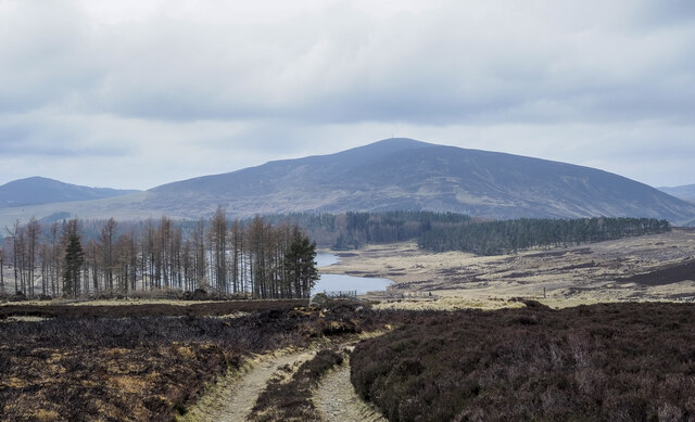
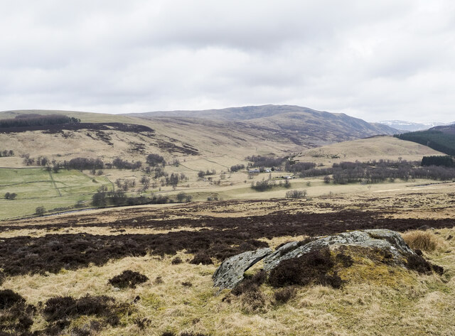
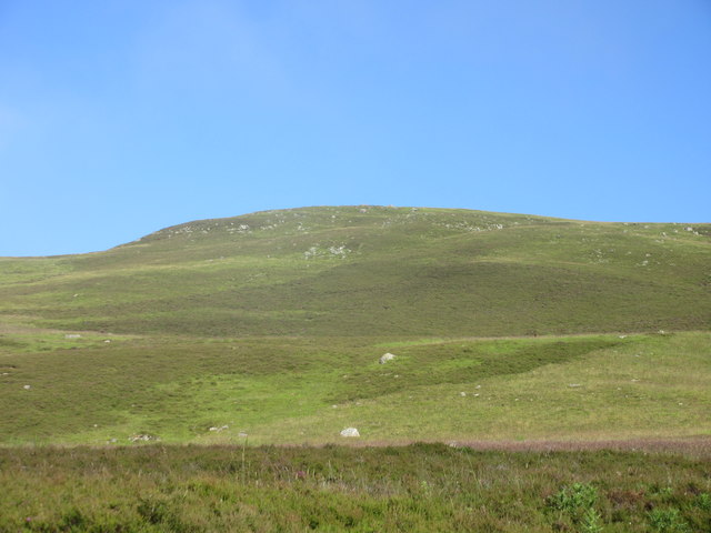
Cnoc na Cailliche, located in Angus, Scotland, is a prominent hill that rises to an elevation of 402 meters (1,319 feet) above sea level. The name Cnoc na Cailliche translates to "Hill of the Old Woman" in Gaelic, referring to a mythical figure from Celtic folklore.

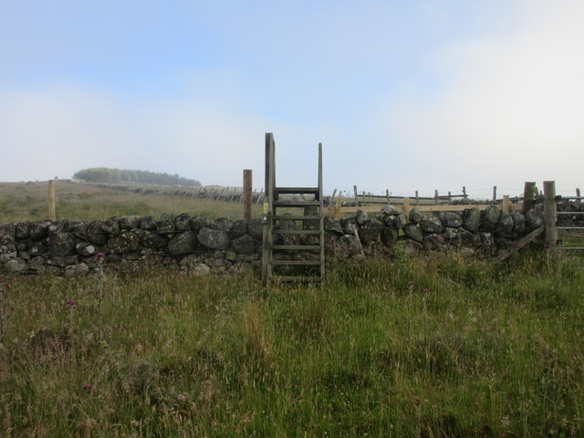
The hill is known for its distinctive shape, with a rounded summit offering panoramic views of the surrounding countryside. It is a popular destination for hikers and outdoor enthusiasts, who can enjoy a challenging ascent and rewarding vistas from the top.

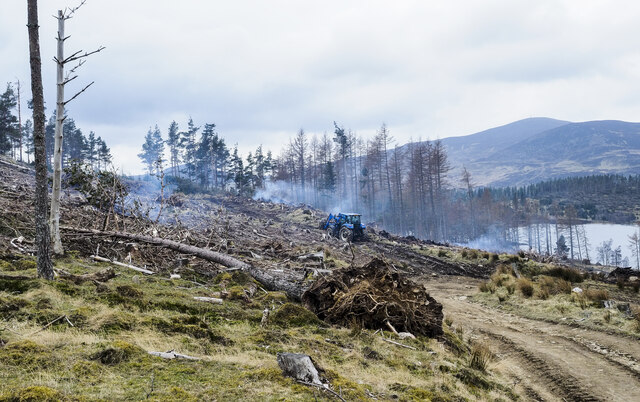
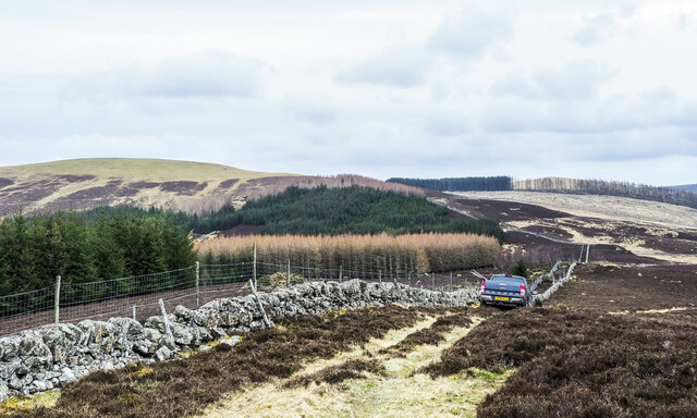
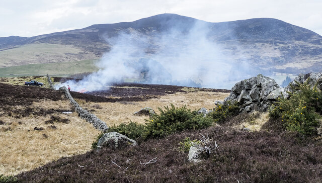
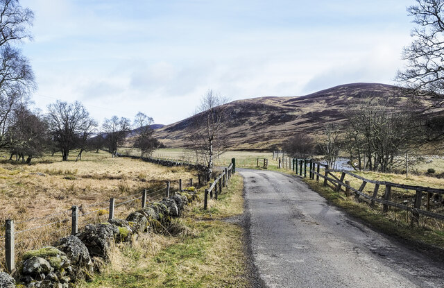
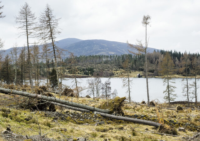
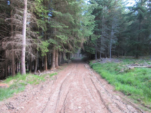
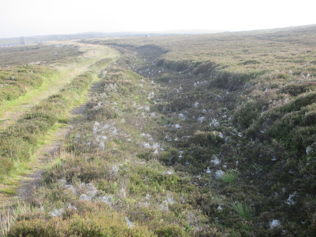
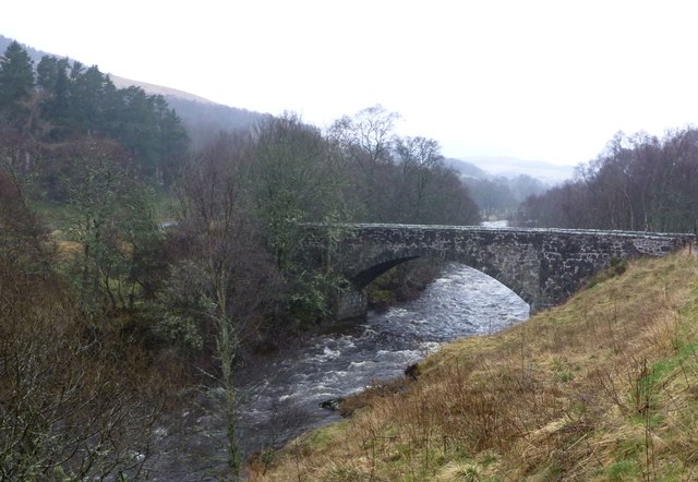
Cnoc na Cailliche is situated within the Angus Glens, a picturesque area of rolling hills, forests, and moorland. The hill is part of the larger Grampian Mountains range, which stretches across northeastern Scotland.

Visitors to Cnoc na Cailliche can expect to encounter a variety of wildlife, including red deer, grouse, and birds of prey. The area is also rich in archaeological sites, with ancient cairns and stone circles scattered throughout the landscape.

Overall, Cnoc na Cailliche offers a unique and memorable outdoor experience for those looking to explore the natural beauty of Angus.

If you have any feedback on the listing, please let us know in the comments section below.

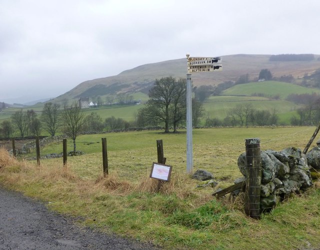
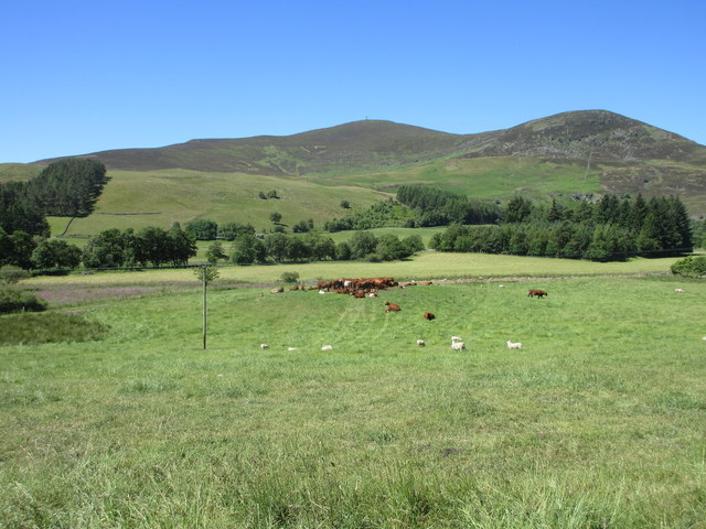
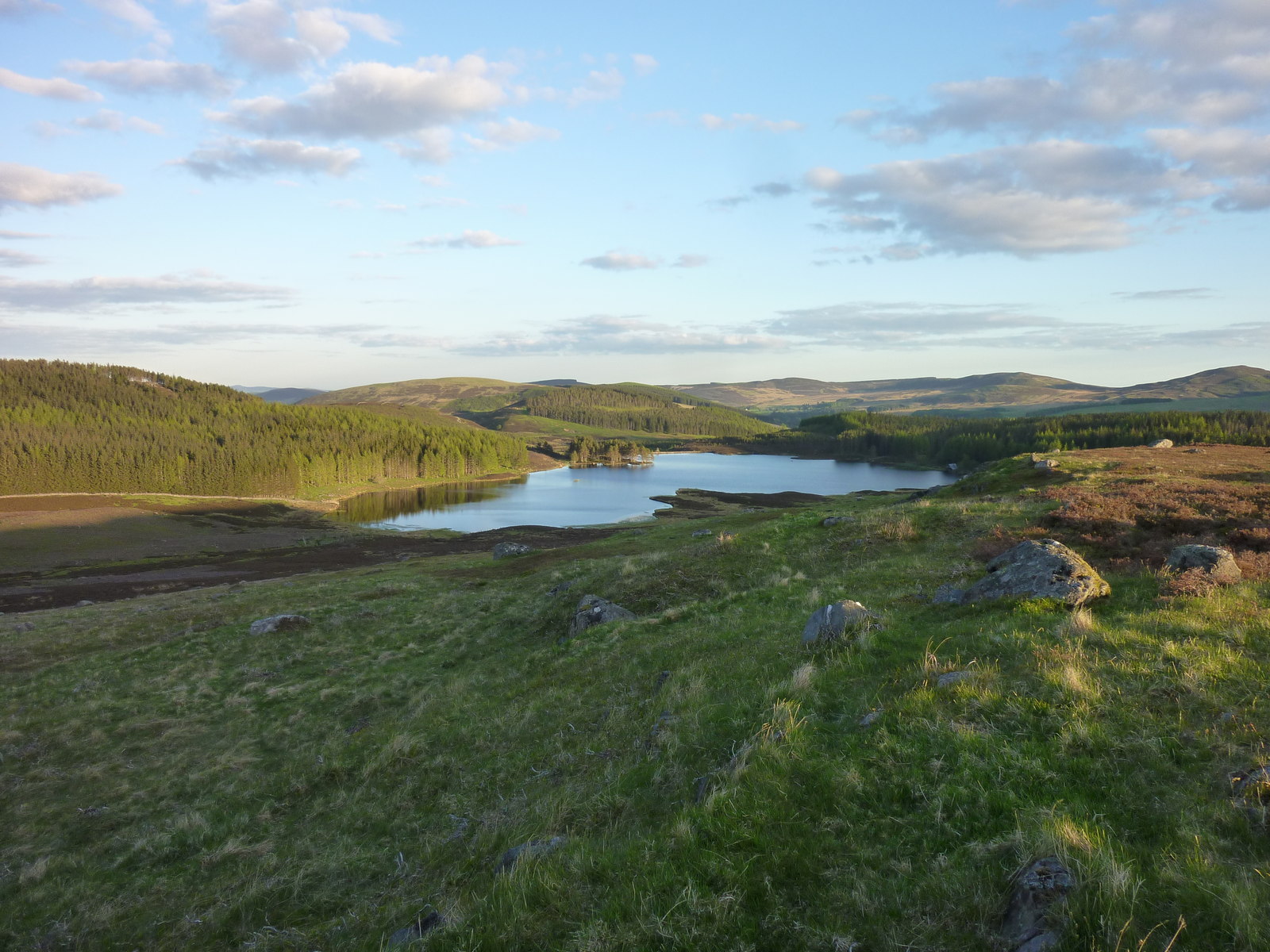
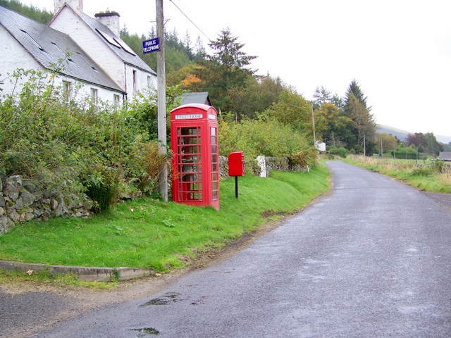
Cnoc na Cailliche Images

Images are sourced within 2km of 56.767029/-3.3055152 or Grid Reference NO2064. Thanks to Geograph Open Source API. All images are credited.

Hill road heading towards Auchintaple Loch The road lies immediately to the south of Badandun Hill and has descended over its slopes.
Auchintaple Loch can be seen in the middle distance; farther away at the centre of the image, is Mount Blair.
Hill road heading towards Auchintaple Loch
The road lies immediately to the south of Badandun Hill and has descended over its slopes. Auchintaple Loch can be seen in the middle distance; farther away at the centre of the image, is Mount Blair.
Coniferous plantation laid waste The plantation close to Auchintaple Loch had already largely been clear-felled but some trees had been left standing. Winter storms then felled some of those - there's one such in the foreground. The smouldering fires simply add to the sense of destruction.
Coniferous plantation laid waste
The plantation close to Auchintaple Loch had already largely been clear-felled but some trees had been left standing. Winter storms then felled some of those - there's one such in the foreground. The smouldering fires simply add to the sense of destruction.
Going off to start a fire! The vehicle leaving the north-west top of Lindalla Hill, is carrying two estate workers whose mission is to begin a heather fire on the ground to the right side of the image as part of the owning estate's land management, presumably for grouse shooting. The resulting fire can be seen here - <a title="https://www.geograph.org.uk/photo/7151422" href="https://www.geograph.org.uk/photo/7151422">Link</a> .
Going off to start a fire!
The vehicle leaving the north-west top of Lindalla Hill, is carrying two estate workers whose mission is to begin a heather fire on the ground to the right side of the image as part of the owning estate's land management, presumably for grouse shooting. The resulting fire can be seen here - Link .
Heather burning along line of wall Heather burning to the north-west of the minor hill, Lindalla.
Mount Blair lies in the distance.
Heather burning along line of wall
Heather burning to the north-west of the minor hill, Lindalla. Mount Blair lies in the distance.
Moorland with embedded rocks beside hill road The hill road, now also the route used by a long distance path, the Cateran Trail, rises from the Forter area in Glen Isla to this location close to The Knaps. The moorland in view is on the road's north-west side, at a gate.
Beyond, the view is across Glen Isla to Duchray Hill.
Moorland with embedded rocks beside hill road
The hill road, now also the route used by a long distance path, the Cateran Trail, rises from the Forter area in Glen Isla to this location close to The Knaps. The moorland in view is on the road's north-west side, at a gate. Beyond, the view is across Glen Isla to Duchray Hill.
Minor road heading into Glen Isla The road heading north from Little Forter with Badandun Hill rising in the distance.
Minor road heading into Glen Isla
The road heading north from Little Forter with Badandun Hill rising in the distance.
Windthrown trees on east side of Auchintaple Loch The plantation had already been clear-felled but as happens regularly a few trees had been left standing; the winter storms of 2021 into 2022 knocked over many of those.
Mount Blair is in the distance.
Windthrown trees on east side of Auchintaple Loch
The plantation had already been clear-felled but as happens regularly a few trees had been left standing; the winter storms of 2021 into 2022 knocked over many of those. Mount Blair is in the distance.
Cateran Trail stile Ladder-type stile on the Cateran Trail.
Cateran Trail stile
Ladder-type stile on the Cateran Trail.
Cateran Trail through woodland A twisting section of the Cateran Trail through woodland east of Auchintaple Loch.
Cateran Trail through woodland
A twisting section of the Cateran Trail through woodland east of Auchintaple Loch.
Cateran Trail cobwebs Early morning cobwebs by the side of the Cateran Trail.
Cateran Trail cobwebs
Early morning cobwebs by the side of the Cateran Trail.
Southern side of Badandun Hill Southern heights of Badandun Hill viewed from the east.
Southern side of Badandun Hill
Southern heights of Badandun Hill viewed from the east.
Birches among the pines Scattered birches in the pine forest next to the track north of Crock.
Birches among the pines
Scattered birches in the pine forest next to the track north of Crock.
Bridge of Forter On a damp day after heavy rain.
Bridge of Forter
On a damp day after heavy rain.
Unhelpful road sign at Folda Strong winds (or vandals) have set all the pointers in the same direction!
See <a title="https://www.geograph.org.uk/photo/1535665" href="https://www.geograph.org.uk/photo/1535665">Link</a>  for how it should look.
Forter Castle has not been moved.
Unhelpful road sign at Folda
Strong winds (or vandals) have set all the pointers in the same direction! See Link for how it should look. Forter Castle has not been moved.
Auchintaple Loch Auchintaple Loch viewed from the Cateran Trail to the east.
Auchintaple Loch
Auchintaple Loch viewed from the Cateran Trail to the east.
Cattle in Glen Isla Curious cattle on the Glen Isla road.
Cattle in Glen Isla
Curious cattle on the Glen Isla road.
Bridge of Forter The bridge over the River Isla at Forter, viewed from the south-east.
Bridge of Forter
The bridge over the River Isla at Forter, viewed from the south-east.
Cattle feeding A distant view of cattle congregating around a feeder near Balnamennoch, with Mount Blair in the background.
Cattle feeding
A distant view of cattle congregating around a feeder near Balnamennoch, with Mount Blair in the background.
Show me another place!

Cnoc na Cailliche is located at Grid Ref: NO2064 (Lat: 56.767029, Lng: -3.3055152)

Unitary Authority: Angus

Police Authority: Tayside

What 3 Words

///scanner.dissolves.reason. Near Alyth, Perth & Kinross

Nearby Locations

Cnoc na Cailliche

Related Wikis

Auchintaple Loch

Auchintaple Loch also known as Auchenchapel Loch, is a small shallow freshwater loch that is located in Glen Isla in Angus, Scotland. == See also == List...

Folda, Angus

Folda is a hamlet in Glen Isla, Angus, Scotland. It is situated on the River Isla, twelve miles north-west of Kirriemuir and eleven miles north of Blairgowrie...

Little Forter

Little Forter is a hamlet in Glen Isla, Angus, Scotland. It is on the River Isla, 13 miles (21 kilometres) north-west of Kirriemuir and 11 miles (18 kilometres...

Forter Castle

Forter Castle is located in Glenisla, Perthshire, Scotland. It was built in 1560 by James Ogilvy, the 5th Lord of Airlie. In 1640, it was burned by Archibald...

Nearby Amenities

Located within 500m of 56.767029,-3.3055152
Cnoc na Cailliche
Ele: 441
Natural: peak
Lat/Long: 56.7669719/-3.3055094
The data included in this document is from www.openstreetmap.org. The data is made available under ODbL.

Have you been to Cnoc na Cailliche?

Leave your review of Cnoc na Cailliche below (or comments, questions and feedback).