Hare Law

Hill, Mountain in Fife

Scotland

Hare Law

B9097 towards Glenrothes
B9097 towards Glenrothes Credit: Steven Brown

The requested URL returned error: 429 Too Many Requests

If you have any feedback on the listing, please let us know in the comments section below.
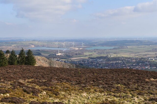
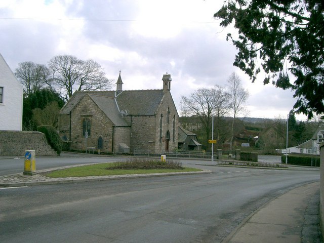
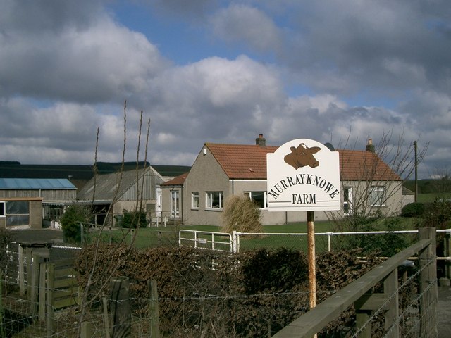
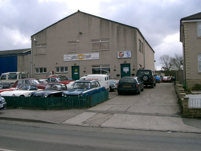
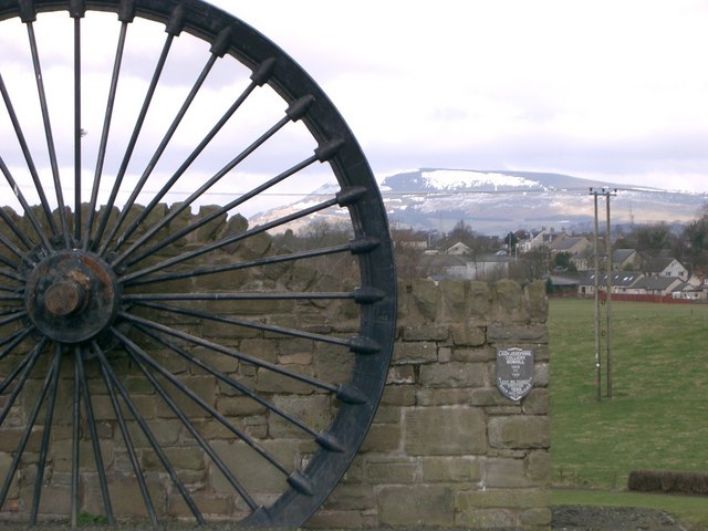
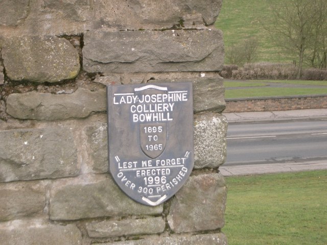
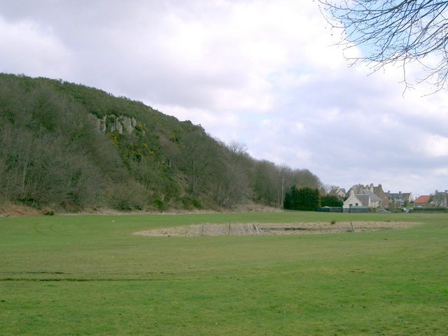
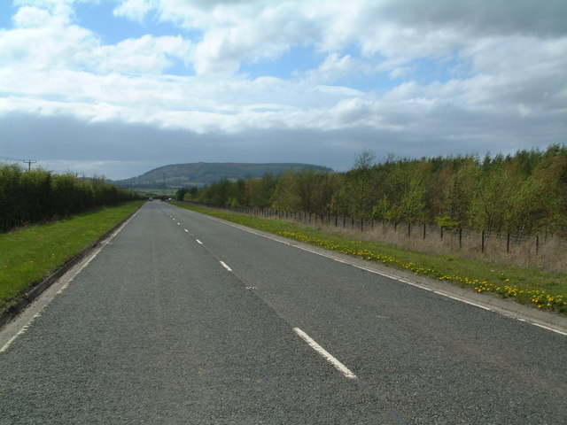
Hare Law Images

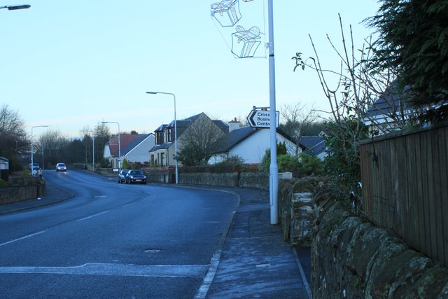
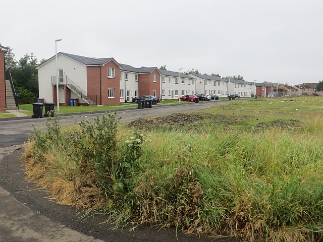
Images are sourced within 2km of 56.154269/-3.2908054 or Grid Reference NT1996. Thanks to Geograph Open Source API. All images are credited.
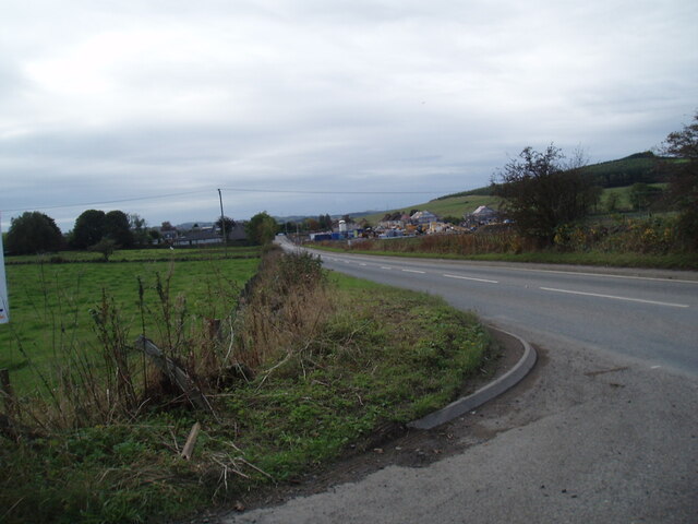
B9097 towards Glenrothes
Kinglassie Road, Cardenden
Farm road near Woodend
B9097 towards Glenrothes
The new Hare Law Summit ridge of a massive landscaped bing. To the north there are huge holes at Westfield, the rock from there ended up here.
The new Hare Law
Summit ridge of a massive landscaped bing. To the north there are huge holes at Westfield, the rock from there ended up here.
Energy, Old and New In this picture is the Westfield Biomass energy plant, the Westfield Wind Farm and the water-filled remains of Westfield open-cast coal mine, at one time claimed to be the largest in Europe.
Energy, Old and New
In this picture is the Westfield Biomass energy plant, the Westfield Wind Farm and the water-filled remains of Westfield open-cast coal mine, at one time claimed to be the largest in Europe.
Brigghills Farm Situated just off the road from Lochgelly to Gardenden [B981]
Brigghills Farm
Situated just off the road from Lochgelly to Gardenden [B981]
Auchterderran Parish Church St.Fothads Church of Scotland.
Auchterderran Parish Church
St.Fothads Church of Scotland.
Murrayknowe Farm Situated on the Lochgelly to Cardenden Road (B981)
Murrayknowe Farm
Situated on the Lochgelly to Cardenden Road (B981)
Garage Situated on Jamphlars Road this garage seems to specialize in cars of a certain age.
Garage
Situated on Jamphlars Road this garage seems to specialize in cars of a certain age.
Memorial A view north to Bishop Hill from mining memorial at Jamphlars.
Memorial
A view north to Bishop Hill from mining memorial at Jamphlars.
Plaque Inscription on mining memorial.
Plaque
Inscription on mining memorial.
Craighead Plantation Marked on the 1940'S map as Craighead Plantation this is how it looks today.
Craighead Plantation
Marked on the 1940'S map as Craighead Plantation this is how it looks today.
Screen of trees The plantation to the north (right hand) side of the B9097 here was grown to screen from view the open-cast coal workings on the other side of it.
Screen of trees
The plantation to the north (right hand) side of the B9097 here was grown to screen from view the open-cast coal workings on the other side of it.
Redhouse Well, that's what the OS map calls this farm. Perhaps the paint has faded.
Redhouse
Well, that's what the OS map calls this farm. Perhaps the paint has faded.
Westfield Opencast Site As the Westfield opencast coal site expanded the local road network was altered several times and in 1992 the railway line that served the site and took the coal away to power stations was also diverted to enable a further area of coal to be exploited.  The present line can be seen coming from the right behind the brick hut and curving towards the loading bank (which is hidden behind the bush on the left). In the foreground is the sole reminder of the original route, the weighbridge on which wagons were weighed before and after loading.  In the background is the chimney of the former British Gas Lurgi coal gasification plant.
Westfield Opencast Site
As the Westfield opencast coal site expanded the local road network was altered several times and in 1992 the railway line that served the site and took the coal away to power stations was also diverted to enable a further area of coal to be exploited. The present line can be seen coming from the right behind the brick hut and curving towards the loading bank (which is hidden behind the bush on the left). In the foreground is the sole reminder of the original route, the weighbridge on which wagons were weighed before and after loading. In the background is the chimney of the former British Gas Lurgi coal gasification plant.
Westfield Opencast Coal Site during restoration Taken from the embankment of one of the internal haulage roads, this view shows the phased restoration of the former opencast site.  Coal extraction from the land to the left of the railway line was completed several years ago; the pit has been backfilled and vegetation is now colonising the surface.  To the right of the railway line, extraction ended more recently; the pit has been filled in but awaits a topsoil covering to enable plants to grow.  The railway line seen here is a deviation constructed in 1992; the original line followed a route more to the right, making directly for the end of the wooded hill near the upper right corner.
Westfield Opencast Coal Site during restoration
Taken from the embankment of one of the internal haulage roads, this view shows the phased restoration of the former opencast site. Coal extraction from the land to the left of the railway line was completed several years ago; the pit has been backfilled and vegetation is now colonising the surface. To the right of the railway line, extraction ended more recently; the pit has been filled in but awaits a topsoil covering to enable plants to grow. The railway line seen here is a deviation constructed in 1992; the original line followed a route more to the right, making directly for the end of the wooded hill near the upper right corner.
Westfield Opencast Site restoration This is the extreme south-eastern corner of the opencast coal site.  Gorse and other shrubs are recolonising the land to the right of the railway line but much less so to the left, where parts of the former excavations are still under water.  When the railway was deviated in 1992 it was provided with two concrete tube tunnels beneath internal haulage roads, one of which can be seen in the middle distance. In the far distance are the silver chimney of the Lurgi gasification plant and beyond that the massive hump of Benarty Hill.
Westfield Opencast Site restoration
This is the extreme south-eastern corner of the opencast coal site. Gorse and other shrubs are recolonising the land to the right of the railway line but much less so to the left, where parts of the former excavations are still under water. When the railway was deviated in 1992 it was provided with two concrete tube tunnels beneath internal haulage roads, one of which can be seen in the middle distance. In the far distance are the silver chimney of the Lurgi gasification plant and beyond that the massive hump of Benarty Hill.
Show me another place!

Hare Law is located at Grid Ref: NT1996 (Lat: 56.154269, Lng: -3.2908054)

Unitary Authority: Fife

Police Authority: Fife

What 3 Words

///compose.audio.exporters. Near Ballingry, Fife

Nearby Locations

Hare Law

Related Wikis

Fife power station

Fife power station was a 120 megawatt gas-fired combined cycle gas turbine generating station at Cardenden in Fife, Scotland. It was a 1+1 configuration...

Crosshill, Fife

Crosshill is a village in Fife, Scotland, located just to the south of the village of Lochore, and to the east of Loch Ore. == History == Crosshill was...

Lochore

Lochore is a former mining village in Fife, Scotland. It takes its name from the nearby Loch Ore. It is largely joined to the adjacent villages of Ballingry...

Auchterderran

Auchterderran () is a village in Fife, Scotland. It is sometimes thought as part of the larger village, Cardenden, although Cardenden is part of the parish...

Nearby Amenities

Located within 500m of 56.154269,-3.2908054
Power: pole
Lat/Long: 56.1516777/-3.2842391
Power: pole
Lat/Long: 56.1514926/-3.2856367
Power: pole
Lat/Long: 56.151142/-3.288358
Power: pole
Lat/Long: 56.150965/-3.2897655
Power: pole
Lat/Long: 56.1507929/-3.2911343
Power: pole
Lat/Long: 56.1506057/-3.2925326
Power: pole
Lat/Long: 56.155682/-3.2955953
Power: pole
Lat/Long: 56.1549433/-3.2951496
Power: pole
Lat/Long: 56.1542129/-3.2947089
Power: pole
Lat/Long: 56.1535421/-3.2943042
Power: pole
Lat/Long: 56.1528117/-3.2938635
Power: pole
Lat/Long: 56.1520864/-3.2934259
Power: pole
Lat/Long: 56.1513127/-3.2929592
Power: pole
Lat/Long: 56.1513154/-3.2870075
Power: pole
Lat/Long: 56.1571063/-3.2964546
Power: pole
Lat/Long: 56.1564483/-3.2960554
Power: pole
Lat/Long: 56.1571762/-3.2962264
Power: pole
Lat/Long: 56.1565026/-3.2958155
Power: pole
Lat/Long: 56.1557197/-3.2953391
Power: pole
Lat/Long: 56.1550123/-3.2949142
Power: pole
Lat/Long: 56.1542814/-3.2944752
Power: pole
Lat/Long: 56.1535791/-3.2940642
Power: pole
Lat/Long: 56.1528227/-3.2935879
Power: pole
Lat/Long: 56.1514696/-3.292766
Power: pole
Lat/Long: 56.1507465/-3.2923223
Power: pole
Lat/Long: 56.1509182/-3.2910287
Power: pole
Lat/Long: 56.1511028/-3.2896978
Power: pole
Lat/Long: 56.1512641/-3.2884135
Power: pole
Lat/Long: 56.1516179/-3.2857096
Power: pole
Lat/Long: 56.1572372/-3.2959993
Power: pole
Lat/Long: 56.1565519/-3.29558
Power: pole
Lat/Long: 56.1558147/-3.2951375
Power: pole
Lat/Long: 56.1550964/-3.2947019
Power: pole
Lat/Long: 56.1543775/-3.2942716
Power: pole
Lat/Long: 56.1536272/-3.2938209
Power: pole
Lat/Long: 56.1529453/-3.293406
Power: pole
Lat/Long: 56.1522863/-3.2929911
Power: pole
Lat/Long: 56.1516073/-3.2925813
Power: pole
Lat/Long: 56.1508997/-3.2921562
Power: pole
Lat/Long: 56.1510595/-3.2908845
Power: pole
Lat/Long: 56.1512312/-3.2896428
Power: pole
Lat/Long: 56.1514011/-3.2884135
Power: pole
Lat/Long: 56.1517472/-3.2858043
Power: pole
Lat/Long: 56.1519223/-3.2844322
Power: pole
Lat/Long: 56.151565/-3.2871776
Power: pole
Lat/Long: 56.1521509/-3.2931713
Power: pole
Lat/Long: 56.1514291/-3.2870999
Power: pole
Lat/Long: 56.1562342/-3.2974836
Power: pole
Lat/Long: 56.1565997/-3.2965686
The data included in this document is from www.openstreetmap.org. The data is made available under ODbL.

Have you been to Hare Law?

Leave your review of Hare Law below (or comments, questions and feedback).